
PACK DIGIATLAS
Download up to 15 digital maps of your choice through a subscription to the 'Pack DigiAtlas'.


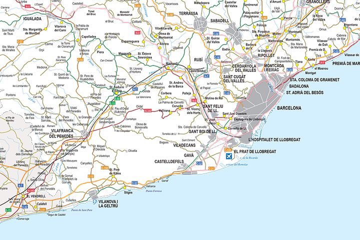
-Description:
Digital map of the province of Barcelona (Catalonia) at a scale of 1:300.000 with detailed geographical and political information. It includes the autonomous, provincial and municipal limits, capitals, cities and population centres, motorway network, dual carriageways, national and autonomous roads of first and second order, local roads, railway network and AVE, main rivers and lakes.
.
This map is downloaded in vector format, which means that it can be fully edited and modified to adapt it to the requirements of any type of project. Vector design applications such as Adobe Illustrator, very common in the world of graphic design, should be used for this purpose, although Acrobat PDF can also be used, which is installed by default on any computer and also allows you to operate with the vector layers offered by the map.
Poster size at high resolution for large format printing.
-Original measurements:
43x45 cm (Fully resizable vector file for High-quality printing).
-Download formats:
Adobe Illustrator, Acrobat PDF
-You can also request a quote » to modify this map and adapt it to your projects.
Download up to 15 digital maps of your choice through a subscription to the 'Pack DigiAtlas'.

Postcode maps of cities, regions and countries. Optionally with demographic data for geo-marketing projects.

City street maps with delineation of urban areas, streets, squares, parks, green areas, buildings of interest, etc.
DigiAtlas select every week until three random maps from their catalog and intends to offer them at a very lower price than its regular cost.
These maps change every 7 days. If either of them matches your interest take advantage of this opportunity to acquire digital maps to a very special price.