


PACK DIGIATLAS
Download up to 15 digital maps of your choice through a subscription to the 'Pack DigiAtlas'.
-Description:
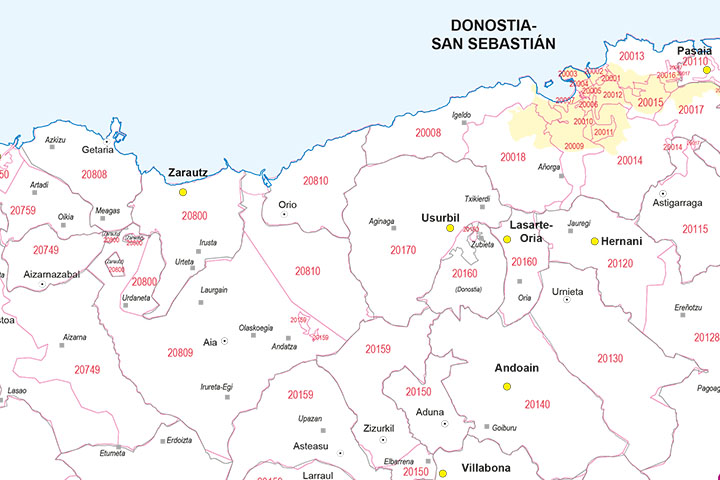
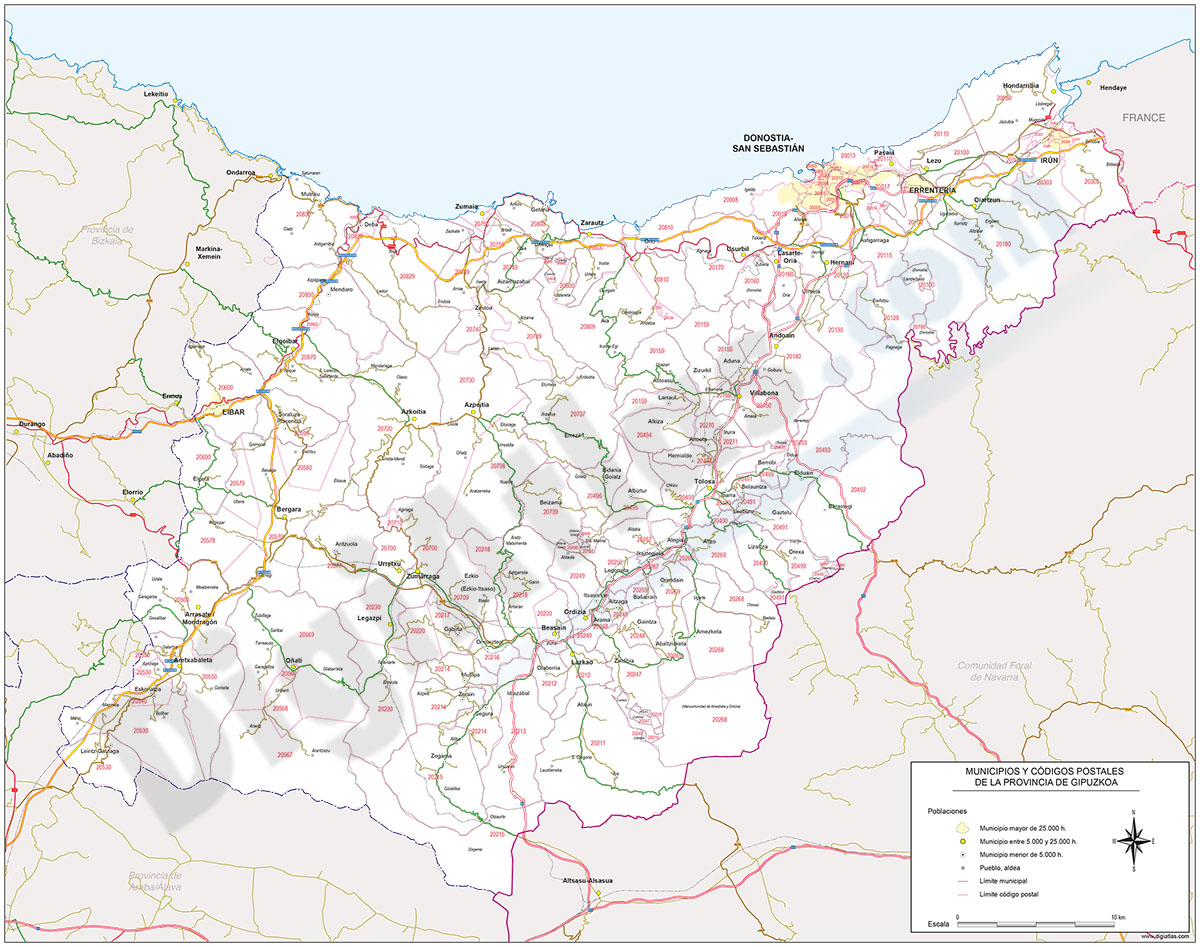
Digital map of the province of Gipuzkoa (Basque Country - Spain) with the areas of all 5-digits postal codes, administrative boundaries (state border, autonomous, provincial and municipal boundaries), cities and towns grouped and separated according to the number of inhabitants.
Available in 100% editable vector format, organized in separate layers to modify colors, texts and styles.
The map also contains the road network in a separate layer that can be displayed or hidden as desired.
-Original measurements:
59x42 cm (A2) (Fully resizable vector file for High-quality printing).
-Download formats:
Adobe Illustrator, Acrobat PDF
-You can also request a quote » to modify this map and adapt it to your projects.
Download up to 15 digital maps of your choice through a subscription to the 'Pack DigiAtlas'.

Postcode maps of cities, regions and countries. Optionally with demographic data for geo-marketing projects.

City street maps with delineation of urban areas, streets, squares, parks, green areas, buildings of interest, etc.
DigiAtlas select every week until three random maps from their catalog and intends to offer them at a very lower price than its regular cost.
These maps change every 7 days. If either of them matches your interest take advantage of this opportunity to acquire digital maps to a very special price.