
PACK DIGIATLAS
Download up to 15 digital maps of your choice through a subscription to the 'Pack DigiAtlas'.

-Description:
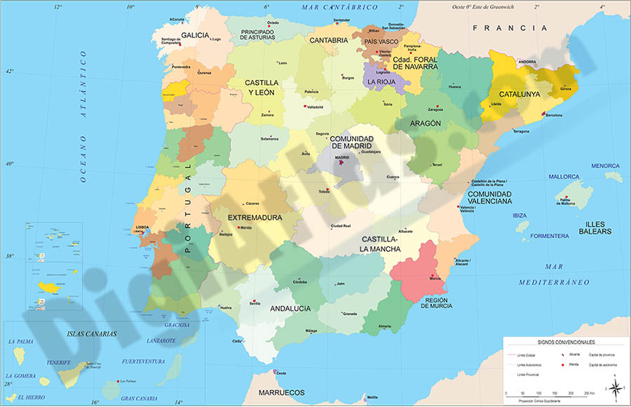
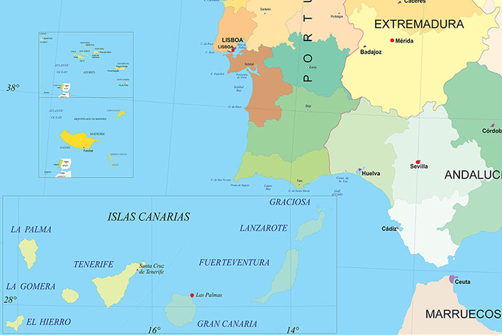
Political map of Spain and Portugal in digital format, showing the internal administrative division of each country, Spanish Autonomous Communities and provinces, and the continental districts and autonomous regions (Azores and Madeira) of Portugal, all of them with their respective capitals.
Two vector files are downloaded: one in Adobe Illustrator 100% editable, to be able to select and colouring each community, region and province separately, as well as edit colors, texts and styles. Another version in Acrobat PDF ready for press at the desired size always with the highest resolution and quality. Both versions are organized in separate layers, which can be displayed and hidden in order to generate customized versions of the map.
-Original measurements:
150x96 cm (Fully resizable vector file for High-quality printing).
-Download formats:
Adobe Illustrator, Acrobat PDF.
- This map is also available through the PACK DIGIATLAS »
-You can also request a quote » to modify this map and adapt it to your projects.
Download up to 15 digital maps of your choice through a subscription to the 'Pack DigiAtlas'.

Postcode maps of cities, regions and countries. Optionally with demographic data for geo-marketing projects.

City street maps with delineation of urban areas, streets, squares, parks, green areas, buildings of interest, etc.
DigiAtlas select every week until three random maps from their catalog and intends to offer them at a very lower price than its regular cost.
These maps change every 7 days. If either of them matches your interest take advantage of this opportunity to acquire digital maps to a very special price.