
PACK DIGIATLAS
Download up to 15 digital maps of your choice through a subscription to the 'Pack DigiAtlas'.


-Description:
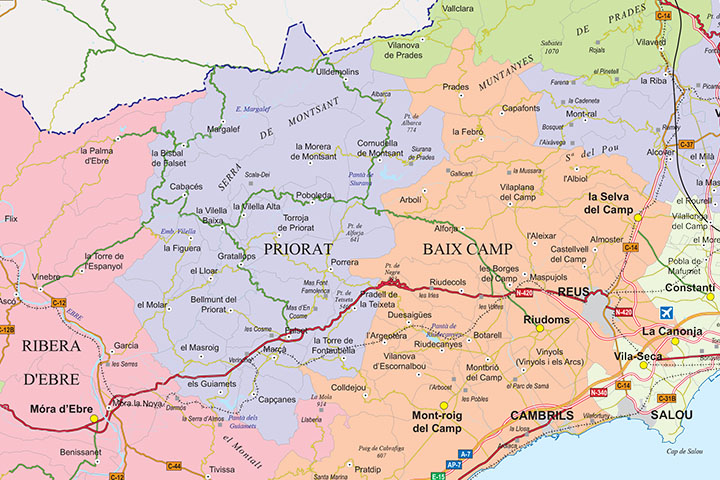
Digital map of the province of TARRAGONA
Map of the province of TARRAGONA at a scale of 1:200.000 with the autonomous, provincial, county and municipal boundaries (municipalities), capitals, cities and towns grouped according to their number of inhabitants, motorways, dual carriageways, national, regional, county and local roads, AVE and railways, main rivers and lakes, geographical names and road labelling.
Digital cartography available in vector format, organised in separate layers to customise colours, texts and styles.
Poster size for high quality printing.
-Original measurements:
100x70 cm (Fully resizable vector file for High-quality printing).
-Download formats:
Adobe Illustrator, Acrobat PDF
- This map is also available through the PACK DIGIATLAS »
-You can also request a quote » to modify this map and adapt it to your projects.
Download up to 15 digital maps of your choice through a subscription to the 'Pack DigiAtlas'.

Postcode maps of cities, regions and countries. Optionally with demographic data for geo-marketing projects.

City street maps with delineation of urban areas, streets, squares, parks, green areas, buildings of interest, etc.
DigiAtlas select every week until three random maps from their catalog and intends to offer them at a very lower price than its regular cost.
These maps change every 7 days. If either of them matches your interest take advantage of this opportunity to acquire digital maps to a very special price.