


PACK DIGIATLAS
Download up to 15 digital maps of your choice through a subscription to the 'Pack DigiAtlas'.
-Description:
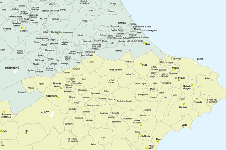
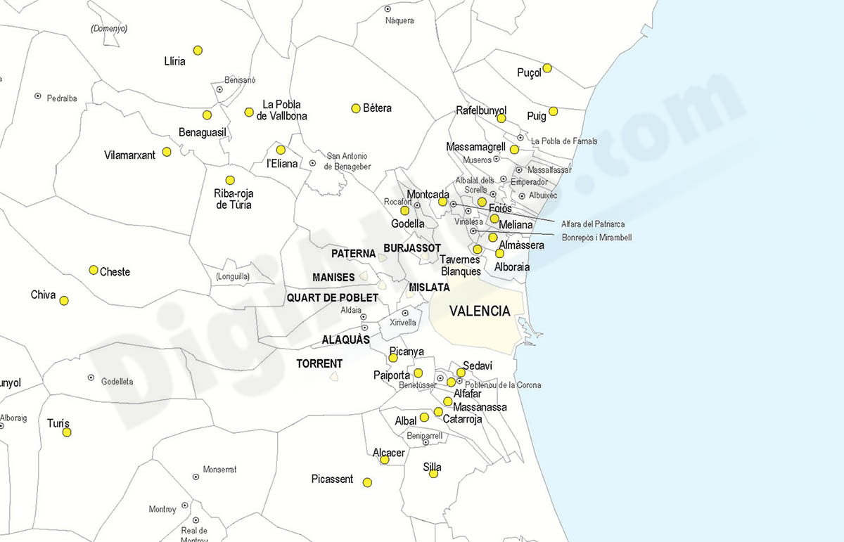
Digital map of the Valencian Community with all the municipalities and towns grouped in layers according to the number of inhabitants.
Two vector files are provided:
A 100% editable version in Adobe Illustrator format, which allows modifying and customising colours, texts and styles, as well as managing (colouring) each municipal district separately.
Another version in Acrobat PDF format for printing directly at the desired size, always with the maximum resolution. It also allows the management of layers, which can be displayed and/or hidden to generate various types of personalised maps.
The acquisition of the maps implies that you must have the appropriate graphic applications to be able to edit the files.
-Original measurements:
400x750 cm (Fully resizable vector file for High-quality printing).
-Download formats:
Adobe Illustrator, Acrobat PDF
- This map is also available through the PACK DIGIATLAS »
-You can also request a quote » to modify this map and adapt it to your projects.
Download up to 15 digital maps of your choice through a subscription to the 'Pack DigiAtlas'.

Postcode maps of cities, regions and countries. Optionally with demographic data for geo-marketing projects.

City street maps with delineation of urban areas, streets, squares, parks, green areas, buildings of interest, etc.
DigiAtlas select every week until three random maps from their catalog and intends to offer them at a very lower price than its regular cost.
These maps change every 7 days. If either of them matches your interest take advantage of this opportunity to acquire digital maps to a very special price.