


PACK DIGIATLAS
Download up to 15 digital maps of your choice through a subscription to the 'Pack DigiAtlas'.
-Description:
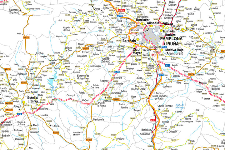
Digital map of the Autonomous Community of Navarre at a scale of 1:300.000, with the autonomous and provincial limits, municipalities, capitals, cities and towns grouped according to the number of inhabitants, road network: motorways, dual carriageways, dual carriageways, high performance roads, roads of general interest, roads of interest to the Autonomous Community, first and second order autonomous roads, local roads and other roads, railway network, rivers and lakes.
100% editable vector map (Adobe Illustrator and Acrobat PDF), organised in separate layers to customise colours, styles and generate different versions of the map for business and graphic design projects.
-Original measurements:
54x56 cm (Fully resizable vector file for High-quality printing).
-Download formats:
Adobe Illustrator, Acrobat PDF
-You can also request a quote » to modify this map and adapt it to your projects.
Download up to 15 digital maps of your choice through a subscription to the 'Pack DigiAtlas'.

Postcode maps of cities, regions and countries. Optionally with demographic data for geo-marketing projects.

City street maps with delineation of urban areas, streets, squares, parks, green areas, buildings of interest, etc.
DigiAtlas select every week until three random maps from their catalog and intends to offer them at a very lower price than its regular cost.
These maps change every 7 days. If either of them matches your interest take advantage of this opportunity to acquire digital maps to a very special price.