
Ask price
Roadmap of Aragon
Digital map of the autonomous community of Aragon (Spain) at a scale of 1:300.000, with all the municipalities, regional and provincial boundaries, detailed network of roads, roads and tracks,
(...) Read more »
Adobe Illustrator, Acrobat PDF
79,00 €
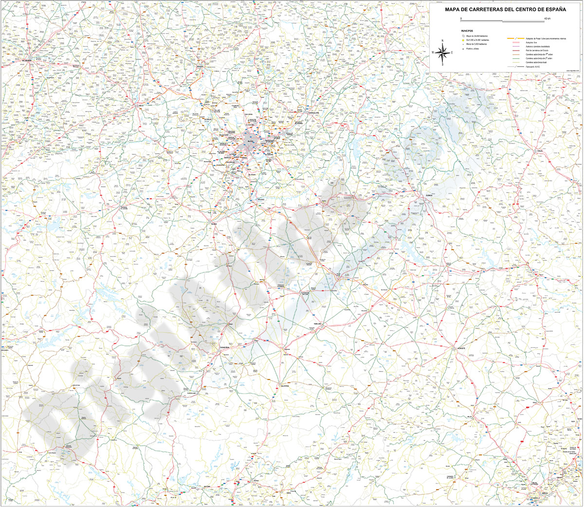
Roadmap of center Spain
Detailed digital map of Center of Spain, include the Autonomous communities of Castilla–La Mancha (Castile–La Mancha) and Community of Madrid, also the province of Soria. Roadmap and all cities, r
(...) Read more »
Adobe Illustrator, PDF

Ask price
Roadmap of Galicia, Asturias and León
Detailed map of roads and towns in the northwest of Spain.
(...) Read more »
Adobe Illustrator, Acrobat PDF

175,00 €
Roadmap of northwestern Spain
Vector file map of Northern and Western Autonomous communities of Spain, with all cities and roads, railroad, principal rivers and lakes and other relevant political information. Scale 1:300.000.
Adobe Illustrator, Acrobat PDF

79,00 €
Tarragona to Barcelona road map
Road map from Tarragona to Barcelona showing towns and cities, major rivers and lakes and coloured comarcas. All features are in separated layers. High quality poster size map for print purposes.
Adobe Illustrator, PDF, JPG (300dpi)
98,00 €
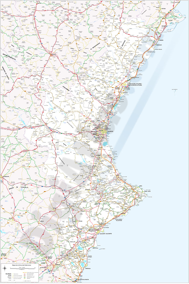
Valencian Community road map
Detailed digital map of the Valencian Community, in digital format and at a scale of 1:325,000.
The map includes the network of motorways, dual carriageways, national, regional and county roads, with their labelling, and local roads, AVE lines and railway network, rivers, lakes, salt lakes and geographical names, regional and provincial boundaries, capitals of municipalities, cities and towns ordered by number of inhabitants.
Cartography in vector format organised in separate layers, fully editable, to customise colours, texts and styles. Download formats: Adobe Illustrator and PDF to print in poster size, always with the highest quality.
See less «
Adobe Illustrator, Acrobat PDF
