79,00 €
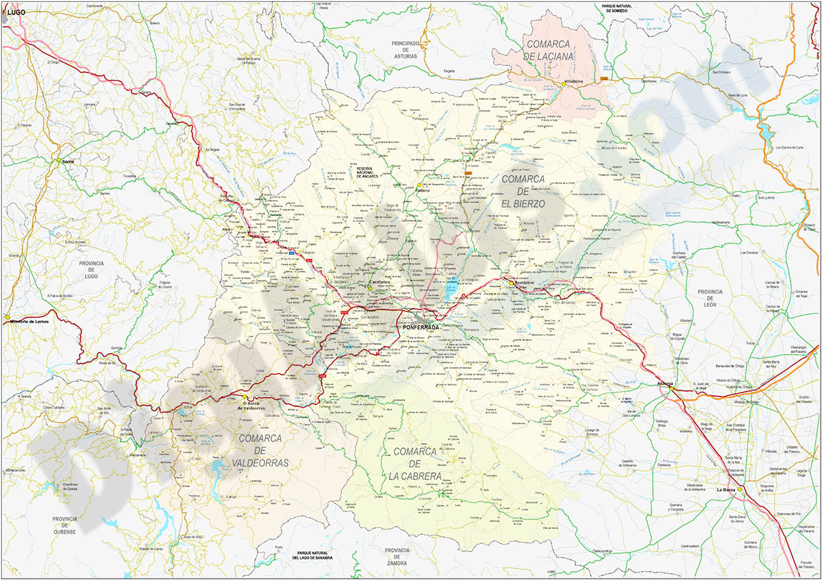
El Bierzo-Valdeorras-Cabrera - comarcal map
Comarcal map of the Comarca de El Bierzo, Laciana, Valdeorras and La Cabrera (provinces of Leon and Galicia, Spain). Poster size map shows detailed roads and cities, rivers and lakes, relevant geograp
(...) Read more »
Acrobat PDF, JPG (300dpi)

95,00 €
Europe map with seaports
Fully vectorized and editable map of Europe with more than 1200 seaports, country names, their capitals, and a color shaded-relief TIFF image.
Adobe Illustrator, Acrobat PDF, imagen TIFF
59,00 €
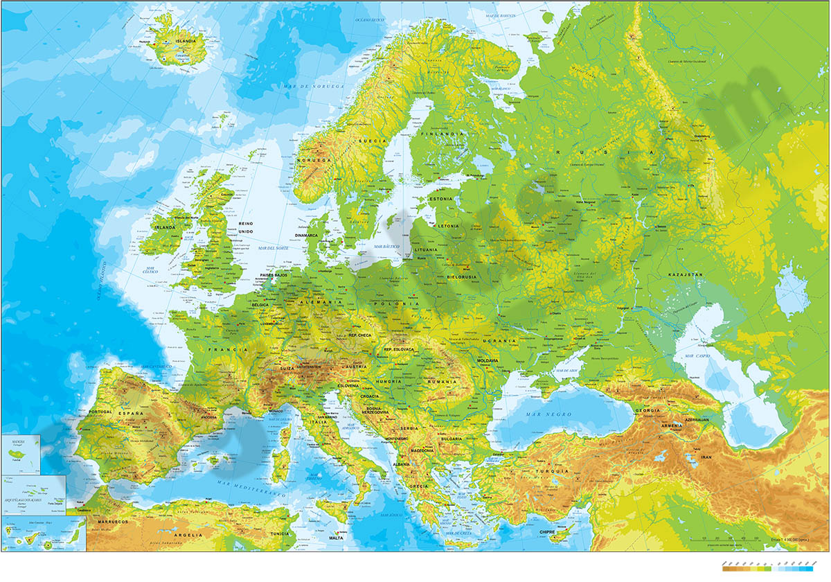
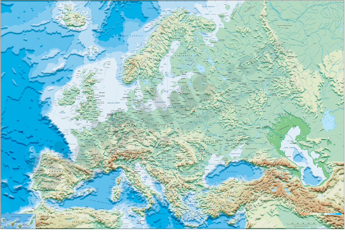
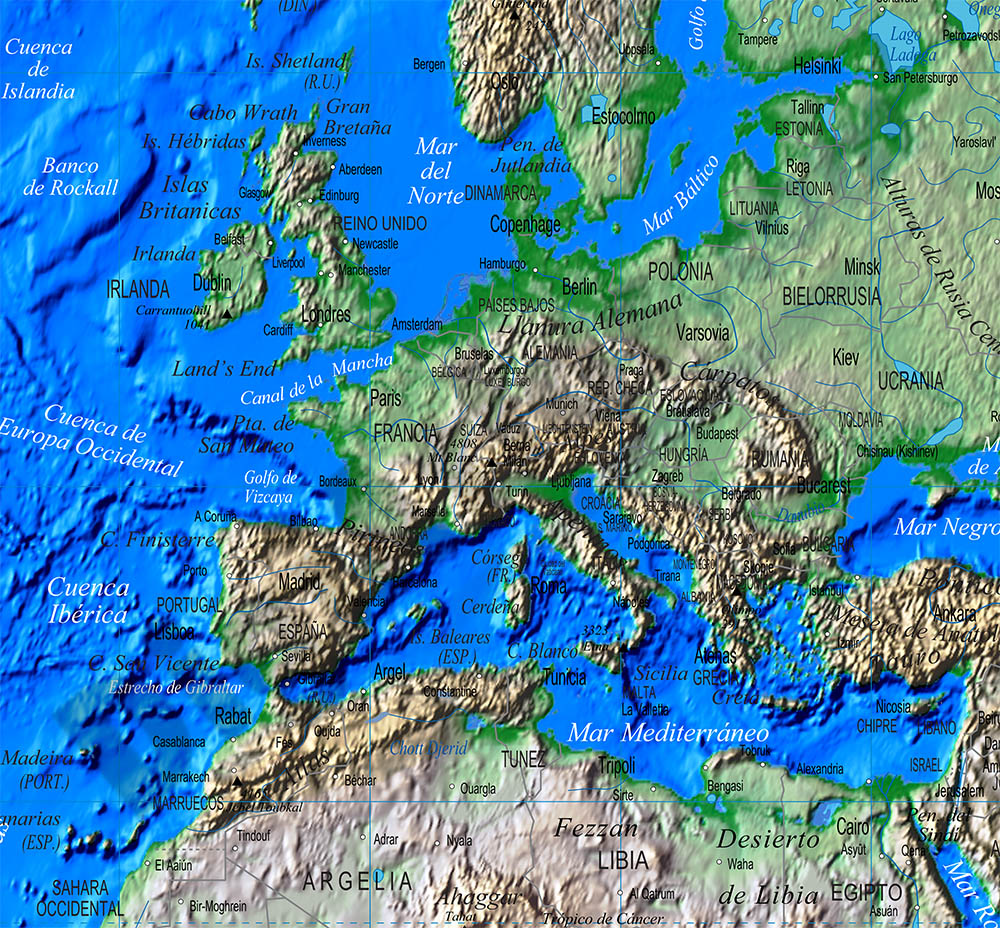
Europe physical vectorized-relief map
Fully editable digital map of Europe continent, showing layers of altitude intervals and Bathymetry colours.
Include geographical and major cities of all countries in Europe.
(...) Read more »
Adobe Illustrator, Acrobat PDF

79,00 €
Europe political and geographical map
Digital physical and geographical map of Europe.
(...) Read more »
Adobe Illustrator, Acrobat PDF + TIFF
55,00 €
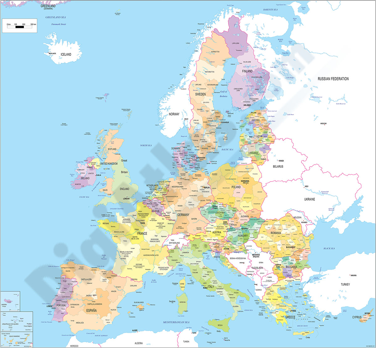
Europe Union regions map
Digital map of the 27 countries of the European Union with regions and capitals.
(...) Read more »
Adobe Illustrator, Acrobat PDF
55,00 €
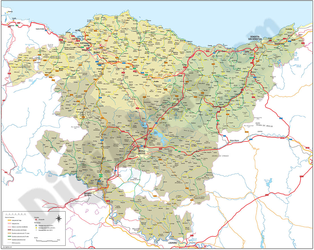
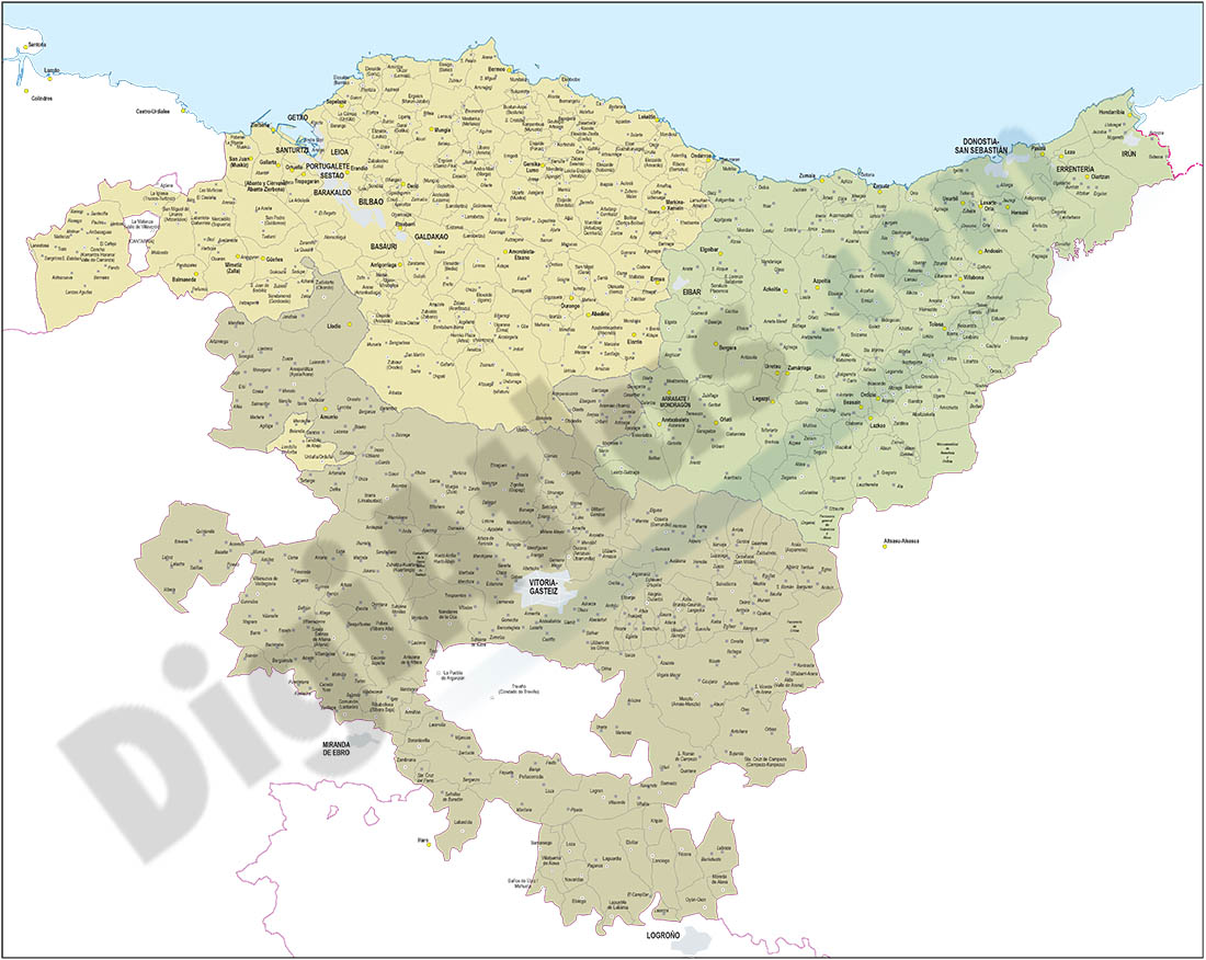
Euskadi map
Detailed autonomous map of the Basque Country, Euskadi, at a scale of 1:300.000, with the limits of the provinces, road network, rivers and lakes, cities and towns, geographical names. 100% editable v
(...) Read more »
Adobe Illustrator, Acrobat PDF
59,99 €
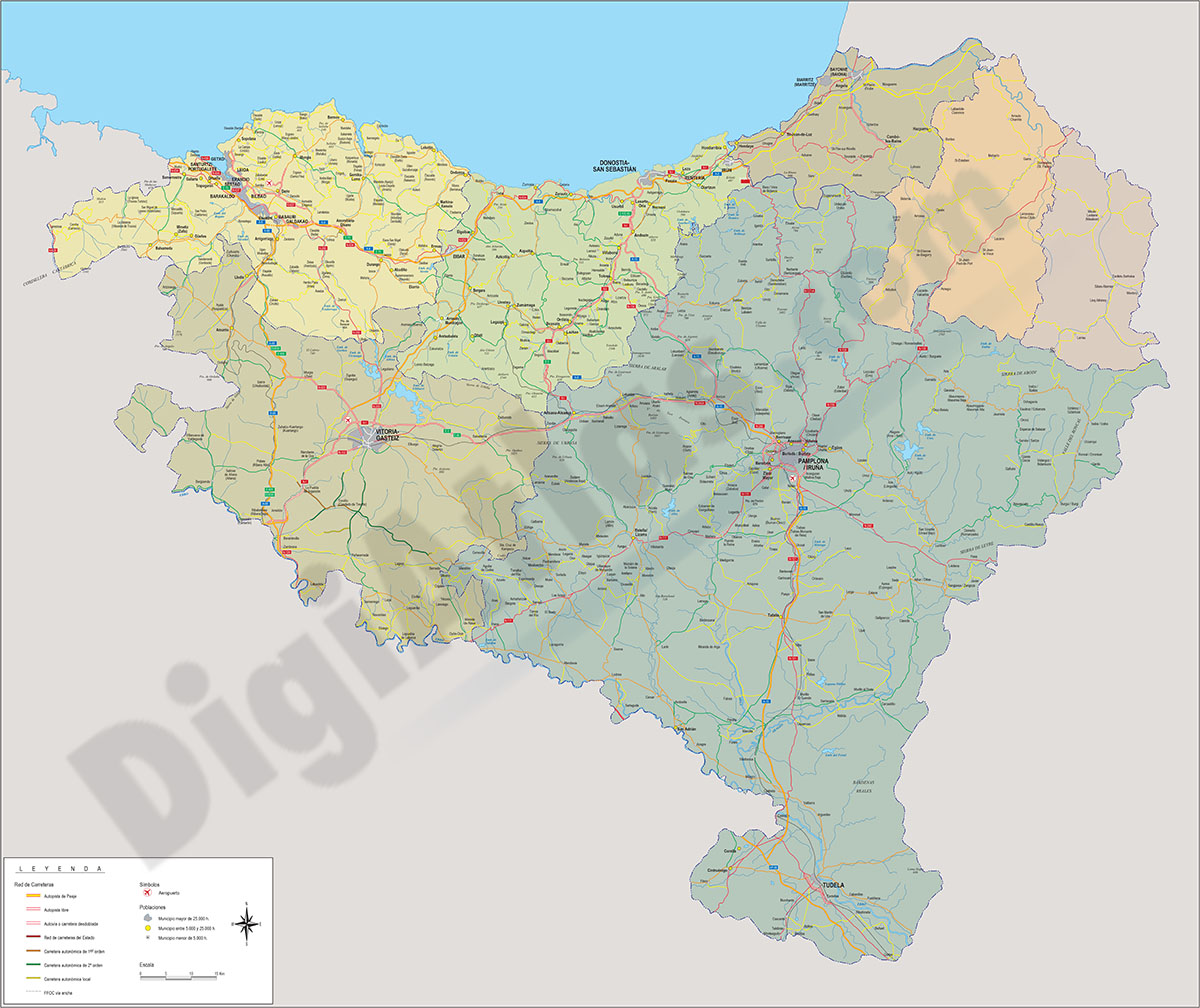
Euskadi map with municipalities borders
Map of Euskadi autonomous community (Spain) showing municipalities borders. Municipality areas of each basque province (Bizkaia, Araba and Gipuzkoa) in a separate color.
Adobe Illustrator, PDF
55,00 €
Euskal Herria map
Digital map at a scale of 1:300,000 of the 7 provinces that make up the Basque Country, with administrative boundaries, towns, road network, railway network, main rivers and lakes.
(...) Read more »
Adobe Illustrator, Acrobat PDF
55,00 €
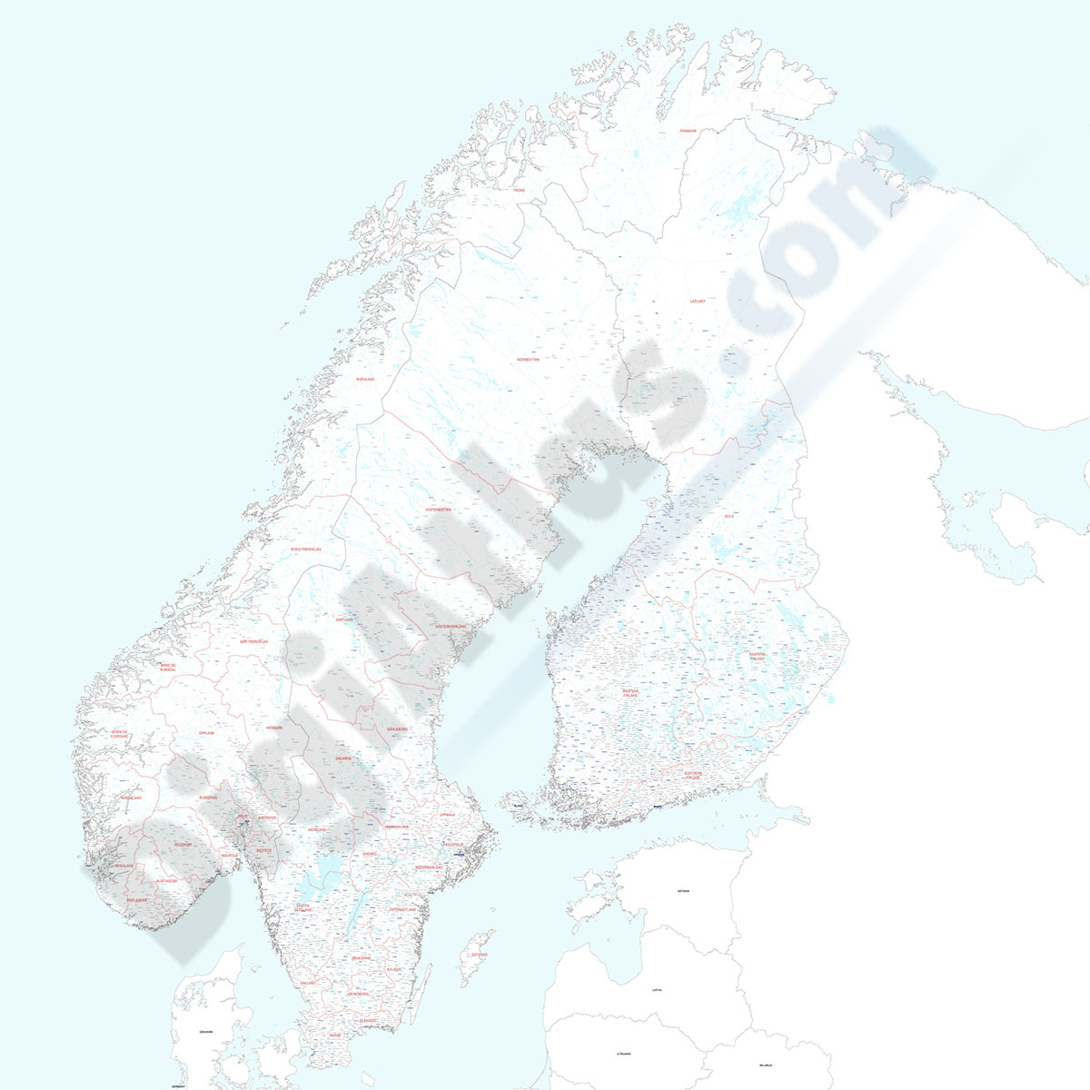
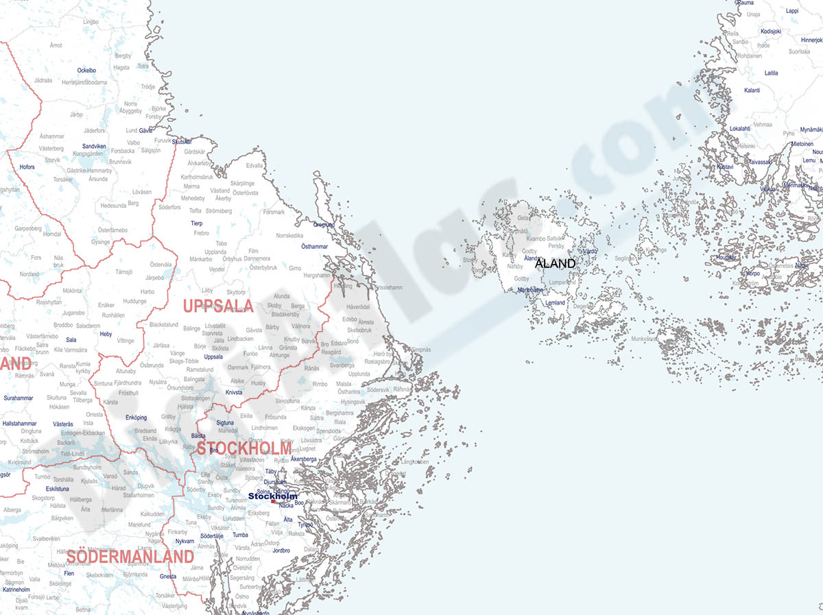
Finland, Norway and Sweden - city map
Detailed map of Finland, Norway and Sweden showing the inner administrative division, counties and municipality borders and a larger number of towns and cities. Poster size map in PDF vectorized file
(...) Read more »
Acrobat PDF
79,00 €
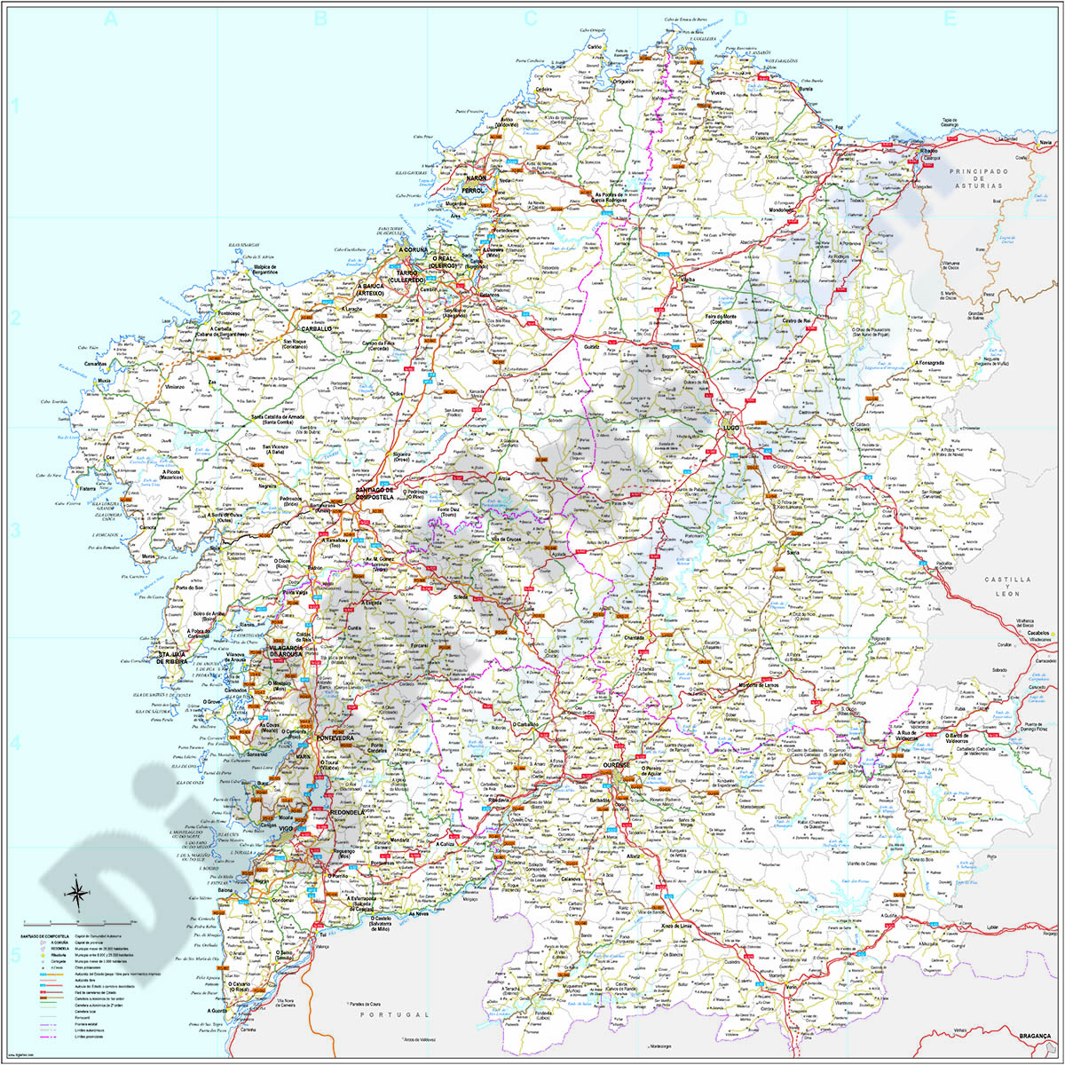
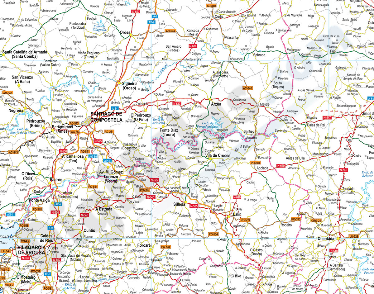
Galicia (Galizia) Spain autonomous community map
Digital poster size map of Galicia autonomous community (Spain).
(...) Read more »
Adobe Illustrator, Acrobat PDF

59,99 €
Galicia map with municipalities
Digital map of Galicia autonomous community (northwest Spain) with the municipalities (concellos), their capitals and villages.
(...) Read more »
Adobe Illustrator, Acrobat PDF
125,00 €
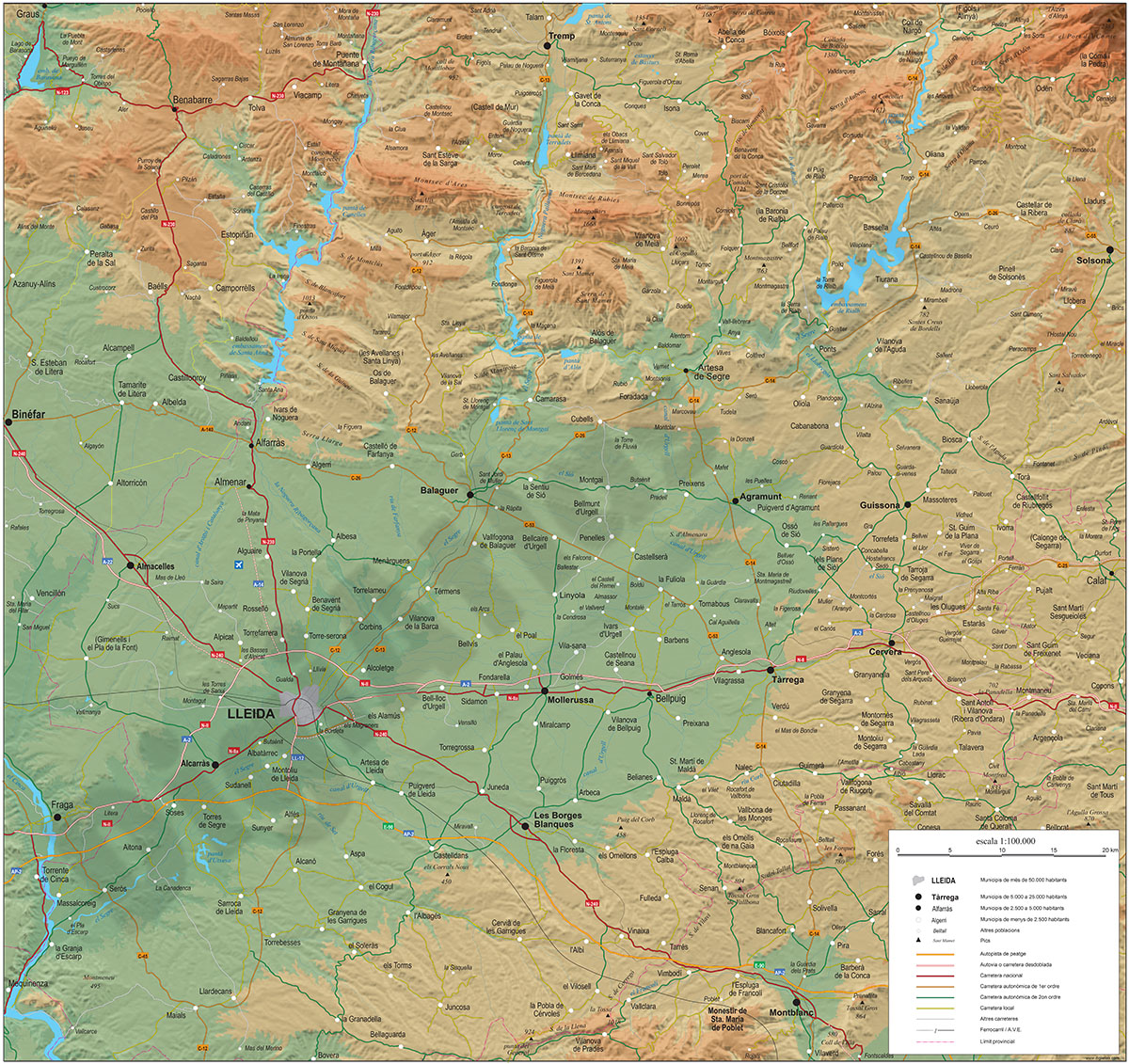
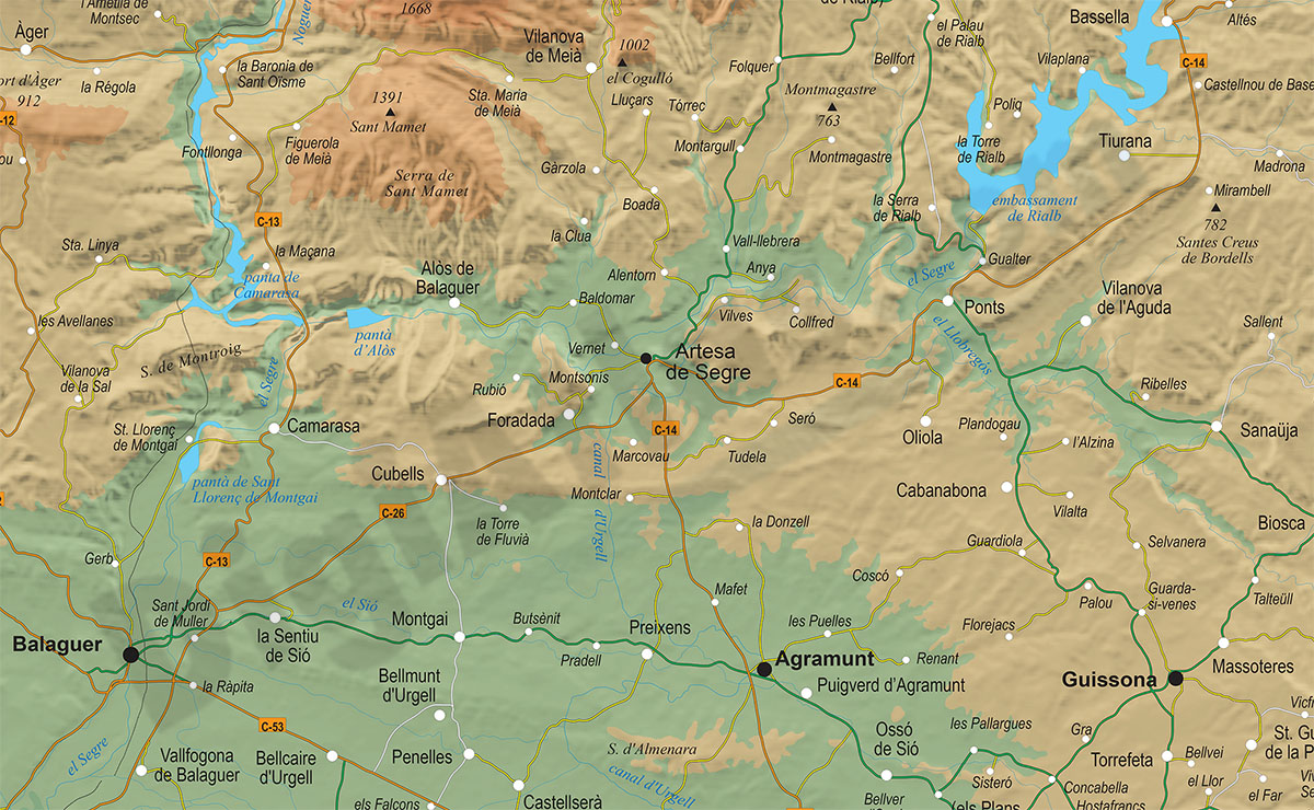
Geographical map of provice of Lleida and eastern Aragon zone
Poster-size digital map of the province of Lleida (Catalonia, Spain) with detailed geographical information.
(...) Read more »
Adobe Illustrator, Acrobat PDF + TIFF
98,00 €
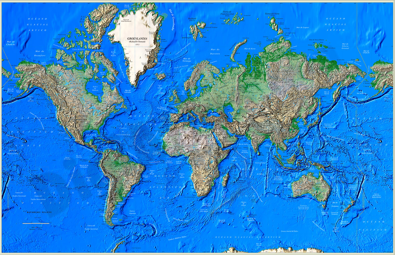
Great Worldmap Poster Relief
Large digital relief map of the world.
Great Worldmap poster with relief available in a TIFF image of 23622x15249 pixels and 250 dpi resolution.
(...) Read more »
Adobe PhotoShop (.psd)
75,00 €
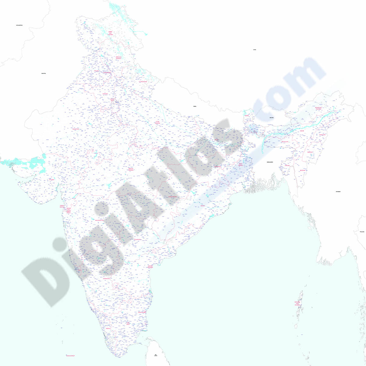
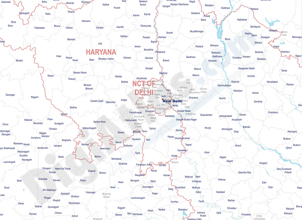
India - city map
Detailed map of India (Republic of India) showing the inner administrative division, states and union territories, municipality borders and many names of towns and cities. Poster size map in PDF vecto
(...) Read more »
Acrobat PDF
55,00 €
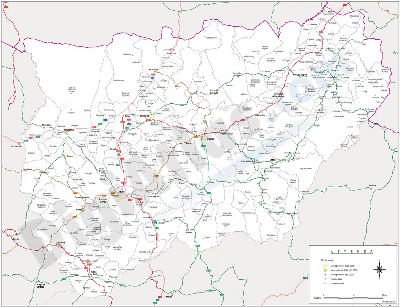
Jaen province map with municipalities
Map of Jaen province (autonomous community of Andalucia-Spain) showing municipalities borders, capitals, towns, cities and major roads.
Adobe Illustrator, Acrobat PDF

