55,00 €
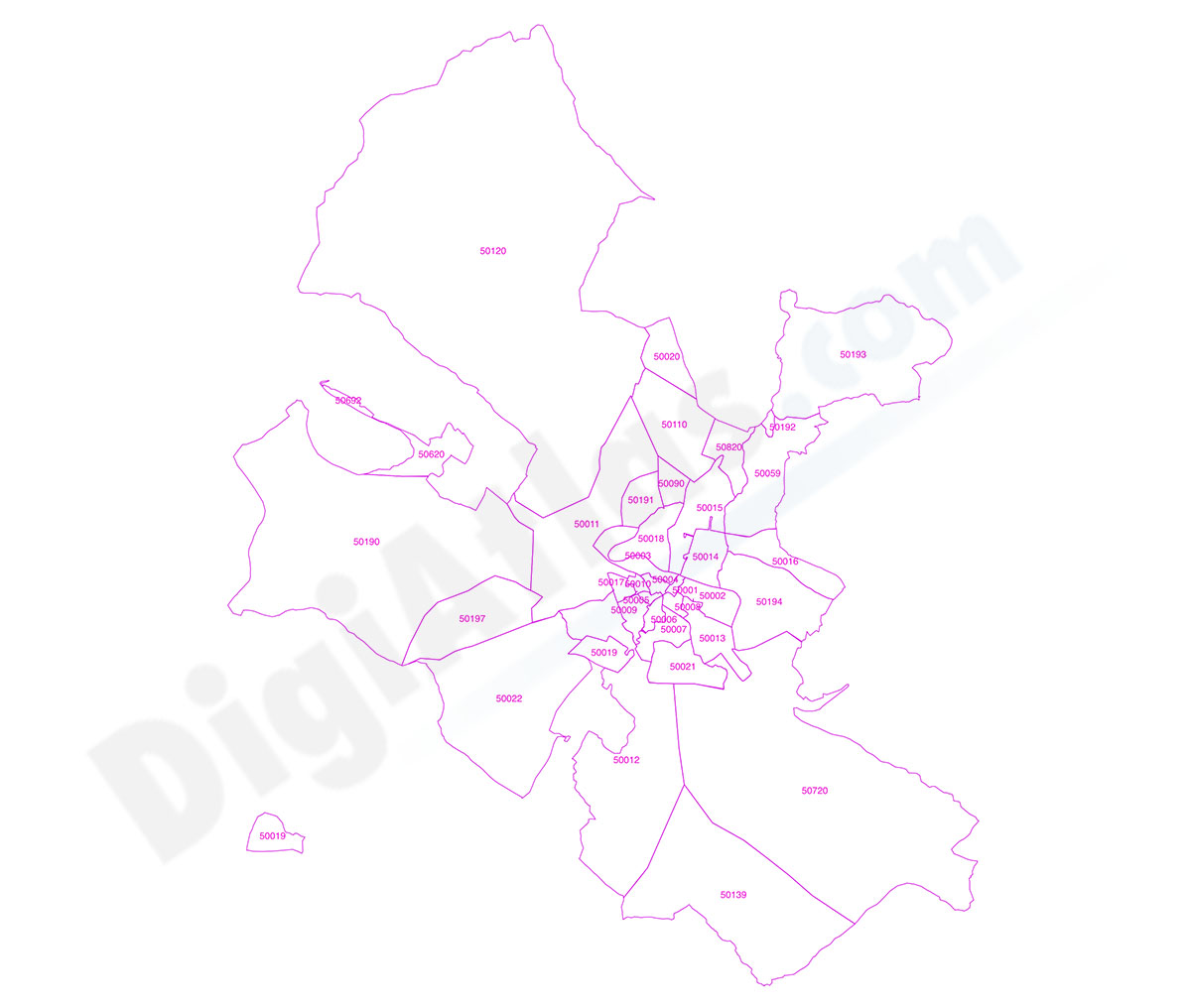
Zaragoza municipality - Population by Zip Code
NUMBER OF INHABITANTS BY POSTAL CODE OF THE MUNICIPALITY OF ZARAGOZA.
Excel file and updated cartography in Shapefile and KML format of all the postcodes of the municipality of Zaragoza with population data. Updated to 2024.
The database includes the postal code of five digits, autonomous community, province, region, municipality, coordinates of the centroid (central point of each postal area), area in km2, Total inhabitants, Total men, Total women and the breakdown by sex and age groups (quinquennial groups).
The information on the population by postcode comes from crossing the postcode cartography with that of census sections of the INE (National Statistics Institute) and that of portals of the IGN (National Geographic Institute), which together with the statistical population data of the INE gives the resulting information an excellent level of accuracy and granularity.
See less «
Excel

65,00 €
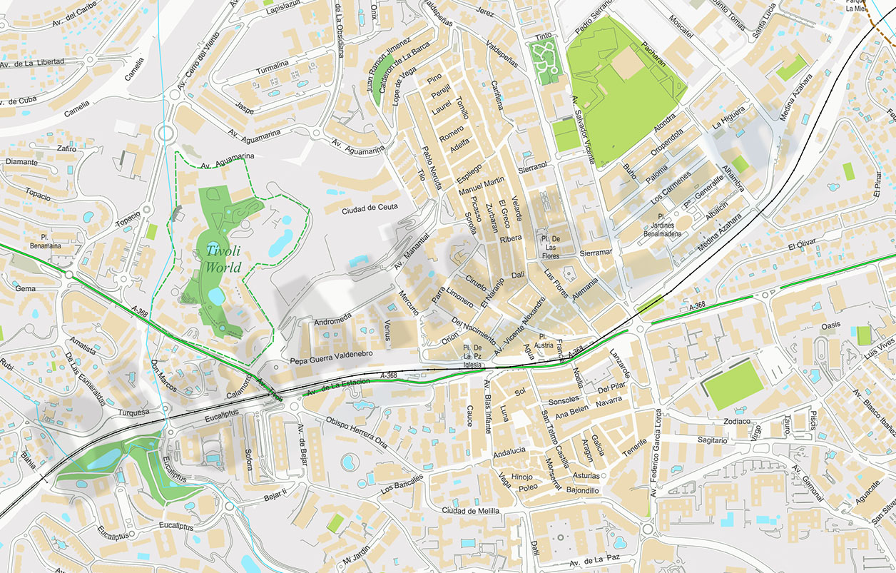
Benalmadena - city map
Digital street map of Benalmádena (province of Málaga, Andalusia) with the delineation of streets and squares, blocks of houses, singular buildings, parks, green areas and names of streets and squar
(...) Read more »
Acrobat PDF
150,00 €
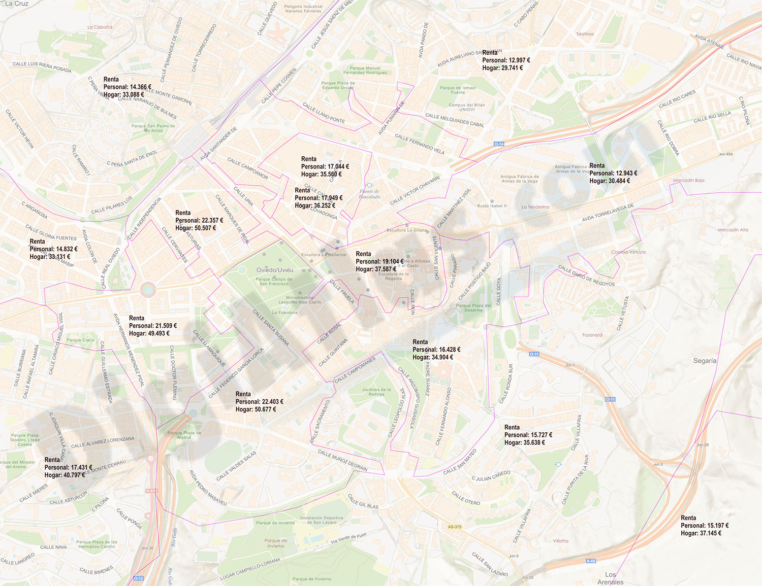
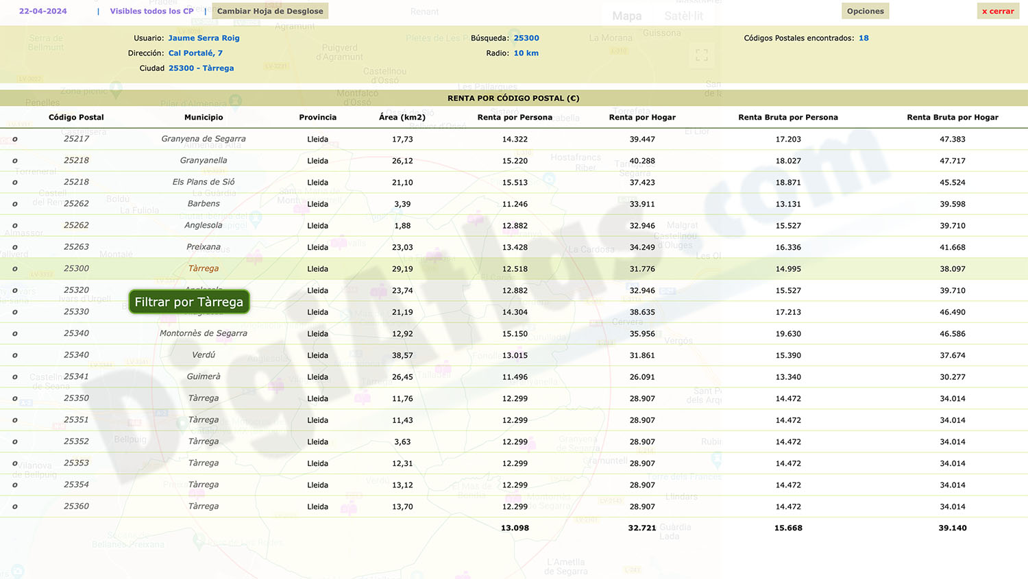
Income and Revenue by Postcode in Spain
Looking to gain valuable insights into income and rental data in Spain? Look no further than our "Excel file with Income and Revenue by Postcode in Spain."
(...) Read more »
Excel
Ask price
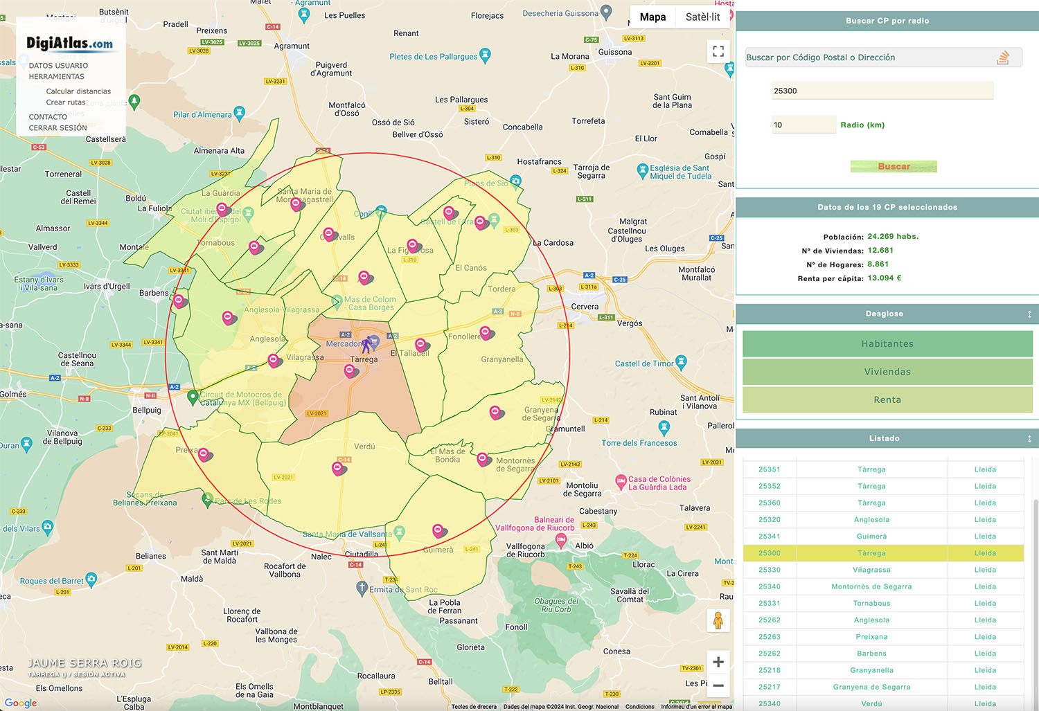
Postal Code Finder by Radio
Postcode finder by radius with demographic information.
(...) Read more »

175,00 €
Population by postcode in Spain
-NUMBER OF INHABITANTS OF EACH ZIP CODE IN SPAIN.
Learn the population data for every zip code in Spain with this comprehensive database.
(...) Read more »
Excel

Ask price
Number of dwellings by postcode in Spain
Number of dwellings by Postal Code
There are 235 municipalities in Spain with more than 25,000 inhabitants and with more than one postal code within their municipal boundaries.
(...) Read more »
Excel
55,00 €
Sant Andreu de Llavaneres - city map
Street map of Sant Andreu de Llavaneres municipality (Comarca of Maresme, province of Barcelona, Autonomous Community of Catalonia, Spain). Digital map contain separate layers of information with urba
(...) Read more »
Adobe Illustrator, PDF
55,00 €
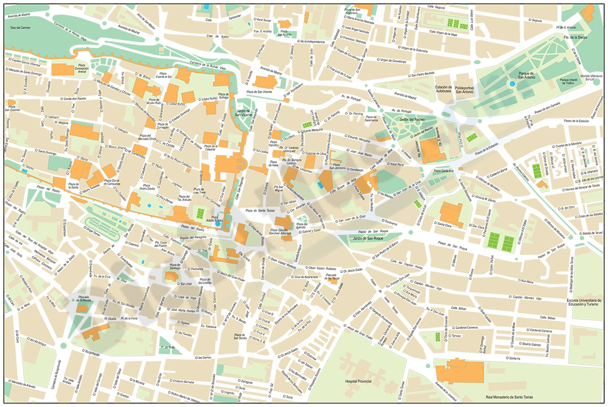
Avila - city map center
Digital street map of the city centre of Ávila (Autonomous Community of Castile and León - Spain), with the delineation of streets and squares, blocks of houses, parks and green areas, with colours
(...) Read more »
Adobe Illustrator, Acrobat PDF
59,00 €
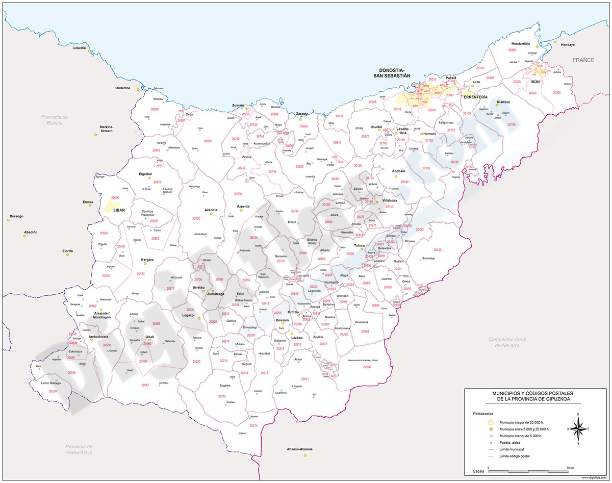
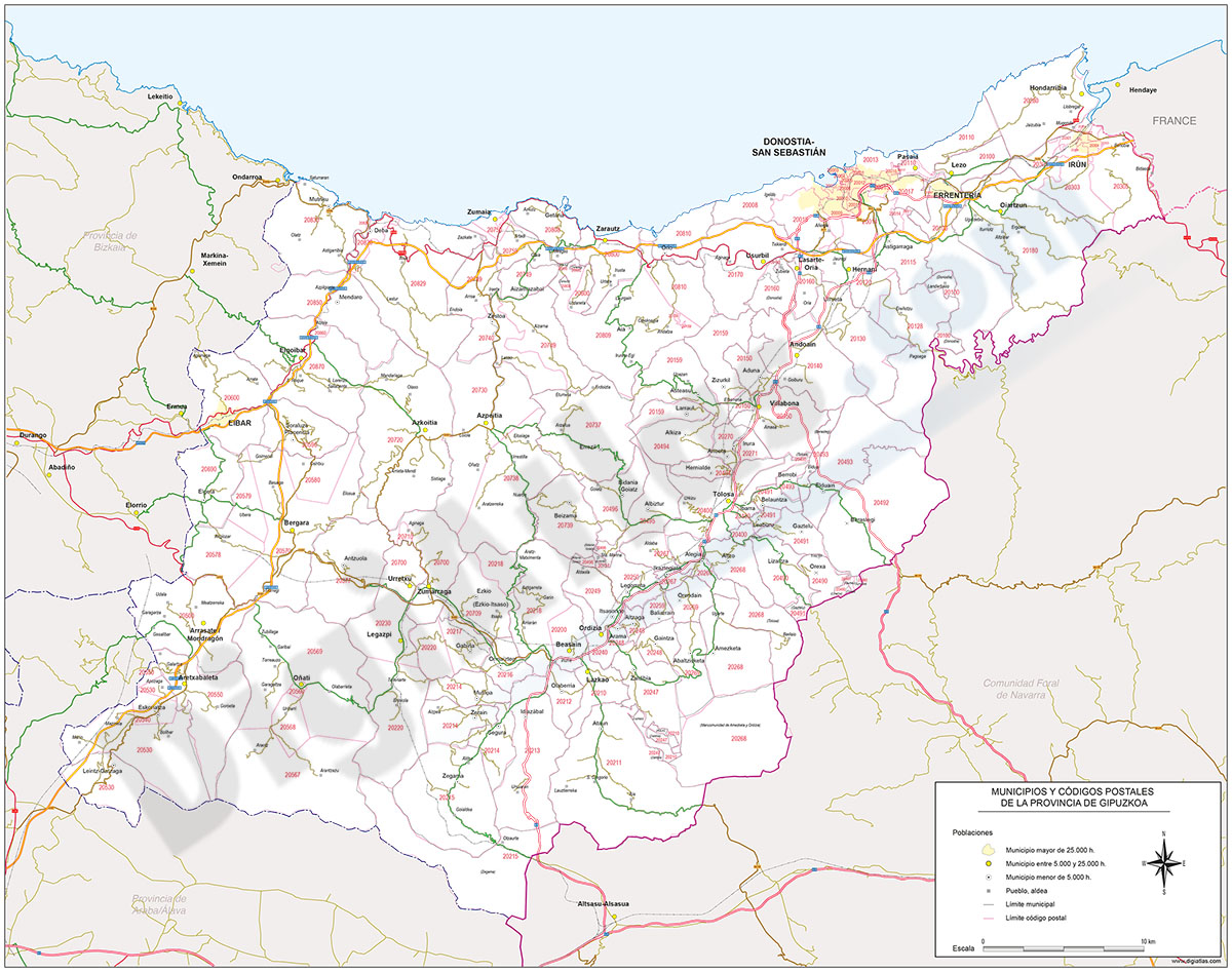
Map of Gipuzkoa province with municipalities and postal codes
Digital map of the province of Gipuzkoa (Basque Country - Spain) with the areas of all 5-digits postal codes, administrative boundaries (state border, autonomous, provincial and municipal boundaries),
(...) Read more »
Adobe Illustrator, Acrobat PDF
59,99 €
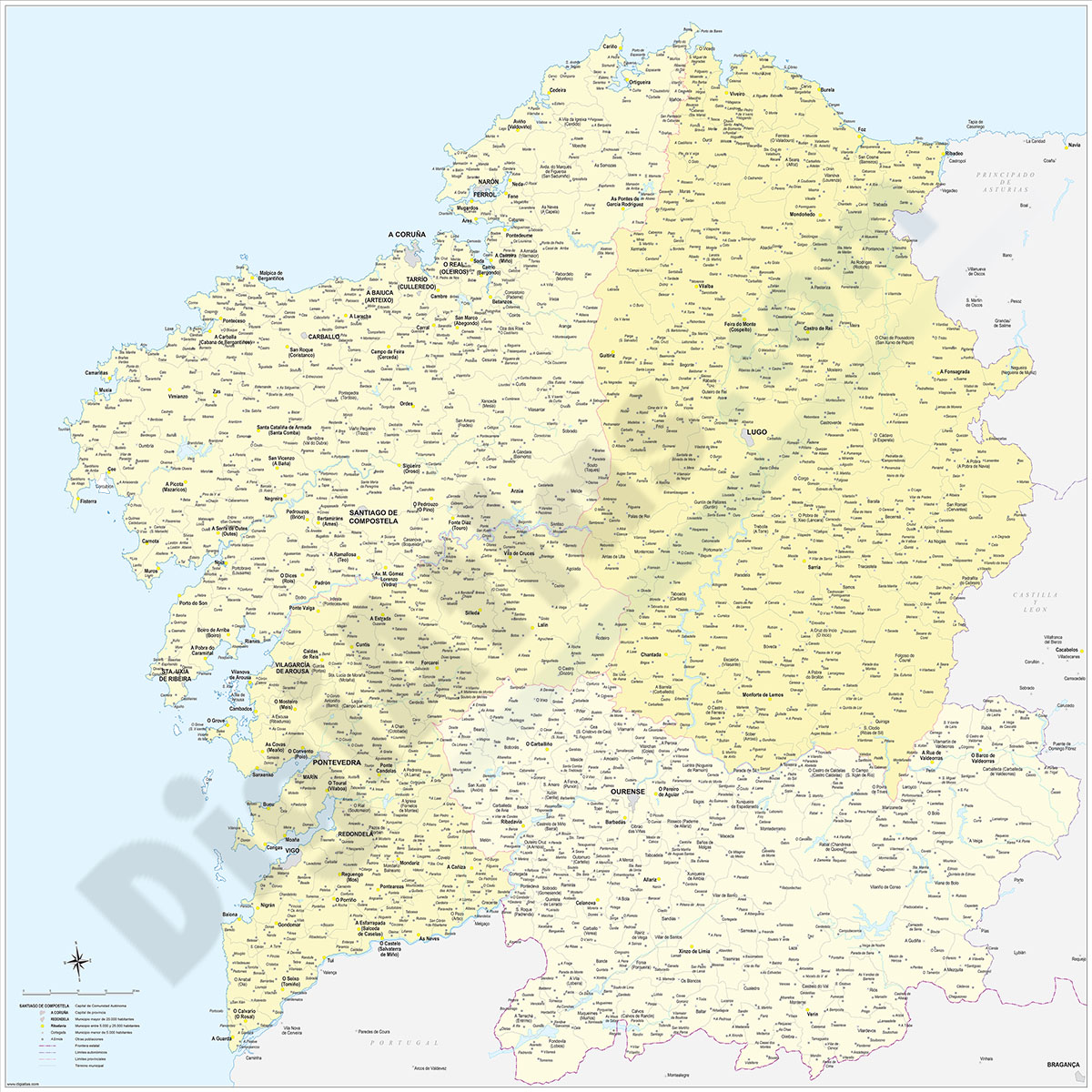
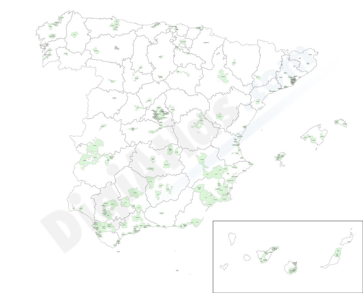
Galicia map with municipalities
Digital map of Galicia autonomous community (northwest Spain) with the municipalities (concellos), their capitals and villages.
(...) Read more »
Adobe Illustrator, Acrobat PDF
59,00 €
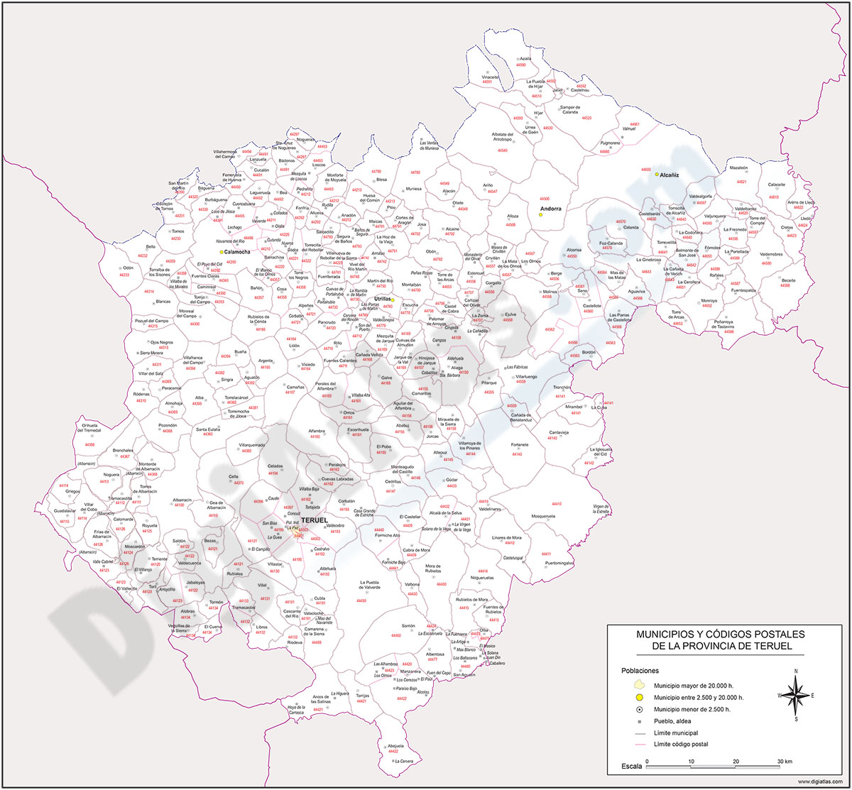
Map of Teruel province with municipalities and postal codes
Map of postal codes of the province of Teruel.
(...) Read more »
Adobe Illustrator, Acrobat PDF
19,95 €
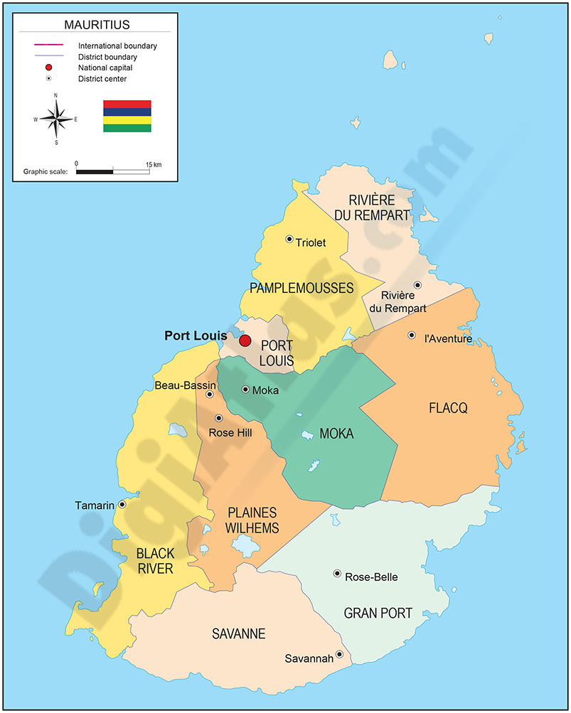
Map of Mauritius
Digital political map of the Republic of Mauritius with the internal administrative division (districts and dependencies), their names and capitals.
(...) Read more »
Adobe Illustrator, Acrobat PDF

350,00 €
Portugal - Population by 7-digit postal code
Excel file with the inhabitants by 7-digit postcodes of Portugal.
(...) Read more »
Excel
275,00 €
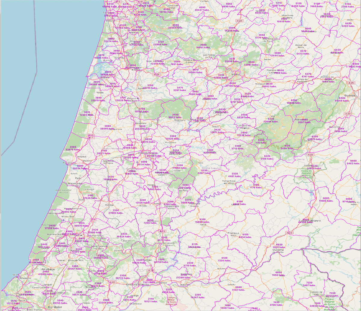
Portugal - population by 4 digit postal codes
Digital map of Portugal postcodes with population data.
(...) Read more »
Shapefile, Excel

125,00 €
Portugal - Excel population by 4-digit postal code
Excel file with the inhabitants by 4-digit postcode of Portugal.
(...) Read more »
Excel
