
PACK DIGIATLAS
Download up to 15 digital maps of your choice through a subscription to the 'Pack DigiAtlas'.

-Description:
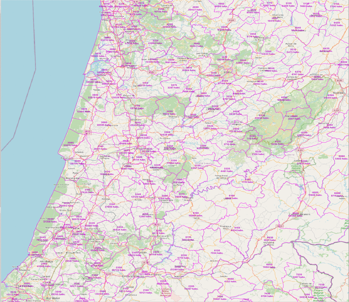
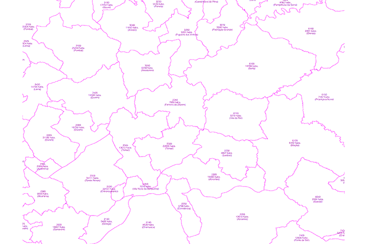
Digital map of Portugal postcodes with population data.
Number of inhabitants of each 4-digit postal area of the whole of Portugal (mainland and autonomous archipelagos of the Azores and Madeira).
Georeferenced cartography in Shapefile format. Also available only the population database in Excel format.
Both the geo-referenced map and the Excel file contain the following information:
id (unique identifier of each postcode area)
CP4 (4-digit postcode)
Distrito
Concelho
xcoord - ycoord (centroid coordinates)
Total inhabitants
Total Men
Total Females
0 to 14 years old
15 to 24 years
25 to 64 years old
over 65 years old
(see more information »)
-Download formats:
Shapefile, Excel
-More information:
Mapa digital dos códigos postais de Portugal com dados populacionais.
Número de habitantes de cada área postal de 4 dígitos de todo o território português (continente e arquipélagos autónomos dos Açores e da Madeira).
Cartografia georreferenciada em formato Shapefile. Também disponível apenas a base de dados da população em formato Excel.
Tanto o mapa geo-referenciado como o ficheiro Excel contêm a seguinte informação:
id (identificador único de cada zona de código postal)
CP4 (código postal com 4 dígitos)
Distrito
Concelho
xcoord - ycoord (coordenadas do centróide)
Total de habitantes
Total Homens
Total Mulheres
0 a 14 anos
15 a 24 anos
25 a 64 anos
mais de 65 anos
-You can also request a quote » to modify this map and adapt it to your projects.
Download up to 15 digital maps of your choice through a subscription to the 'Pack DigiAtlas'.

Postcode maps of cities, regions and countries. Optionally with demographic data for geo-marketing projects.

City street maps with delineation of urban areas, streets, squares, parks, green areas, buildings of interest, etc.
DigiAtlas select every week until three random maps from their catalog and intends to offer them at a very lower price than its regular cost.
These maps change every 7 days. If either of them matches your interest take advantage of this opportunity to acquire digital maps to a very special price.