
95,00 €
Merida - urban area map
Digital map of MéRIDA (capital of the autonomous community of Extremadura, province of Badajoz, western central Spain) with the delineation of the urban area, municipal boundaries, communication rout
(...) Read more »
Adobe Illustrator, Adobe PDF

75,00 €
Map of Extremadura with municipalities, postal codes and major roads
Vector-file map of Extremadura autonomous community (Spain) with cities, towns, municipalities borders, major roads and 5-digit postal codes.
(...) Read more »
Adobe Illustrator, Arobat PDF

55,00 €
Merida - city map
Vector-file map of Merida (capital of the autonomous community of Extremadura, province of Badajoz, western central Spain). All features are in separated layers.
Adobe Illustrator, PDF

55,00 €
15 maps of Spanish provinces with comarcas and municipalities
Digital maps of 15 provinces of Spain with comarcas and municipalty borders and city names. (Cáceres, Badajoz, Albacete, Ciudad Real, Toledo, Alicante, Castellón, Valencia, Murcia, Burgos, León, Sa
(...) Read more »
imagen JPG (250 dpi)

79,00 €
Comarcal maps of Spain autonomous communities
Maps of the comarcal division of all 17 spanish autonomous communities. Each map shows administrative limits and their coloured and named comarcas, capitals and major cities.
(...) Read more »
Adobe Illustrator, PDF

29,00 €
Map of Extremadura Autonomous Community with municipalities
Digital map of the autonomous community of Extremadura (Spain) with regional and provincial boundaries, municipalities, cities and towns.
(...) Read more »
Adobe Illustrator, Acrobat PDF
59,00 €
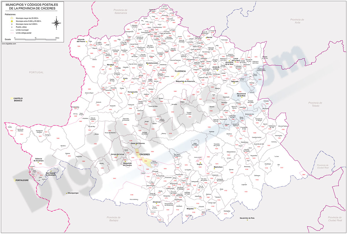
Map of Caceres province with municipalities and postal codes
Digital map of the province of Cáceres (autonomous community of Extremadura, Spain) with municipalities, towns and all postcodes.
Two vector files can be downloaded: the Adobe Illustrator (.ai) version is 100% editable and allows you to modify and customise colours, texts and styles, as well as manage (colour) each municipality and each postcode separately. The PDF version allows the map to be printed directly at the desired size, always with the maximum resolution.
It also allows the management of layers, which can be displayed and/or hidden to generate various types of customised maps.
The map is optimised for establishing commercial areas, distribution and sales zones, transport routes, graphic design, advertising, etc.
High resolution map to print directly at the desired size, always with the highest quality.
See less «
Adobe Illustrator, Acrobat PDF