1- Asia physical vectorized-relief map
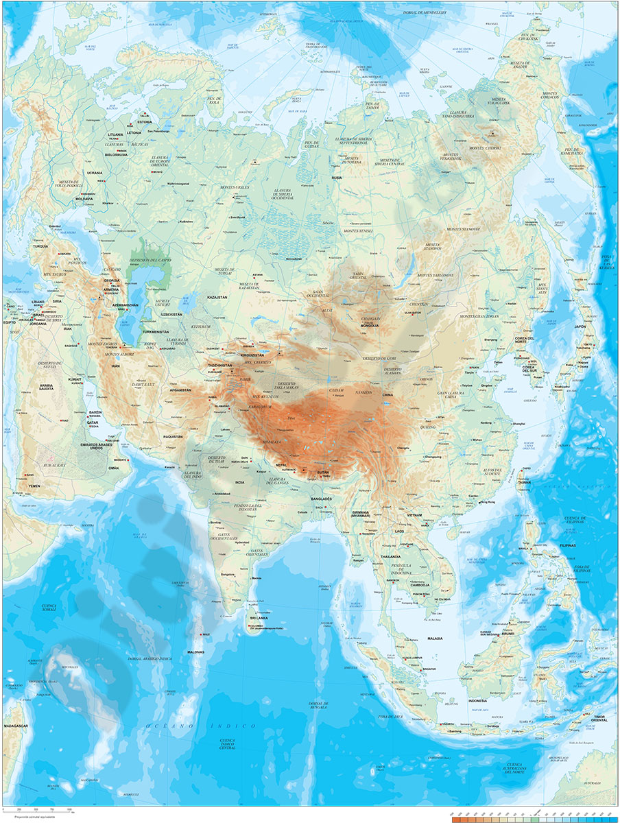
Digital map of Asia.
Map in 100% editable vector format of the entire Asian continent, with the altimetry and bathymetry strips coloured and separated in layers, all country borders with their capitals, geographical names and important towns.
A... Read more
Adobe Illustrator, Acrobat PDF, TIFF image
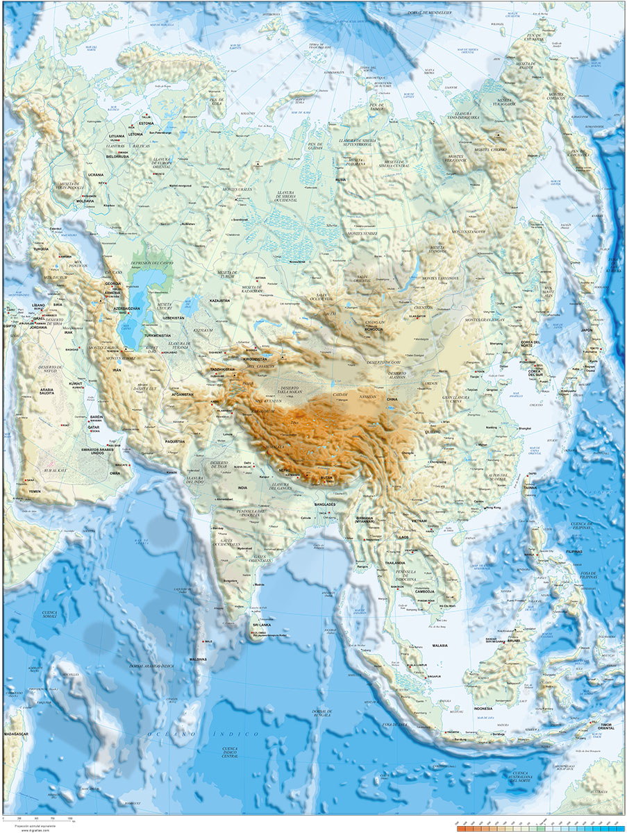
2- Asia political and geographical map
Digital political and geographical map of Asia.
Download 100% editable vectorized files with political and geographical layers of information (borders, countries, rivers, lakes, capitals, important cities and geographical names).
Includes a TIFF... Read more
Adobe Illustrator, Acrobat PDF, TIFF image
3- Map of Brunei

Fully editable vector file. Include political layers of inner administrative division, with their names and capitals.
Adobe Illustrator, PDF
4- Map of Indonesia
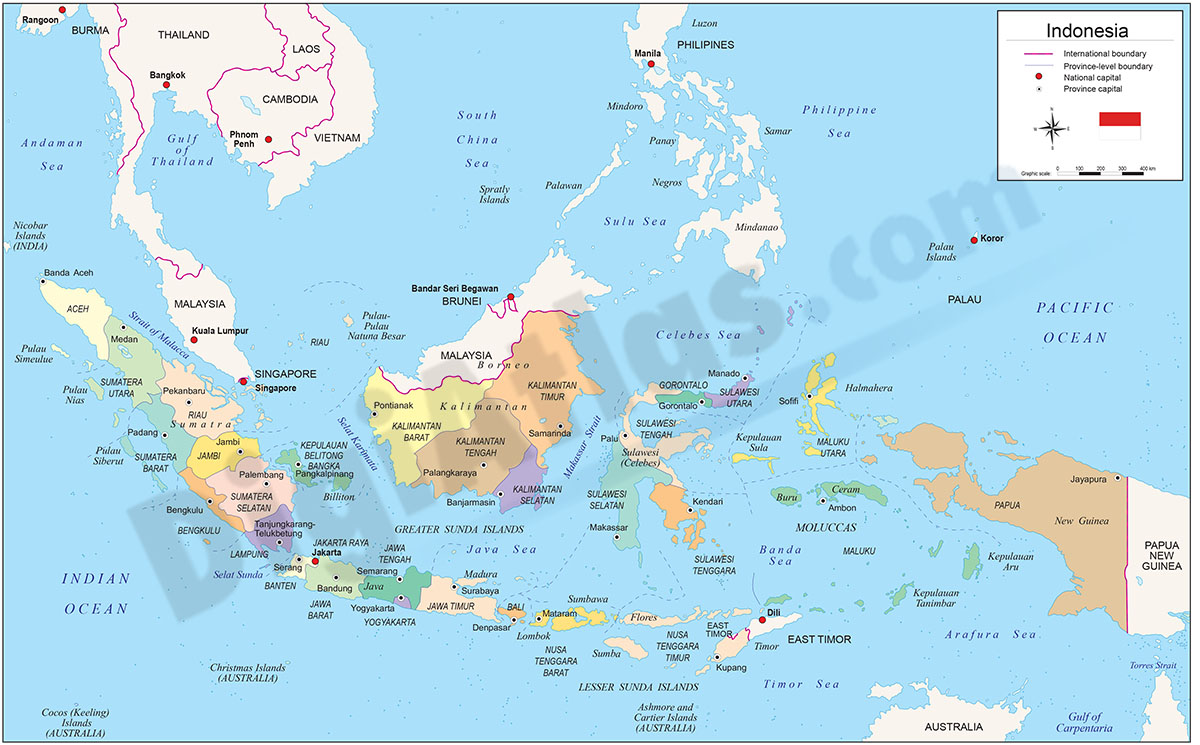
Digital political map of the Republic of Indonesia with internal administrative divisions, their names and capitals.
Vector map 100% editable.
Adobe Illustrator, Acrobat PDF