125,00 €
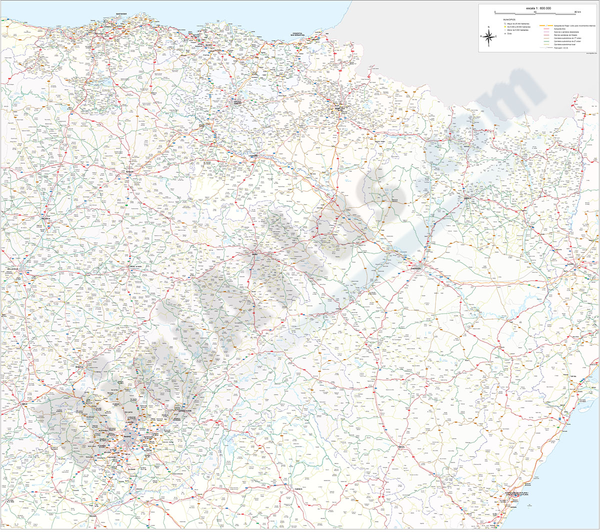
Northern roadmap of Spain
Vector file map of Cantabria, Basque Country, Navarra, La Rioja and Aragón Autonomous communities of Spain, with all cities and roads, railroad, principal rivers and lakes and other relevant politica
(...) Read more »
Adobe Illustrator, Acrobat PDF

19,95 €
Map of Honduras
Digital political map of Honduras with the internal administrative division, its 18 departments and capitals.
(...) Read more »
Adobe Illustrator, Acrobat PDF

55,00 €
Zaragoza municipality - Population by Zip Code
NUMBER OF INHABITANTS BY POSTAL CODE OF THE MUNICIPALITY OF ZARAGOZA.
(...) Read more »
Excel

19,95 €
Map of Japan
Digital political map of Japan with internal administrative division, names and capitals.
The map of Japan shows the boundaries of their 47 prefectures coloured. Downloadable files in 100% editable vector format.
See less «
Adobe Illustrator, Acrobat PDF

65,00 €
Alicante province zip code population
Digital map of postcodes of the province of Alicante/Alacant with the number of inhabitants of each area or postal district.
(...) Read more »
Excel, Acrobat PDF
55,00 €
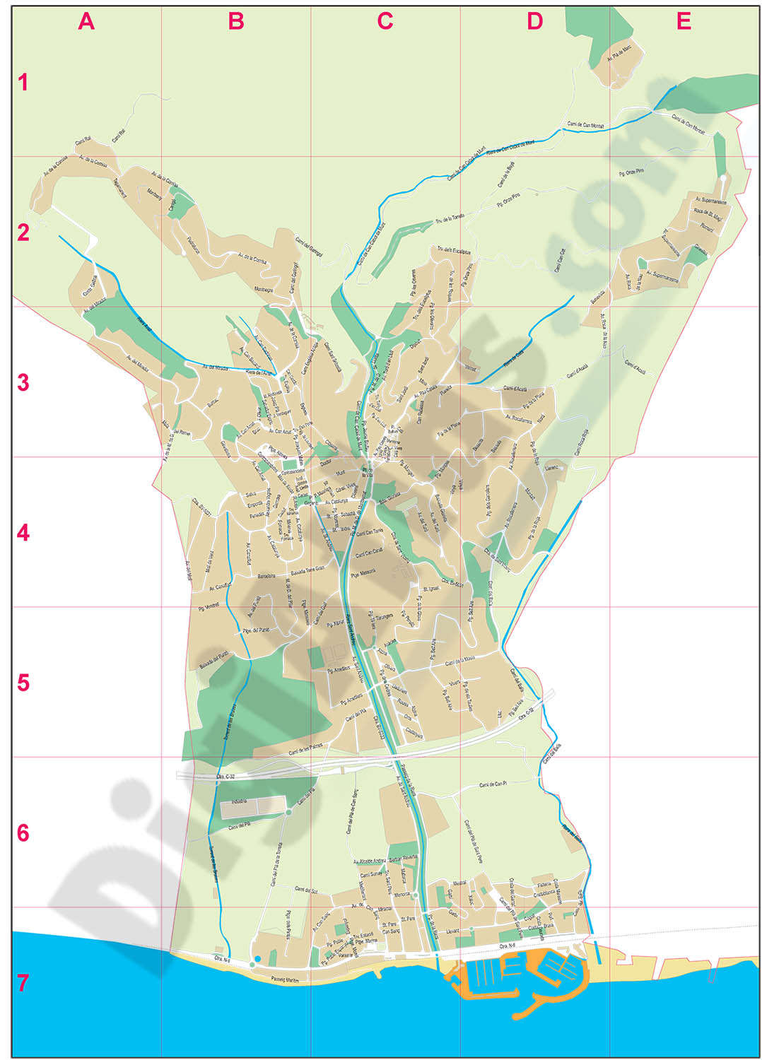
Sant Andreu de Llavaneres - city map
Street map of Sant Andreu de Llavaneres municipality (Comarca of Maresme, province of Barcelona, Autonomous Community of Catalonia, Spain). Digital map contain separate layers of information with urba
(...) Read more »