55,00 €
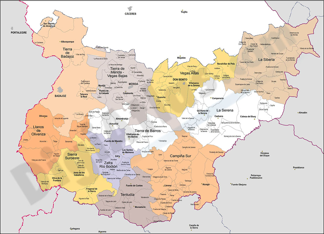
15 maps of Spanish provinces with comarcas and municipalities
Digital maps of 15 provinces of Spain with comarcas and municipalty borders and city names. (Cáceres, Badajoz, Albacete, Ciudad Real, Toledo, Alicante, Castellón, Valencia, Murcia, Burgos, León, Sa
(...) Read more »
imagen JPG (250 dpi)
79,00 €
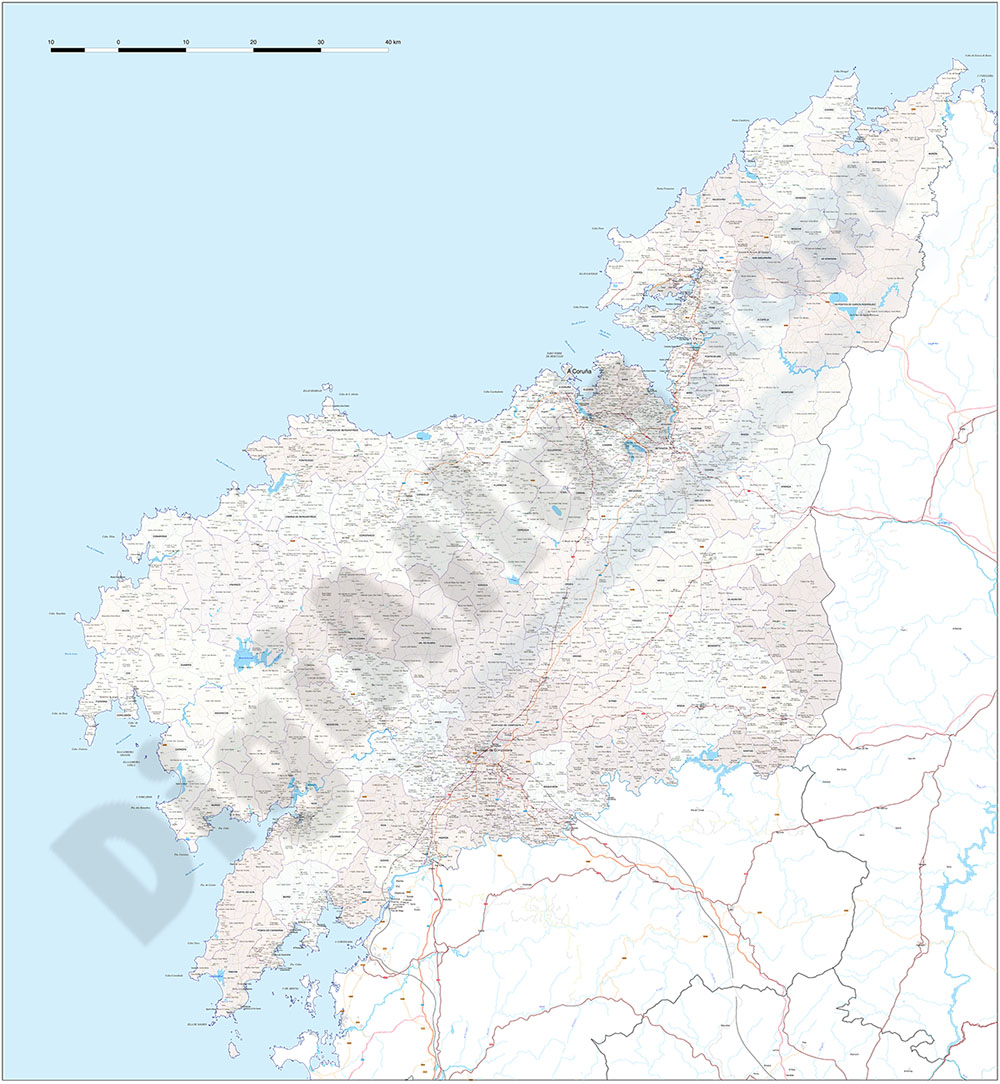
A Coruña (Corunna) - Map of province with parroquias and aldeas
Map of A Coruña province (Galicia, Spain) showing Autonomous Communities, provinces, concellos and parroquias boundaries. Include cities, 'aldeas', highways, major and minor roads, railroad, princip
(...) Read more »
Adobe Illustrator, PDF

59,99 €
Alava (Araba) - Map of the province
Digital map of the province of Araba/Álava (Basque Autonomous Community)
(...) Read more »
Adobe Illustrator, Acrobat PDF

59,99 €
Alicante - Map of province
Vector format spain province map showing community and province boundaries, cities, highways, major and minor roads, railroad, principal rivers and lakes and other relevant political information. Scal
(...) Read more »
Adobe Illustrator, PDF, JPG (300dpi)

59,99 €
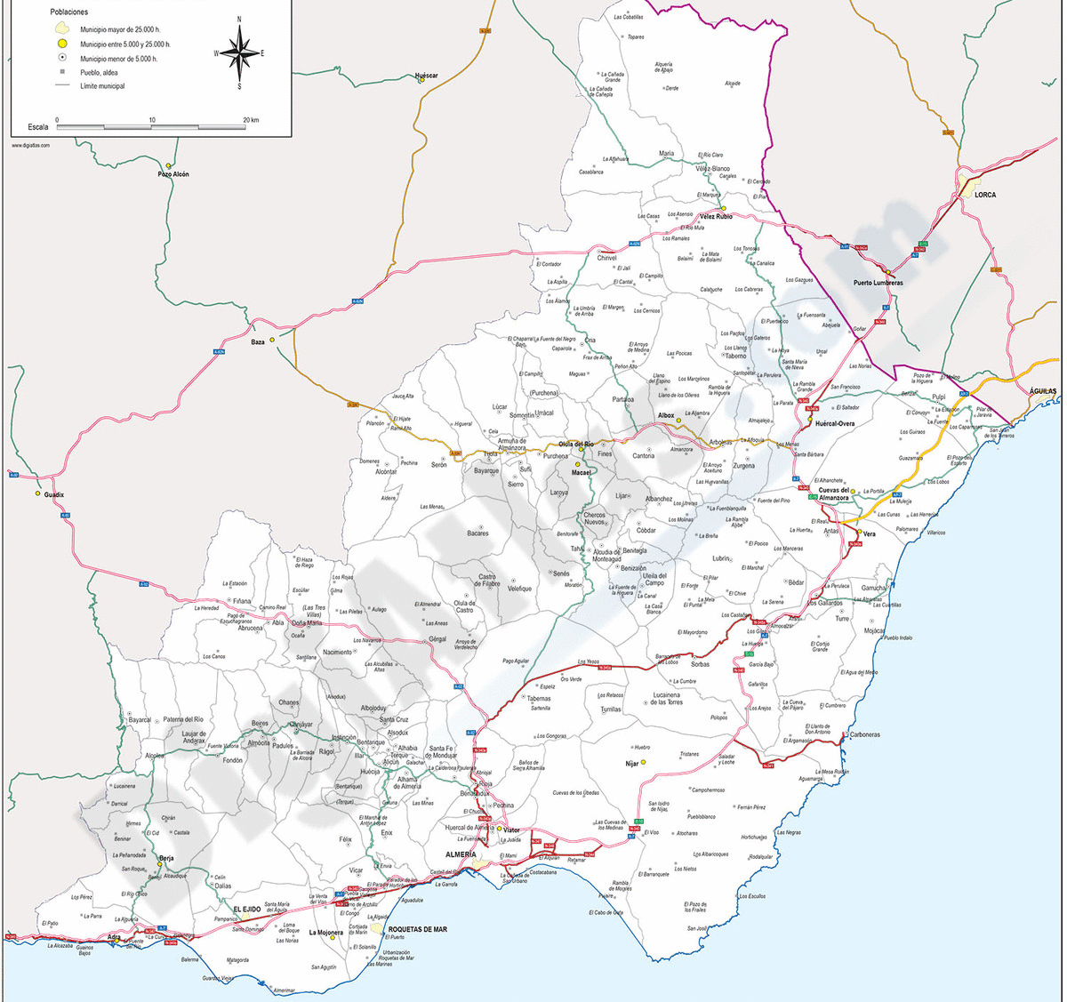
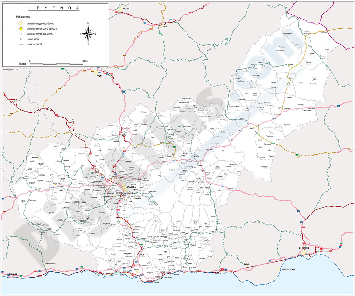
Almeria - Province digital map
Digital map of the Almeria spanish province, showing community and province boundaries, cities, highways, major and minor roads, railroad, principal rivers and lakes and other relevant political infor
(...) Read more »
Adobe Illustrator, PDF
65,00 €
Andalucia provinces with municipalities
Digital maps of the 8 Andalusian provinces
(...) Read more »
Adobe Illustrator, Acrobat PDF
59,99 €
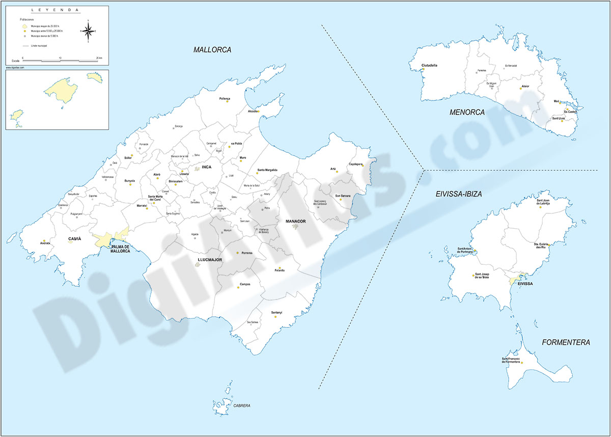
Balearic Islands with municipalities
Digital map of the Balearic Islands (Illes balears) with the limits of the municipalities and their capitals.
(...) Read more »
Adobe Illustrator, Acrobat PDF

59,99 €
Barcelona - Map of province
Digital map of the province of Barcelona (Catalonia) at a scale of 1:300.000 with detailed geographical and political information. It includes the autonomous, provincial and municipal limits, capitals, cities and population centres, motorway network, dual carriageways, national and autonomous roads of first and second order, local roads, railway network and AVE, main rivers and lakes.
.
This map is downloaded in vector format, which means that it can be fully edited and modified to adapt it to the requirements of any type of project. Vector design applications such as Adobe Illustrator, very common in the world of graphic design, should be used for this purpose, although Acrobat PDF can also be used, which is installed by default on any computer and also allows you to operate with the vector layers offered by the map.
Poster size at high resolution for large format printing.
See less «