


PACK DIGIATLAS
Download up to 15 digital maps of your choice through a subscription to the 'Pack DigiAtlas'.
-Description:
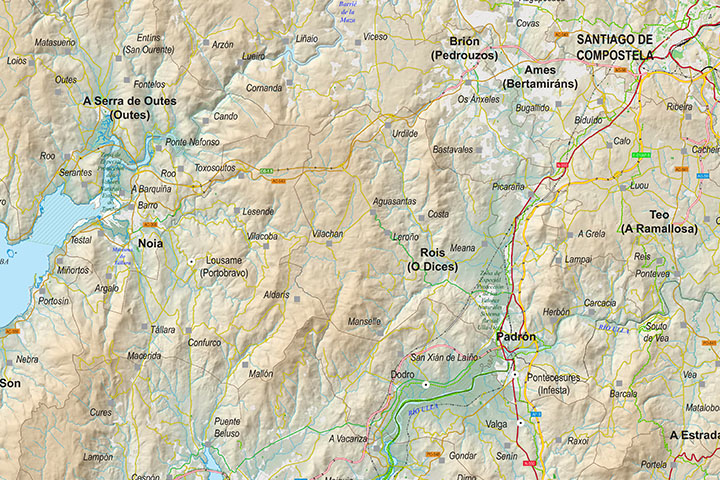
Digital map of the area between Corcubión (A Coruña) and Forcarei (Pontevedra).
The working scale is 1:80.000. The map includes administrative boundaries (Autonomous Communities, provinces and municipalities), hydrographic network, road and railway network, urban areas, cities and a large number of villages and towns grouped according to the number of inhabitants, boundaries of protected areas, tourist itineraries and geographical names.
It incorporates a TIFF image with detailed shaded and coloured relief on a background layer at a scale of 1:25:000.
-Original measurements:
100x60 cm (Fully resizable vector file for High-quality printing).
-Download formats:
Adobe Illustrator, Acrobat PDF
-You can also request a quote » to modify this map and adapt it to your projects.
Download up to 15 digital maps of your choice through a subscription to the 'Pack DigiAtlas'.

Postcode maps of cities, regions and countries. Optionally with demographic data for geo-marketing projects.

City street maps with delineation of urban areas, streets, squares, parks, green areas, buildings of interest, etc.
DigiAtlas select every week until three random maps from their catalog and intends to offer them at a very lower price than its regular cost.
These maps change every 7 days. If either of them matches your interest take advantage of this opportunity to acquire digital maps to a very special price.