
PACK DIGIATLAS
Download up to 15 digital maps of your choice through a subscription to the 'Pack DigiAtlas'.


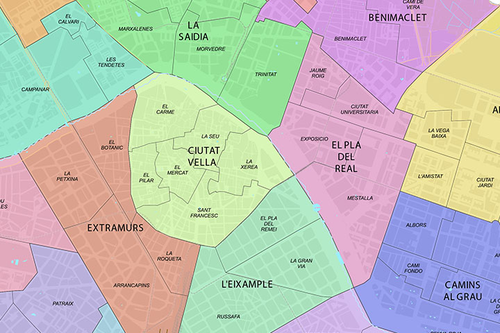
-Description:
Street map of the urban area of Valencia city.
The map shows the municipal boundaries, the urban delineation without toponyms, the limits and colors of the districts and neighborhoods of the city.
Two files are downloaded in vector format (Adobe Illustrator and Acrobat PDF) organized in separate layers fully editable.
See also the complete map of Valencia with place names, postal codes, districts and neighborhoods.
-Original measurements:
70x60 cm (Fully resizable vector file for High-quality printing).
-Download formats:
Adobe Illustrator, Acrobat PDF
- This map is also available through the PACK DIGIATLAS »
-You can also request a quote » to modify this map and adapt it to your projects.
Download up to 15 digital maps of your choice through a subscription to the 'Pack DigiAtlas'.

Postcode maps of cities, regions and countries. Optionally with demographic data for geo-marketing projects.

City street maps with delineation of urban areas, streets, squares, parks, green areas, buildings of interest, etc.
DigiAtlas select every week until three random maps from their catalog and intends to offer them at a very lower price than its regular cost.
These maps change every 7 days. If either of them matches your interest take advantage of this opportunity to acquire digital maps to a very special price.