
75,00 €
India - city map
Detailed map of INDIA (Republic of INDIA) showing the inner administrative division, states and union territories, municipality borders and many names of towns and cities. Poster size map in PDF vecto
(...) Read more »
Acrobat PDF

98,00 €
Asia political and geographical map
Digital political and geographical map of Asia.
(...) Read more »
Adobe Illustrator, Acrobat PDF, TIFF image

98,00 €
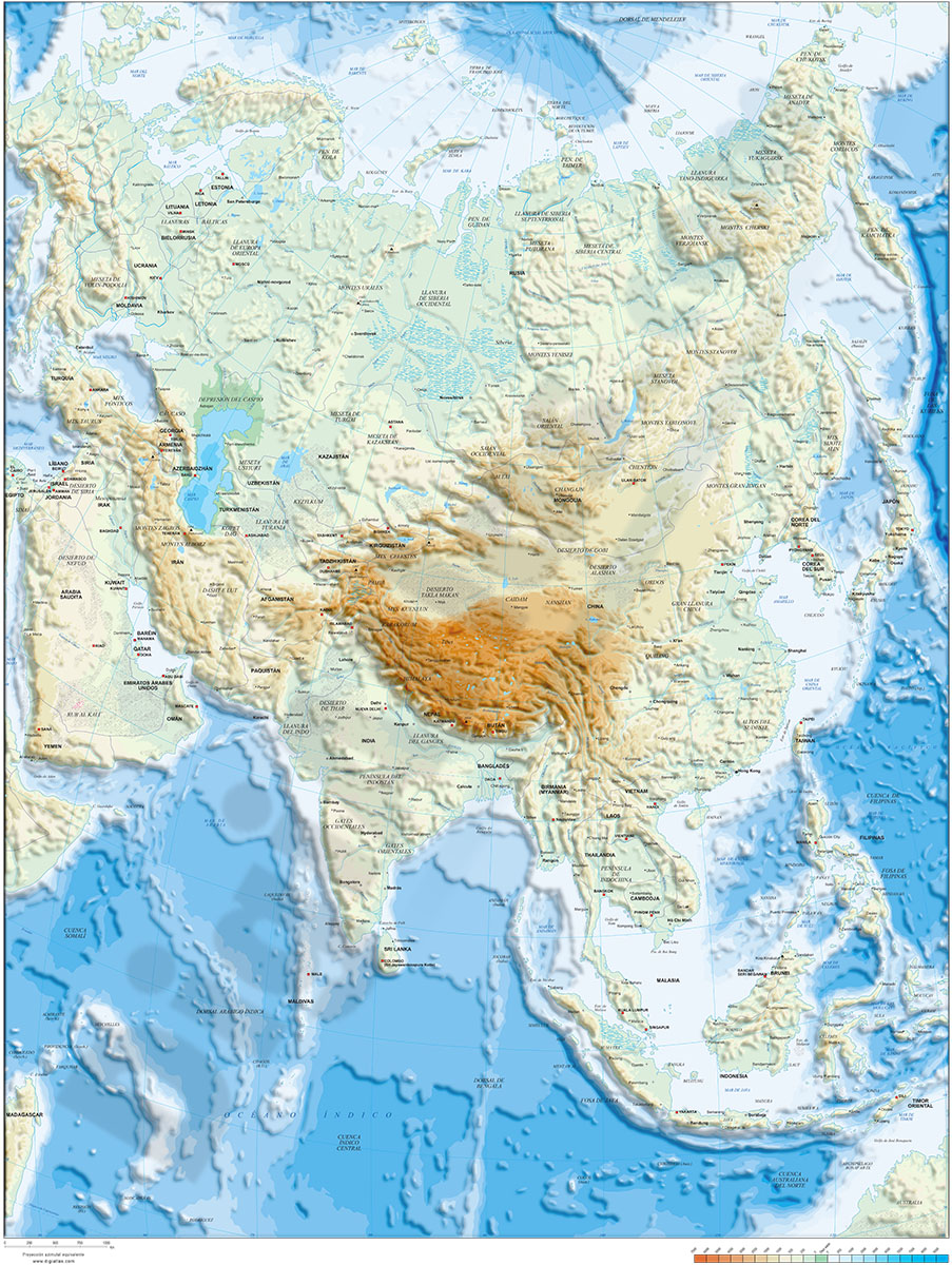
Asia physical vectorized-relief map
Digital map of Asia.
(...) Read more »
Adobe Illustrator, Acrobat PDF, TIFF image

19,95 €
Map of United States of America
Fully editable vectorized map of United States of America (USA). Map shows inner administrative division, with their names and capitals. Digital map are organized into separate layers, in order to cre
(...) Read more »
Adobe Illustrator, PDF

19,95 €
Map of Sri Lanka
Fully editable vector file map of Sri Lanka showing political layers of inner administrative division, with their names and capitals. Vectorized fully editable file organized in separate layers.
Adobe Illustrator, Acrobat PDF

19,95 €
Map of Mozambique
Fully editable vector file of the Republic of Mozambique, showing political layers of inner administrative division, with their names and capitals.
Adobe Illustrator, PDF

19,95 €
Map of Mauritius
Digital political map of the Republic of Mauritius with the internal administrative division (districts and dependencies), their names and capitals.
(...) Read more »
Adobe Illustrator, Acrobat PDF

19,95 €
Map of Madagascar
Digital political map of Madagascar with the current political-administrative organisation: 22 regions (faritra), their names and capitals.
(...) Read more »
Adobe Illustrator, Acrobat PDF

19,95 €
Map of Indonesia
Digital political map of the Republic of Indonesia with internal administrative divisions, their names and capitals.
Vector map 100% editable.
Adobe Illustrator, Acrobat PDF

19,95 €
Map of India
Fully editable vector file map of INDIA.
Political map of INDIA showing inner administrative division of the federal union, comprising 29 states with their names and capitals.
(...) Read more »
Adobe Illustrator, Acrobat PDF