59,99 €
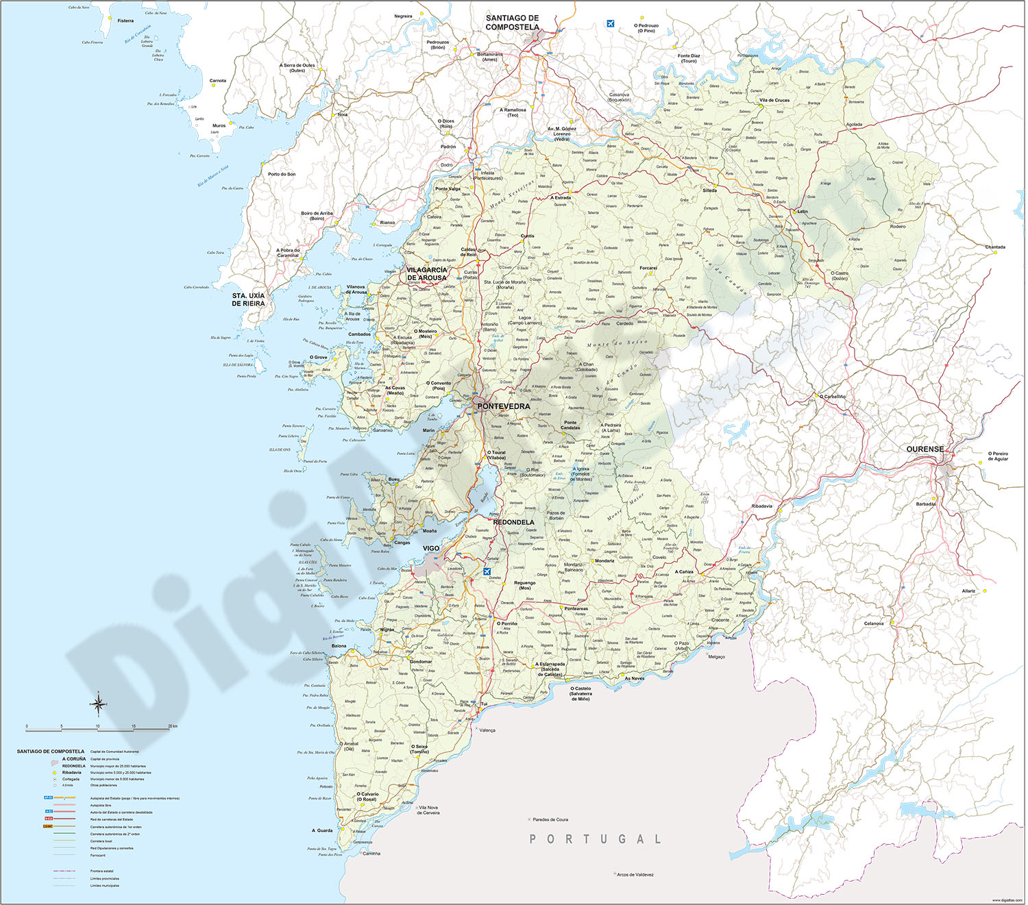
Map of Pontevedra
Vectorized map of the province of PONTEVEDRA (autonomous community of Galicia, Spain) showing community and province boundaries, towns and cities, highways, detailed major and minor roads, railroad, p
(...) Read more »
Adobe Illustrator, PDF, JPG (300dpi)
OFFER: 79,00 € | 39,50 €
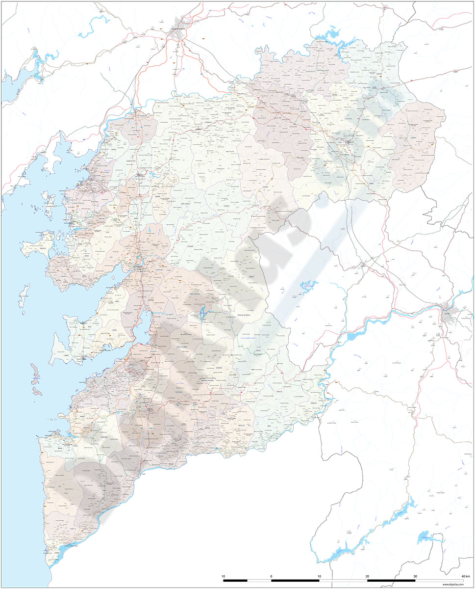
Pontevedra (Galicia, Spain), map of province with parroquias and villages
Map of province of PONTEVEDRA (Galicia, Spain) showing Autonomous Communities and provinces limits, concellos and parroquias boundaries, cities, towns, 'aldeas', highways, major and minor roads, railroad, principal rivers and lakes and other relevant political information. Scale 1:200.000. Poster size and vectorized fully editable file in high quality resolution for print purposes.
See less «
Adobe Illustrator, PDF, JPG (300dpi)