98,00 €
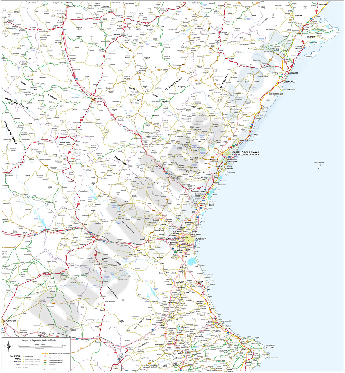
Map of Castellón and Valencia provinces
Digital map of the provinces of Valencia and Castellón with detailed geographical information: regional and provincial boundaries, municipalities and towns, motorways, dual carriageways, national and regional roads of first and second order, local roads, railway network, rivers and lakes.
The cartography can be downloaded directly in Adobe Illustrator vector format and in Acrobat PDF, both organised in separate layers that can be fully edited or printed directly at the desired size, always with the highest resolution.
The map is designed and prepared to be used as a working base for business or graphic design projects.
The vector format of the files allows, for example, to cut out and enlarge certain areas of the map to create working copies or print them at high quality, hide and/or visualise different layers of information to generate personalised versions of the cartography, modify colours and styles to adapt them to your preferences, add more layers of information, logos, etc.
The delivery of our maps in digital format does not imply any restriction to edit and print them. It is only forbidden to transfer or resell them to third parties in any kind of digital format.
See less «
Adobe Illustrator, Acrobat PDF
59,99 €
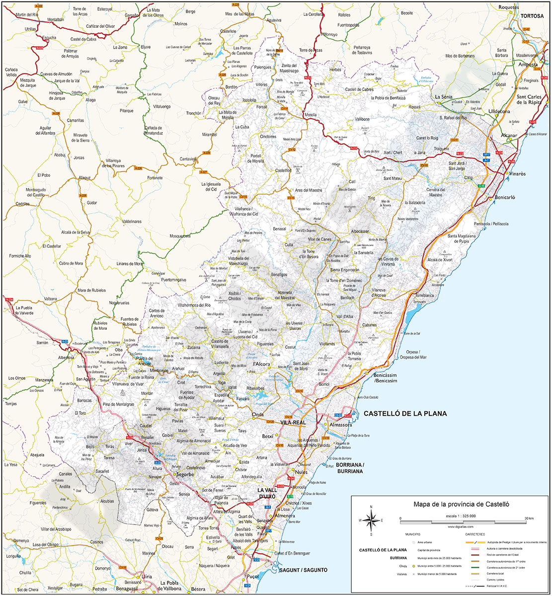
Map of the province of Castellon
Digital map of the province of Castellón (Valencian Community) at a scale of 1:325.000 and adjusted to a DIN A2 sheet.
(...) Read more »
Adobe Illustrator, Acrobat PDF