98,00 €
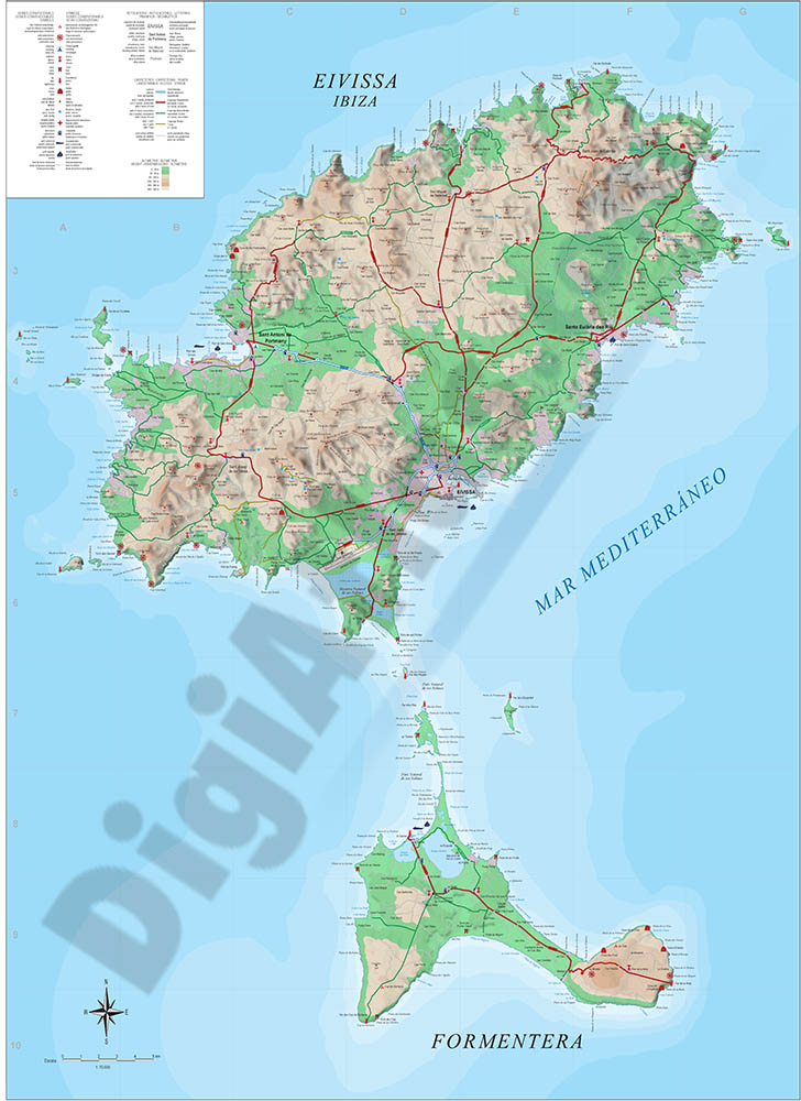
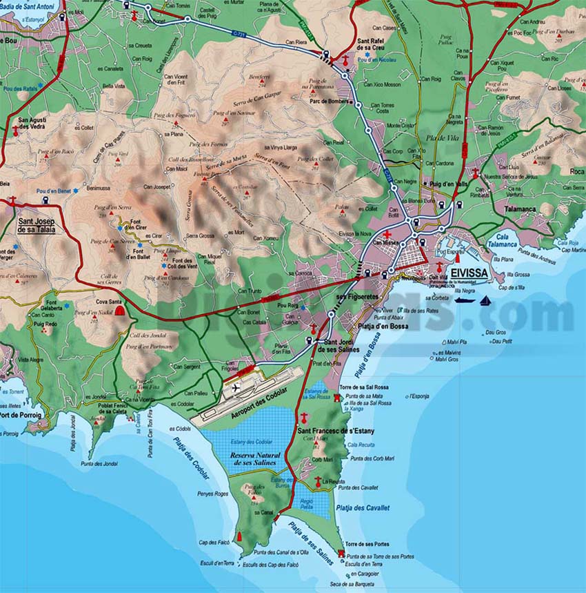
Map of Ibiza-Eivissa island (Balearic Islands)
Vectorized map of Eivissa-IBIZA island (Balearic islands) howing detailed geographic and touristic information. Include High-resolution color shaded relief TIFF image. Scale: 1:70.000.
Adobe Illustrator, PDF, JPG (300dpi)
55,00 €
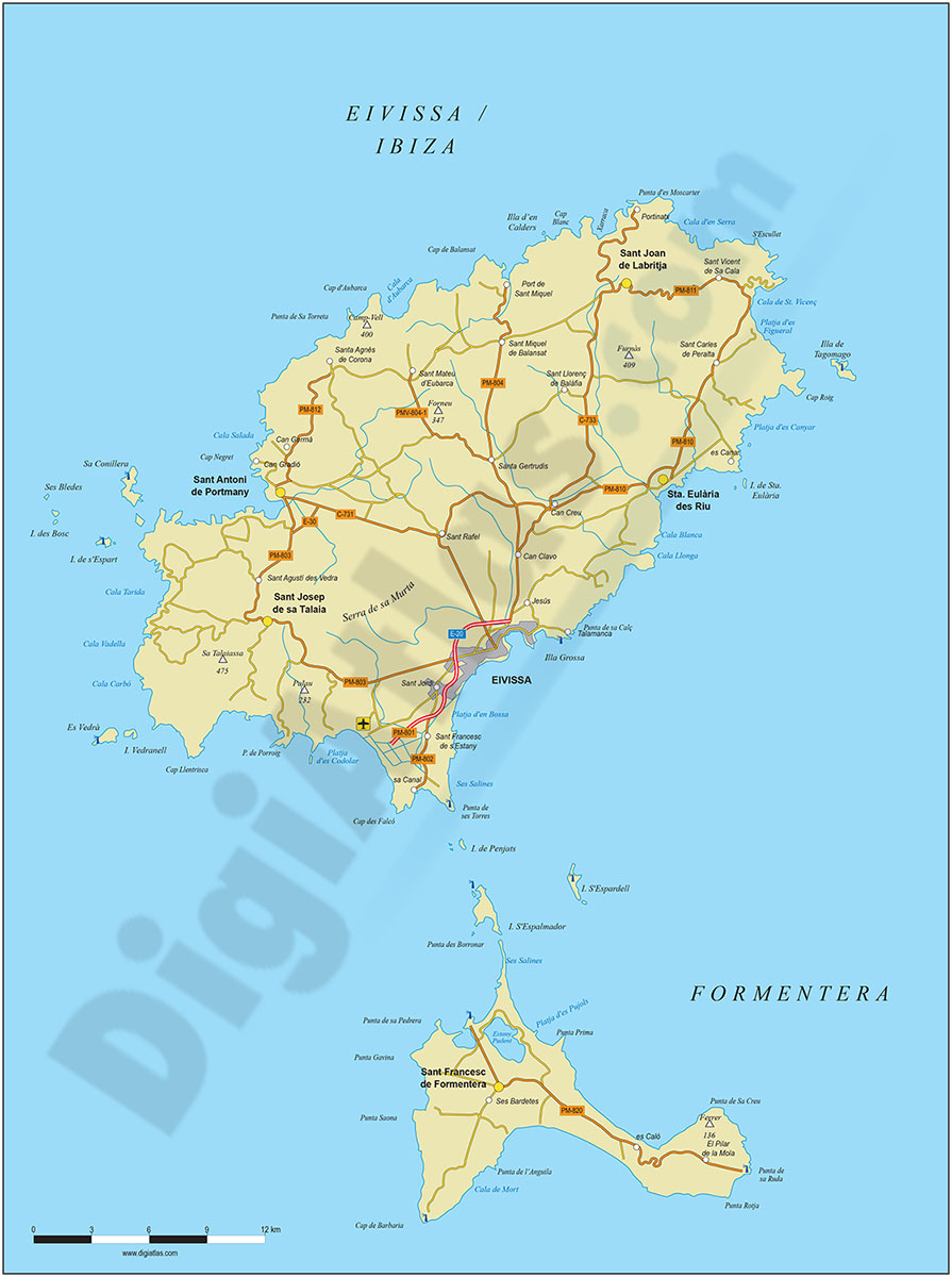
Map of Ibiza-Eivissa island (Balearic Islands)
Digital map of the island of IBIZA (Eivissa, Illes Balears) at a scale of 1:300.000 with the main towns, road network, railway network, rivers and lakes.
Poster size map for high quality printing. Editable vector format organised in layers for projects of companies and graphic designers (tourism, travel agencies, advertising, etc.).
See less «
Adobe Illustrator, Acrobat PDF