
78,65 €
Andalucia - map of comarcas
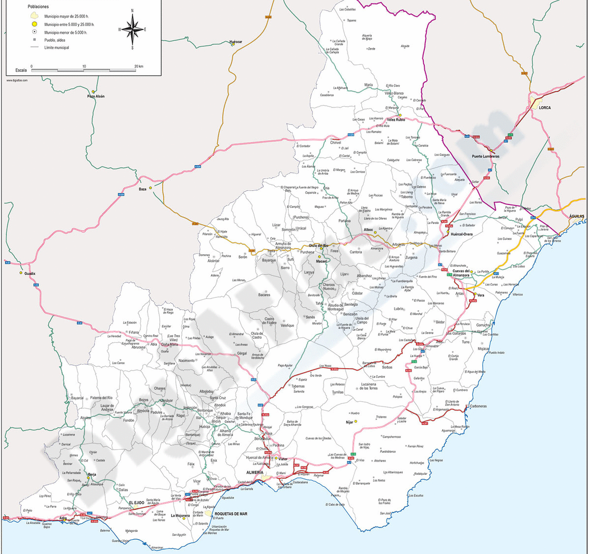
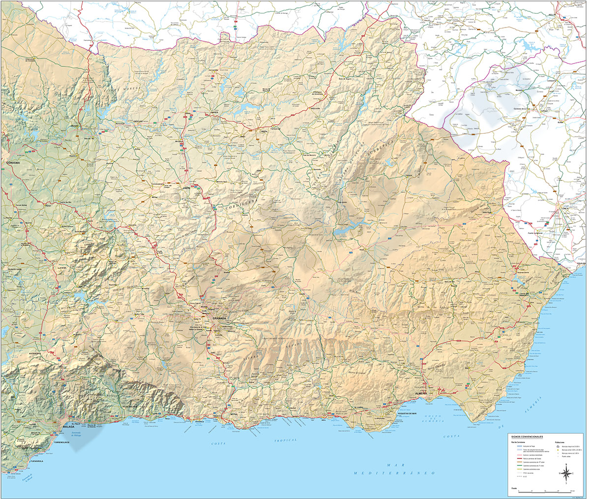
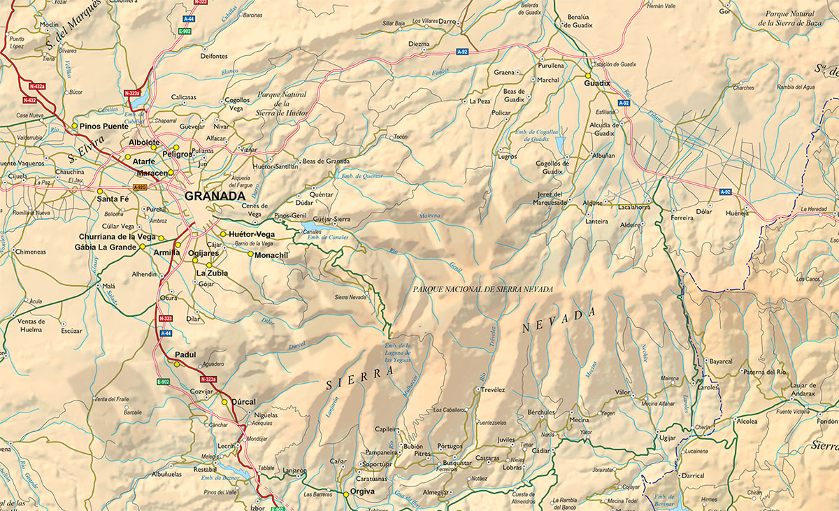
Map of Eastern ANDALUCIA (Granada, Jaen and Almeria provinces), showing community and province boundaries, cities, highways, major and minor roads, railroad, rivers and lakes and relevant geographic i
(...) Read more »
Adobe Illustrator, Acrobat PDF
151,25 €
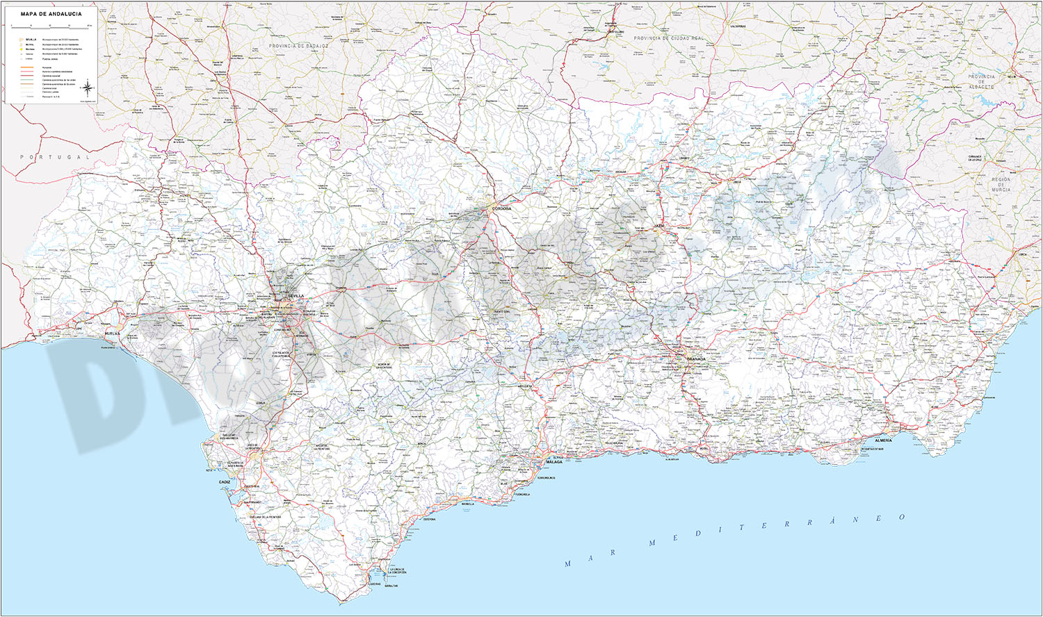
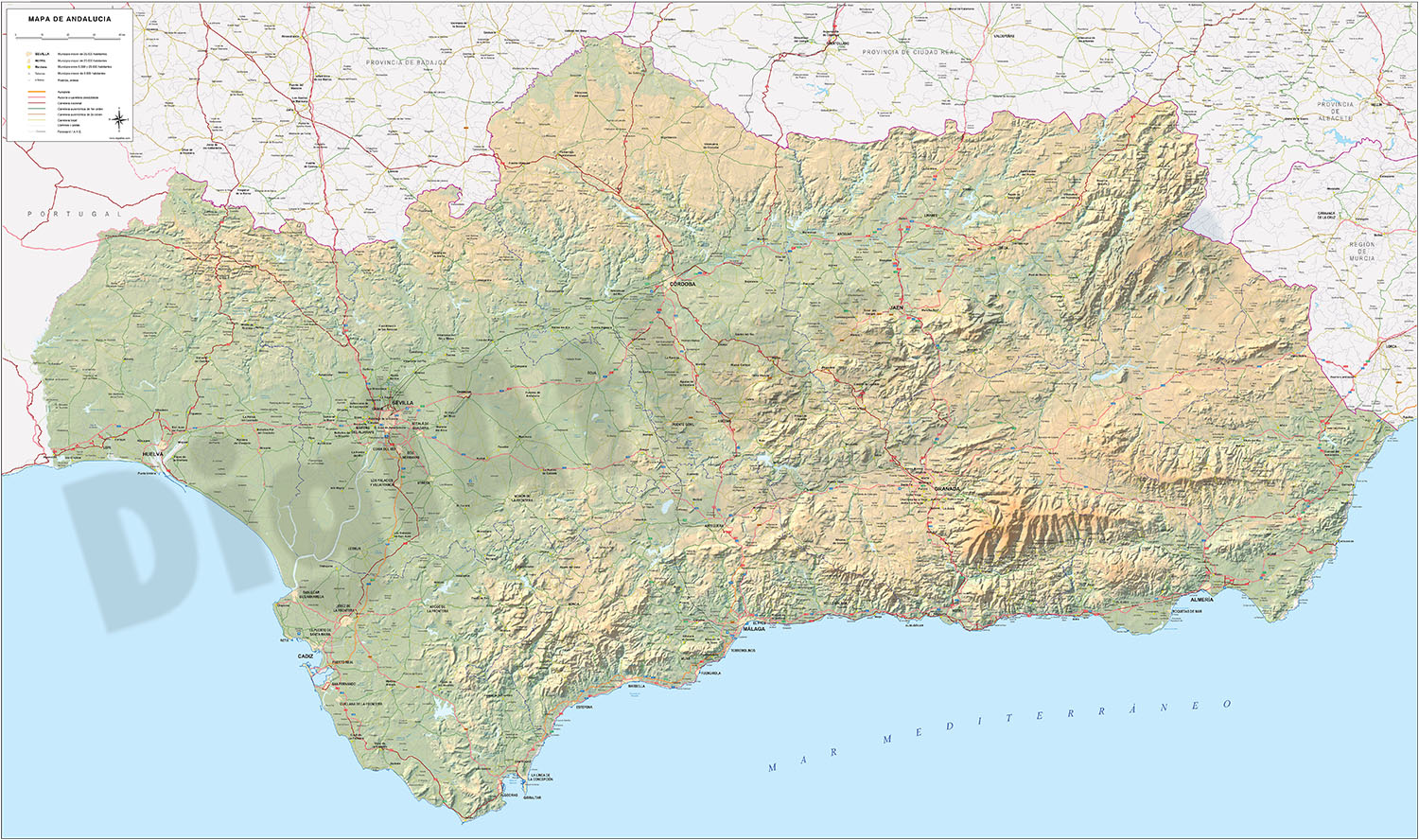
Andalucia Poster Map
Detailed map of all Andalusia autonomous community of Spain at a scale of 1:300.000, with municipal, provincial and autonomous boundaries, rivers and lakes, road network up to local road level, railwa
(...) Read more »
Adobe Illustrator, Acrobat PDF
65,00 €
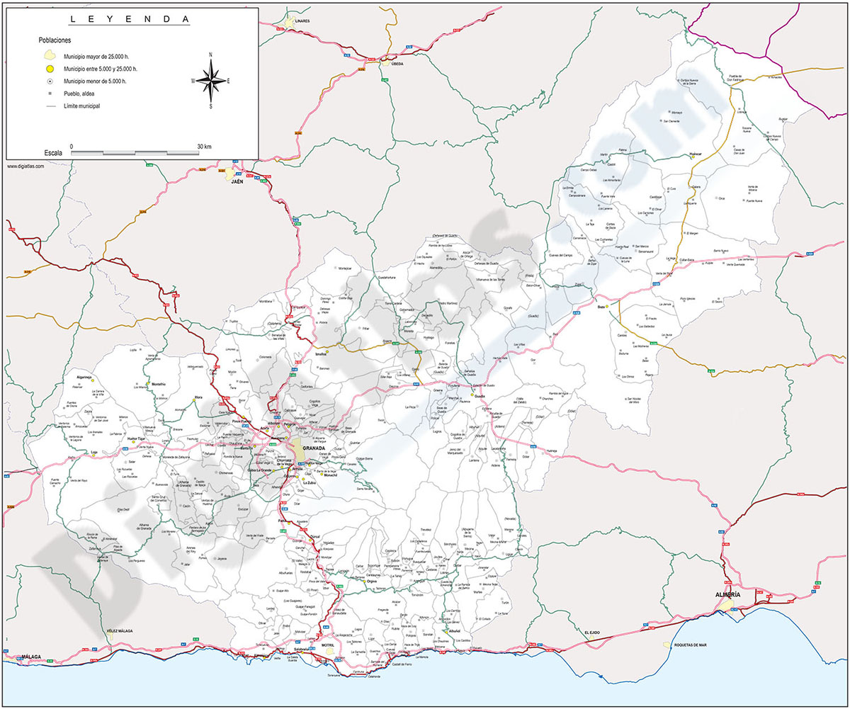
Andalucia provinces with municipalities
Digital maps of the 8 Andalusian provinces
.
Each province is in a separate file and shows the boundaries or municipalities, the capitals, cities and towns grouped according to the number of inhabitants and the main road network (motorways, dual carriageways and regional roads).
The cartography is delivered in Adobe Illustrator and Acrobat PDF vector format, organised in separate layers that can be fully edited or printed directly at the desired size, always with the highest resolution.
The vector format of the files allows, for example, to cut out and enlarge certain areas of the map to create working copies or print them at high quality, hide and/or visualise different layers of information to generate personalised versions of the plans, modify colours and styles to adapt them to your preferences, add more layers of information, such as logos, etc.
See less «
Adobe Illustrator, Acrobat PDF
75,00 €
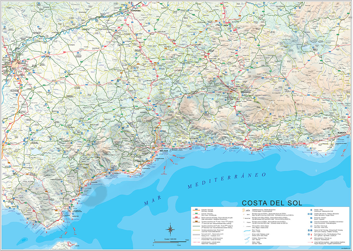
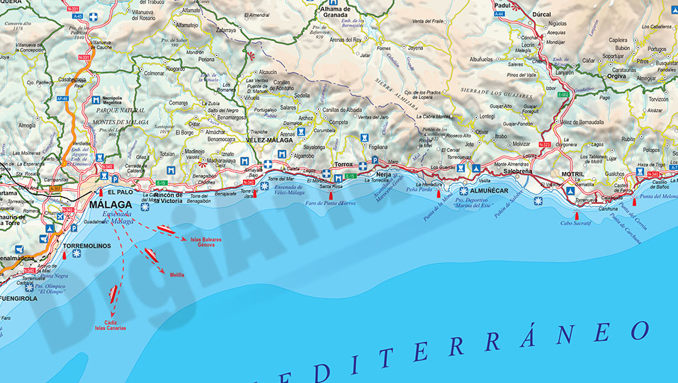
Costa del Sol political and geographical map
Costa del Sol physical and political map. Vectorized and fully-editable map, showing detailed geographic and touristic information. High-resolution color shaded relief TIFF image is included. Scale: 1
(...) Read more »
Adobe Illustrator, PDF
79,00 €
Map of Eastern Andalucia (Spain)
Map of Eastern ANDALUCIA (Granada, Jaen and Almeria provinces), showing community and province boundaries, cities, highways, major and minor roads, railroad, rivers and lakes and relevant geographic i
(...) Read more »
Adobe Illustrator, Acrobat PDF