55,00 €
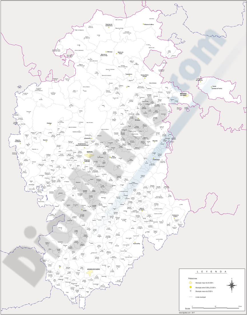
Castilla y Leon map with municipalities
Map of Castile and León (Castilla y León autonomous commuity) showing their provinces with municipalities in digital format.
Adobe Illustrator, PDF

151,25 €
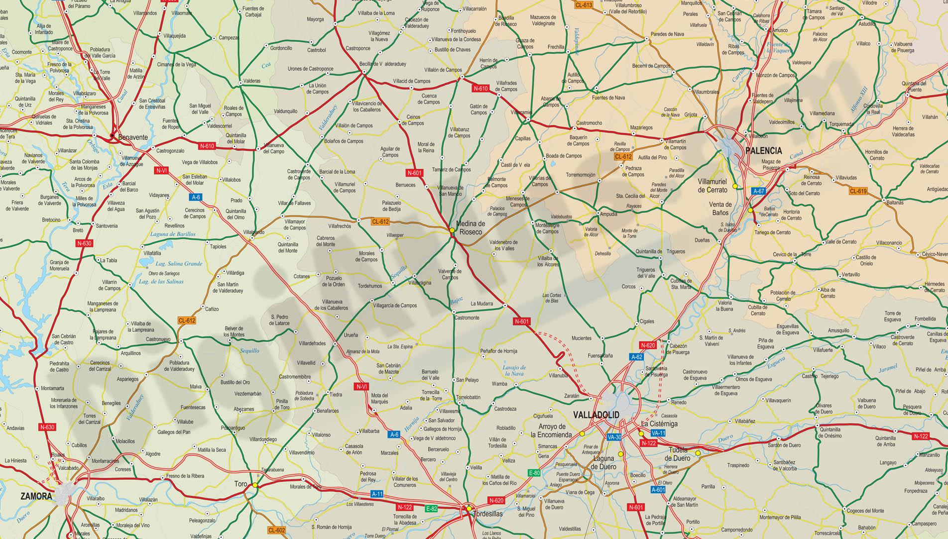
Map of Castilla y Leon autonomous community
Detailed digital map of Castile and León (Castilla y León autonomous community in north-western Spain). Map shows province borders, roads, rivers and lakes, cities, towns and relevant geographical i
(...) Read more »
Adobe Illustrator, PDF, JPG (300dpi)
59,99 €
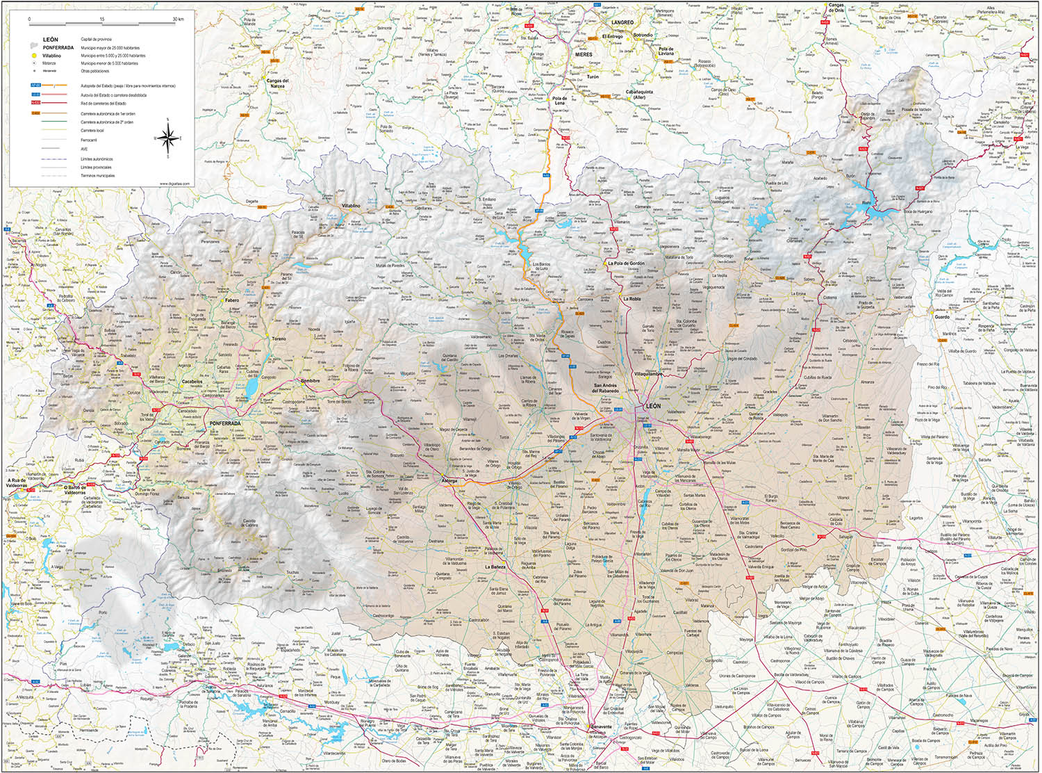
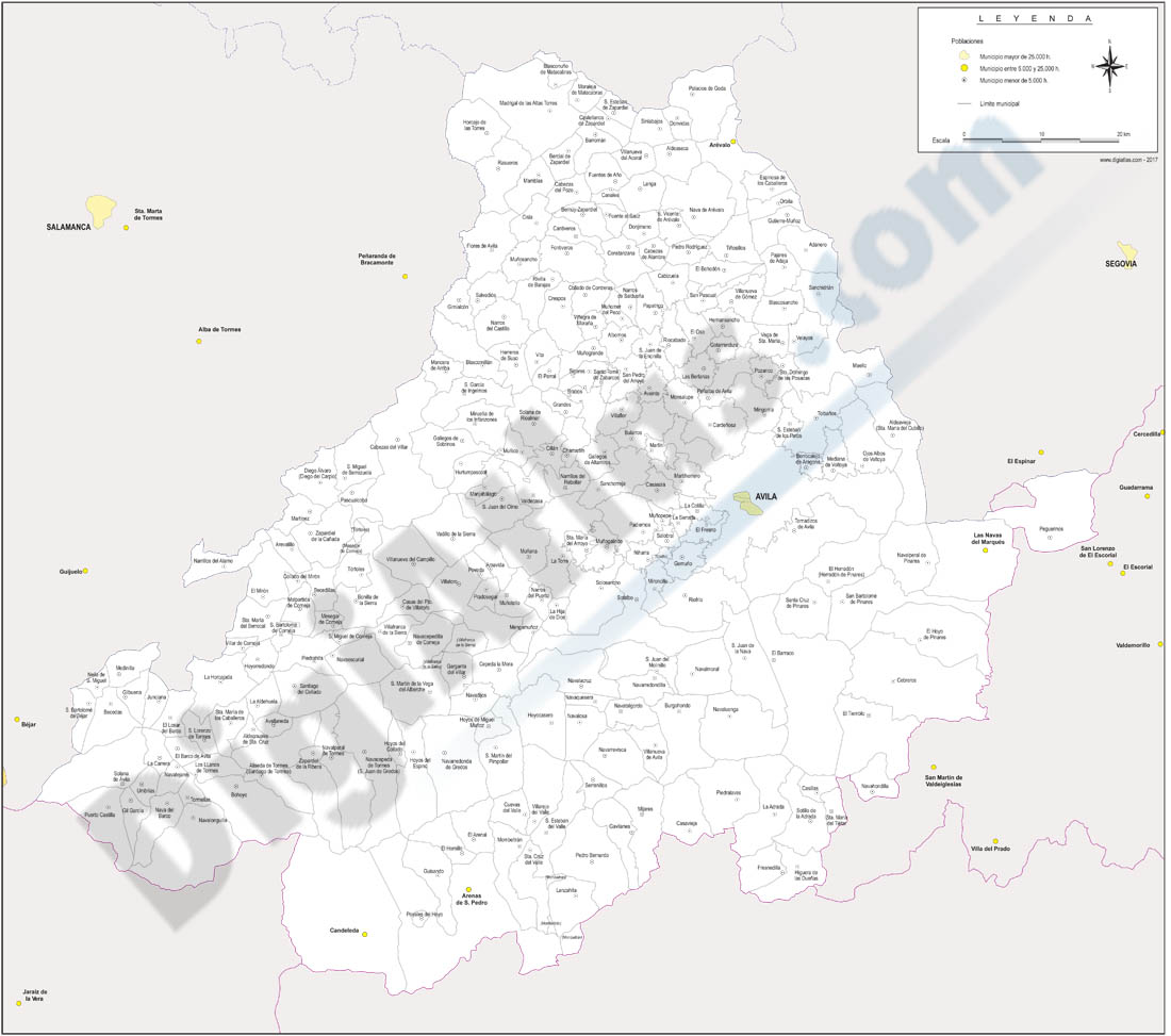
Map of province of Leon
Digital map of the province of LEON (autonomous community of Castile and León, Spain), showing regional and provincial boundaries, cities, highways, major and minor roads, railroad, principal rivers
(...) Read more »
Adobe Illustrator, PDF
19,95 €
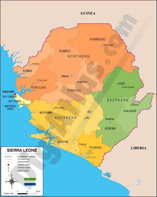
Map of Sierra Leone
Fully editable vector file. Include political layers of inner administrative division, with their names and capitals.
Adobe Illustrator, PDF
Ask price
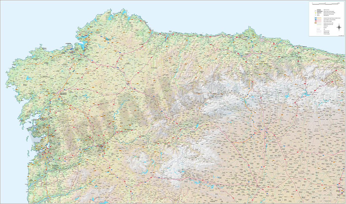
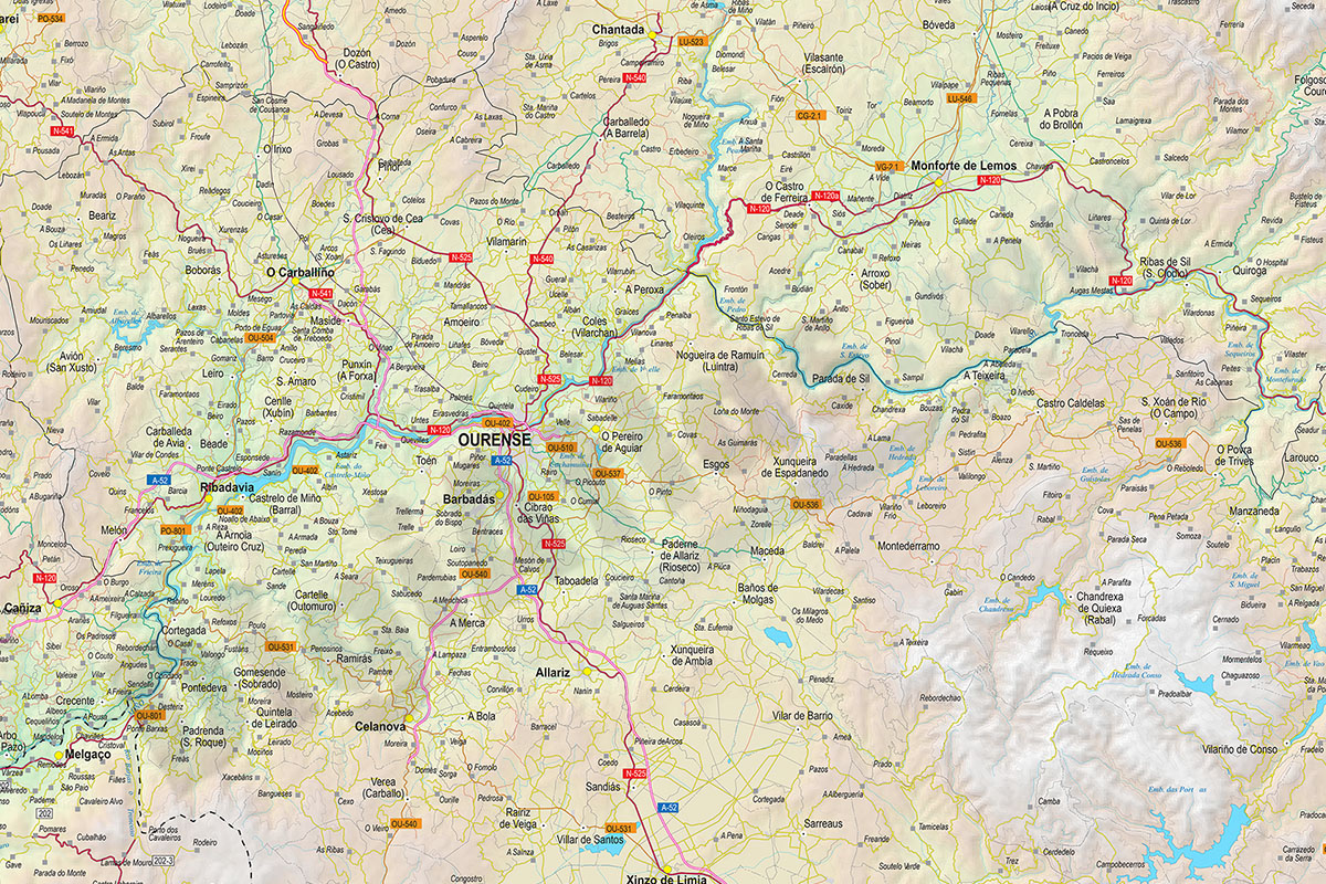
Roadmap of Galicia, Asturias and León
Detailed map of roads and towns in the northwest of Spain.
Poster-size digital map in Adobe Illustrator vector format and PDF of Galicia, Principality of Asturias and the province of León, with detailed political and geographical information, road network, motorways, dual carriageways, national and regional roads, local roads, AVE and railway lines, rivers, lakes, reservoirs and a great detail of towns, grouped according to the number of inhabitants.
It includes an image in TIFF format with the relief shaded and coloured.
See less «
Adobe Illustrator, Acrobat PDF