
Ask price
diary maps - maps for agendas
Political maps for school agendas and projects.
(...) Read more »
Adobe Illustrator, Acrobat PDF

95,00 €
Alicante - city map with postal codes
Digital street map of the city of Alacant/Alicante (Valencian Community) with the delineation of blocks of houses, singular buildings, hydrographic network, parks, green areas, railways, urban roads,
(...) Read more »
Adobe Illustrator, Acrobat PDF

65,00 €
Jumilla - city map
Digital street map of Jumilla (Region of Murcia) with the delineation of streets and squares, blocks of houses, parks and green areas with colours and names.
(...) Read more »
Adobe Illustrator, Acrobat PDF
79,00 €
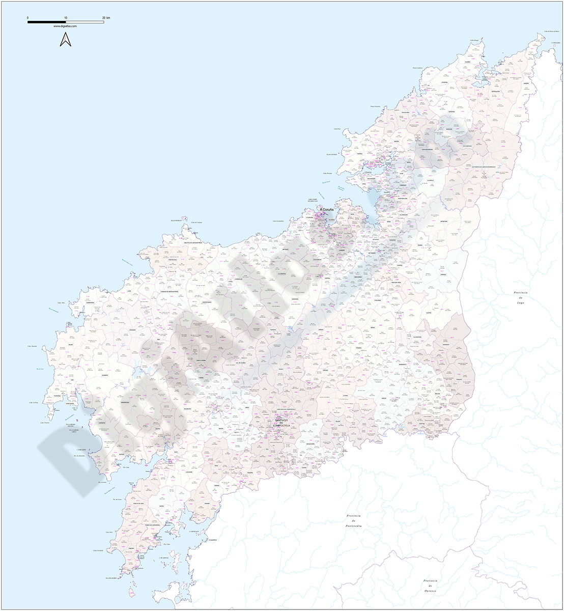
A Coruña (Corunna) - Map of province with parroquias and postal codes
Map of the province of A Coruña (Galicia, Spain) with regional and provincial boundaries, coloured municipalities, parish boundaries and all postcodes.
Adobe Illustrator, Acrobat PDF

45,00 €
Santa Cruz de Tenerife- Population by postal code
Population data by postcode for the province of Santa Cruz de Tenerife (Canary Islands).
An Excel file is downloaded with the following structure: idpc - Autonomous community - province - comarca - municipality - geographical coordinates of the centroid (central point of each postal area) - Total inhabitants - Total men - Total women - age groups (five-year age groups) for each sex.
See less «
Excel

Ask price
Portugal - Population by 7-digit postal code
Excel file with the inhabitants by 7-digit postcodes of Portugal.
(...) Read more »
Excel

Ask price
Population by Postcode (Historical 2012-2022 biannual)
-HISTORICAL POPULATION BY POSTCODE IN SPAIN.
These are several digital files, in Excel format, with population data by postcode from 2012 to 2022, every two years.
(...) Read more »
Excel

OFFER: 98,00 € | 49,00 €
Burgos and La Rioja - inhabitants by postcode
Digital map of the province of Burgos and the autonomous community of La Rioja showing the municipalities, postcode boundaries and the number of inhabitants of each postcode.
(...) Read more »
Adobe Illustrator, Acrobat PDF y Excel
