
98,00 €
Asia political and geographical map
Digital political and geographical map of Asia.
(...) Read more »
Adobe Illustrator, Acrobat PDF, TIFF image
Ask price
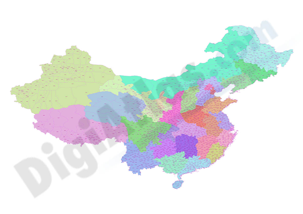
Map of China with regions and Postal Codes
Digital map of the People's Republic of China with provinces, prefectures and 4-digit postal code areas. Cartography in georeferenced shapefile format.
Shapefile format (.shp)
19,95 €
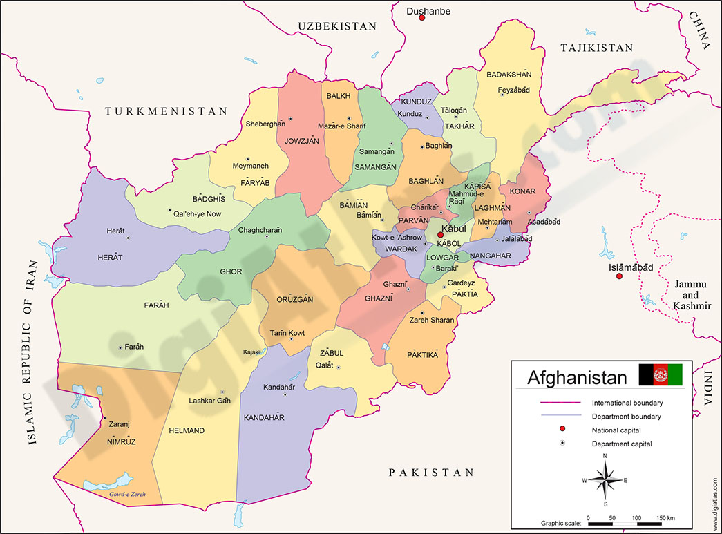
Map of Afghanistan
Fully editable vector file map of the Islamic Republic of Afghanistan showing political layers of inner administrative division, their names and capitals.
Adobe Illustrator, Acrobat PDF
55,00 €
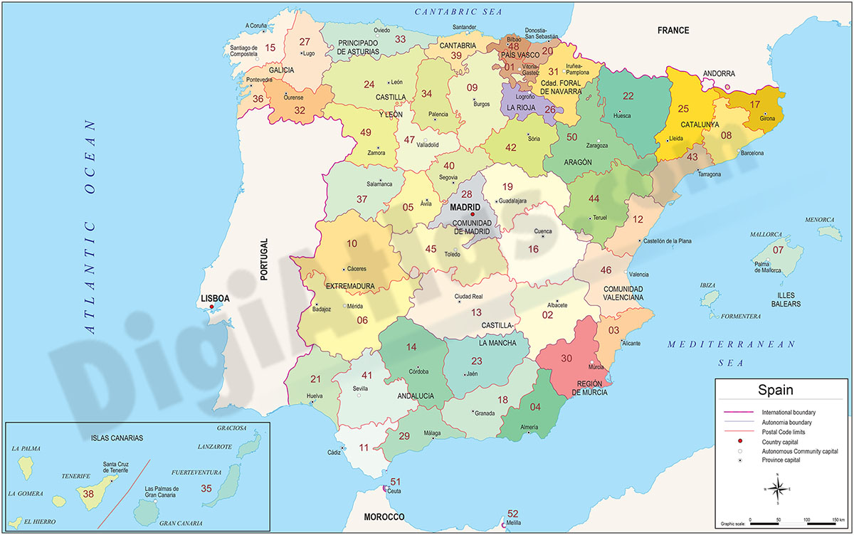
Map of Spain with autonomous communities, provinces and 2-digit postal code
Digital map of Spain with colored autonomous communities and provinces, their capitals and 2-digit postal codes.
(...) Read more »
Adobe Illustrator, Acrobat PDF
59,00 €
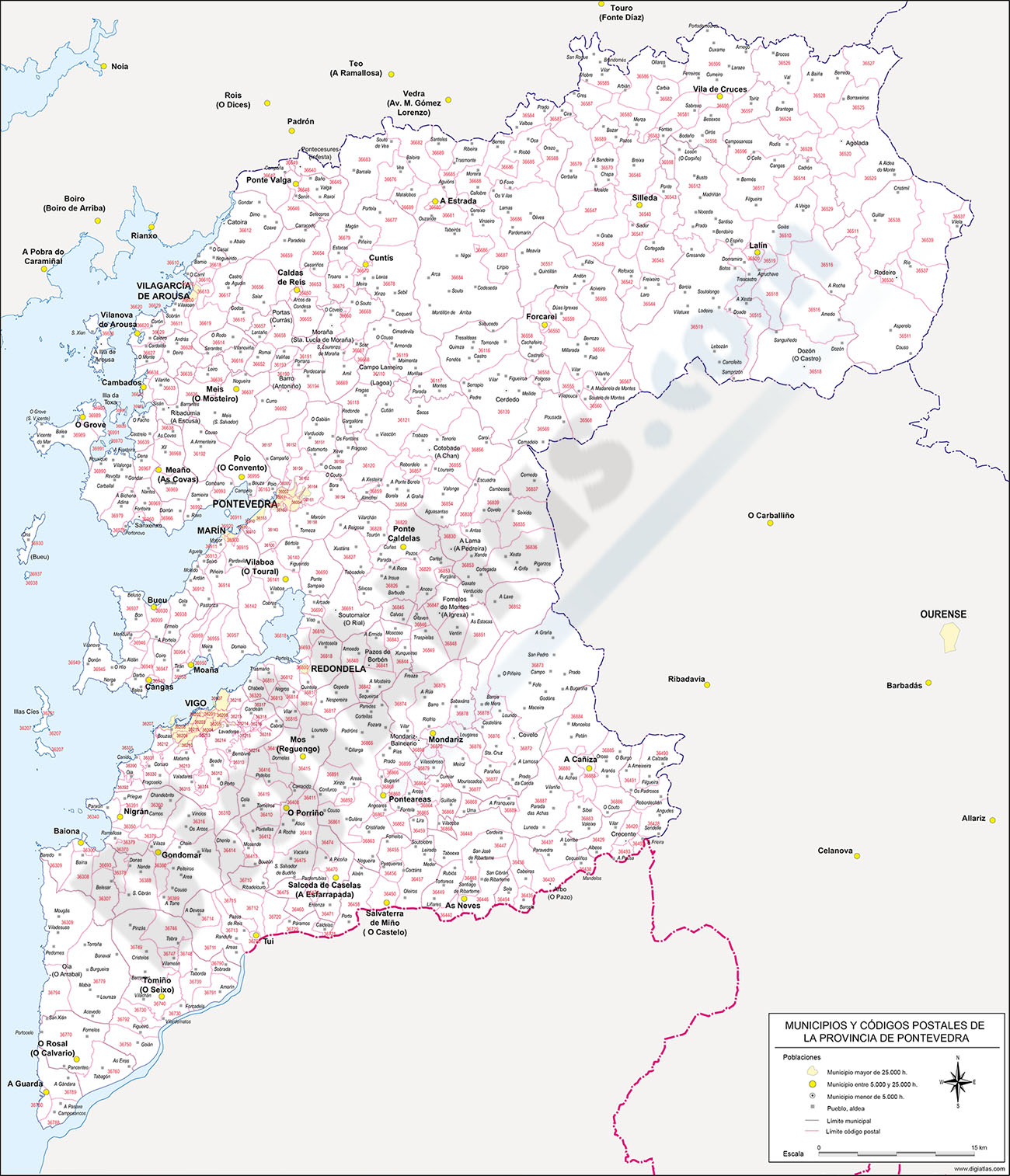
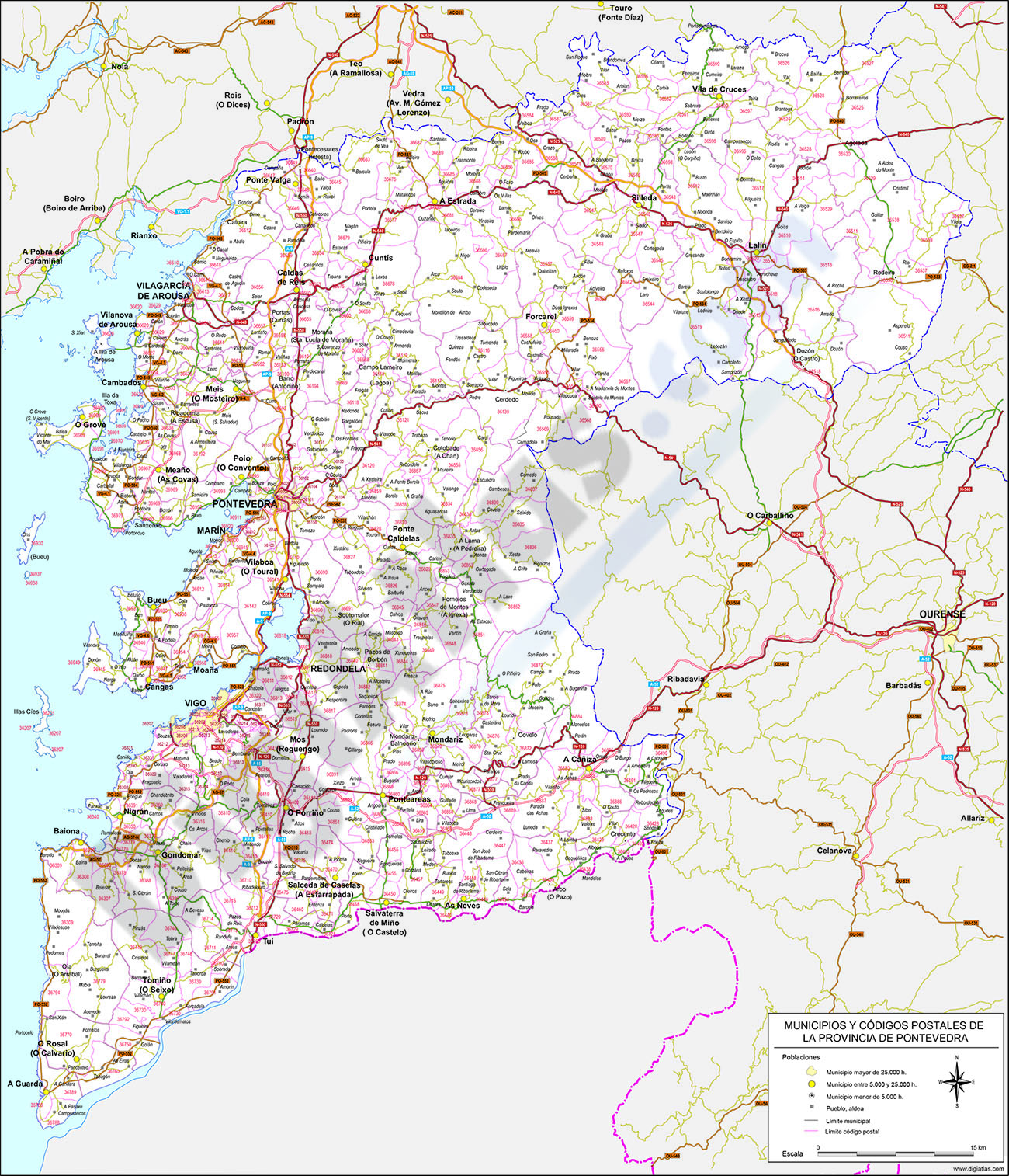
Map of Pontevedra province map with municipalities and postal codes
Digital map of the province of Pontevedra (Galicia, Spain) with zip codes, municipalities, capitals, cities and towns grouped according to their number of inhabitants.
(...) Read more »
Adobe Illustrator, Acrobat PDF
Ask price
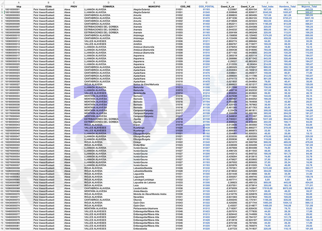
Inhabitants per postcode in Spain (5-year groups)
-POPULATION DATA FOR EACH POSTCODE IN SPAIN.
(...) Read more »
Excel

120,00 €
Map of Spain 100x70 cm
Poster size map of Spain and Portugal, 100x70 cm.
(...) Read more »
Adobe Illustrator, Acrobat PDF
55,00 €
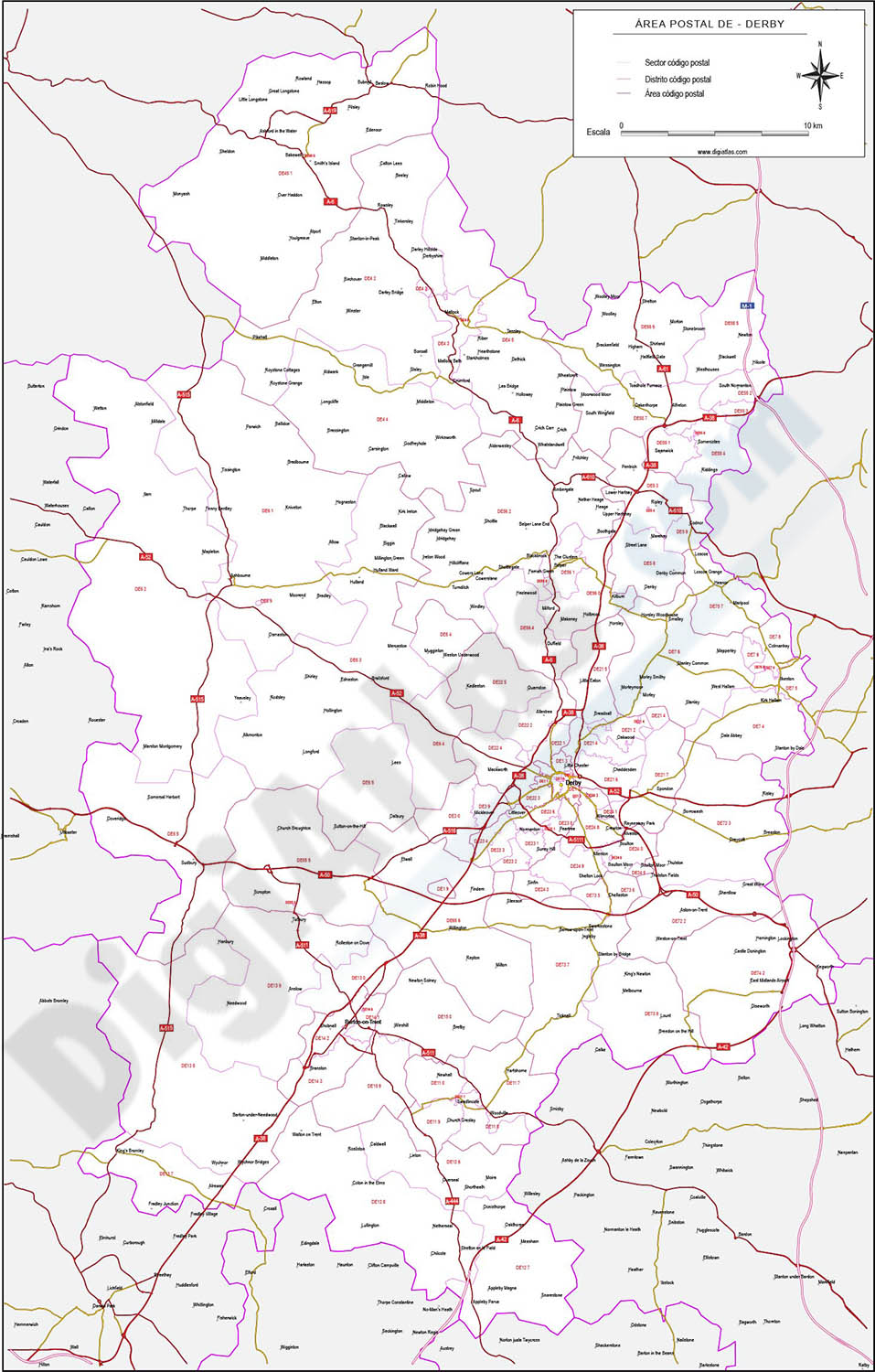
Derby - map of postcode area (DE) with cities and major roads
Vectorized and fully editable map of Coventry postcode area (DE). Map includes cities, major roads, postcode districts and postacode sectors.
Adobe Illustrator, PDF, JPG (300dpi)
59,99 €
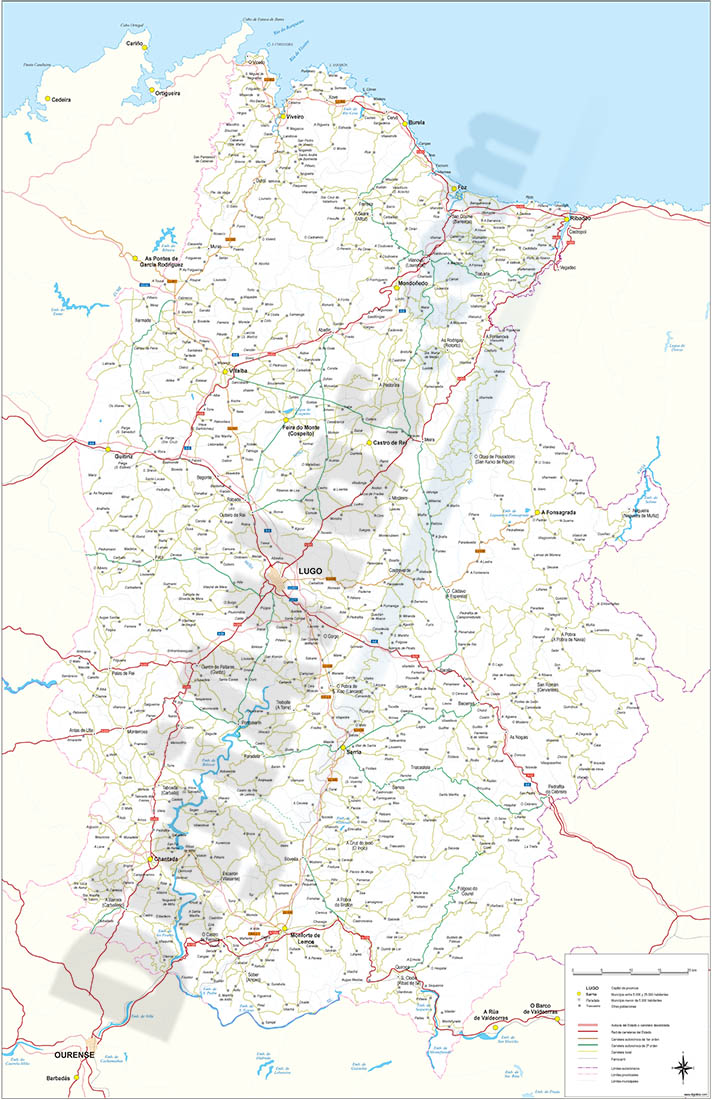
Map of Lugo
Vector format spain province map showing community and province boundaries, cities, highways, major and minor roads, railroad, principal rivers and lakes and other relevant political information. Scal
(...) Read more »
Adobe Illustrator, Acrobat PDF
19,95 €
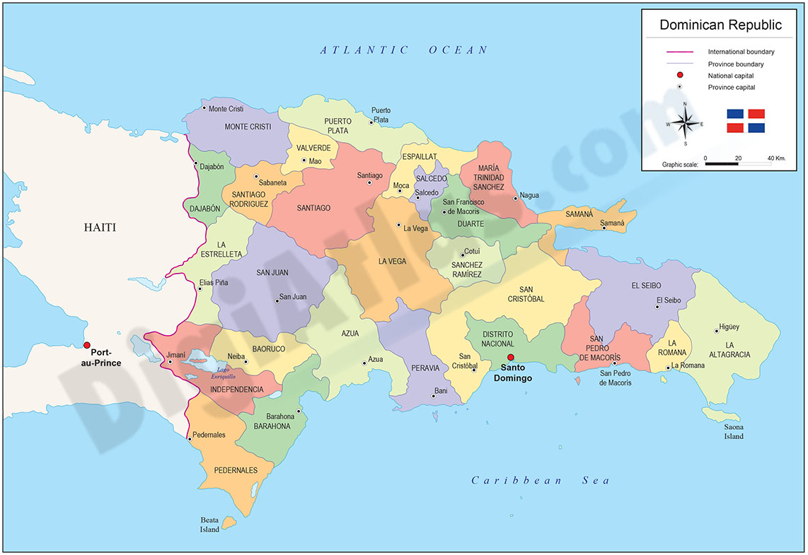
Map of Dominican Republic
Political map of the Dominican Republic with the internal administrative division into 31 provinces and one national district, their names and capitals.
(...) Read more »
Adobe Illustrator, Acrobat PDF
125,00 €
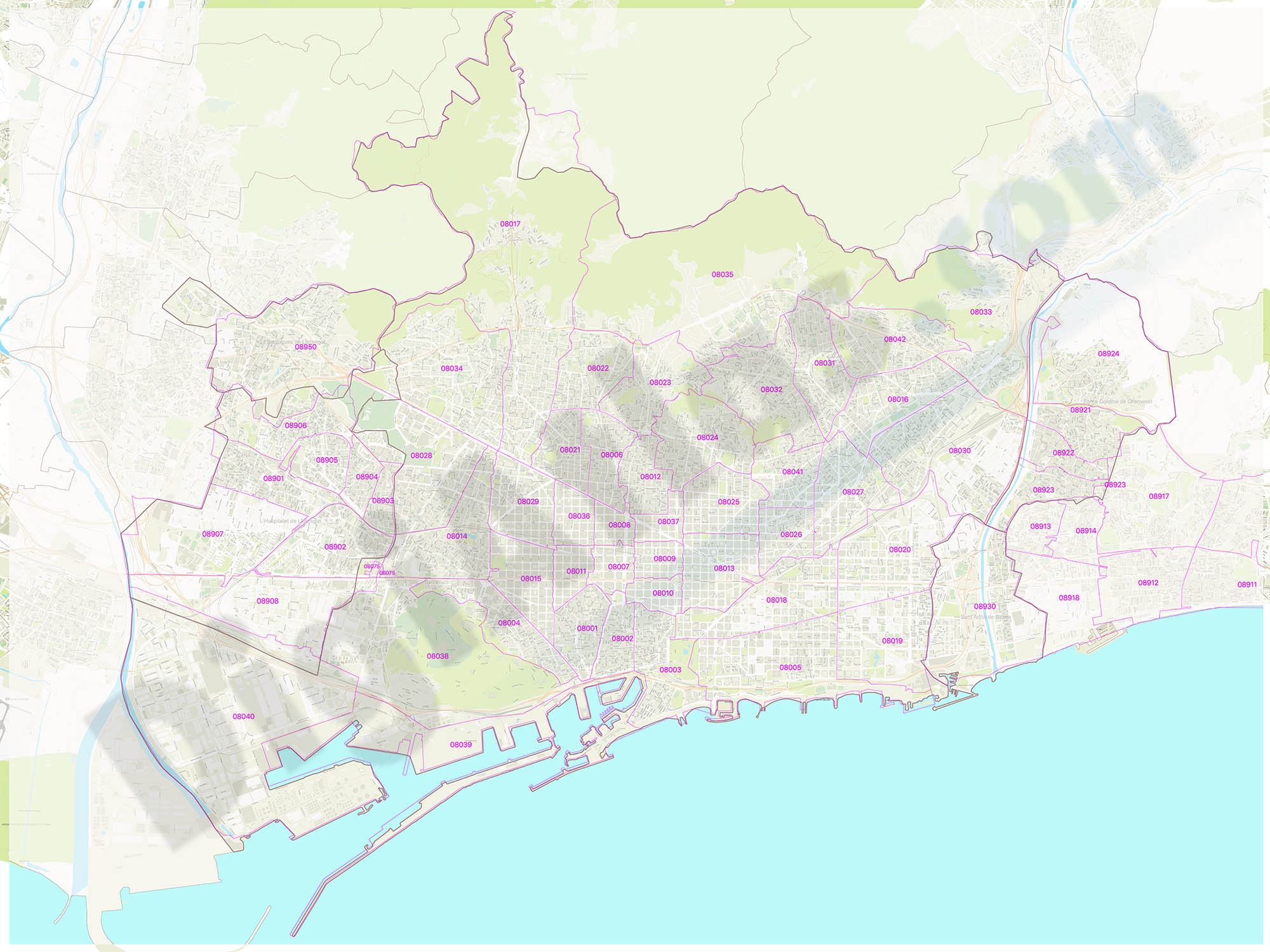
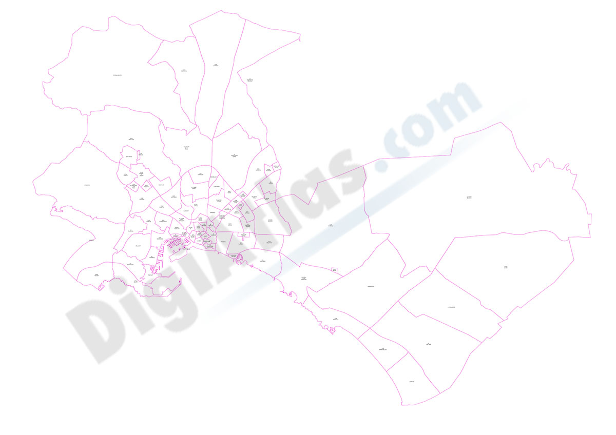
Metropolitan Area of Barcelona with postal codes
Digital map of the Metropolitan Area of Barcelona with postcodes.
(...) Read more »
Adobe Illustrator, Acrobat PDF
Ask price
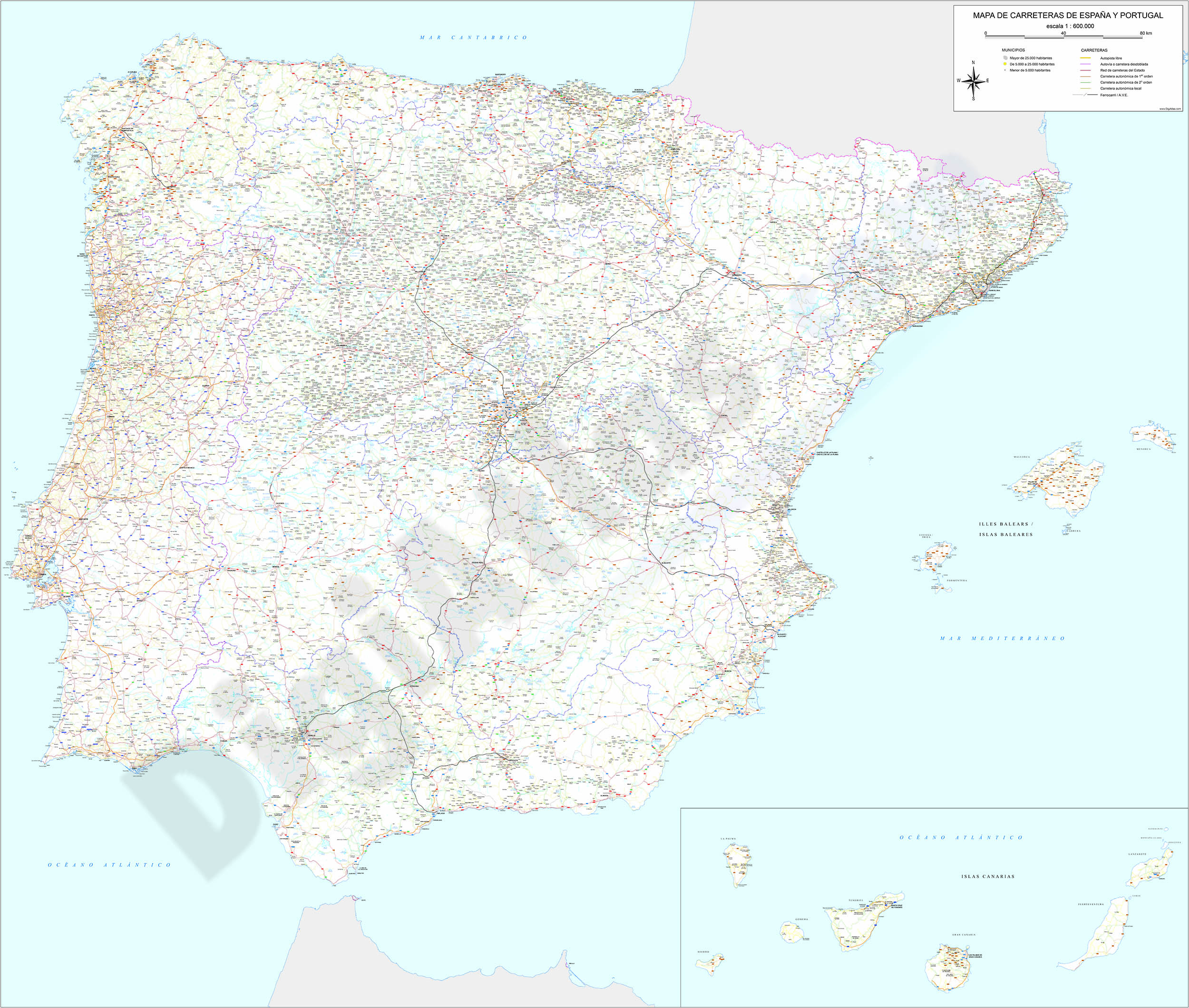
Detailed Road Map of Spain and Portugal
Detailed digital road map of Spain and Portugal, at a working scale of 1:100.000 and adjusted to poster size of 2 meters wide.
(...) Read more »
Adobe Illustrator, Acrobat PDF
59,29 €
Palma de Mallorca - districts and neighbourhoods
Georeferenced digital map of the city of Palma de Mallorca with the division of the districts, neighbourhoods and statistical areas of the city council of Palma.
Map in Shapefile format.
Shapefile (.shp)

59,00 €
Map of Lleida province with municipalities and postal codes
Map of Lleida province (Catalonia, Spain) showing municipalities borders and 5-digit postal codes areas. Fully editable vectorized file organized in separate layers.
Adobe Illustrator, Acrobat PDF
75,00 €
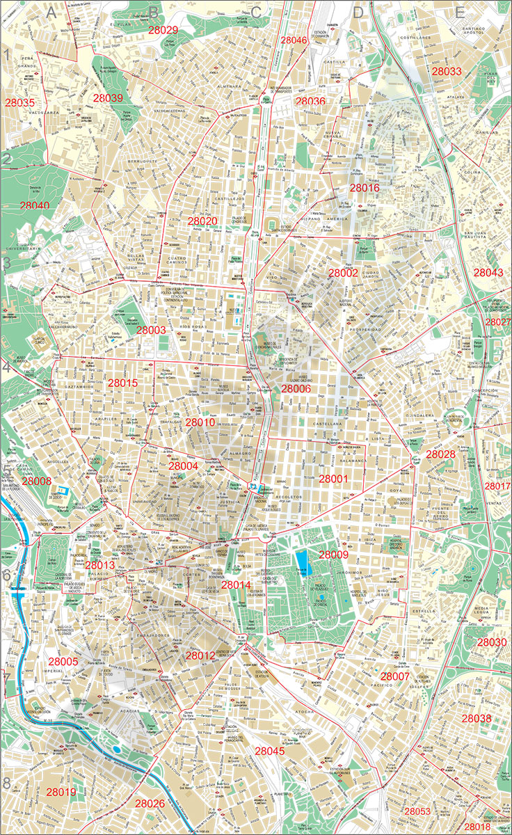
Madrid center city with postal districts
City Map of Madrid center in digital format. Fully editable vectorized file organized in layers. Street map of central area shows urban blocks of buildings, parks and green zones, street and square na
(...) Read more »
Adobe Illustrator, PDF

