
75,00 €
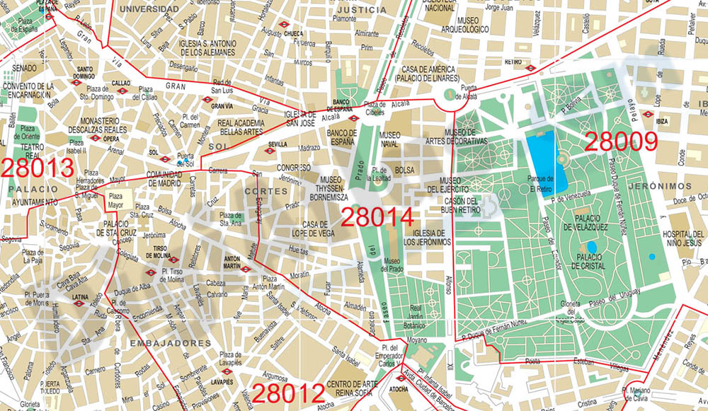
Madrid center city with postal districts
City Map of Madrid center in digital format. Fully editable vectorized file organized in layers. Street map of central area shows urban blocks of buildings, parks and green zones, street and square na
(...) Read more »
Adobe Illustrator, PDF

59,00 €
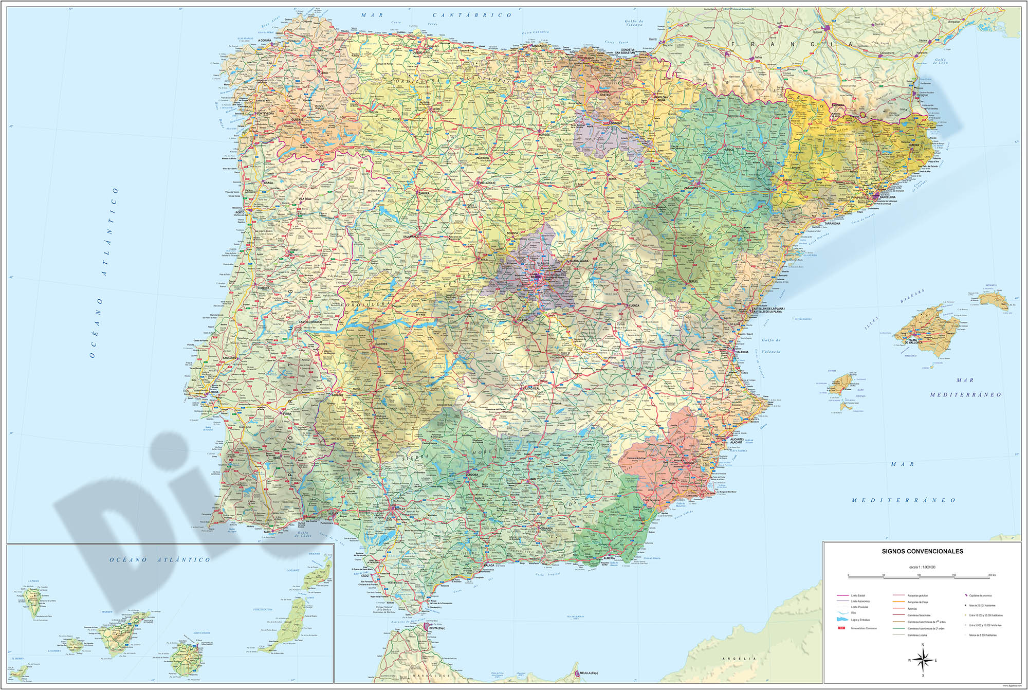
Major roads map of Spain and Portugal
Digital map of Spain and Portugal with the general road network, hydrographic network and main towns.
(...) Read more »
Adobe Illustrator, Acrobat PDF

Ask price
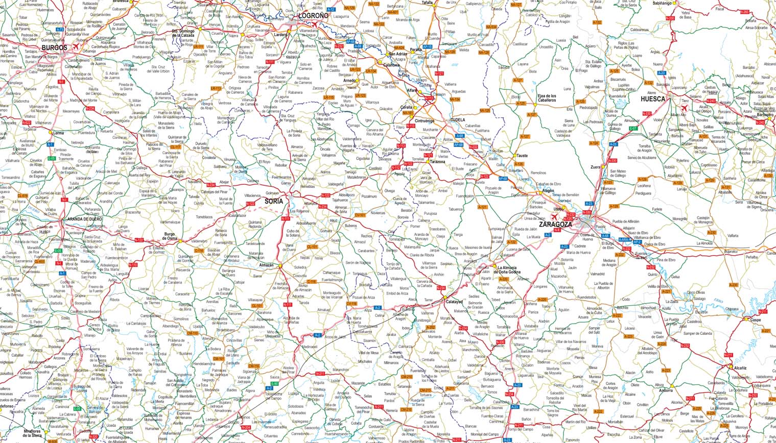
Detailed roads and cities map of Spain
Detailed vector road map of Spain (excluding Portugal) at a scale of 1:600.000 and adjusted to 2 meters wide.
(...) Read more »
Acrobat PDF

55,00 €
Argentona (Barcelona, Spain) - city map
Vector-file map of Argentona (Barcelona, Spain) city. All features are in separated layers. Street coordinates are included.
Adobe Illustrator, PDF
79,00 €
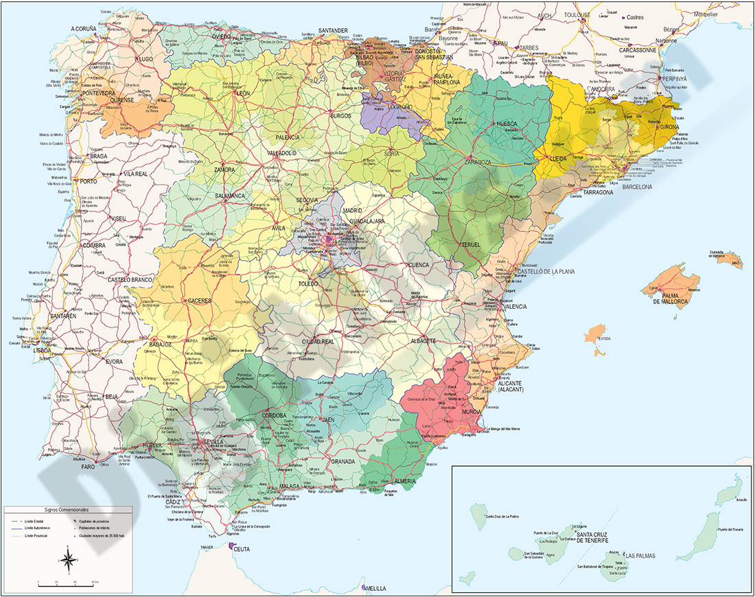
Spain political-relief poster map
Physical-political Spain map. Include a lot of roads, more than 3.500 cities, major rivers and lakes and geographical names. More than 40 fully-editable layers. 1.1.000.000 scale. High-resolution colo
(...) Read more »
Adobe Illustrator, PDF, JPG (300dpi)

59,99 €
Valencia - Map of province
Vector format spain province map showing community and province boundaries, cities, highways, major and minor roads, railroad, principal rivers and lakes and other relevant political information. Scal
(...) Read more »
Adobe Illustrator, PDF, JPG (300dpi)

55,00 €
Avilés city map
Vector-file map of Aviles (Asturias-Spain) city. All map features are in separated layers.
FreeHand, Illustrator, PDF

55,00 €
Vilassar de Mar (Barcelona, Spain) - city map
Vector-file map of Vilassar de Mar (Barcelona, Spain) city. All features are in separated layers. Street coordinates are included.
Illustrator, PDF

59,00 €
Map of A Coruña province with municipalities, major roads and postal cod
Map of A Coruña province showing municipalities, postal codes areas and major roads
Illustrator, PDF

55,00 €
Cordoba center - city map
Vector-file map of the center city of Cordoba (Andalucia, Spain). All features are in separated layers.
Illustrator, PDF, JPG (300dpi)

55,00 €
Benissa-Teulada-Moraira - city map
Vector-file map of Benissa and Teulada-Moraira cities (province of Alicante, Spain). All features are in separated layers.
Illustrator, PDF

55,00 €
Tortosa - city map of the center
Vector file map of Tortosa city (province of Tarragona, autonomous community of Catalonia, Spain). All features are in separated layers.
Adobe Illustrator, PDF
55,00 €
Map of Spain and Portugal DIN A3
Map of Spain and Portugal with major cities and roads. DIN A3 paper size. vector file 100% editable
Illustrator, PDF

55,00 €
Elda (Alicante) - city map
Vector-file detailed street map of Elda (Province of Alicante, Spain), showing streets, squares, blocks of houses and green areas, with colours and names. All elements are grouped in separate layers f
(...) Read more »
Adobe Illustrator, Acrobat PDF

59,00 €
Map of Ciudad Real province with municipalities, major roads and postal cod
Map of Ciudad Real province showing municipalities, postal codes areas and major roads
Illustrator, PDF