
55,00 €
Maps of Central and South american countries with political division
Digital maps of Argentina, Bolivia, Brazil, Chile, COLOMBIA, Ecuador, Guyana, Paraguay, Peru, Surinam, Uruguay, Venezuela, Guatemala, Belize, Honduras, El Salvador, Nicaragua, Costa Rica, Panamá and
(...) Read more »
Adobe Illustrator, Acrobat PDF
79,00 €
Central America political map
Digital file of Central America (Central America or América del centro) with the delimitation of the countries and other layers with geographical and political information (relief, rivers, lakes, cap
(...) Read more »
Adobe Illustrator, Acrobat PDF, image TIFF

79,00 €
America physical vectorized-relief map
Fully editable vector file map of all american continent. Shows colored altimetry and bathymetry, international boundaries, major lakes, country capitals and relevant geographic names. High-resolution
(...) Read more »
Adobe Illustrator, Acrobat PDF
55,00 €
Colombia - city map
Detailed map of COLOMBIA (Republic of COLOMBIA) showing the inner administrative division, departments, the Capital District of Bogotá, municipality borders, a lot of towns and cities. Poster size ma
(...) Read more »
Acrobat PDF
19,95 €
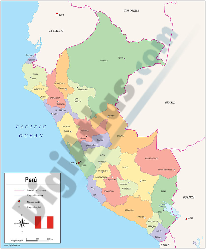
Map of Peru
Fully editable vector file map of Peru. Include political layers of inner administrative division, with their names and capitals.
Adobe Illustrator, PDF

79,00 €
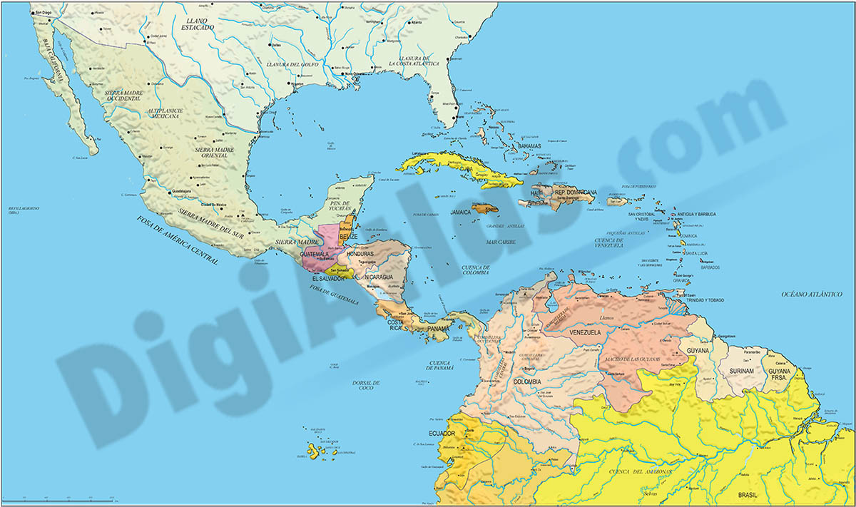
South and Central America and Mexico
Digital map of South America and Mexico with political and geographic information.
(...) Read more »
Adobe Illustrator, Acrobat PDF

79,00 €
America political and geographical map
Fully editable vector file. Layers: colour and name of countries, international boundaries, major lakes, country capitals and relevant geographic names. High-resolution TIFF relief-image is included.
Adobe Illustrator, PDF + TIFF, JPG (300dpi)

19,95 €
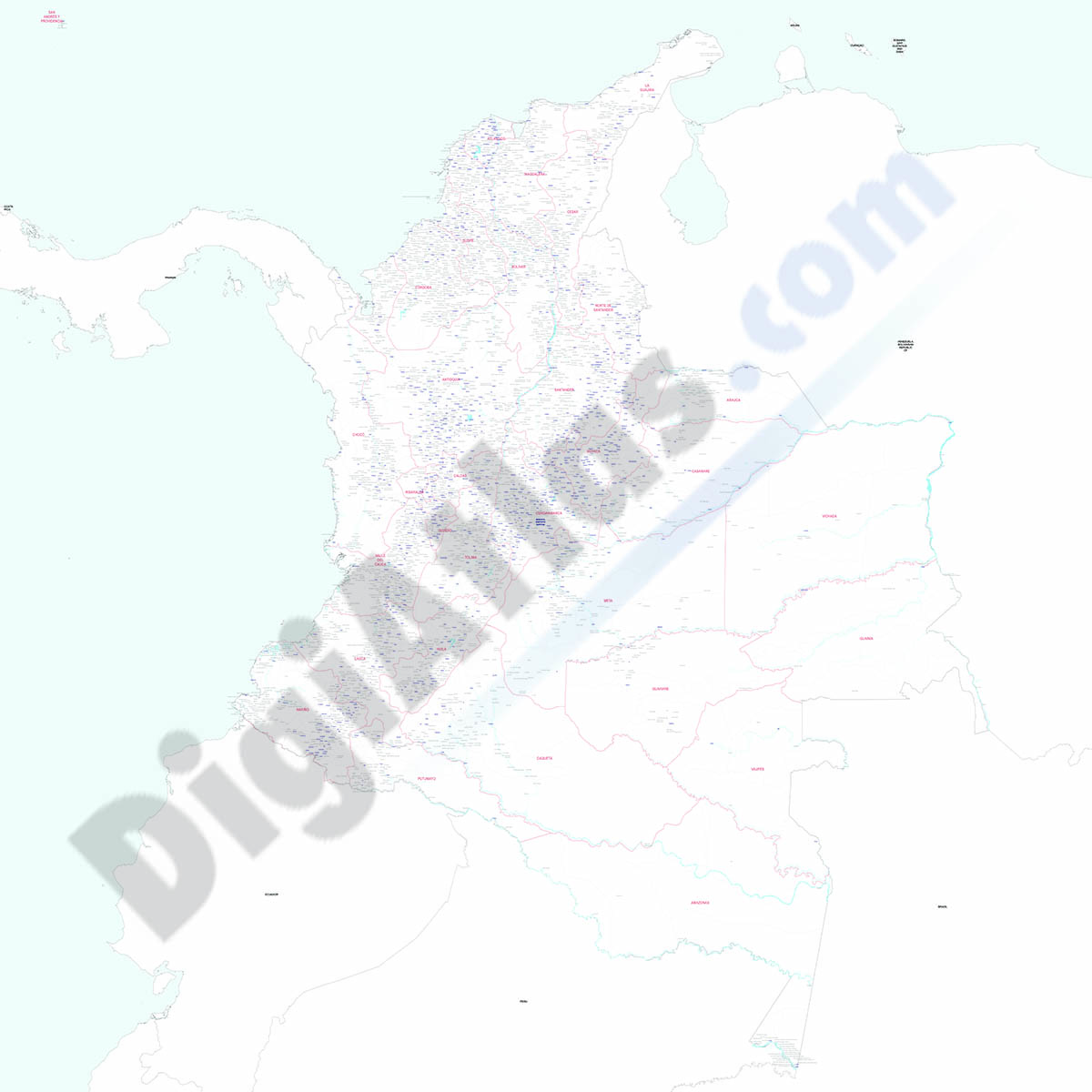
Map of Colombia
Digital map of COLOMBIA with internal political administrative divisions, their names and capitals.
100% editable vector map organised in separate layers.
Adobe Illustrator, Acrobat PDF

Ask price
Colombia - map of 4 digit postal codes
Digital map of COLOMBIA with the 4-digit postcodes.
Georeferenced cartography of COLOMBIA with the 4-digit postal zones, which refer to the departments and regional zones.
(...) Read more »
Shapefile (.shp)