
Ask price
diary maps - maps for agendas
Political maps for school agendas and projects.
(...) Read more »
Adobe Illustrator, Acrobat PDF

Ask price
Italy zip codes map with demographic data
Digital map of Italy with 5 digit postal code areas and their demographics data.
Shapefile format (.shp)

55,00 €
Map of Italy with regions and Postal Codes
Vectorized and fully editable Map of Italy with regions, capitals and 2-digit postal codes.
Illustrator, Acrobat PDF

29,00 €
Province of Bergamo with municipalities and cities
Digital map of the province of Bergamo (region of Lombardy, Italy), showing municipalities (comuni) and their names and cities.
Adobe Illustrator, Acrobat PDF

29,00 €
Province of Cremona with municipalities and cities
Digital map of the province of Cremona (region of Lombardy, Italy), showing municipalities (comuni) and their names and cities.
Adobe Illustrator, Acrobat PDF

29,00 €
Province of Lodi with municipalities and cities
Map of the province of Lodi (region of Lombardy), showing municipalities (comuni) and their names and cities.
Adobe Illustrator, PDF

19,95 €
Map of Switzerland
Digital political map of Switzerland (Swiss Confederation) with the territorial organisation (Federal State with 26 cantons), their names and capitals.
(...) Read more »
Adobe Illustrator, Acrobat PDF
19,95 €
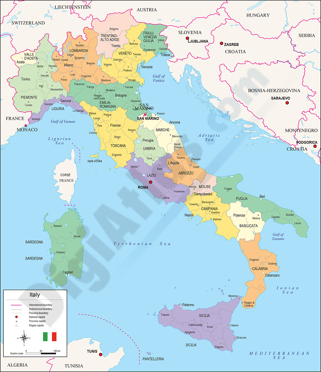
Map of Italy
Fully editable vector file map of Italy, ITALIAn Republic, showing political inner administrative division, with their names and capitals.
Adobe Illustrator, PDF