65,00 €
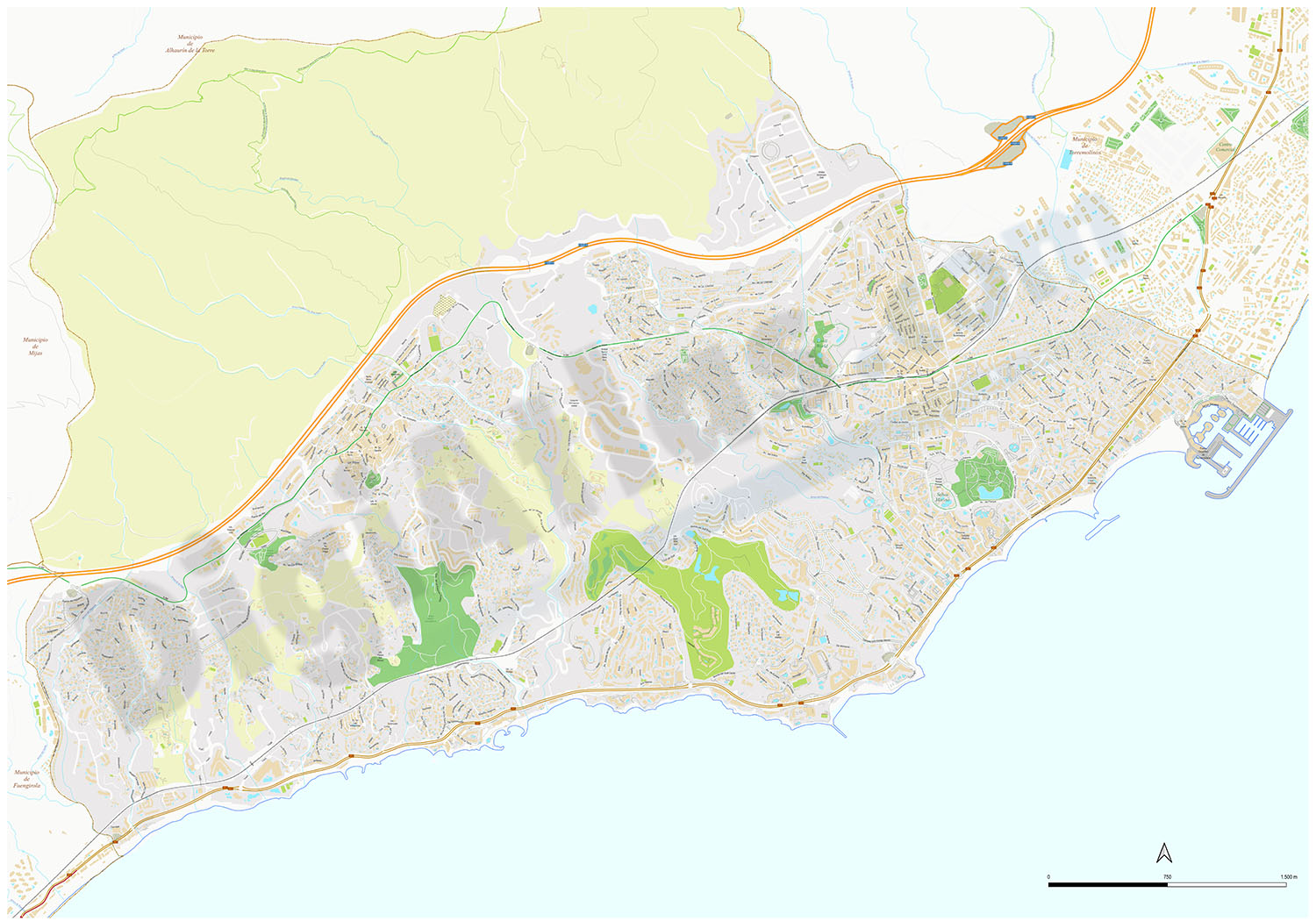
Benalmadena - city map
Digital street map of Benalmádena (province of Málaga, Andalusia) with the delineation of streets and squares, blocks of houses, singular buildings, parks, green areas and names of streets and squar
(...) Read more »
Acrobat PDF

55,00 €
Chiclana de la Frontera - city map
Vector file map of Chiclana de la Frontera (province of Cadiz, Andalucia, Spain). All features are in separated layers.
Adobe Illustrator, Acrobat PDF

59,99 €
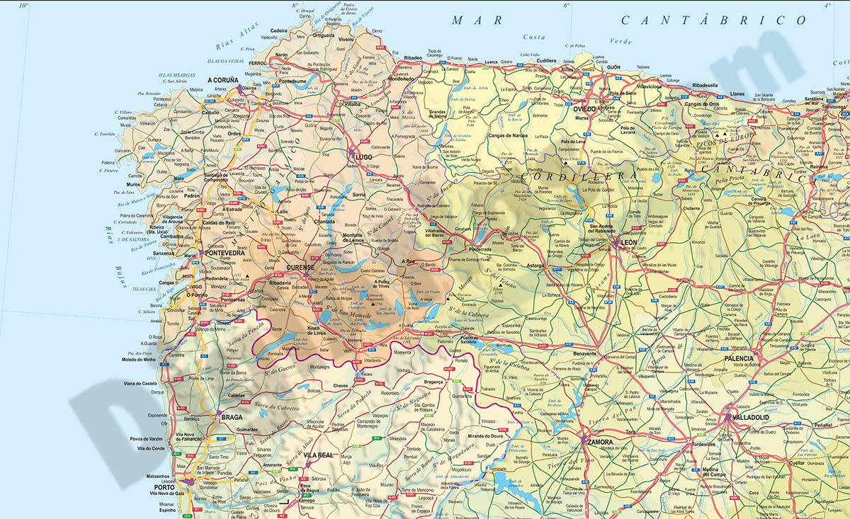
Map of Lugo
Vector format spain province map showing community and province boundaries, cities, highways, major and minor roads, railroad, principal rivers and lakes and other relevant political information. Scal
(...) Read more »
Adobe Illustrator, Acrobat PDF

Ask price
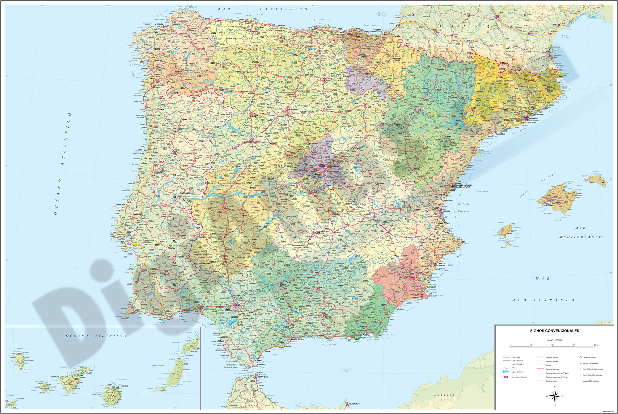
Detailed roads and cities map of Spain
Detailed vector road map of Spain (excluding Portugal) at a scale of 1:600.000 and adjusted to 2 meters wide.
(...) Read more »
Acrobat PDF

59,00 €
Map of Lugo province with municipalities and postal codes
-Postcode map of the province of Lugo (Galicia).
(...) Read more »
Adobe Illustrator, Acrobat PDF

59,00 €
Map of Murcia autonomous community with municipalities and postal codes
Map of murcia region (Spain) showing municipalities borders and postal codes.
Adobe Illustrator, PDF, JPG(300 dpi)
79,00 €
Spain political-relief poster map
Physical-political Spain map. Include a lot of roads, more than 3.500 cities, major rivers and lakes and geographical names. More than 40 fully-editable layers. 1.1.000.000 scale. High-resolution colo
(...) Read more »
Adobe Illustrator, PDF, JPG (300dpi)

59,99 €
Valencia - Map of province
Vector format spain province map showing community and province boundaries, cities, highways, major and minor roads, railroad, principal rivers and lakes and other relevant political information. Scal
(...) Read more »
Adobe Illustrator, PDF, JPG (300dpi)

55,00 €
Belgium map with administrative limits
Map of Belgium showing provinces, arrondissements and municipalities (communes) and their names.
Adobe Illustrator, Acrobat PDF

59,00 €
Map of A Coruña province with municipalities, major roads and postal cod
Map of A Coruña province showing municipalities, postal codes areas and major roads
Illustrator, PDF

59,99 €
Valencian Community, Murcia, Cuenca and Albacete with municipalities
Digital map of the Valencian Community, Region of Murcia, province of Cuenca and province of Albacete (Spain) with the municipalities coloured and the towns grouped according to number of inhabitants.
(...) Read more »
Adobe Illustrator, Acrobat PDF

55,00 €
Map of Murcia with municipalities
Digital map of the Region of Murcia (autonomous community of Spain) with all its municipalities, capitals, cities and towns.
Download files in vector format 100% editable, so you can customize the lo
(...) Read more »
Adobe Illustrator, Acrobat PDF
55,00 €
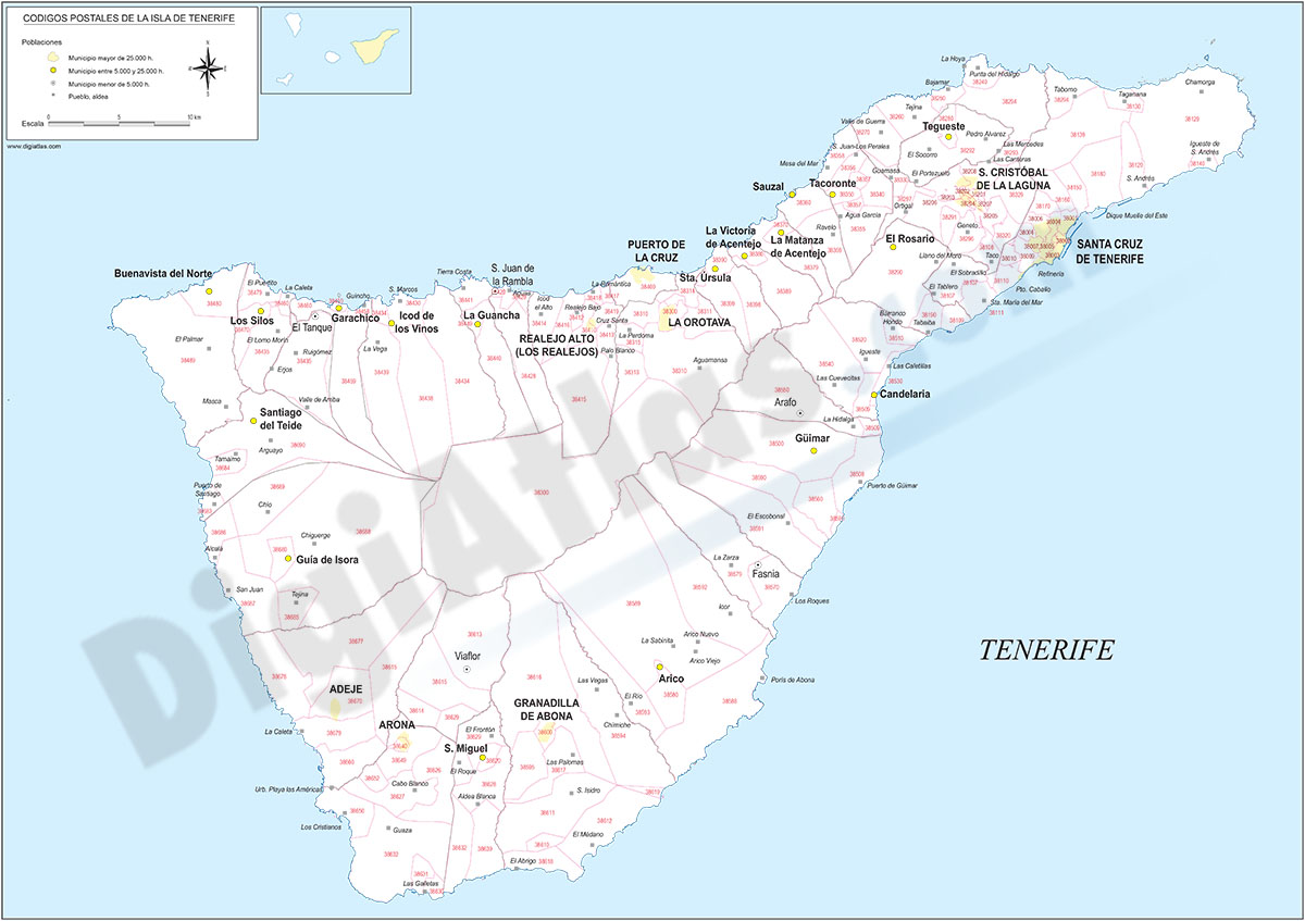
Tenerife - map of the island with municipalities and postal codes
Map of the island of Tenerife (Canary Islands - Spain) showing municipalities borders and 5-digits postal codes.
Download vectorized and fully editable map organized in separated layers.
Adobe Illustrator, Acrobat PDF

55,00 €
León (Spain) - center of city map
Vector file map of Leon city center (autonomous community of Castile and León, Spain). All features are in separated layers.
Adobe Illustrator, PDF

59,00 €
Map of Ciudad Real province with municipalities, major roads and postal cod
Map of Ciudad Real province showing municipalities, postal codes areas and major roads
Illustrator, PDF