75,00 €
Madrid city map with postal code areas
Postal code map of Madrid.
(...) Read more »
Acrobat PDF
75,00 €
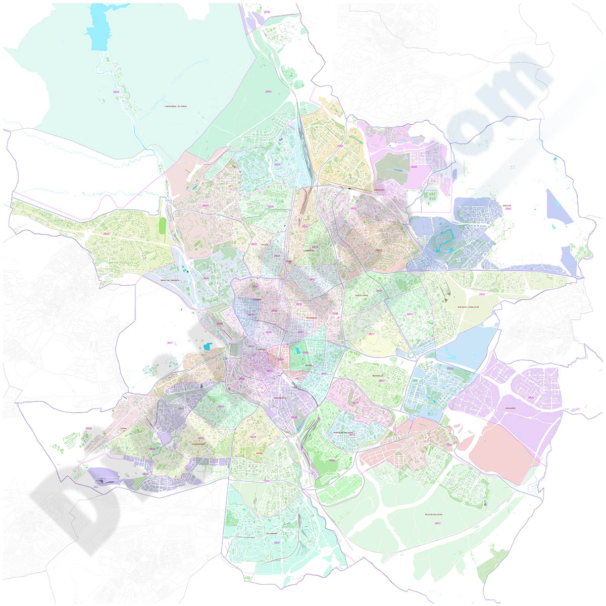
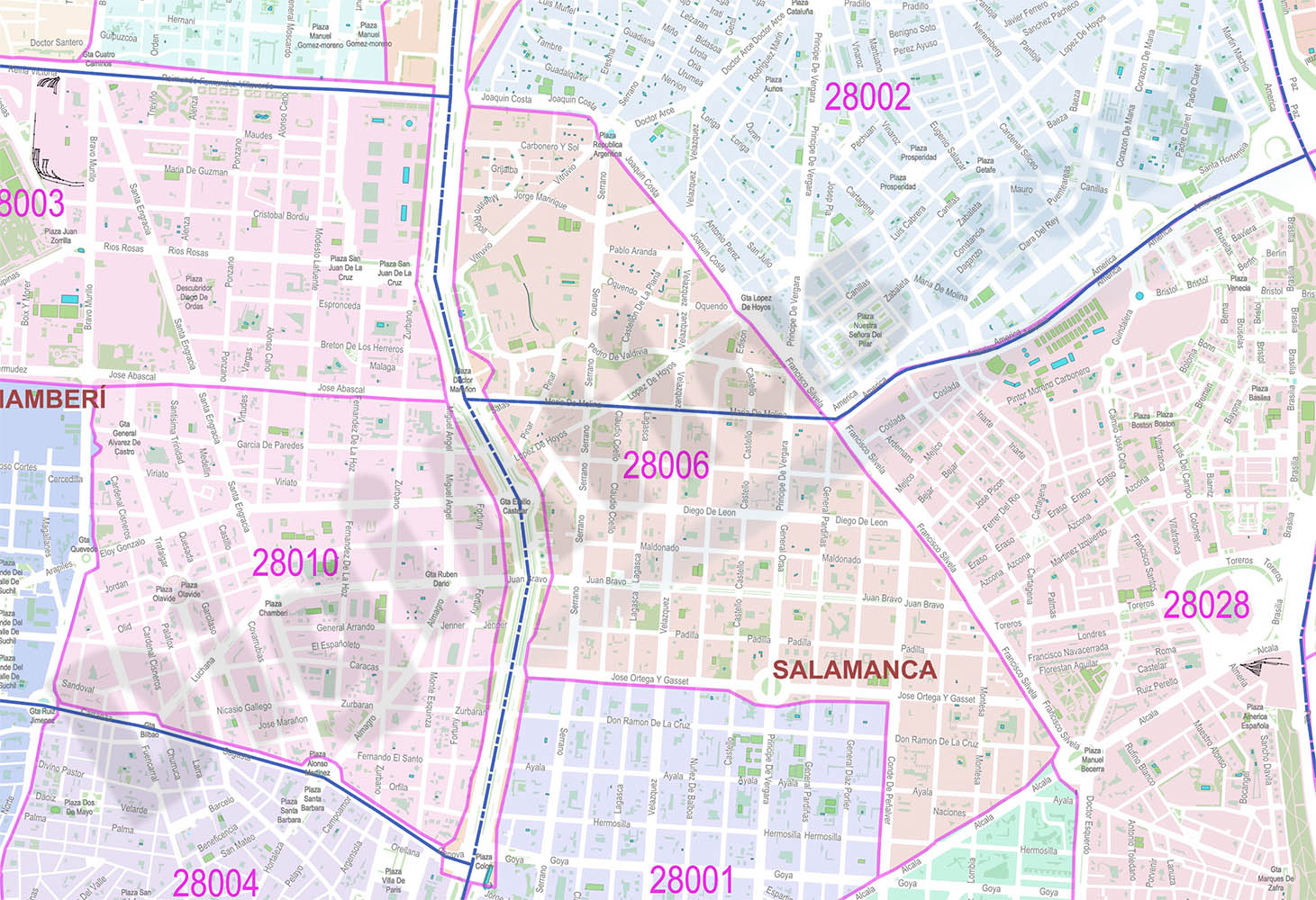
Madrid city map with postal code areas
Vectorized and high quality file map of Madrid municipality. Digital map of Madrid shows major street names and district limits, 5-digit postal code areas.
Adobe PDF
95,00 €
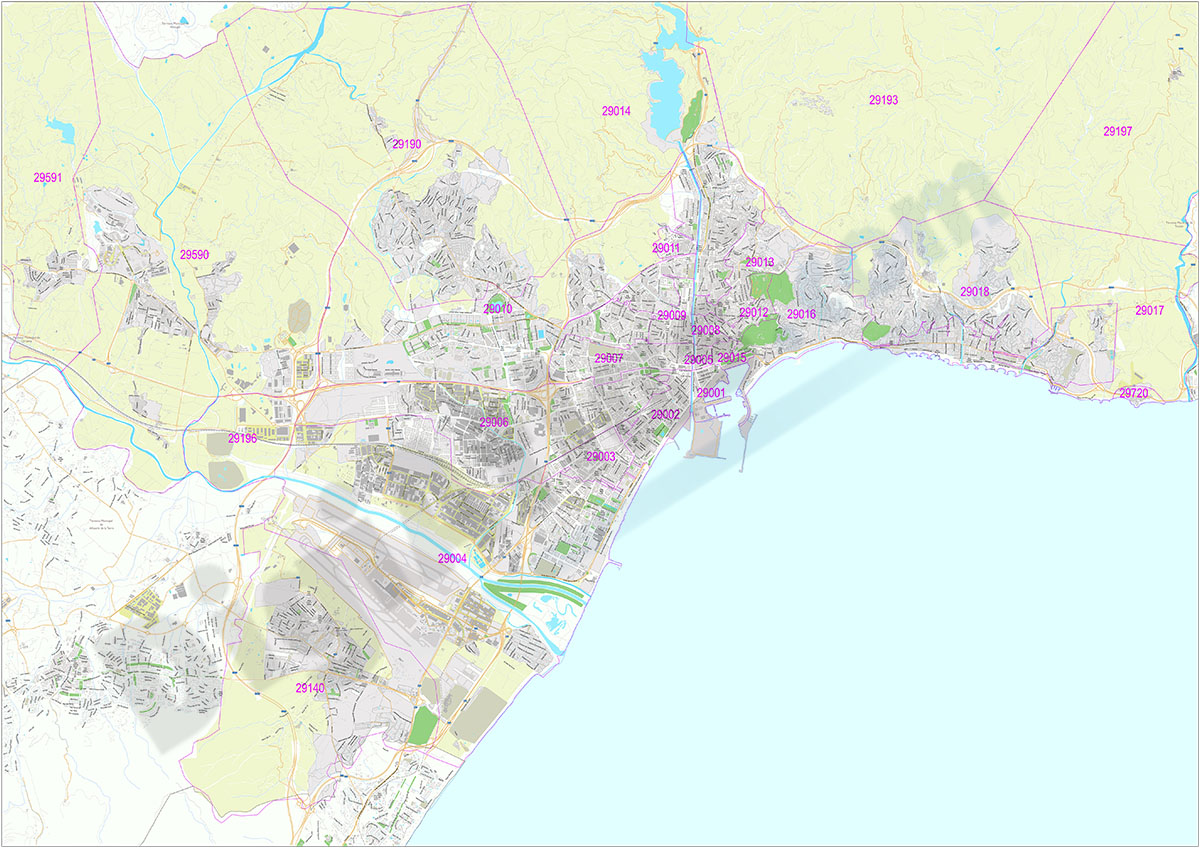
Malaga (Andalusia, Spain) - city map with postal codes
Digital street map of Malaga with postcodes
The map of the city of Malaga (Andalusia, Spain) covers the entire urban area from La Araña to Churriana, with the delineation of blocks of houses, blocks of houses and singular buildings, hydrographic network, parks, green areas, railways, urban roads and 5-digit postal code areas and the names of streets and squares.
Two vector files are downloaded: one in Adobe Illustrator (.ai) format, 100% editable, which allows modifying and customising colours, texts and styles, as well as managing (colouring) each postcode separately. A second version is in Acrobat PDF format, which allows the map to be printed directly at the desired size, always with the maximum resolution. Both versions of the map are organised in layers, which can be displayed and/or hidden to generate various types of customised maps.
The digital map of Malaga is optimised to establish commercial areas, distribution and sales zones, delivery routes, graphic design, advertising, etc.
See less «
Adobe Illustrator, Acrobat PDF
125,00 €
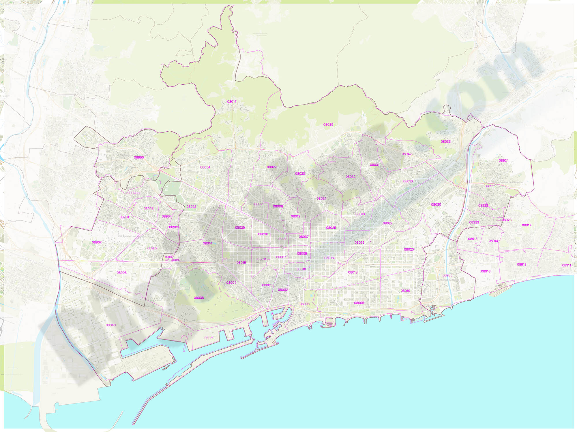
Metropolitan Area of Barcelona with postal codes
Digital map of the Metropolitan Area of Barcelona with postcodes.
(...) Read more »
Adobe Illustrator, Acrobat PDF
95,00 €
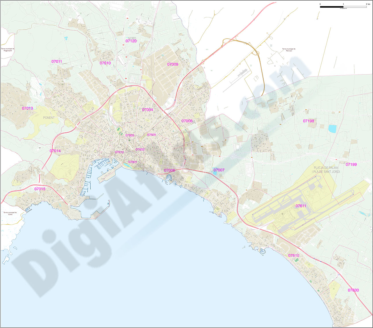
Palma de Mallorca city map with postcode districts
Digital map of the city of Palma (Island of Mallorca, Balearic Islands, Spain).
(...) Read more »
Adobe Illustrator, Acrobat PDF
59,00 €
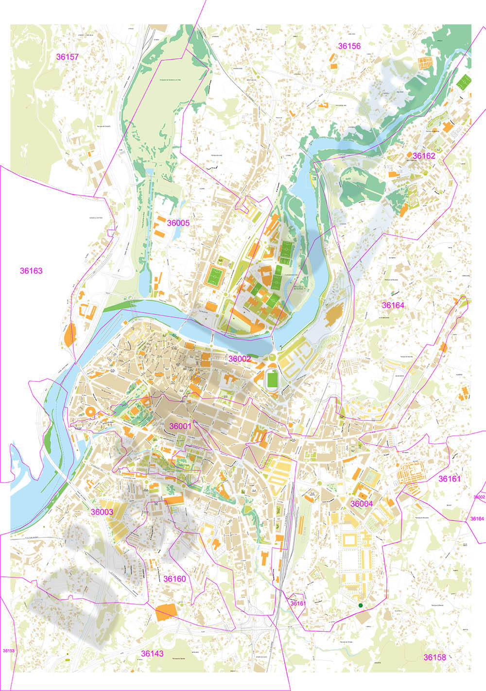
Pontevedra (Galicia, Spain) - city map with postal codes
City Map of Pontevedra (Galicia, Spain) in digital format showing urban blocks of buildings, parks, green zones, street and square names and 5-digit postal code areas. Downloads a fully editable vecto
(...) Read more »
Adobe Illustrator, PDF
78,65 €
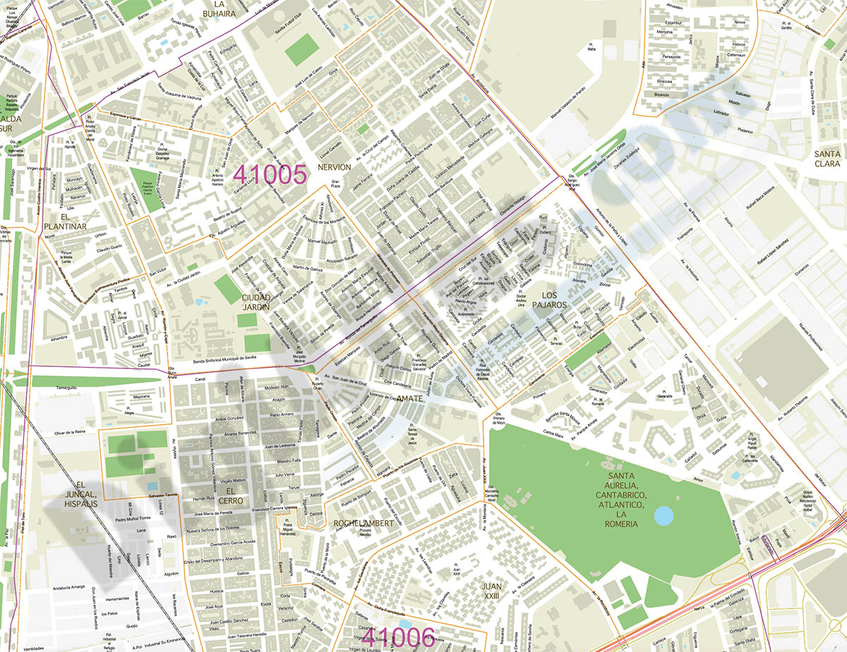
Sevilla City map with postcode areas
Digital map of Sevilla or Seville city (Andalusia, Spain) with the delineation of streets and squares, blocks of houses, parks and green areas, singular buildings and the names of streets and s
(...) Read more »
Acrobat PDF
55,00 €
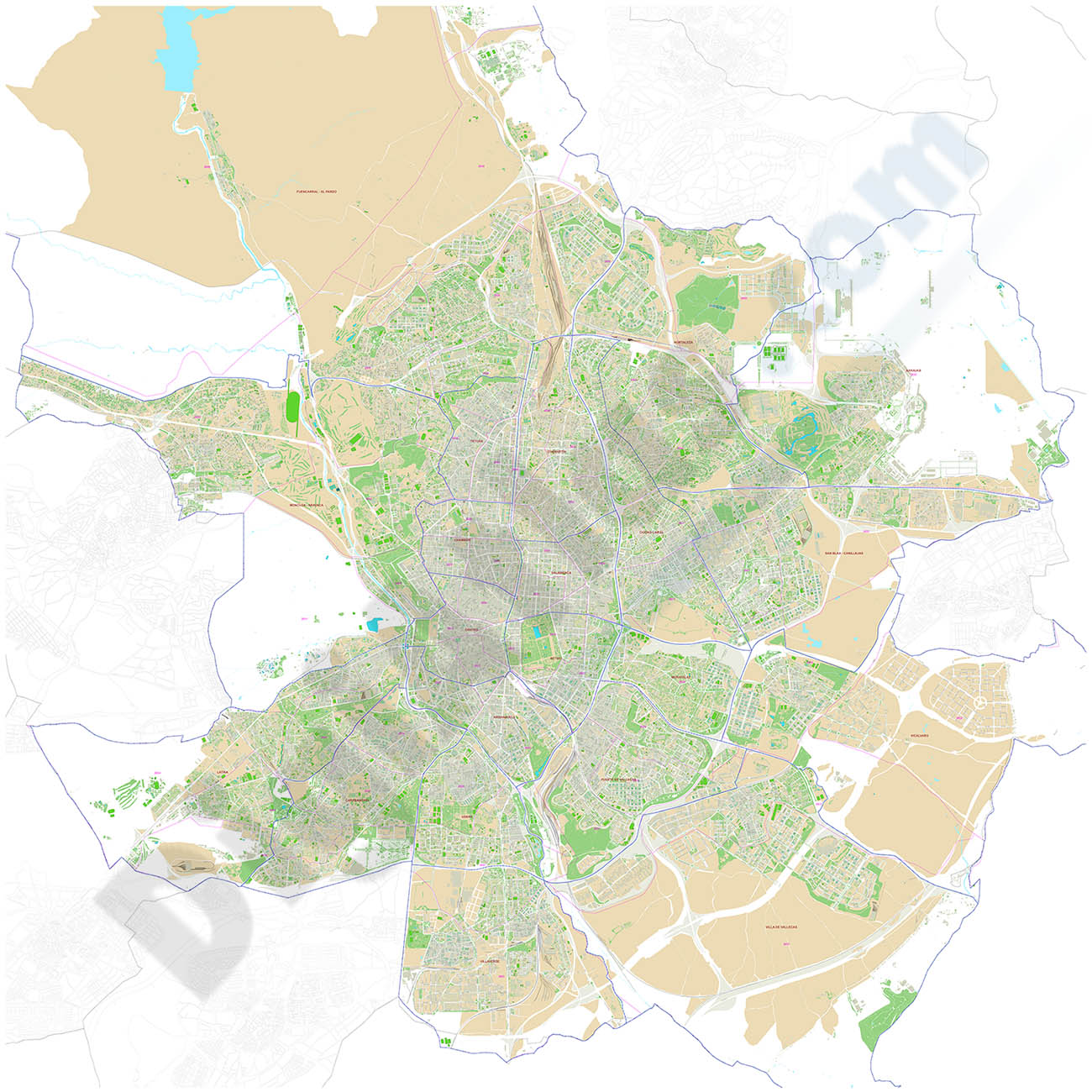
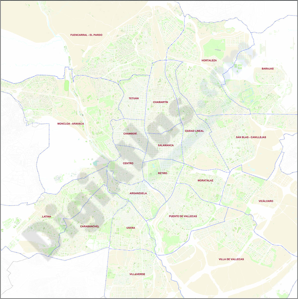
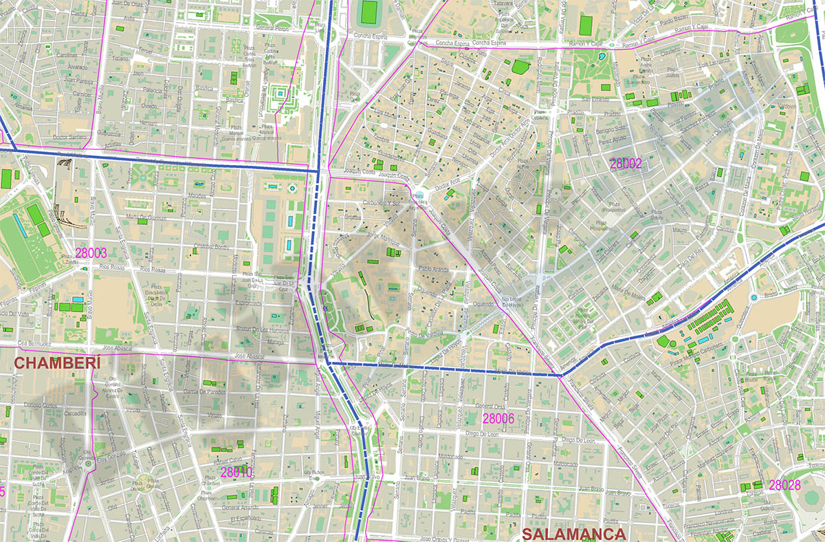
Street map of Madrid with districts
Map of the municipality of Madrid showing all district areas.
Adobe Illustrator, PDF, JPG (300dpi)
89,95 €
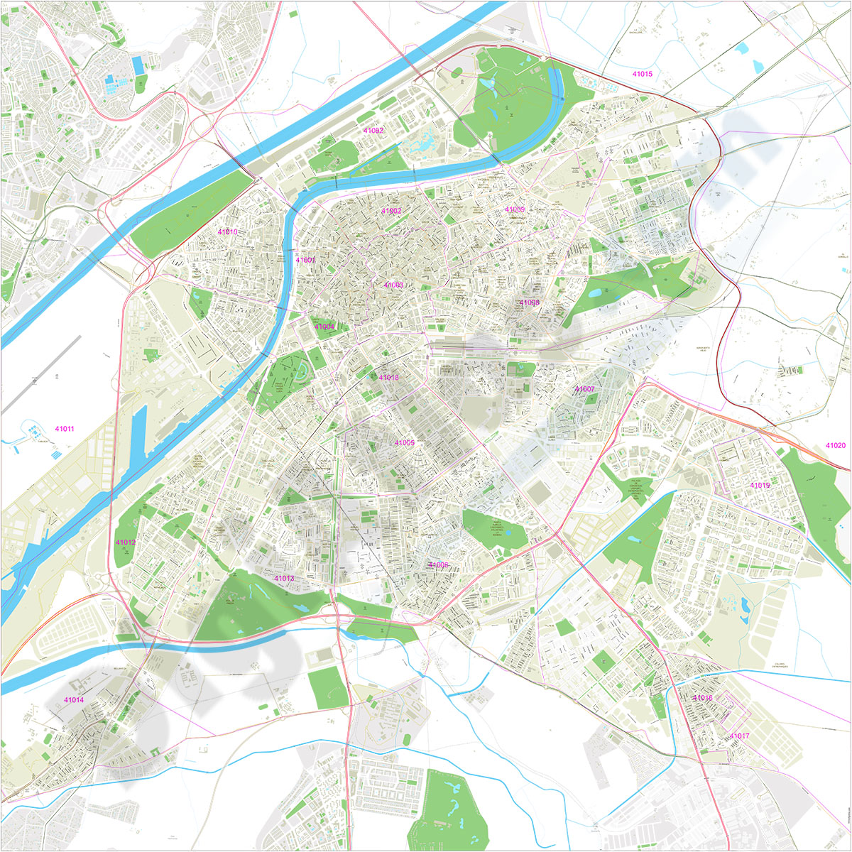
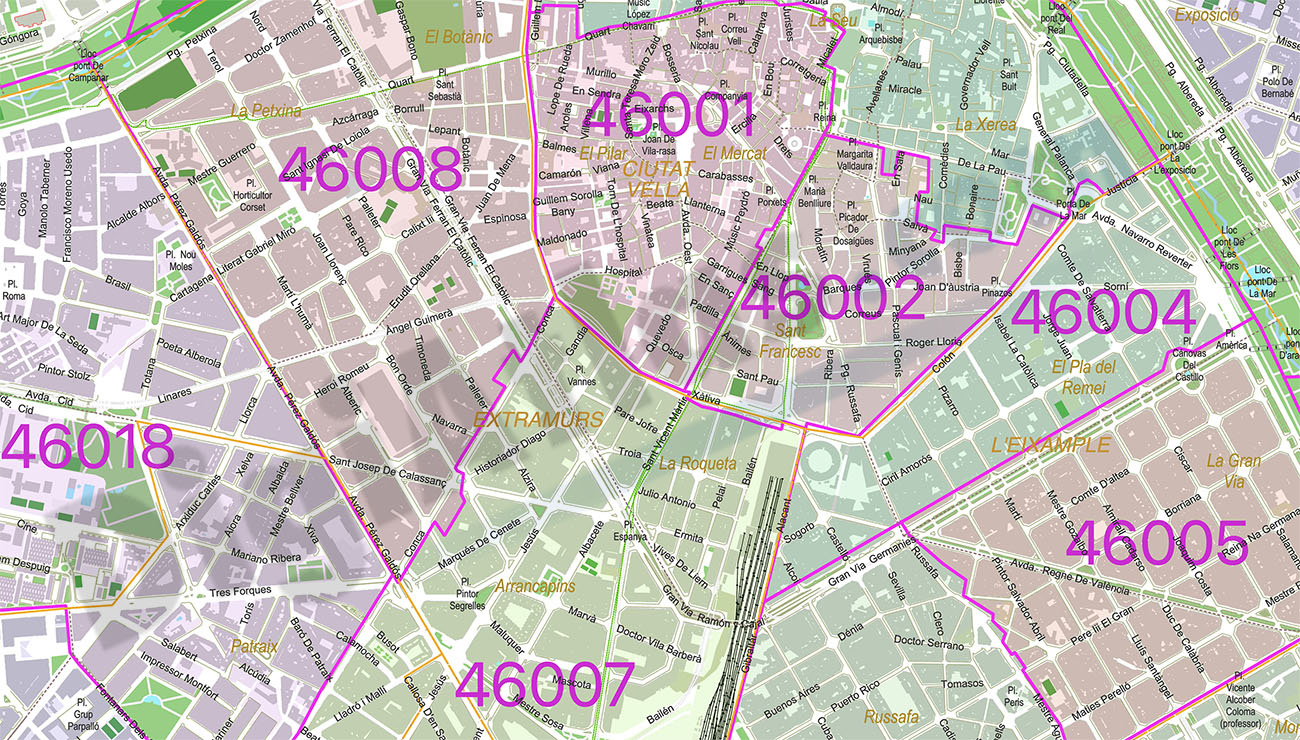
Valencia City map with postcode districts
Digital street map of the city of Valencia, with the delineation of streets and squares, blocks of houses, parks, green areas, zip codes, districts, neighborhoods and the names of streets and squares.
(...) Read more »
Adobe Illustrator, Acrobat PDF
59,00 €
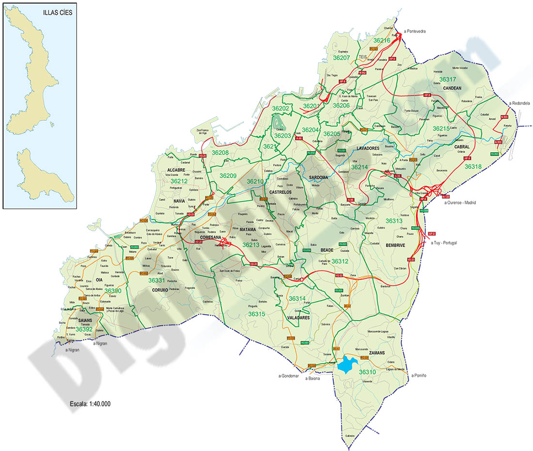
Vigo - city map with postalcodes
Vector-file map of Vigo Metropolitan Area (province of Pontevedra, Spain) with all postal code districts, surrounding municipalities, cities and major roads. Digital map in poster size in high resolut
(...) Read more »
Adobe Illustrator, PDF, JPG (300dpi)
