98,00 €
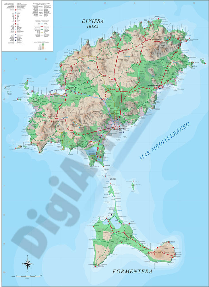
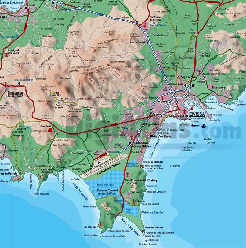
Map of Ibiza-Eivissa island (Balearic Islands)
Vectorized map of Eivissa-Ibiza island (Balearic islands) howing detailed geographic and touristic information. Include High-resolution color shaded relief TIFF image. Scale: 1:70.000.
Adobe Illustrator, PDF, JPG (300dpi)
55,00 €
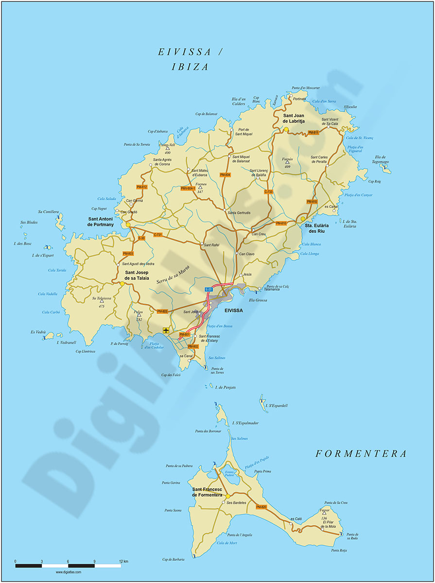
Map of Ibiza-Eivissa island (Balearic Islands)
Digital map of the island of Ibiza (Eivissa, Illes Balears) at a scale of 1:300.000 with the main towns, road network, railway network, rivers and lakes.
(...) Read more »
Adobe Illustrator, Acrobat PDF
55,00 €
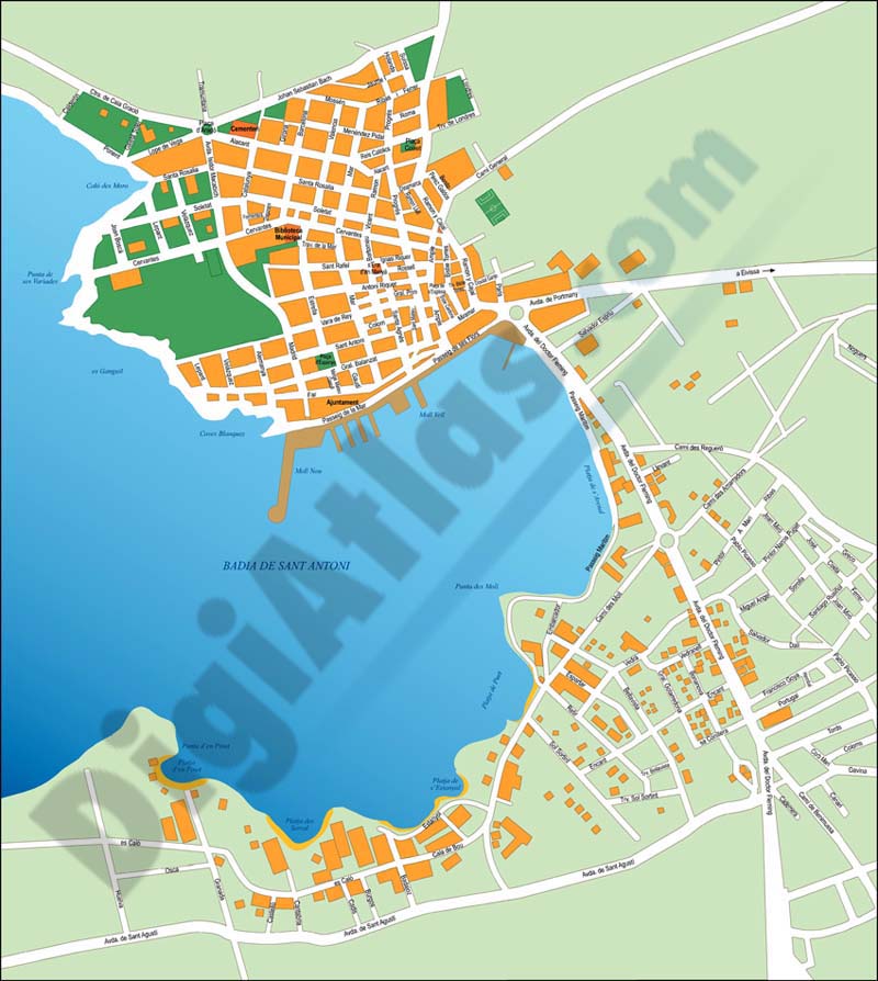
Sant Antoni de Portmany (Ibiza) city map
Vector-file map of Sant ANTONI de Portmany (town on the western coast of Ibiza island, Balearic Islands, Spain). All features are in separated layers.
FreeHand, Illustrator, PDF