1- Alella (Barcelona) - city map

Vector-file map of Alella (Catalonia, Spain) city. All features are in separated layers.
Adobe Illustrator, PDF
2- Argentona (Barcelona, Spain) - city map

Vector-file map of Argentona (BARCELONA, Spain) city. All features are in separated layers. Street coordinates are included.
Adobe Illustrator, PDF
3- Badalona (Barcelona, Spain) - city map

Vector-file map of Badalona (BARCELONA, Spain) city. All features are in separated layers. Street coordinates are included.
Adobe Illustrator, PDF
4- Barcelona City Center Street Map

Vector map of BARCELONA center (Spain), showing streets, squares and green zones with their colours and names. Also included Metro (Underground) and FFCC (train) stations.
All map features are organized into separate layers. Vector file 100%... Read more
Adobe Illustrator, Acrobat PDF
5- Barcelona city map (raster file)

Digital street map of BARCELONA in poster size, with the delineation of streets and squares, blocks of houses and green areas, with colors and names. Includes metro and FFCC stations.
Imagen TIFF a 300 dpi de resolución
6- Barcelona zipcodes map

Digital map of the postal districts 08009,08010,08013 and 0802 of BARCELONA.
The map shows the names of streets and squares and the police numbers (a portal number as a reference for each street section).
The map of BARCELONA is available in... Read more
Adobe Illustrator, Acrobat PDF
7- Cabrils (Barcelona, Spain) - city map

Vector-file map of Cabrils (BARCELONA, Spain) city. All features are in separated layers. Street coordinates are included.
Adobe Illustrator, Acrobat PDF
8- Calella (Barcelona) city map

Vector-file map of Calella city (BARCELONA-Catalonia). All features are in separated layers.
Adobe Illustrator, PDF
9- Canet de Mar (Barcelona) - city map

Vectorized street map of Canet de Mar (province of BARCELONA, Catalonia, Spain) with the delineation of streets and squares, blocks of houses and green areas, with colours and names.
All elements are grouped in separate layers fully editable.
Adobe Illustrator, Acrobat PDF
10- Catalonia - map of municipalities, counties and vegueries

Map of municipalities, comarques and vegueries of Catalonia.
Digital map of Catalonia with the municipalities, county boundaries and the countryside.
Fully editable vectorial map, organized with separate layers to customize colours, texts and... Read more
Adobe Illustrator, Acrobat PDF
11- Cornellà de Llobregat city map

Vector-file map of Cornellà de Llobregat (BARCELONA). All features are in separated layers. Sreet index is included.
Adobe Illustrator, PDF
12- Cubelles (Barcelona) - city map

Vector-file map of Cubelles city (comarca of Garraf, province of BARCELONA, Catalonia). Touristic map of Cubelles with all features organized in separate layers.
Adobe Illustrator, PDF
13- Dosrius - city map

Street map of Dosrius city (Comarca of Maresme, province of BARCELONA, Autonomous Community of Catalonia, Spain) showing urban blocks of buildings, parks and green zones, street and square names. Fully editable vectorized file organized in separate... Read more
Adobe Illustrator, PDF
14- El Prat de Llobregat (Spain) - city map
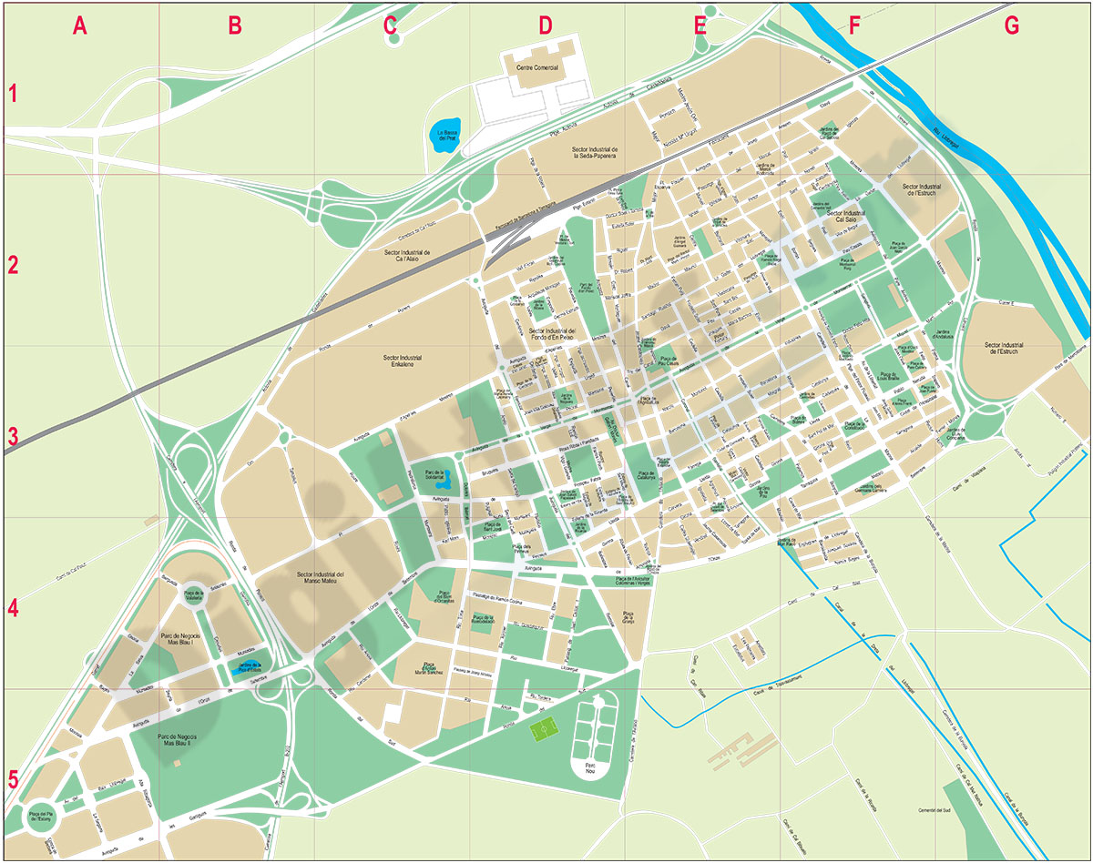
Digital street map of El Prat de Llobregat (province of BARCELONA) with the delineation of streets and squares, blocks of houses, parks and green areas, with colours and names.
100% editable vector files are downloaded, with all elements grouped in... Read more
Adobe Illustrator, Acrobat PDF
15- Esplugues de Llobregat city map

Digital street map of Esplugues de Llobregat (province of BARCELONA, Catalonia, Spain) with delineation of streets and squares, blocks of houses and green areas, with colors and names.
Map in vector format organized in separate layers fully... Read more
Adobe Illustrator, Acrobat PDF
