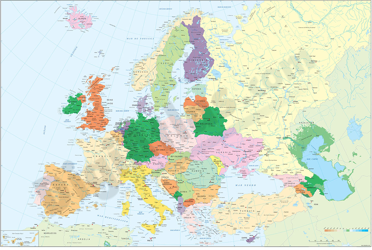
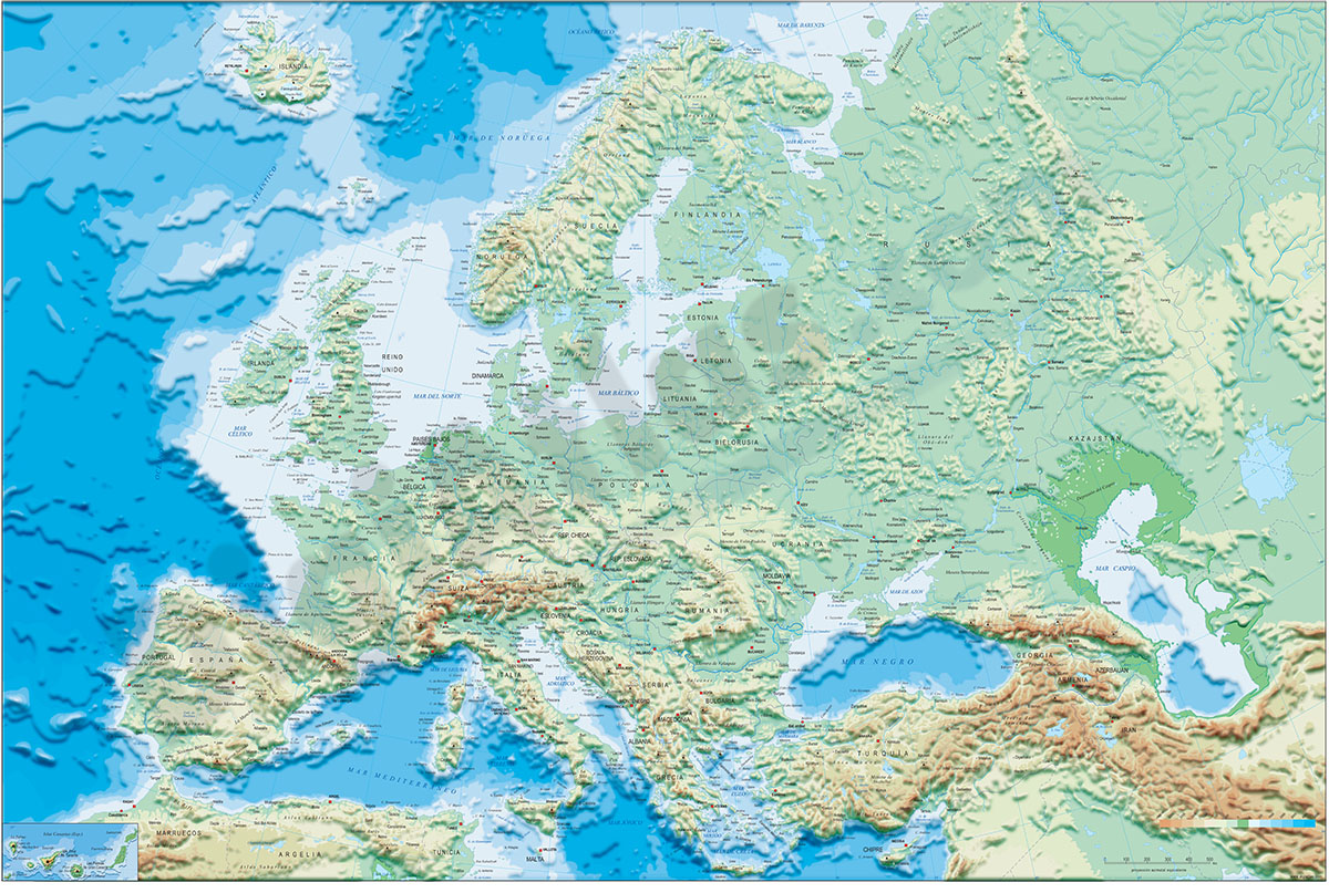
1- Europe political and geographical map
Digital physical and geographical map of Europe.
Digital cartography of the entire European continent with relevant physical and political information. Includes country borders, capitals, major rivers and lakes, important cities and geographical... Read more
Adobe Illustrator, Acrobat PDF + TIFF
2- Map of Slovenia
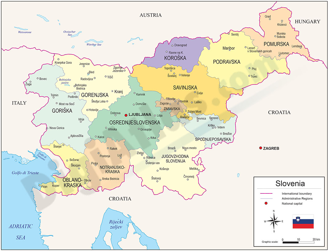
Political map of SLOVENIA with statistical regions, which are 12 administrative subdivisions (NUTS level 3) created in May 2005 for legal and statistical purposes.
Downloadable files in 100% editable vector format.
Adobe Illustrator, Acrobat PDF
3- Map of Slovenia with regions and Postal Codes
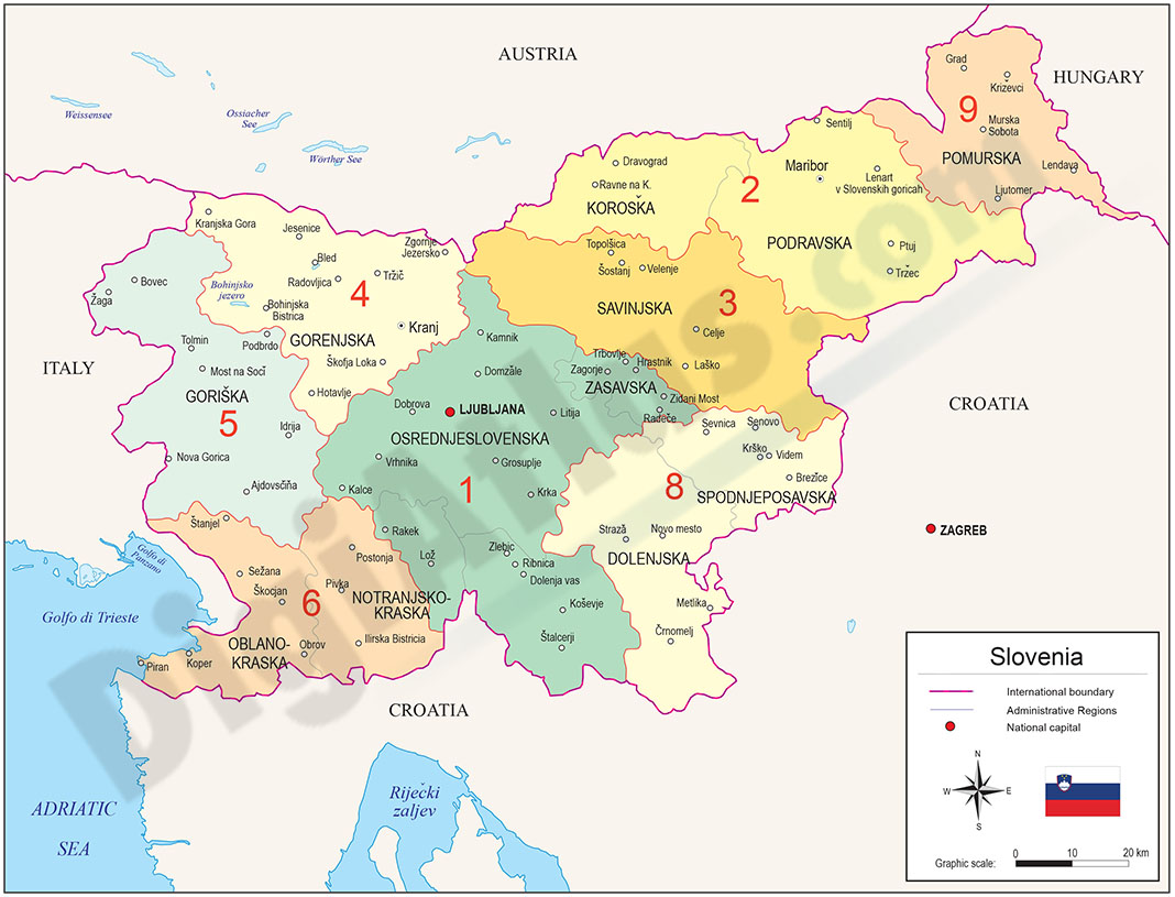
Vectorized map of SLOVENIA, with regions and 2-digits postcode areas.
Illustrator, PDF