Pack DigiAtlas

Available maps

(3)
Below are all the available maps for groenlandia


1- Finland, Norway and Sweden - city map

Finland, Norway and Sweden - city map

Detailed map of Finland, Norway and Sweden showing the inner administrative division, counties and municipality borders and a larger number of towns and cities. Poster size map in PDF vectorized file format.
Acrobat PDF


2- Map of Denmark with regions and 2 digit postal codes areas

Map of Denmark with regions and 2 digit postal codes areas

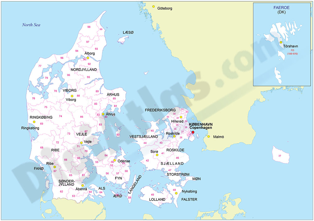
Vectorized and fully editable Map of Denmark with regions, capitals and 2-digit postal codes areas.
Adobe Illustrator, Acrobat PDF


3- Map of Greenland

Image not available

Fully editable vector file map of Greenland. Include political layers of inner administrative division, with their names and capitals.
Adobe Illustrator, PDF