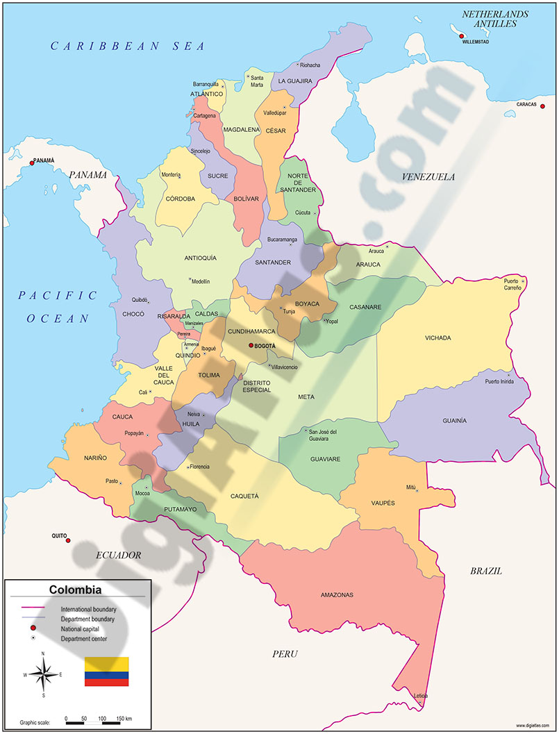
1- Maps of Central and South american countries with political division
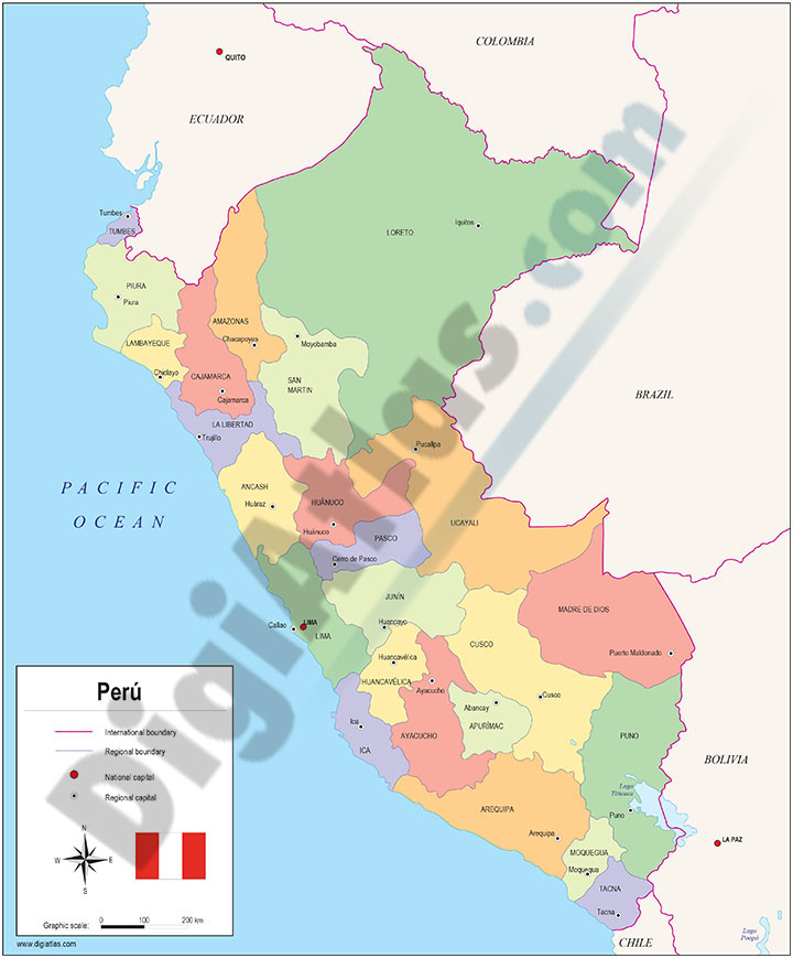
Digital maps of Argentina, Bolivia, Brazil, Chile, Colombia, Ecuador, Guyana, Paraguay, Peru, Surinam, Uruguay, Venezuela, Guatemala, Belize, Honduras, El Salvador, Nicaragua, Costa Rica, Panamá and MEXICO, with their administrative division.... Read more
Adobe Illustrator, Acrobat PDF
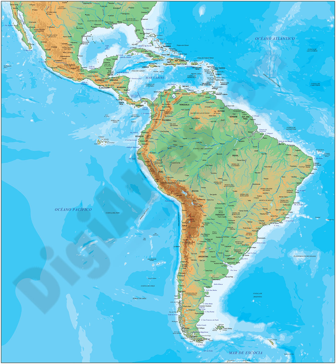
2- Central America political map
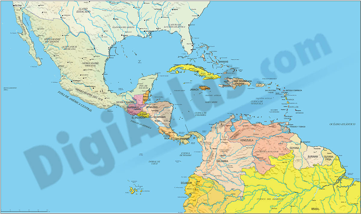
Digital file of Central America (Central America or América del centro) with the delimitation of the countries and other layers with geographical and political information (relief, rivers, lakes, capitals and important cities).
It shows the... Read more
Adobe Illustrator, Acrobat PDF, image TIFF
3- Map of Belize
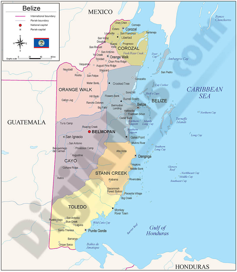
Fully editable vector file map of Belize showing their inner political division; Belize is divided into six districts. Digital map for high-resolution printing.
Adobe Illustrator, Acrobat PDF
4- Map of Mexico
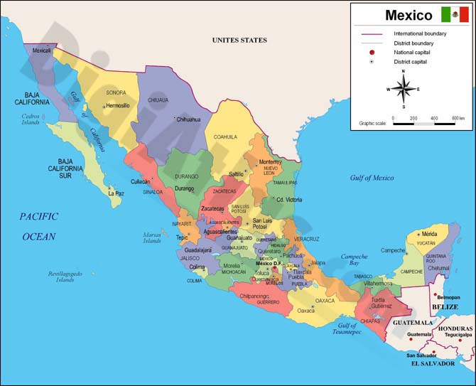
Fully editable vector file map of MEXICO. Digital map shows different layers with inner political administrative divisions (states) with their names and capitals.
Adobe Illustrator, PDF
5- North America political and geographical map
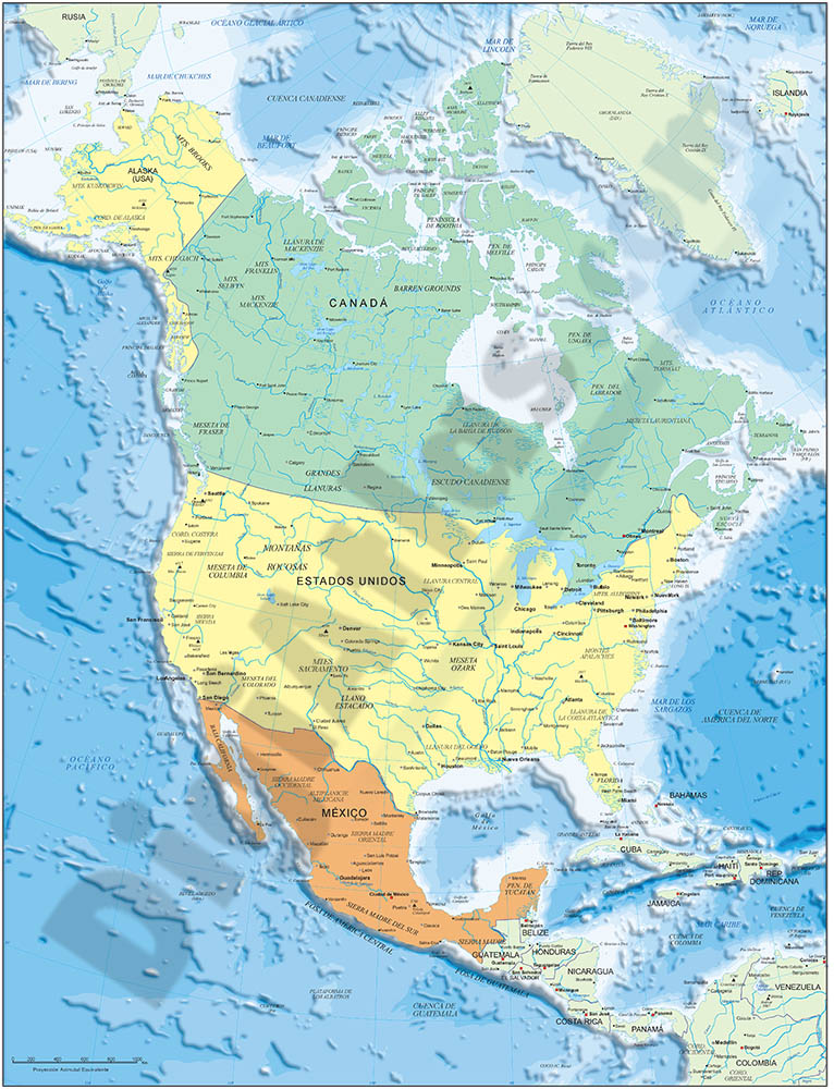
Digital physical and political map of North America (Canada, USA and MEXICO). The map is organised in separate layers with political and geographical information (borders, countries, rivers, lakes, capitals, major cities and geographical names).
It... Read more
Adobe Illustrator, Acrobat PDF + TIFF
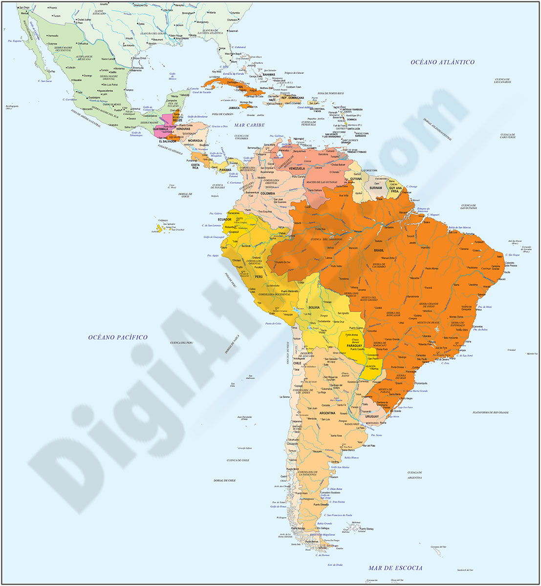
6- South and Central America and Mexico
Digital map of South America and MEXICO with political and geographic information.
It contains two separate files: one with the political version: borders, coloured countries, main rivers and lakes, capitals and important cities.
A second file... Read more
Adobe Illustrator, Acrobat PDF