1- Braga - map of postcode area (CV) with cities and major roads

Vectorized and fully editable map of district of Braga (PORTUGAL). Map includes cities, major roads and 4-digit postcode areas.
Adobe Illustrator, PDF
2- Europe political and geographical map
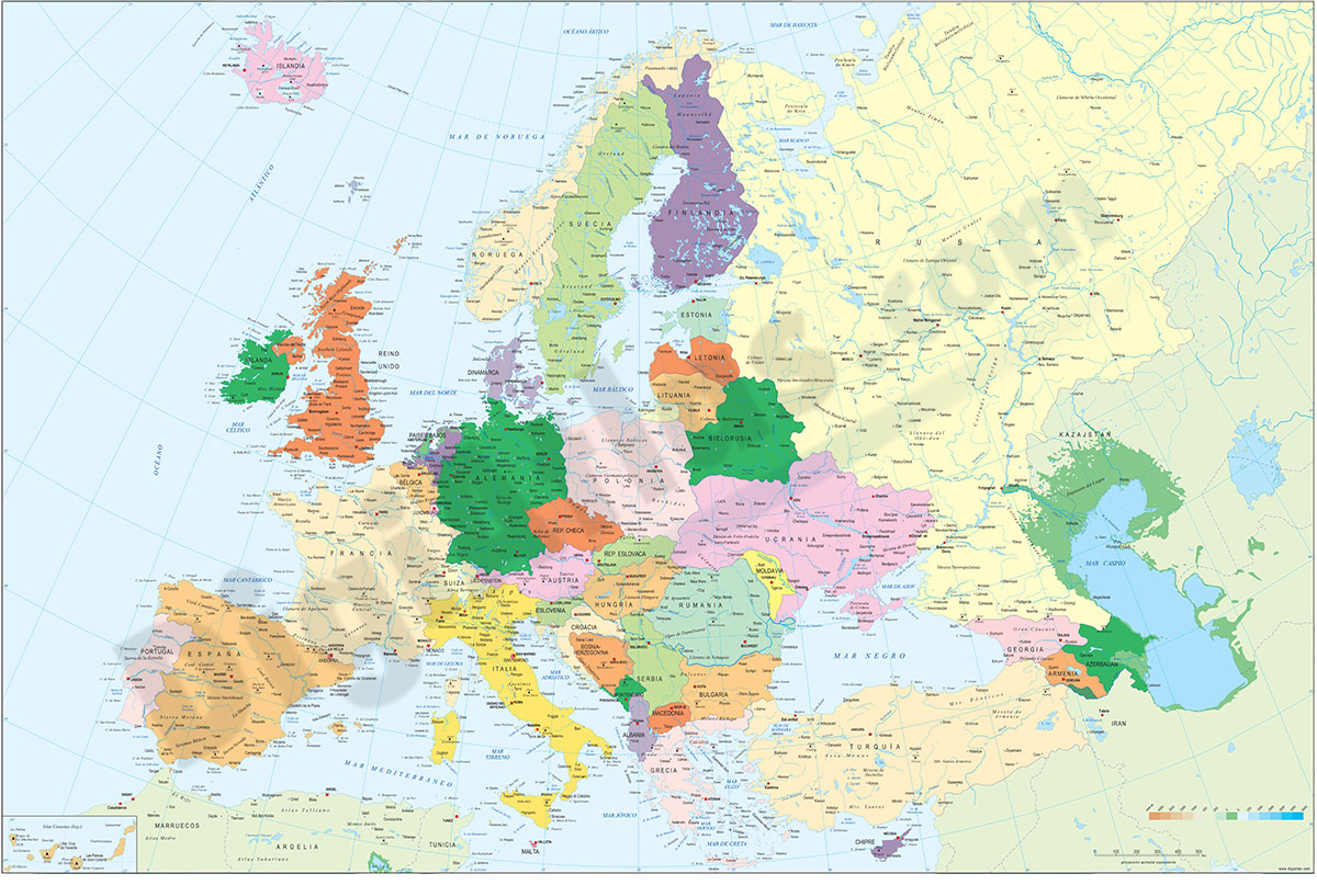
Digital physical and geographical map of Europe.
Digital cartography of the entire European continent with relevant physical and political information. Includes country borders, capitals, major rivers and lakes, important cities and geographical... Read more
Adobe Illustrator, Acrobat PDF + TIFF
3- Faro (Portugal) city map
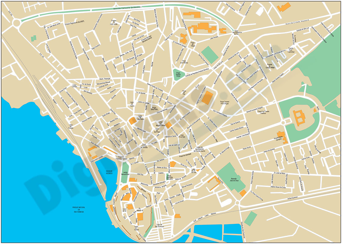
Street map of Faro (PORTUGAL) showing street and square delineation, blocks of houses and green areas, with colours and names. All elements are grouped in separate layers fully editable.
Adobe Illustrator, Acrobat PDF
4- Lisbon - city map
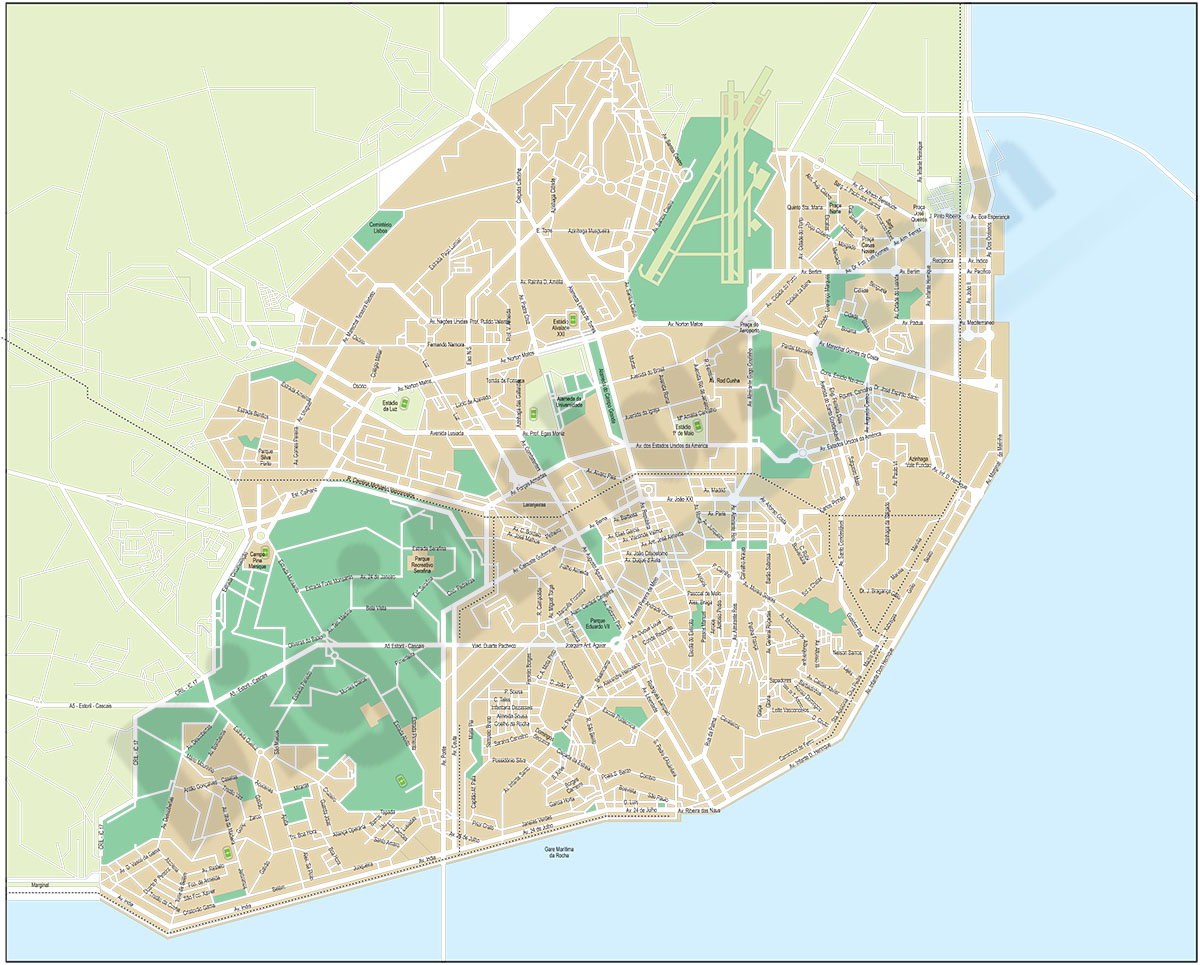
Digital street map of the urban area of Lisbon, with the delineation of main streets and squares with their names.
Adobe Illustrator, Acrobat PDF
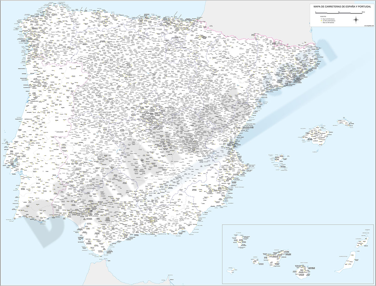
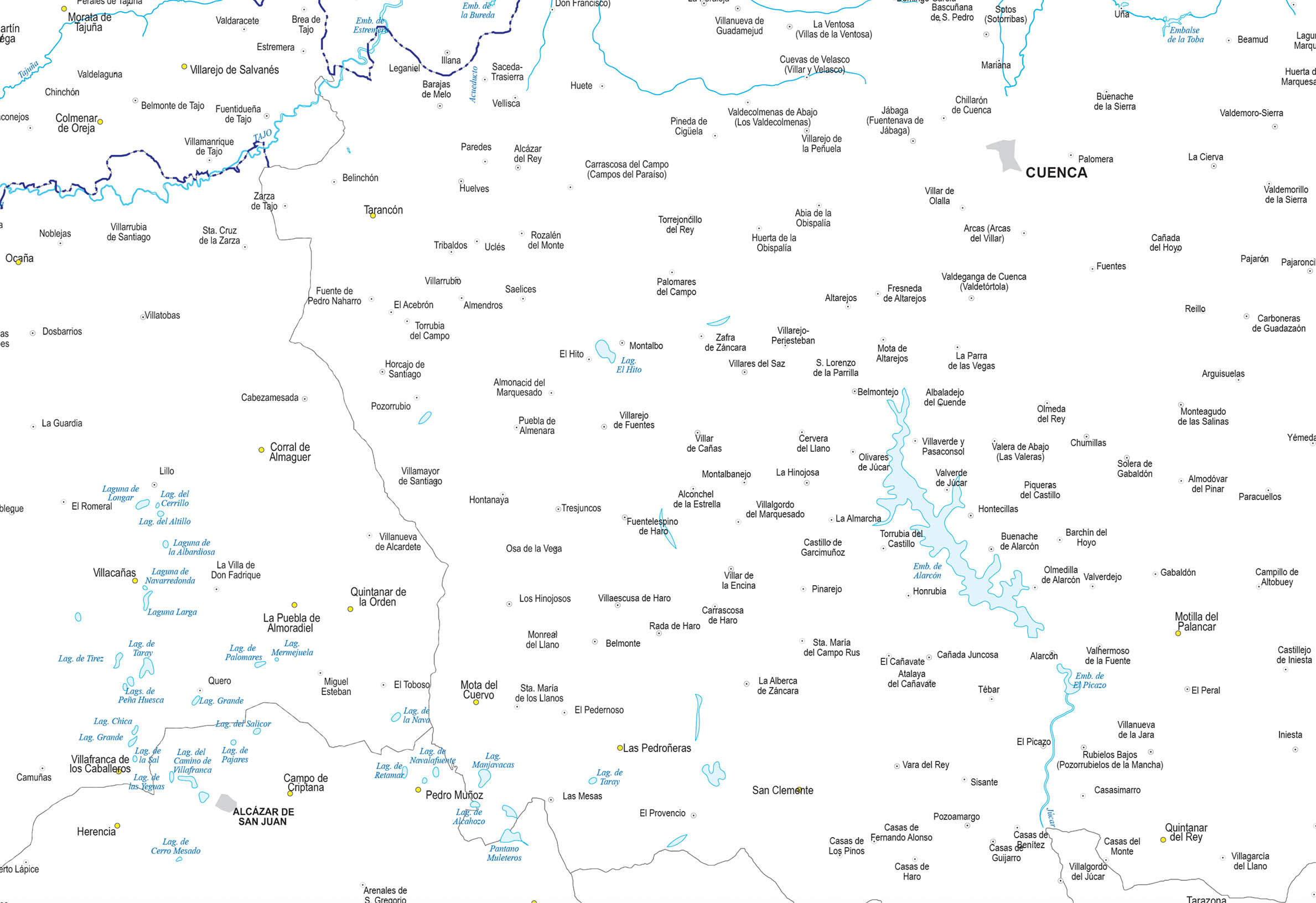
5- Major roads map of Spain and Portugal

Digital map of Spain and PORTUGAL with the general road network, hydrographic network and main towns.
The map is downloaded in vector format, 100% editable and organized in separate layers, allowing to modify colors, texts and styles to create... Read more
Adobe Illustrator, Acrobat PDF
6- Map of Algarve (Portugal)
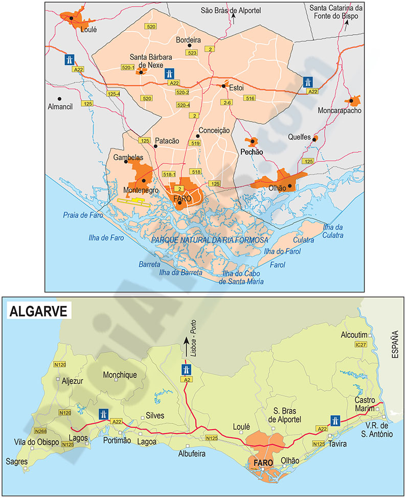
Map of the Algarve region (PORTUGAL) with municipalities, roads and towns.
Digital file in 100% editable vector format, organized in separate layers.
Adobe Illustrator, Acrobat PDF
7- Map of Portugal

Fully editable vector file. Include political layers of inner administrative division, with their names and capitals.
Adobe Illustrator, PDF
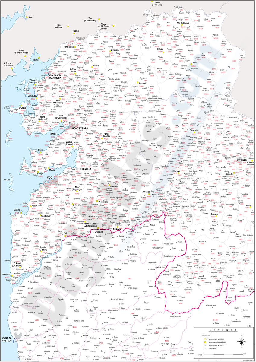
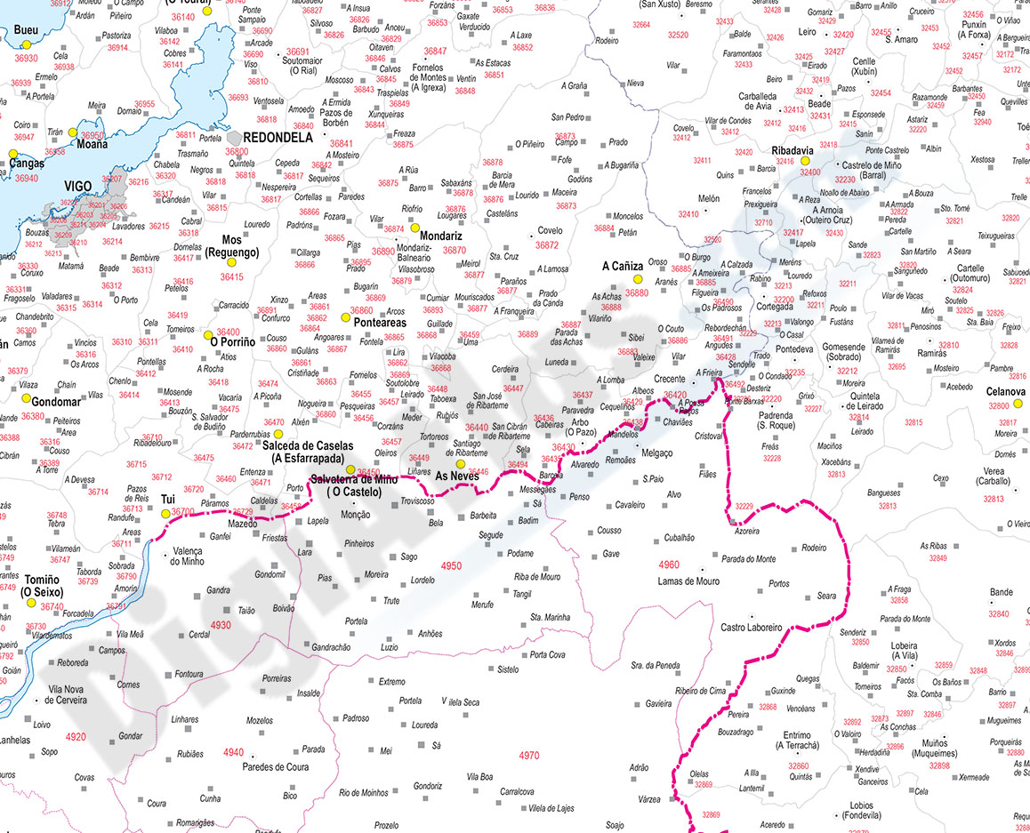
8- Map of Portugal with regions and Postal Codes
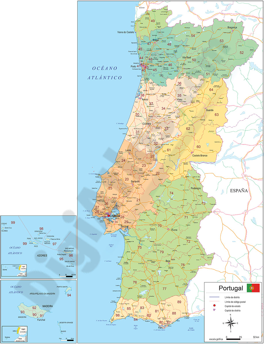
Digital map of PORTUGAL with regions, capitals, main roads and 2-digit postcodes.
Files are downloaded in vector format, fully editable and organised in separate layers in order to generate customised versions of the map.
Adobe Illustrator, Acrobat PDF
9- Map of Spain and Portugal DIN A3
Map of Spain and PORTUGAL with major cities and roads. DIN A3 paper size. vector file 100% editable
Illustrator, PDF
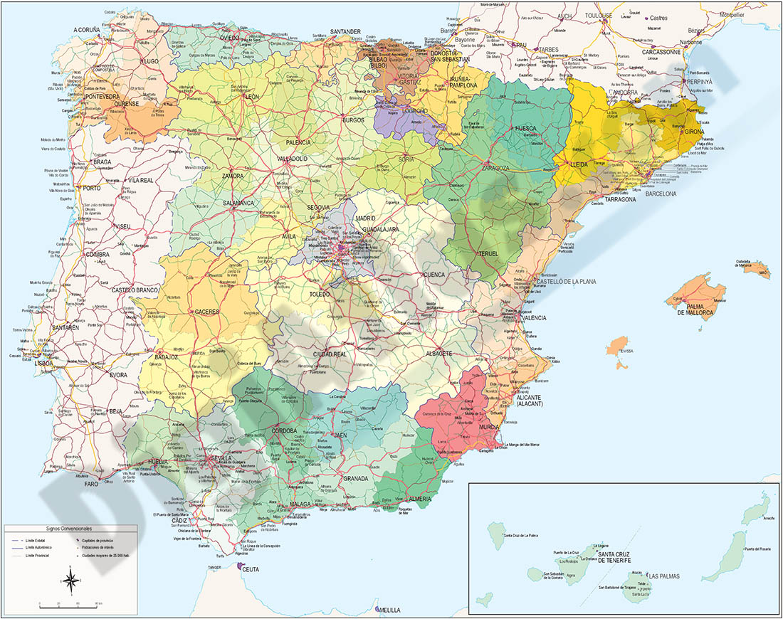
11- Map of Spain and Portugal with communities and provinces

Political map of Spain and PORTUGAL in digital format, showing the internal administrative division of each country, Spanish Autonomous Communities and provinces, and the continental districts and autonomous regions (Azores and Madeira) of PORTUGAL,... Read more
Adobe Illustrator, Acrobat PDF.
12- Map of Spain and Portugal with provinces and Postal Codes
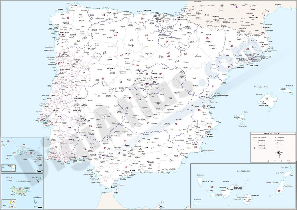
Postcode map of Spain and PORTUGAL.
Digital cartography of the Iberian Peninsula with autonomous regions, regions, provinces, capitals, important cities and 2-digit postcodes.
Adobe Illustrator, Acrobat PDF
14- Road Map of Portugal
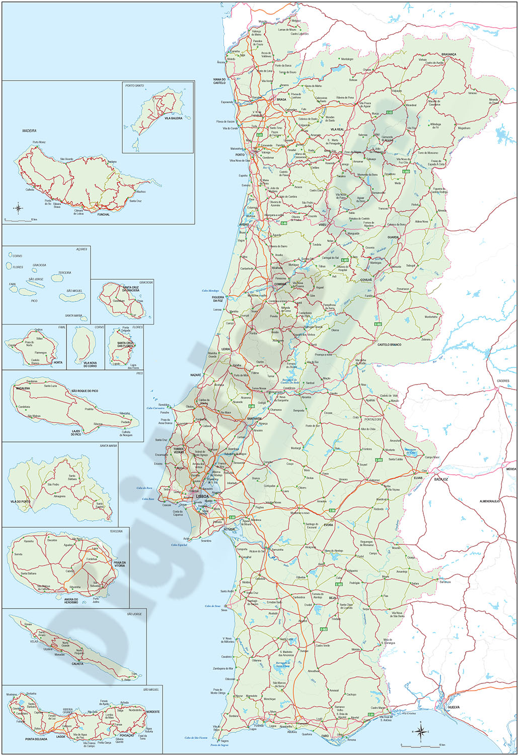
Digital road map of PORTUGAL, with the motorways, dual carriageways and the main road network. Also include towns and villages
Files in vector format 100% editable and organised in separate layers.
Adobe Illustrator, Acrobat PDF