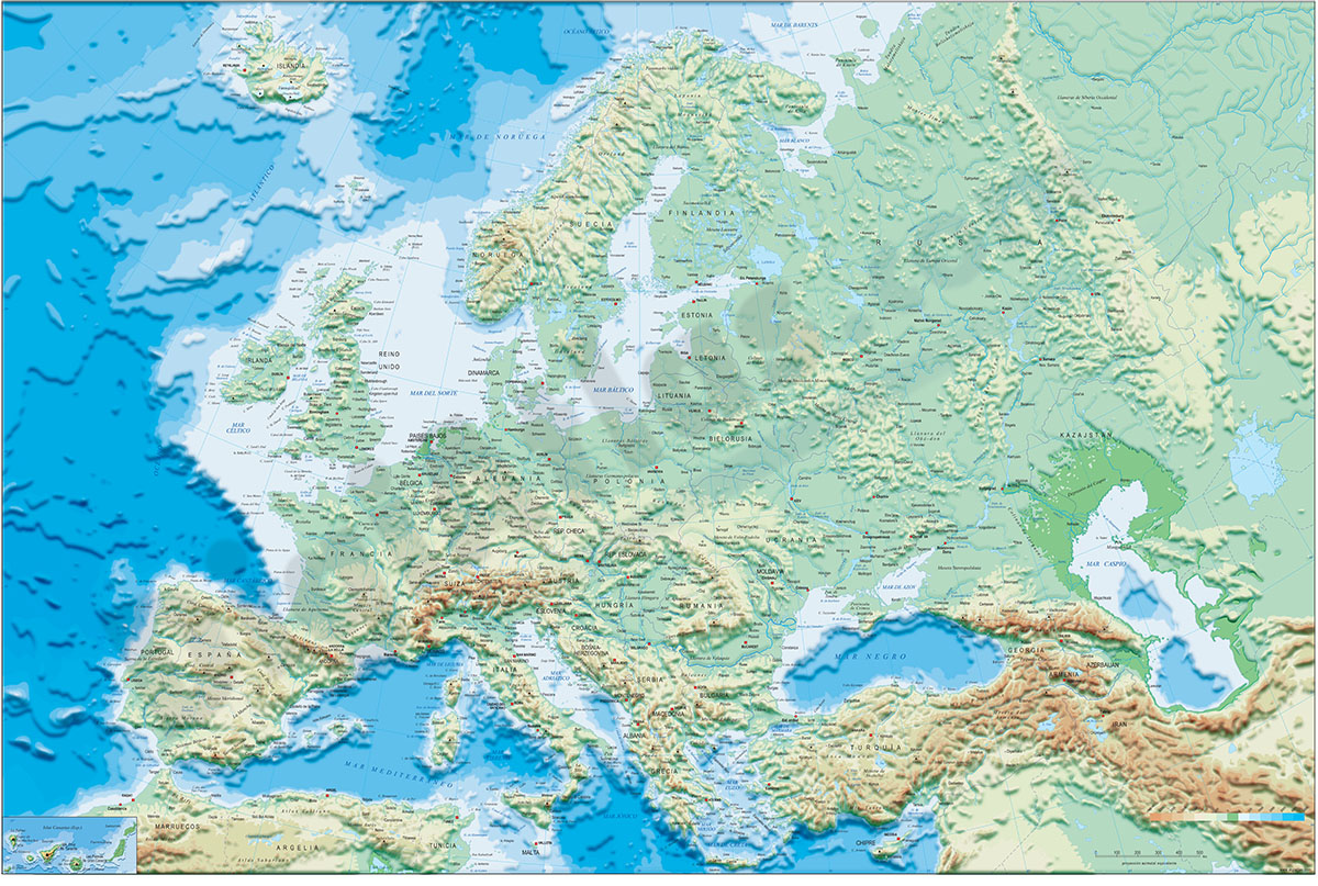
1- Europe political and geographical map
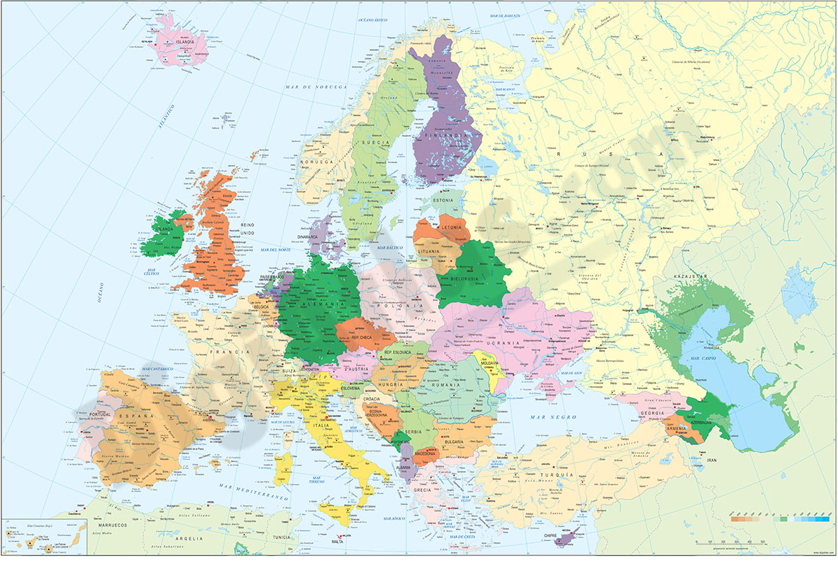
Digital physical and geographical map of Europe.
Digital cartography of the entire European continent with relevant physical and political information. Includes country borders, capitals, major rivers and lakes, important cities and geographical... Read more
Adobe Illustrator, Acrobat PDF + TIFF
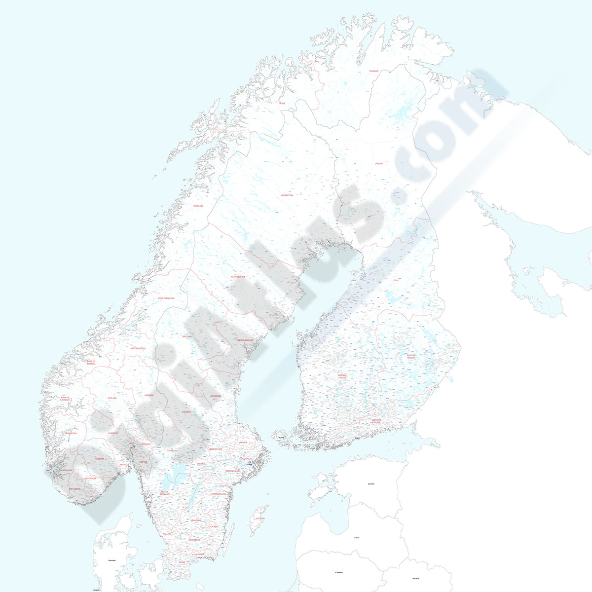
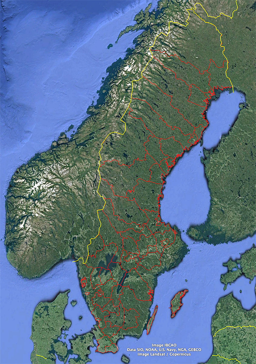
3- Map of Norway and Sweden with regions and Postal Codes
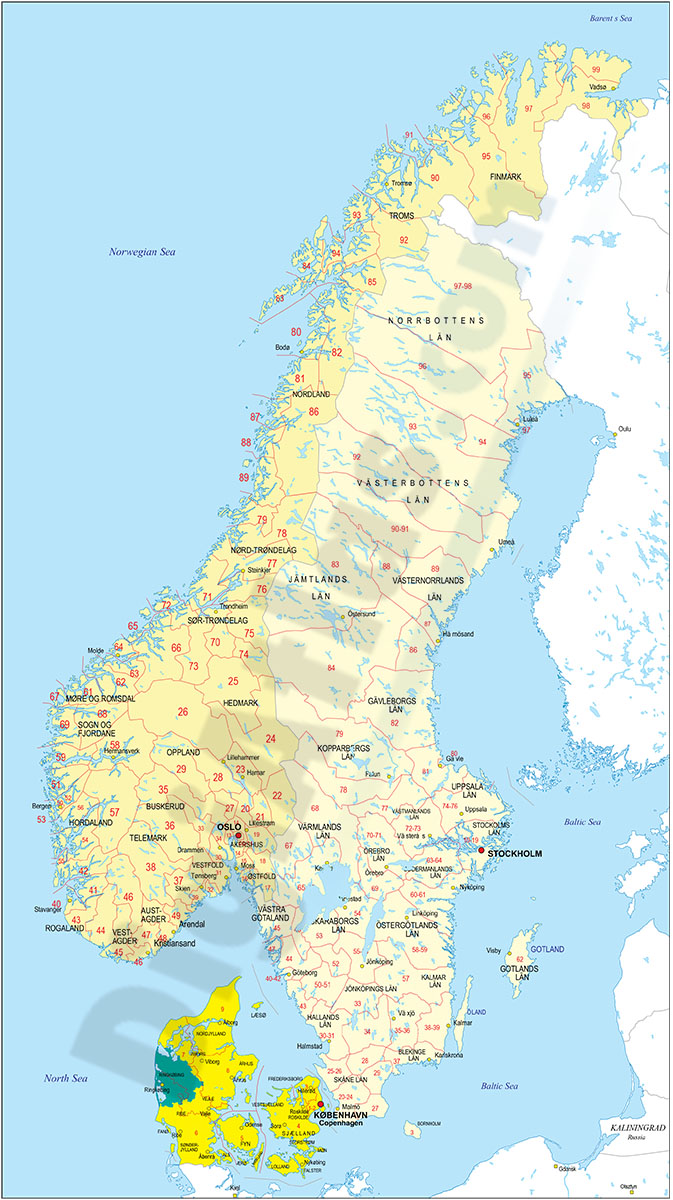
Vectorized and fully editable digital map of Norway and Sweden with administrative regions, their capitals and 2-digit postal codes areas.
Adobe Illustrator, Acrobat PDF
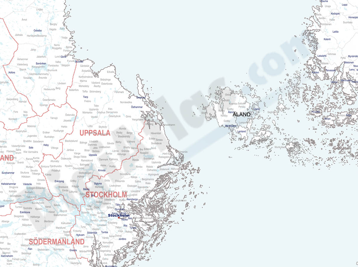
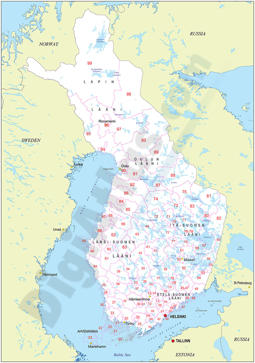
4- Map of Norway, Sweden, Finland and Denmark with regions and 2 digit postal
Vectorized and fully editable maps of Norway, Sweden, Finland and Denmark (Danmark) showing their administrative regions, capitals and 2-digit postal codes areas.
Vector files are downloaded for each country separately, 100% editable.
Adobe Illustrator, Acrobat PDF
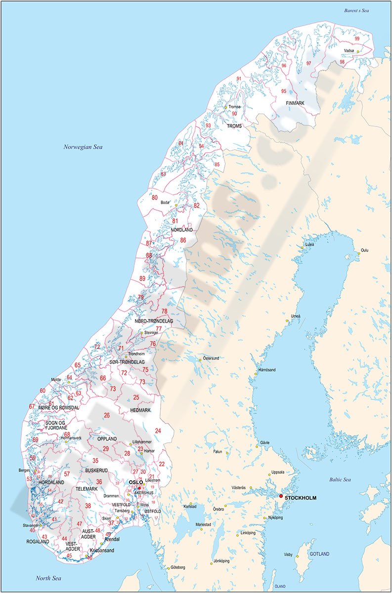
5- Map of Sweden
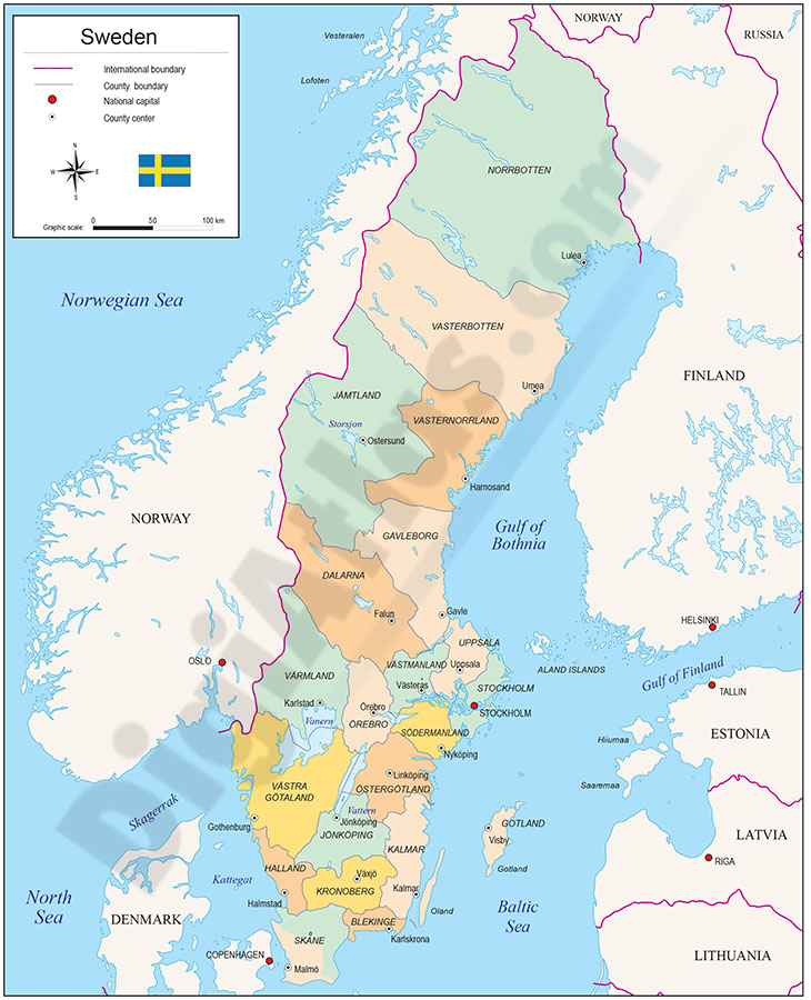
Fully editable vector file. Include political layers of inner administrative division, with their names and capitals.
Adobe Illustrator, PDF
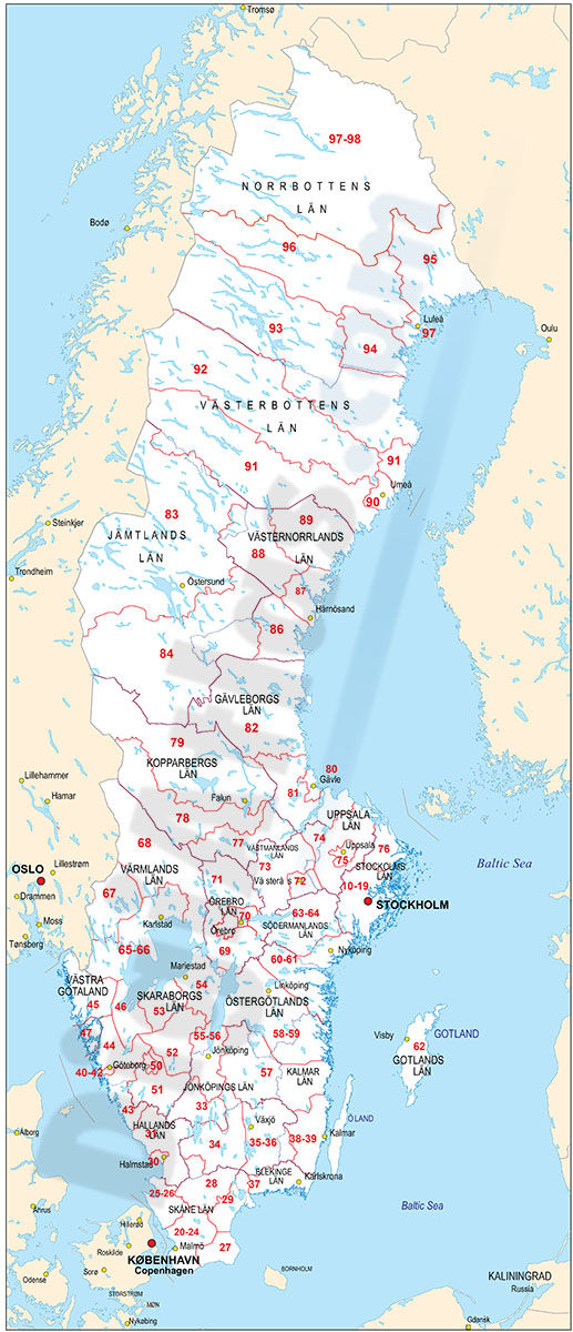
6- Map of Sweden with regions and Postal Codes
Vectorized and fully editable Map of Sweden with regions, capitals and 2-digit postal codes.
Vector format files (Adobe Illustrator and Acrobat PDF) are downloaded together with georeferenced KML files for Google Earth and Shapefile.
Adobe Illustrator, Acrobat PDF, KML, Shapefile (.shp)