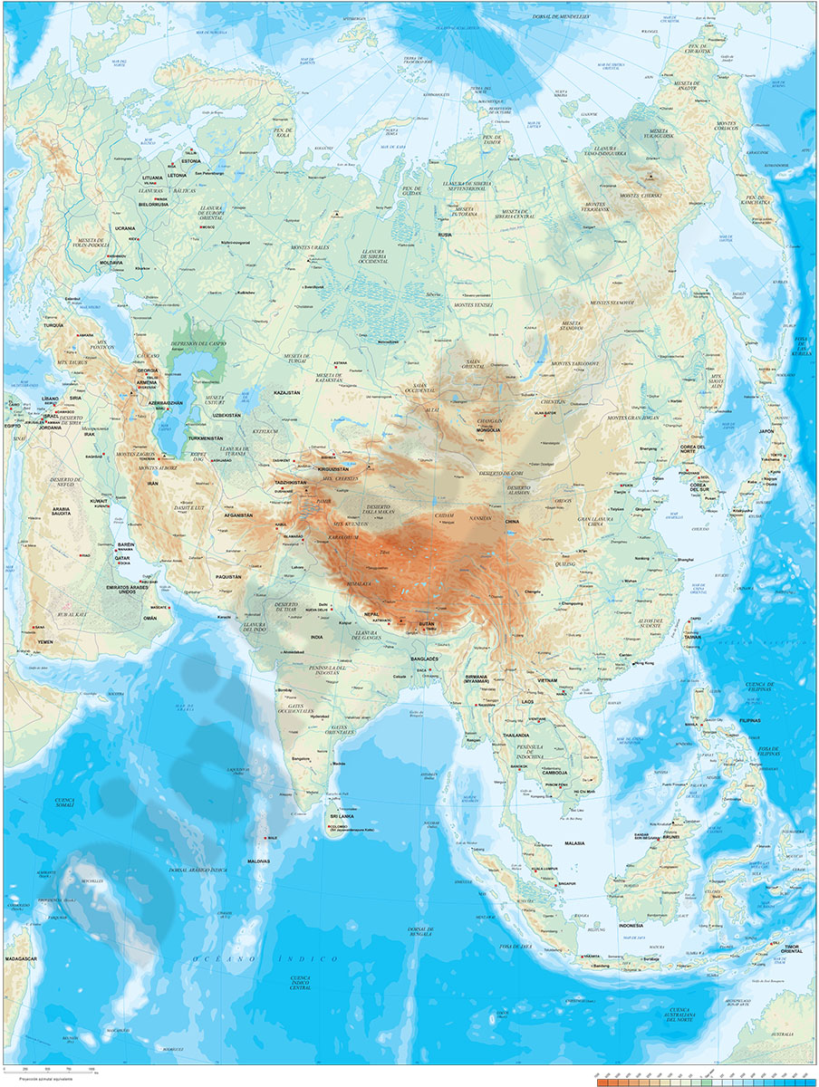
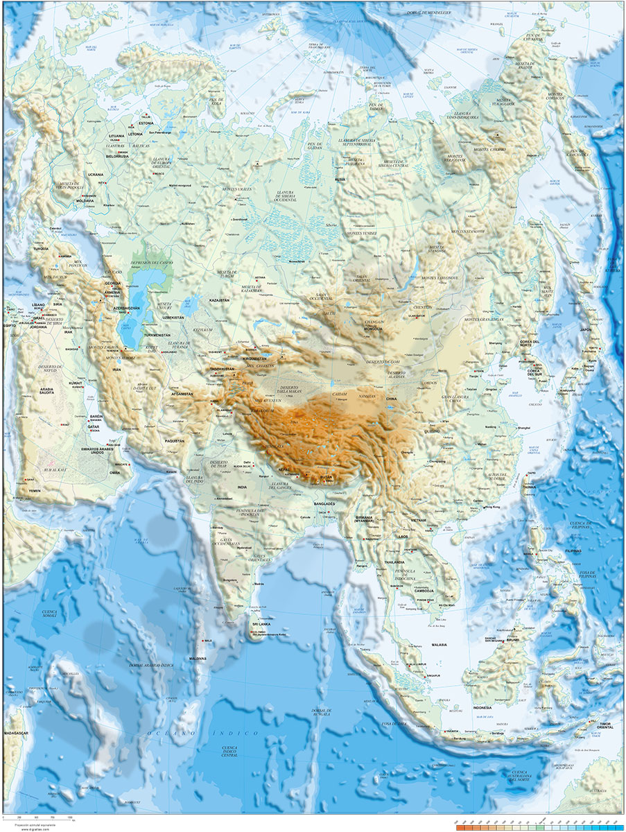
1- Asia physical vectorized-relief map
Digital map of Asia.
Map in 100% editable vector format of the entire Asian continent, with the altimetry and bathymetry strips coloured and separated in layers, all country borders with their capitals, geographical names and important towns.
A... Read more
Adobe Illustrator, Acrobat PDF, TIFF image
2- Asia political and geographical map
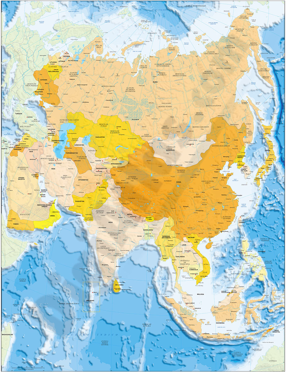
Digital political and geographical map of Asia.
Download 100% editable vectorized files with political and geographical layers of information (borders, countries, rivers, lakes, capitals, important cities and geographical names).
Includes a TIFF... Read more
Adobe Illustrator, Acrobat PDF, TIFF image
3- Map of Afghanistan
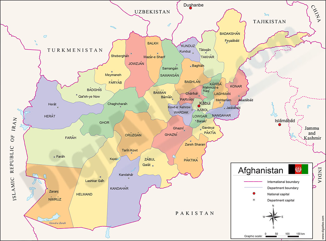
Fully editable vector file map of the Islamic Republic of Afghanistan showing political layers of inner administrative division, their names and capitals.
Adobe Illustrator, Acrobat PDF
4- Map of Kazakhstan
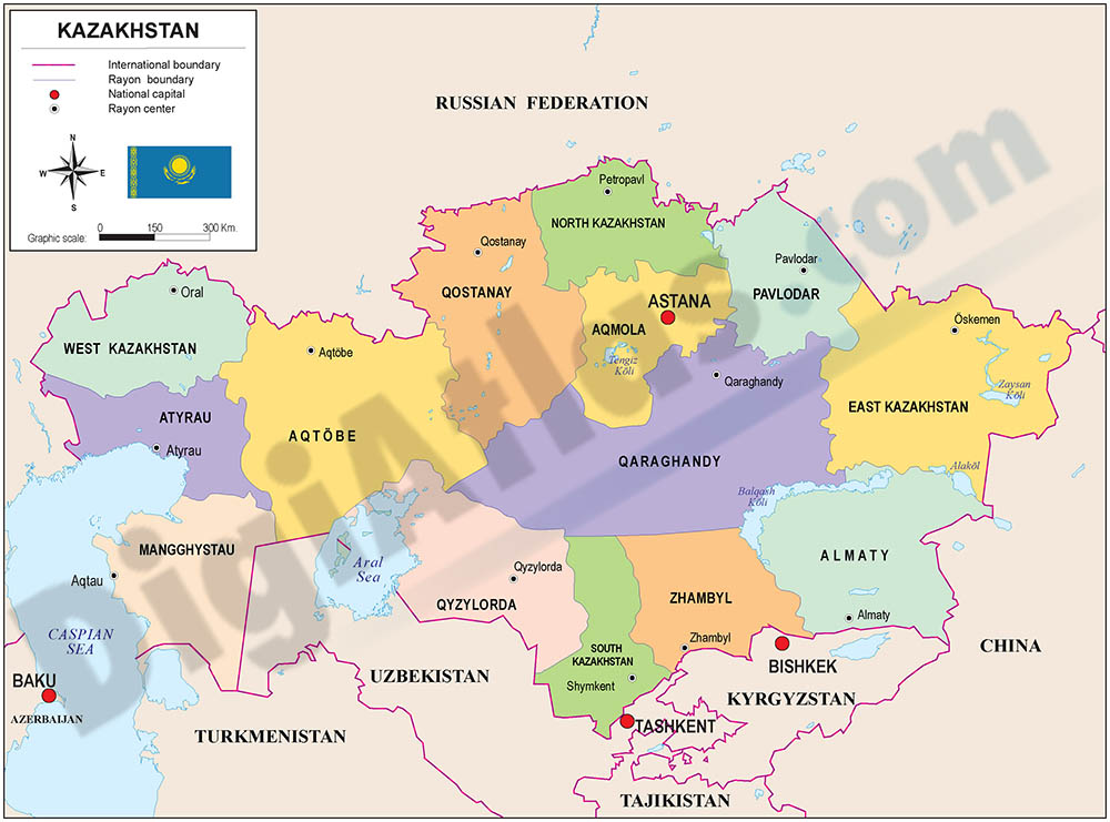
Fully editable vector file of Kazakhstan with political layers of inner administrative division, with their names and capitals.
Adobe Illustrator, PDF
5- Map of Kazakhstan with regions and Postal Codes
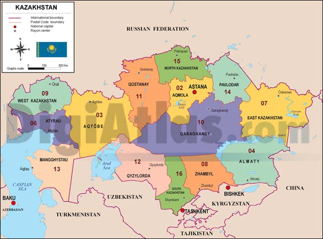
Postal code map of Kazakhstan in fully editable vectorized file organized into separate layers for best edition and printing. Map of Kazakhstan shows fourteen regions, their capitals and 2-digit postal codes areas.
Adobe Illustrator, PDF, JPG (300dpi)
6- Map of Uzbekistan
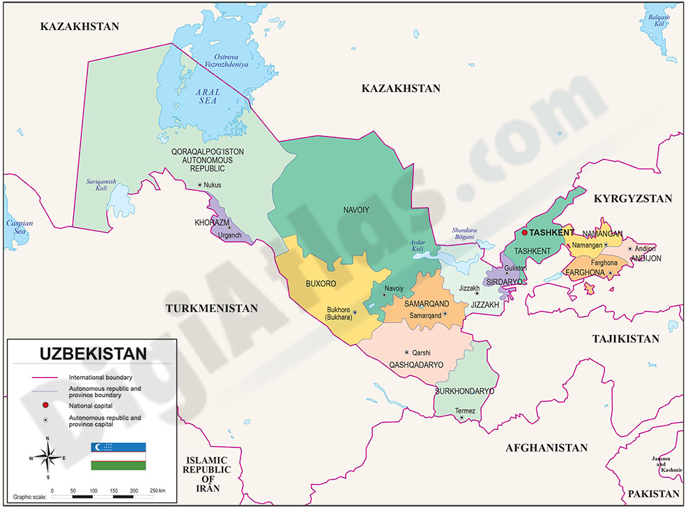
Fully editable map of Republic of UZBEKISTAN, with inner administrative division, names and capitals organized in a separate layers.
Adobe Illustrator, Acrobat PDF
7- Map of Uzbekistan with regions and Postal Codes

Vectorized and fully editable Map of UZBEKISTAN with regions, capitals and 2-digit postal codes.
FreeHand, Illustrator, PDF, JPG (300dpi)