1- Africa physical vectorized-relief map
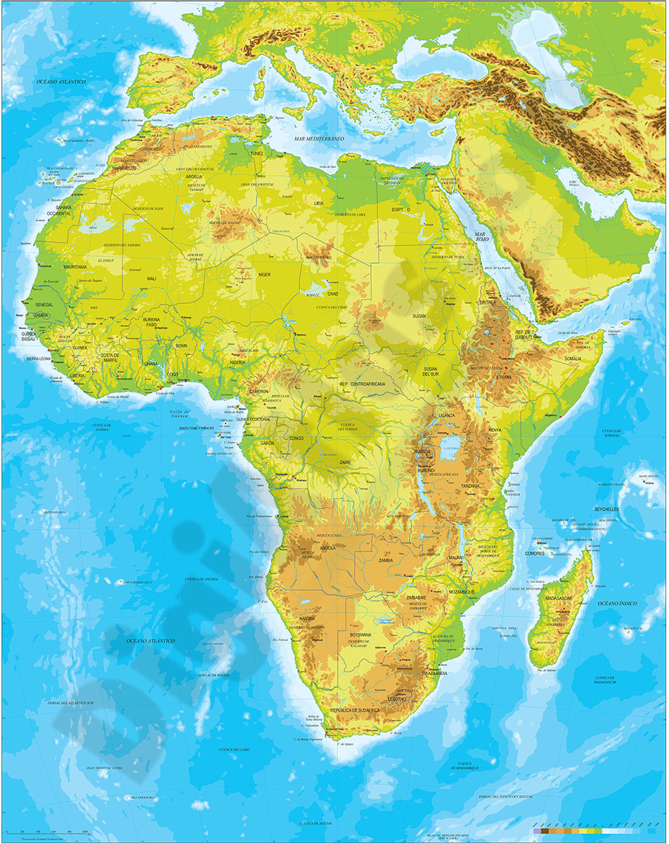
Physical map of Africa.
Digital map of the African continent with the altimetry and bathymetry strips coloured and separated into fully editable layers. Includes geographical names, country boundaries, capitals, cities and major... Read more
Adobe Illustrator, Acrobat PDF
2- Map of Antigua and Barbuda
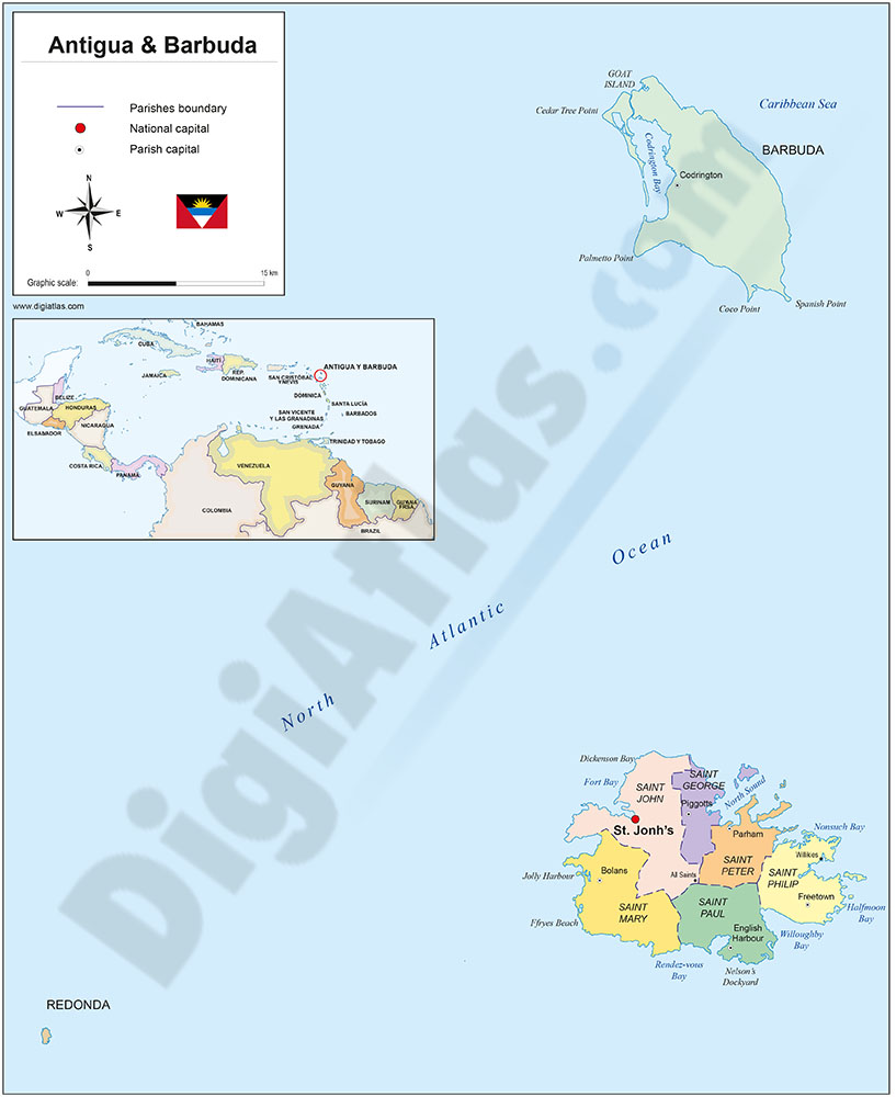
Political map of ANTIGUA and Barbuda with internal administrative divisions, their names and capitals. 100% editable vector map.
Adobe Illustrator, Acrobat PDF
3- Map of Ethiopia
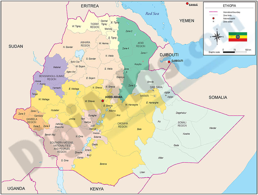
Political map of Ethiopia, Federal Democratic Republic of Ethiopia (FDRE), with internal administrative division (nine administrative regions based on ethnicity (astedader akababiwach, singular: astedader akabibi) and two cities with special... Read more
Adobe Illustrator, Acrobat PDF
4- Map of Guyana
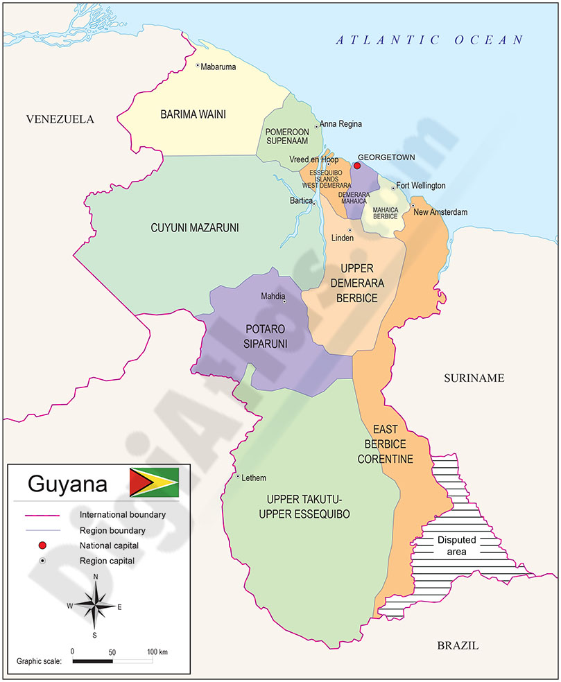
Digital political map of Guyana (Co-operative Republic of Guyana) with the internal administrative division (ten administrative regions), their names and capitals.
Files in vector format 100% editable.
Adobe Illustrator, Acrobat PDF
5- Map of Malawi
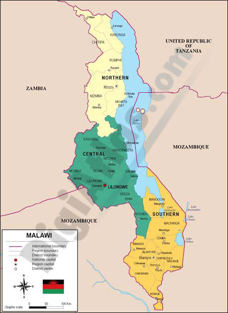
Fully editable vector file map of Malawi. Political map include political layers of inner administrative division, with their names and capitals.
Adobe Illustrator, PDF
6- Map of Slovenia
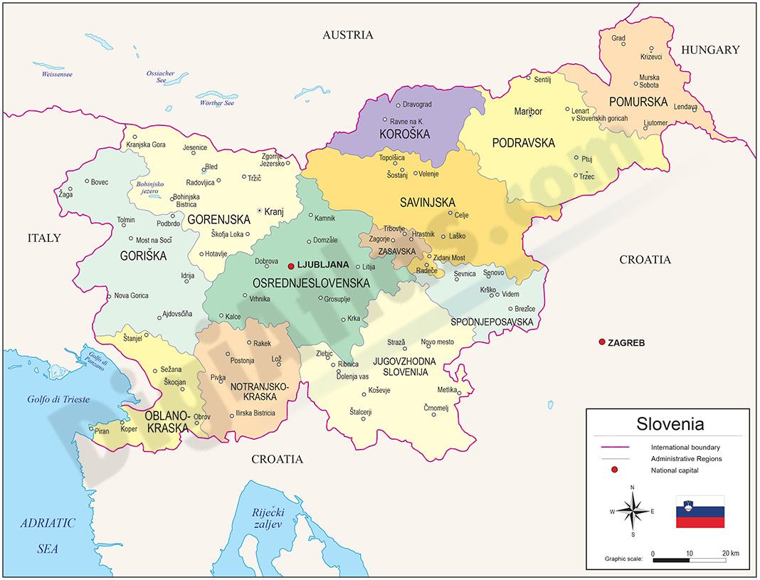
Political map of Slovenia with statistical regions, which are 12 administrative subdivisions (NUTS level 3) created in May 2005 for legal and statistical purposes.
Downloadable files in 100% editable vector format.
Adobe Illustrator, Acrobat PDF
7- Map of Zimbabwe
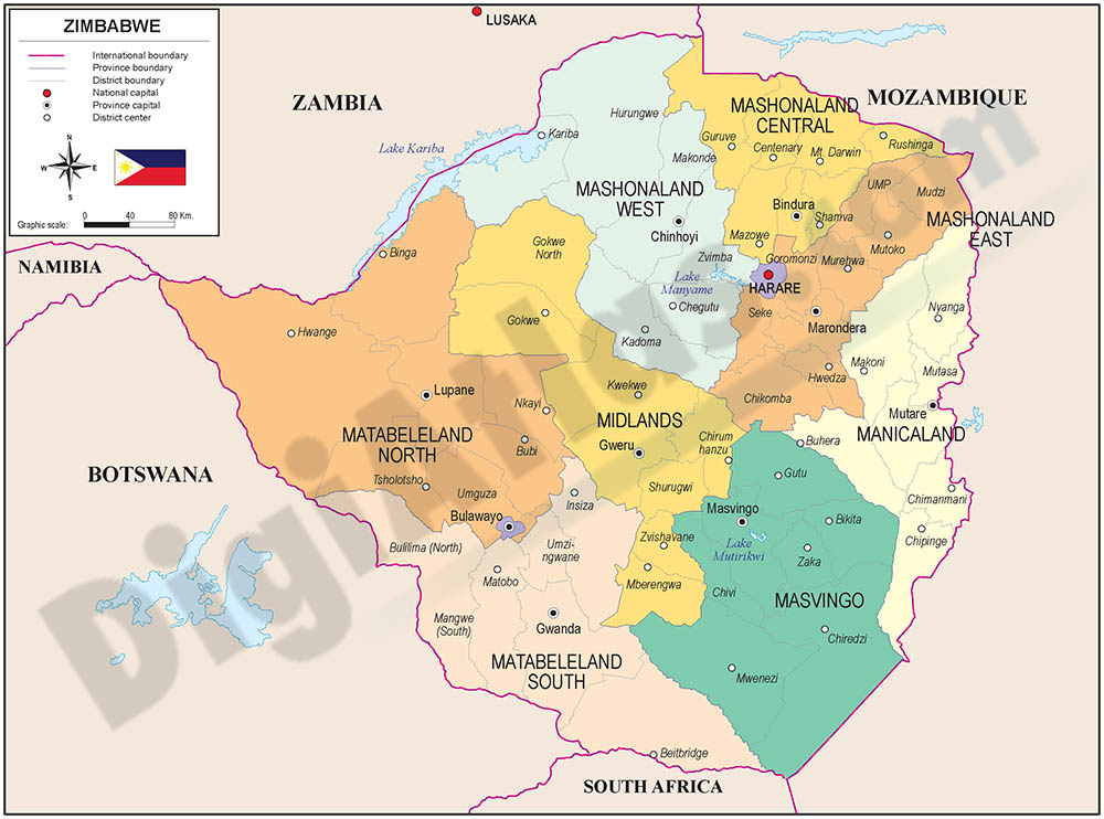
Fully editable vector file map of Zimbabwe. Include political layers of inner administrative division, with their names and capitals.
Adobe Illustrator, PDF