1- Map of Antigua and Barbuda
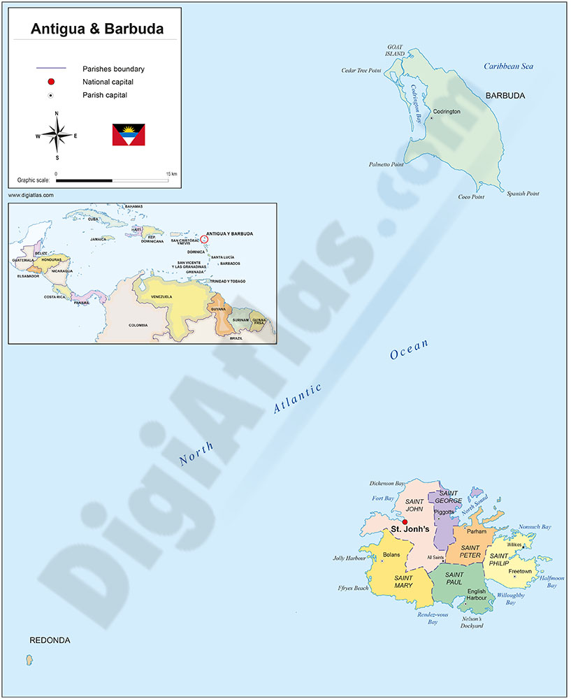
Political map of Antigua and Barbuda with internal administrative divisions, their names and capitals. 100% editable vector map.
Adobe Illustrator, Acrobat PDF
2- Map of Aruba
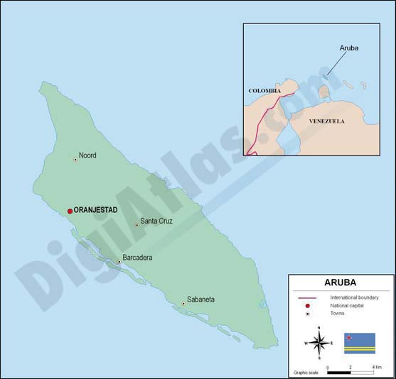
Fully editable vector file. Include political layers of inner administrative division, with their names and capitals.
Adobe Illustrator, PDF
3- Map of Barbados

Fully editable vector file. Include political layers of inner administrative division, with their names and capitals.
Adobe Illustrator, PDF
4- Map of Cayman Islands
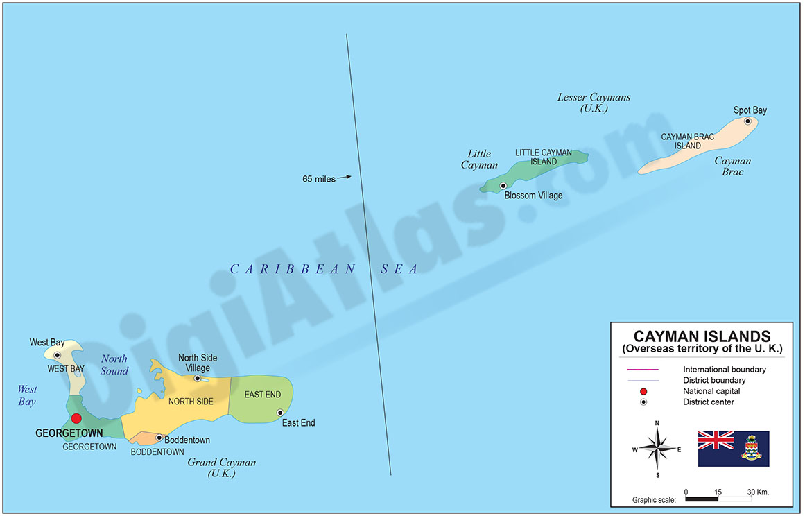
Digital political map of Cayman Islands with internal administrative division, districts, names and capitals.
100% editable vector map organized in separate layers.
Adobe Illustrator, Acrobat PDF
5- Map of Dominican Republic
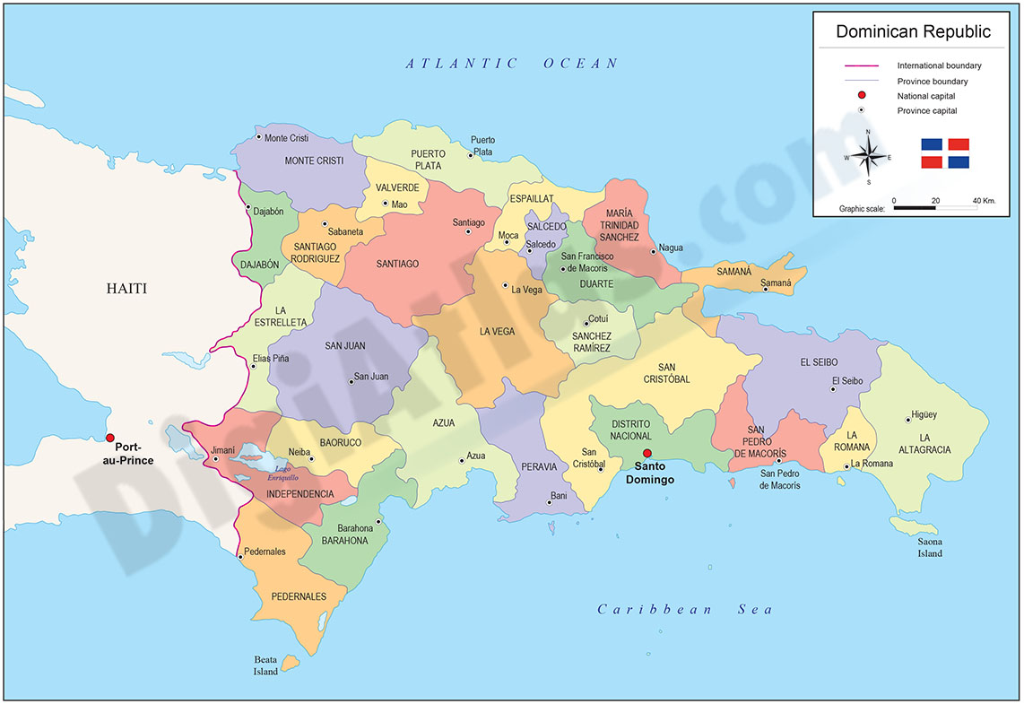
Political map of the Dominican Republic with the internal administrative division into 31 provinces and one national district, their names and capitals.
100% editable vector map organized in separate layers to customize colors, texts and styles.
Adobe Illustrator, Acrobat PDF
6- Map of Haiti
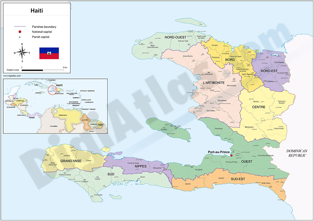
Political map of Haiti in digital format, with the internal political-administrative organisation: 10 departments, 41 districts (arrondissements) and 133 communes, their names and capitals.
Downloadable in vector format, organised in 100% editable... Read more
Adobe Illustrator, Acrobat PDF
7- Map of Puerto Rico
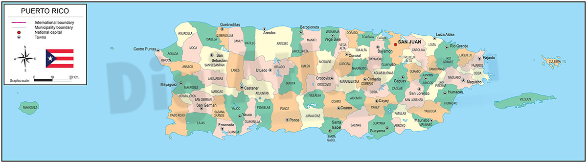
Digital map of Puerto Rico with internal administrative division, names and capitals.
Two vector files are downloaded: Adobe Illustrator (.ai) 100% editable to be able to modify colours, texts, size and styles and an Acrobat PDF file, also... Read more
Adobe Illustrator, Acrobat PDF
8- Map of St. Vincent and the Grenadines
Fully editable vector file map of Saint Vincent and the Grenadines. Include political layers of inner administrative division, with their names and capitals.
Adobe Illustrator, PDF
9- Map of Trinidad and Tobago
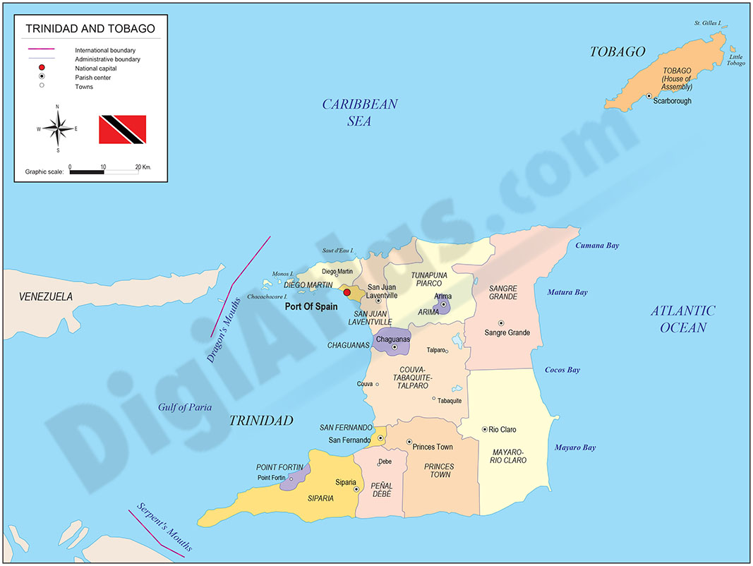
Fully editable vector file map of The Republic of Trinidad and Tobago. Map includes political layers of inner administrative division, with their names and capitals.
Adobe Illustrator, Acrobat PDF