1- Avilés city map
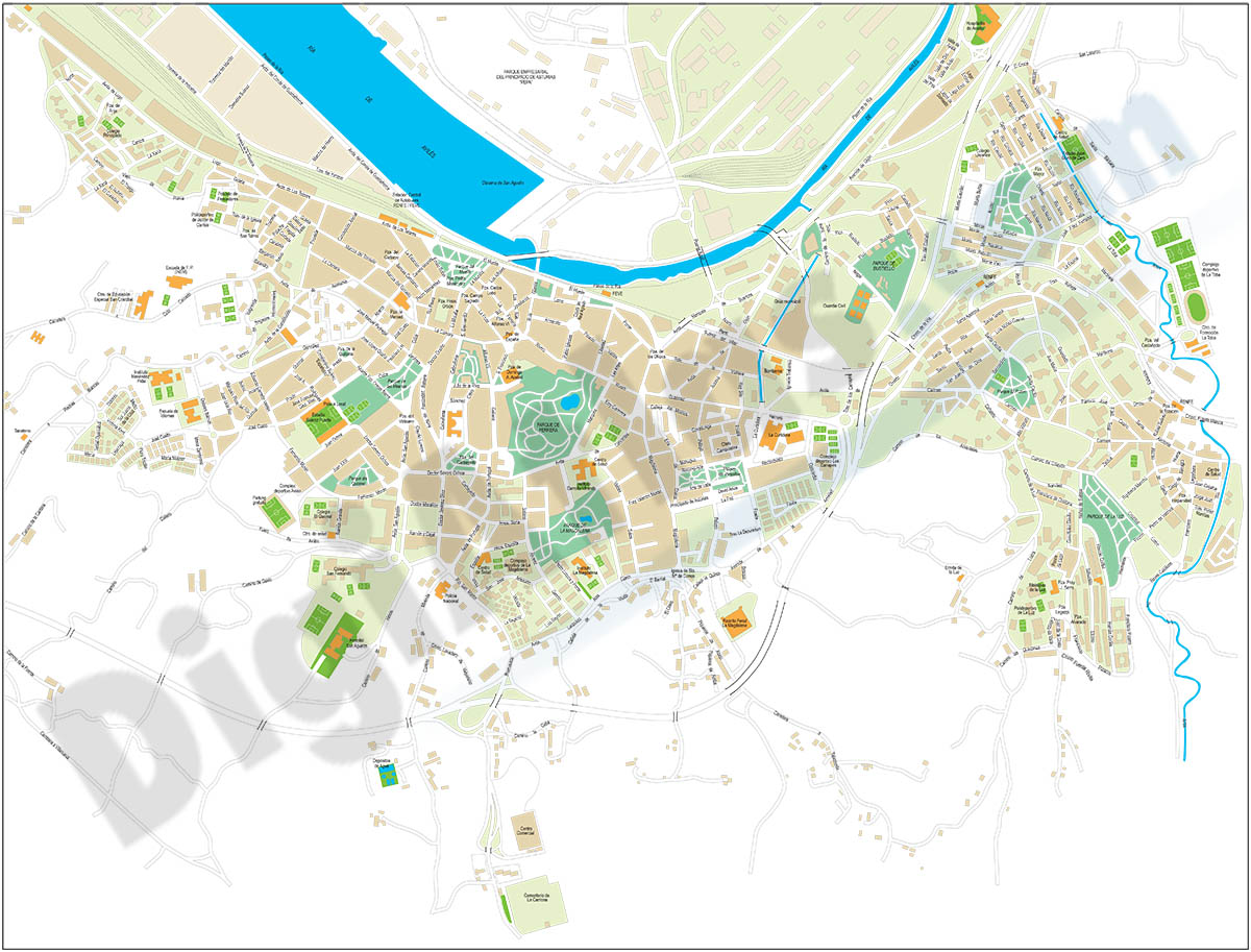
Vector-file map of Aviles (ASTURIAS-Spain) city. All map features are in separated layers.
FreeHand, Illustrator, PDF
2- Map of Cantabria
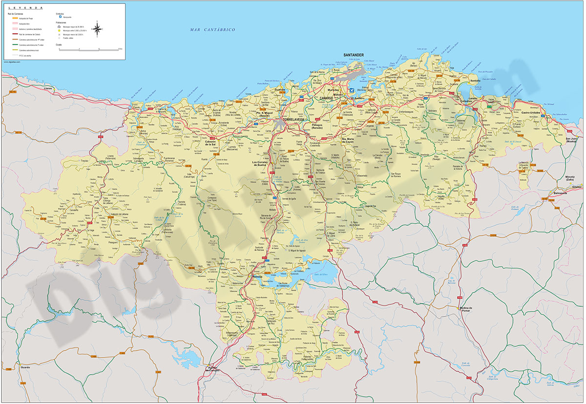
Vectorized map of Cantabria (autonomous community in Spain) showing community and province boundaries, cities, highways, major and minor roads, railroad, principal rivers and lakes and other relevant political information. Scale 1:200.000.
adobe Illustrator, PDF
3- Map of The Principality of Asturias
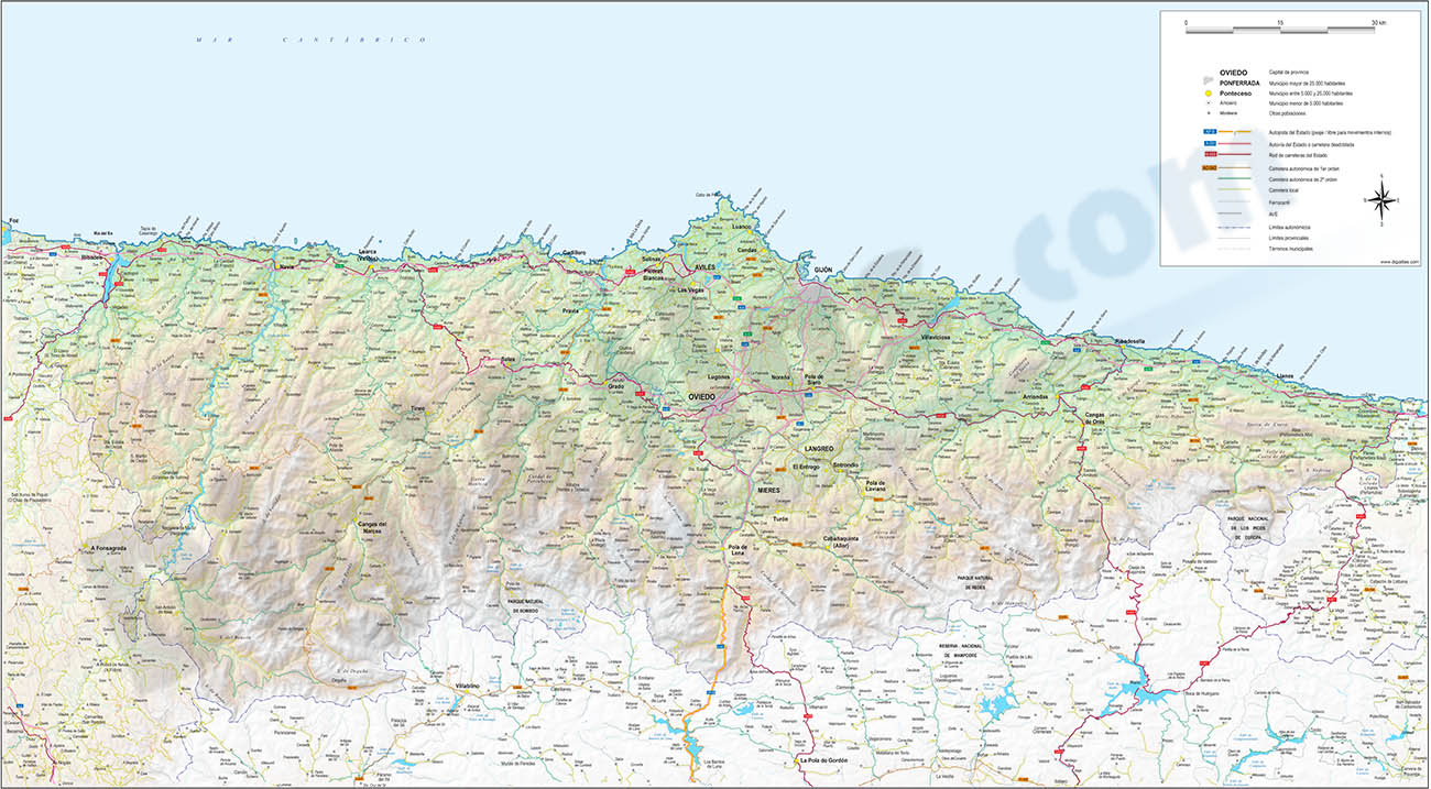
Map of the Principality of ASTURIAS autonomous community (Spain) showing provincial and municipal boundaries, cities, highways, major and minor roads, railroad, principal rivers and lakes and other relevant political and geographical information.... Read more
Adobe Illustrator, Acrobat PDF