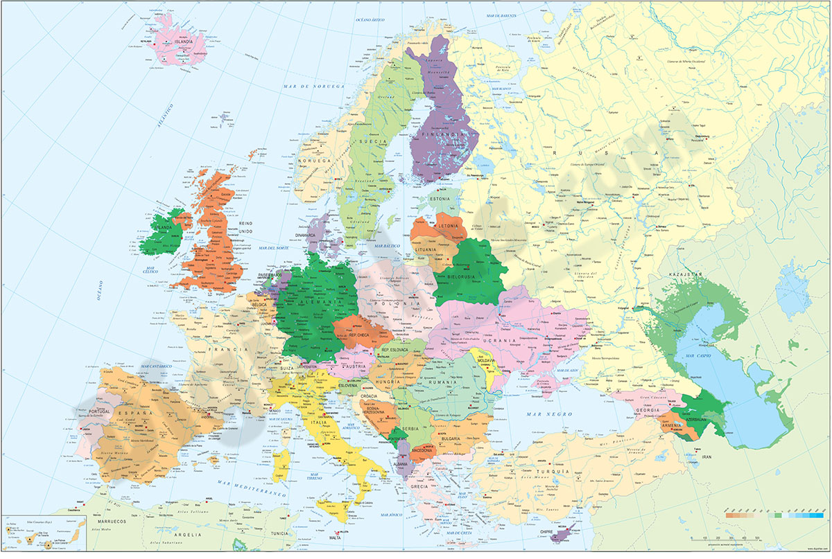
1- Europe political and geographical map
Digital physical and geographical map of Europe.
Digital cartography of the entire European continent with relevant physical and political information. Includes country borders, capitals, major rivers and lakes, important cities and geographical... Read more
Adobe Illustrator, Acrobat PDF + TIFF
2- Map of Benelux

Digital map of Benelux (intergovernmental cooperation between Belgium, the Netherlands and Luxembourg) with motorways and major roads, major rivers and lakes and the internal administrative division of the Netherlands, Belgium and... Read more
Adobe Illustrator, Acrobat PDF
3- Map of Benelux with regions and Postal Codes

Digital map of Benelux (Belgium, Netherlands and Luxembourg), showing regions, capitals and 2-digit postal code areas. Vectorized and fully editable file organized in separate layers.
Adobe Illustrator, PDF, JPG (300dpi)
4- Map of Luxembourg

Political map of Luxembourg with internal administrative divisions, their names and capitals.
File in vector format 100% editable.
Adobe Illustrator, Acrobat PDF