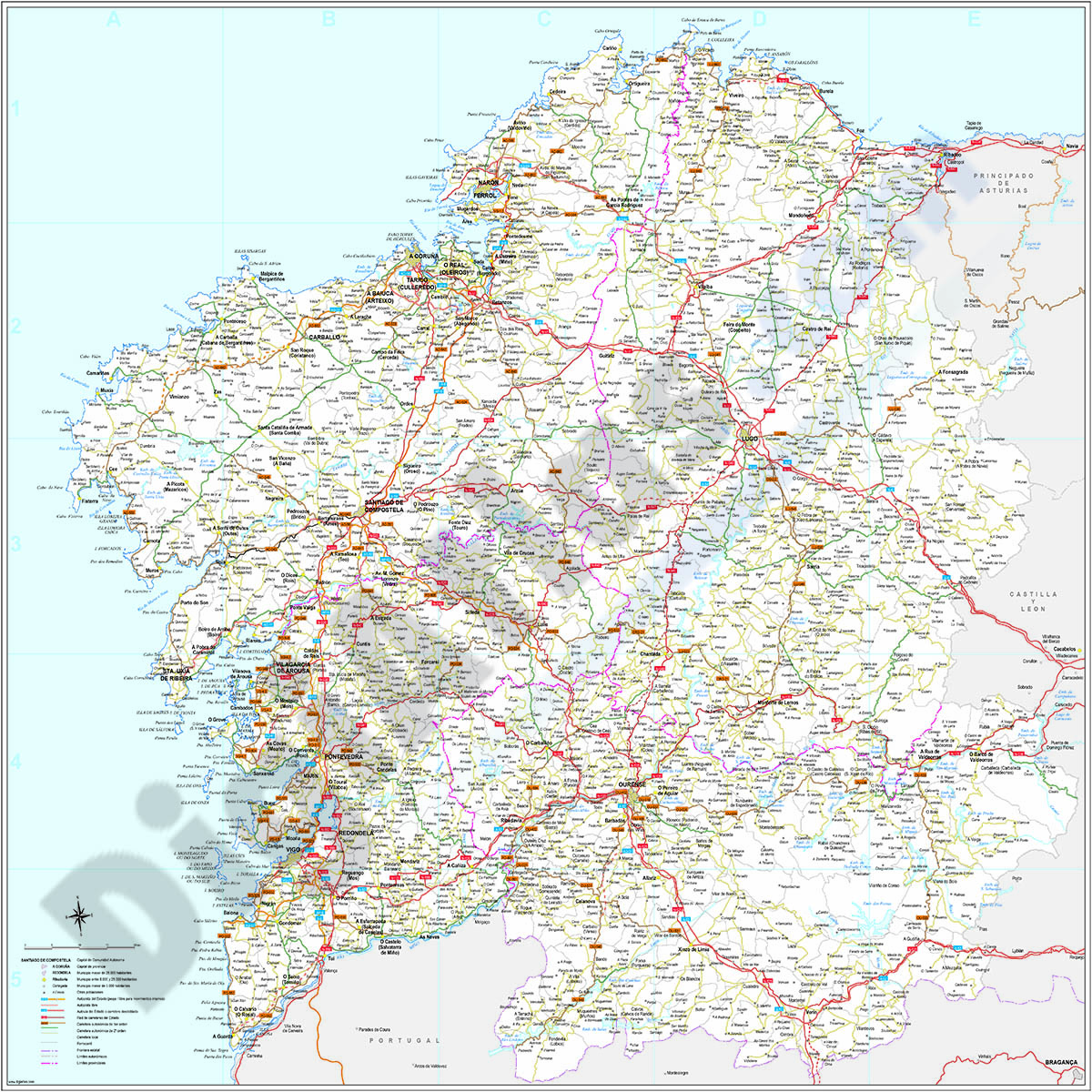
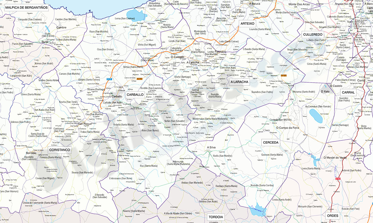
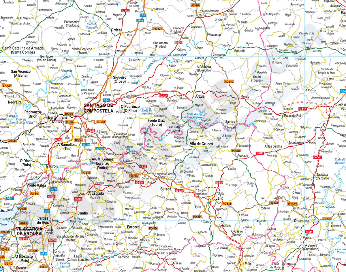
1- A Coruña (Corunna) - Map of province with parroquias and aldeas

Map of A Coruña province (Galicia, Spain) showing Autonomous Communities, provinces, concellos and parroquias boundaries. Include cities, 'aldeas', highways, major and minor roads, railroad, principal rivers and lakes and other relevant political... Read more
Adobe Illustrator, PDF
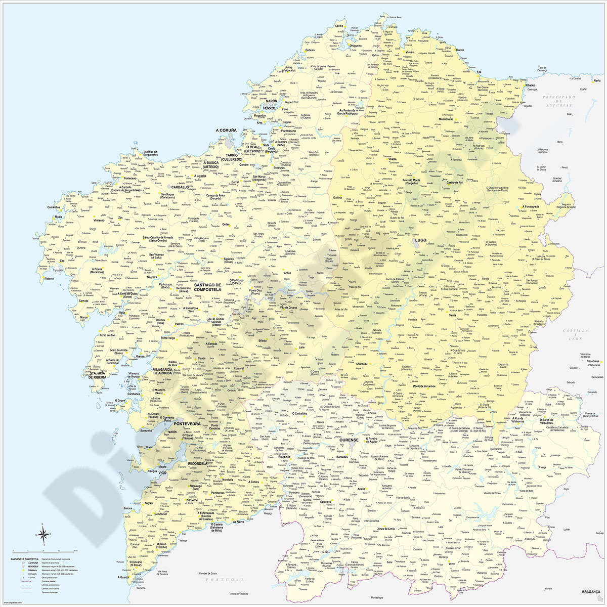
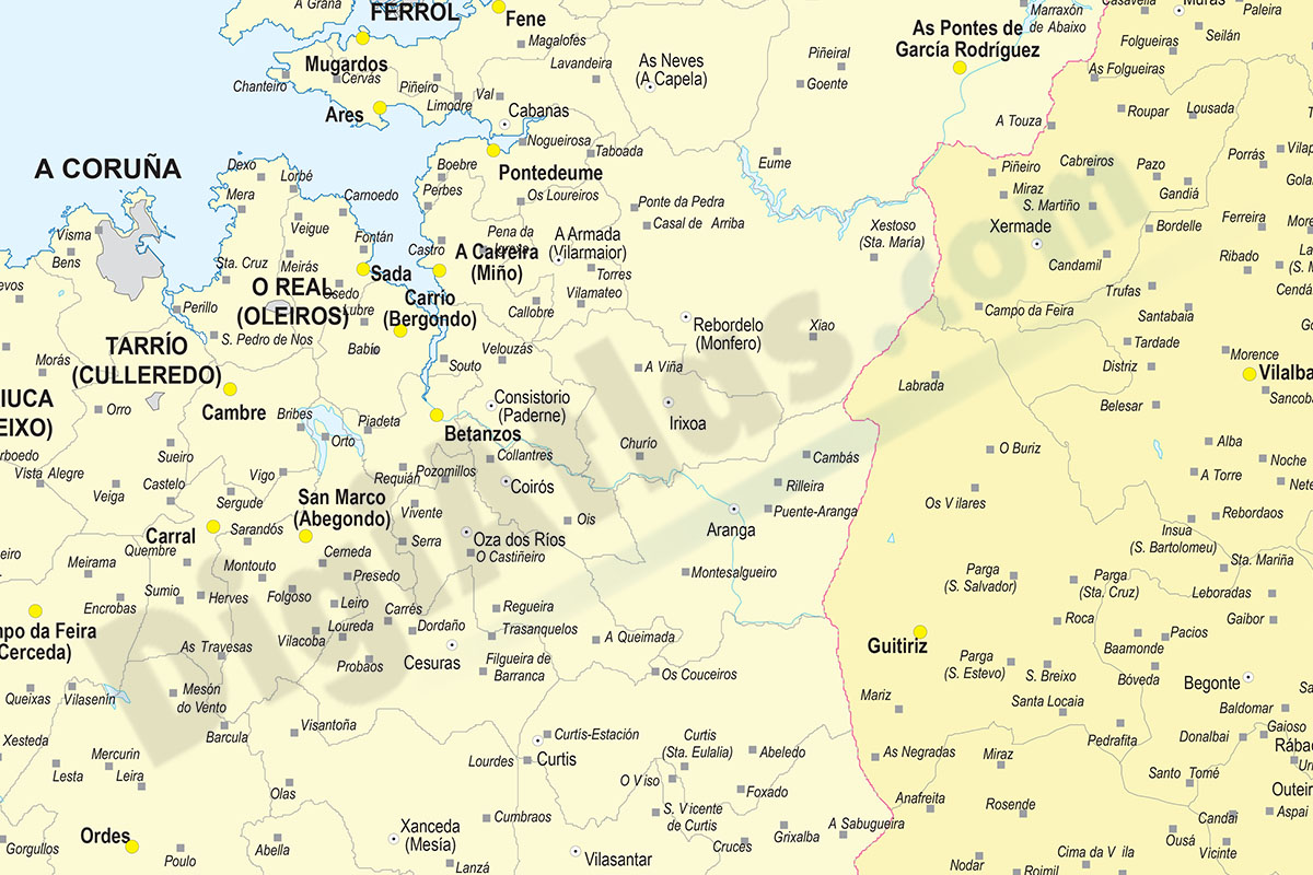
2- Galicia (Galizia) Spain autonomous community map
Digital poster size map of Galicia autonomous community (Spain).
The map shows the autonomous, provincial and municipal limits (concellos), road and rail network with the labeling of highways and national roads, capitals, cities and population... Read more
Adobe Illustrator, Acrobat PDF
3- Galicia map with municipalities
Digital map of Galicia autonomous community (northwest Spain) with the municipalities (concellos), their capitals and villages.
Two vector files are downloaded: the Adobe Illustrator (.ai) version is 100% editable and allows you to modify and... Read more
Adobe Illustrator, Acrobat PDF
4- Map of Ourense
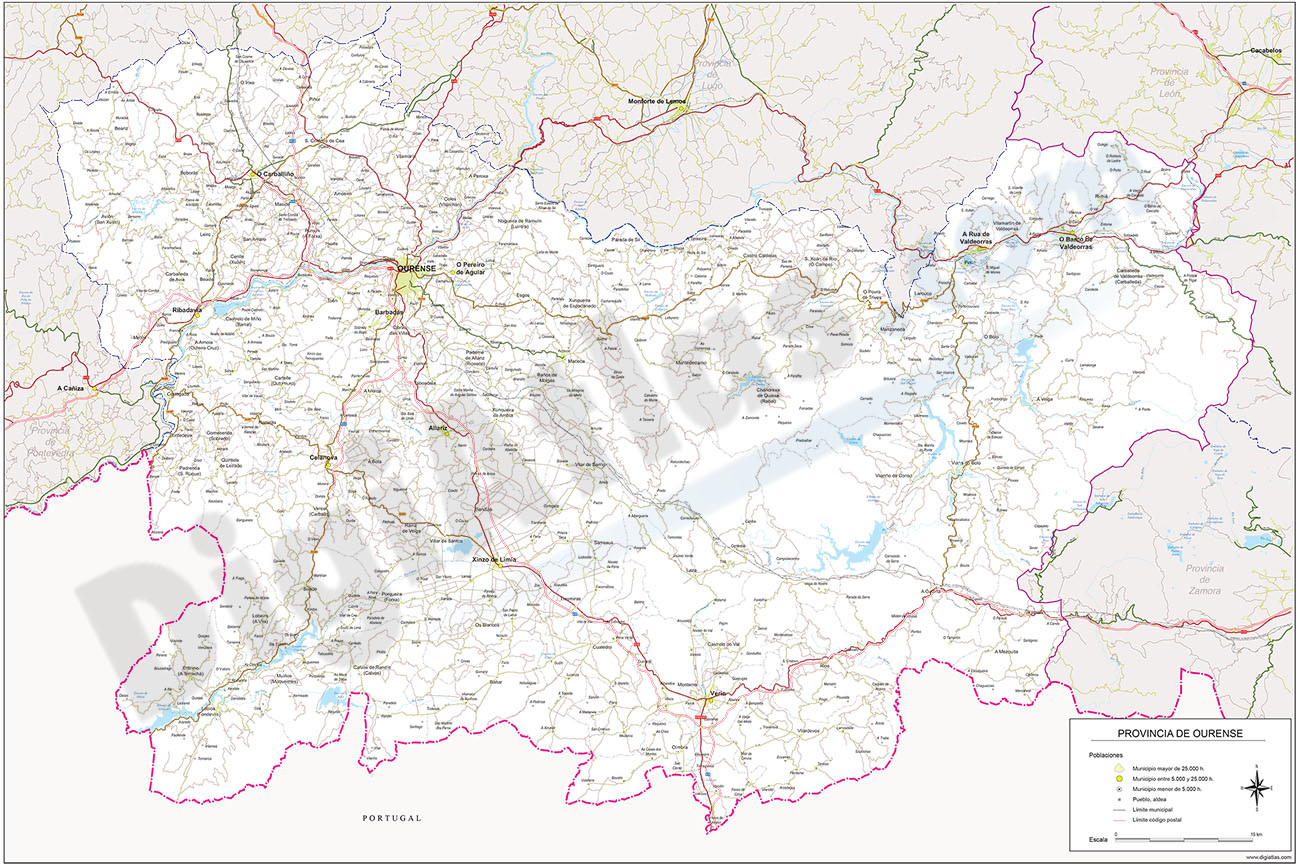
Digital map of the province of OURENSE (Galicia) at scale 1:250.000.
The map shows the municipal, provincial and regional boundaries, capitals and towns grouped by population, road network, AVE and railroad (highways, freeways, national and... Read more
Adobe Illustrator, Acrobat PDF
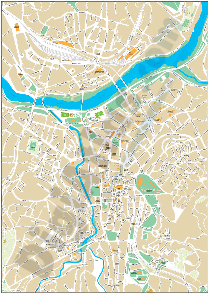
5- Ourense - city map of the center

Digital street map of the centre of OURENSE (Galicia, Spain), with the delineation of streets and squares, blocks of houses, parks, green areas and names of streets and squares.
Map in 100% editable vector format organized in layers that allows... Read more
Adobe Illustrator, Acrobat PDF
6- Ourense and Vitoria - city map of the center

Digital street maps of the centres of OURENSE (Galicia) and Vitoria-Gasteiz (Euskadi), with the delineation of streets and squares, blocks of houses, green areas and the names of the main streets and squares.
Two files are downloaded in vector... Read more
Adobe Illustrator, Acrobat PDF