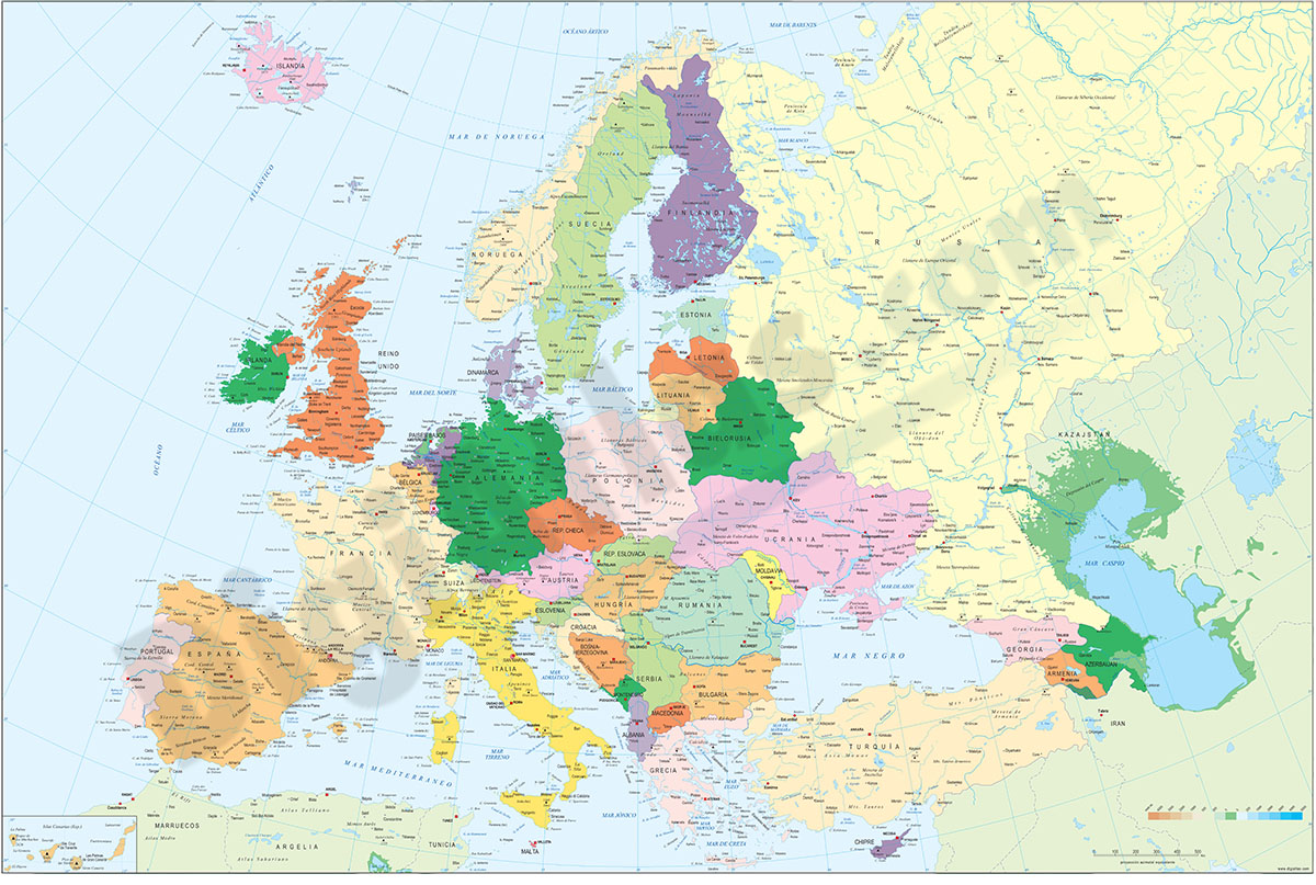
1- Europe political and geographical map
Digital physical and geographical map of Europe.
Digital cartography of the entire European continent with relevant physical and political information. Includes country borders, capitals, major rivers and lakes, important cities and geographical... Read more
Adobe Illustrator, Acrobat PDF + TIFF
2- Map of Belarus
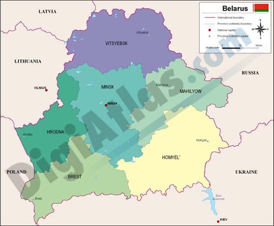
Fully editable vector file map of Belarus. Include political layers of inner administrative division, with their names and capitals.
Adobe Illustrator, Acrobat PDF
3- Map of Poland
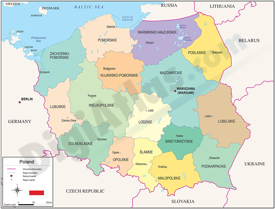
Fully editable vector file. Include political layers of inner administrative division, with their names and capitals.
Adobe Illustrator, PDF
4- Map of Poland roads and cities map
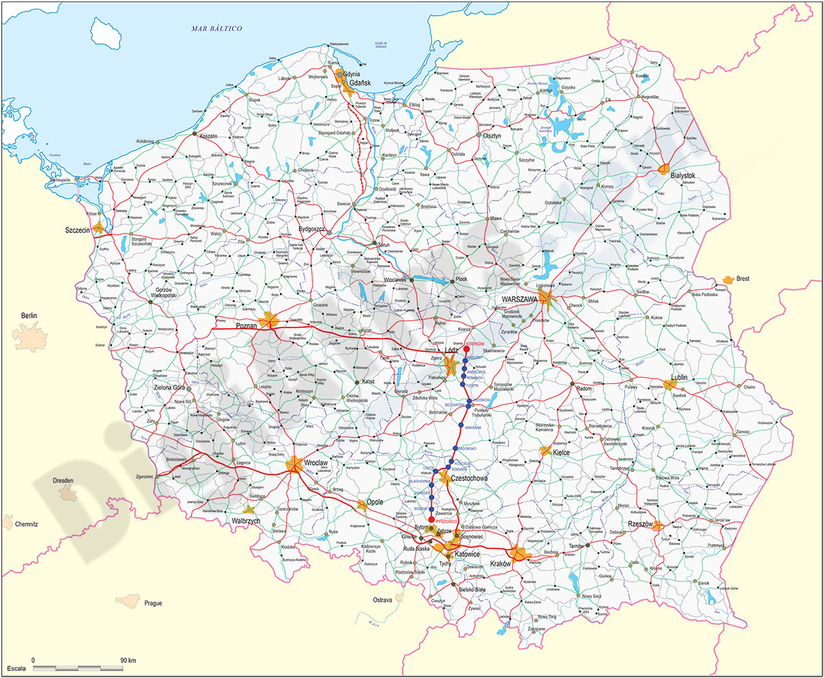
Digital political map of the Republic of Poland with regions or Voivodeships, provinces, main roads and settlements grouped according to their number of inhabitants.
Fully editable vector map for graphic design organised in layers.
Adobe Illustrator, Acrobat PDF
5- Map of Poland with regions and Postal Codes
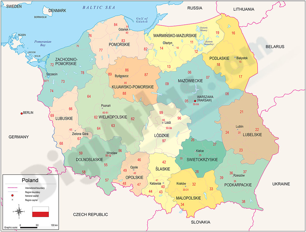
Vectorized and fully editable Map of Poland with regions, capitals and 2-digit postal codes.
FreeHand, Illustrator, PDF, JPG (300dpi)