


PACK DIGIATLAS
Download up to 15 digital maps of your choice through a subscription to the 'Pack DigiAtlas'.
-Description:
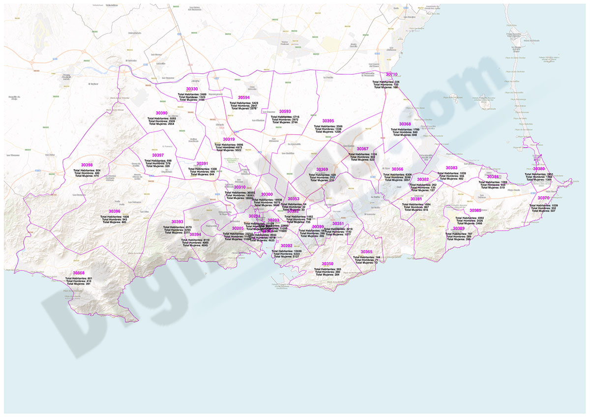
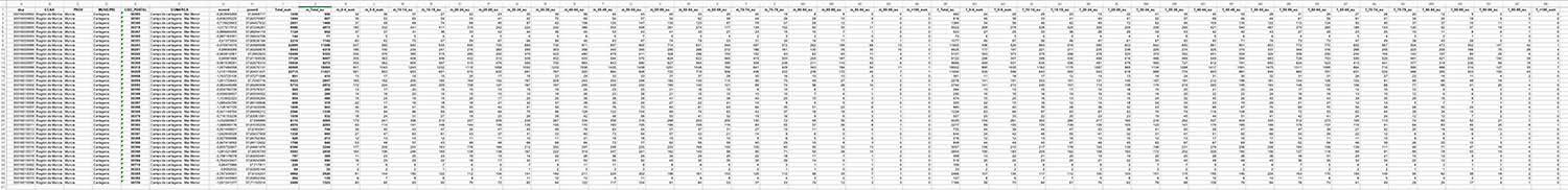
Population by postal code of the municipality of Cartagena (Region of Murcia).
An Excel file is downloaded: idpc - Autonomous community - province - comarca - municipality - geographical coordinates of the centroid (central point of each postal area) - Total inhabitants - Total men - Total women - age groups (five-year age groups) for each sex.
The data are updated to 1 January 2022 (INE - Spanish National Statistical Institute).
-Original measurements:
georeferenciado (Fully resizable vector file for High-quality printing).
-Download formats:
Excel
-You can also request a quote » to modify this map and adapt it to your projects.
Download up to 15 digital maps of your choice through a subscription to the 'Pack DigiAtlas'.

Postcode maps of cities, regions and countries. Optionally with demographic data for geo-marketing projects.

City street maps with delineation of urban areas, streets, squares, parks, green areas, buildings of interest, etc.
DigiAtlas select every week until three random maps from their catalog and intends to offer them at a very lower price than its regular cost.
These maps change every 7 days. If either of them matches your interest take advantage of this opportunity to acquire digital maps to a very special price.