95,00 €
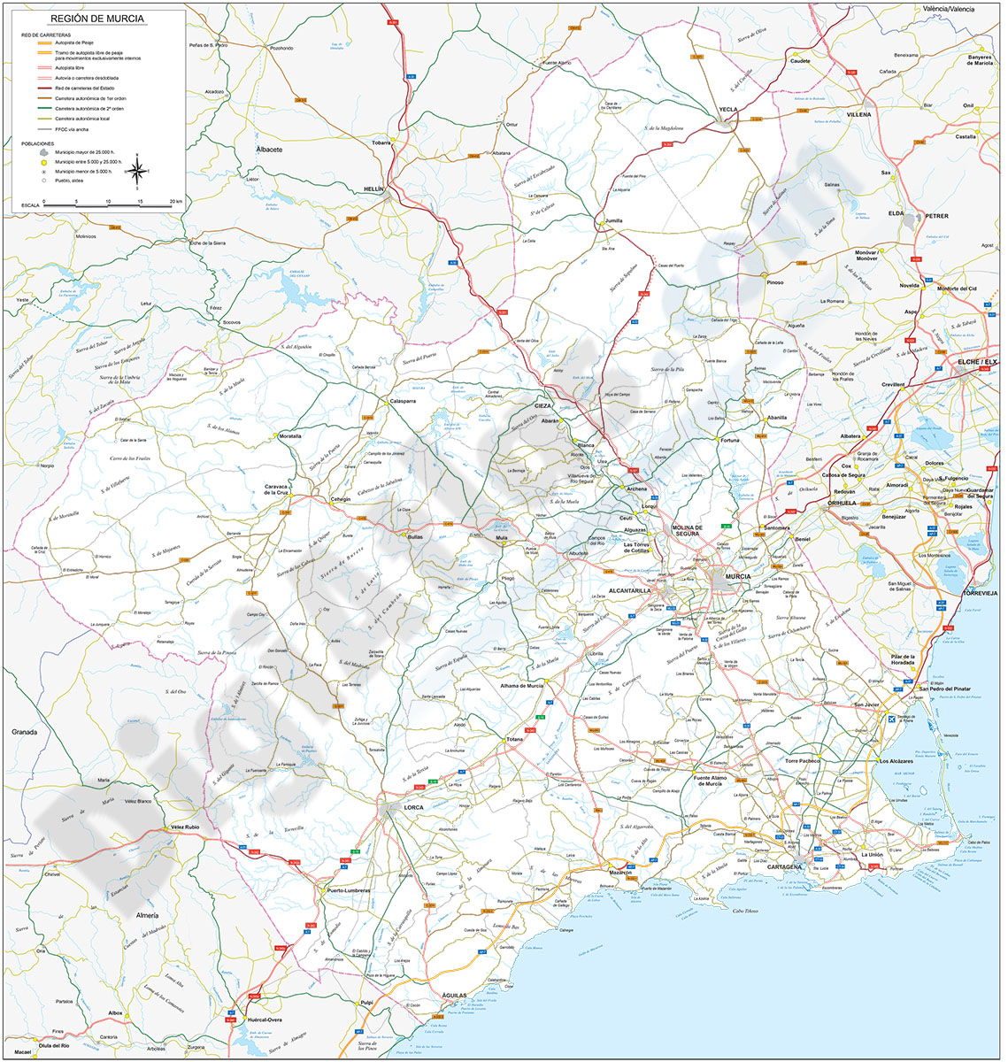
Map of Región de Murcia
Digital map of the Region of Murcia at scale 1:300.000
(...) Read more »
Adobe Illustrator, Acrobat PDF

45,00 €
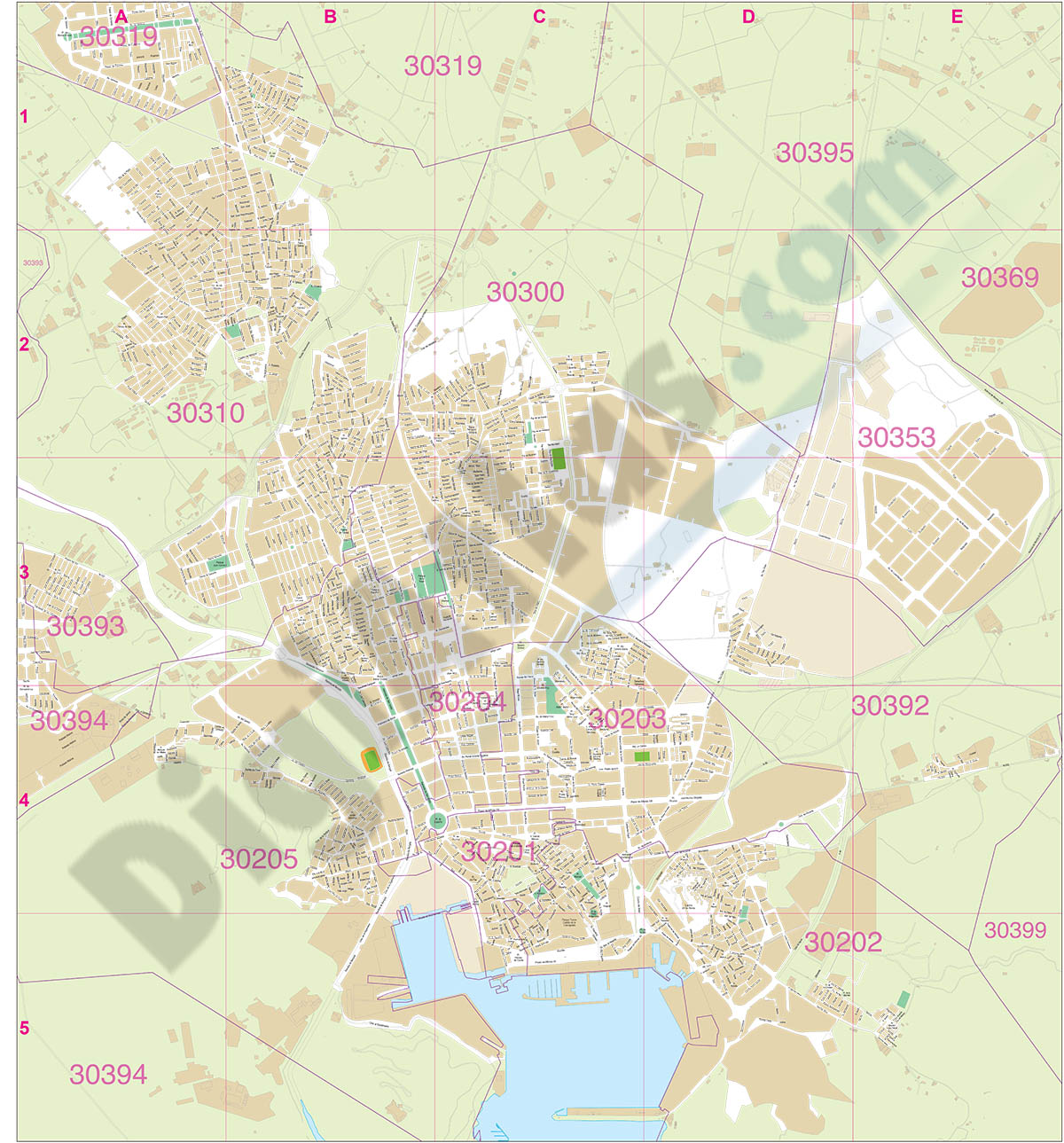
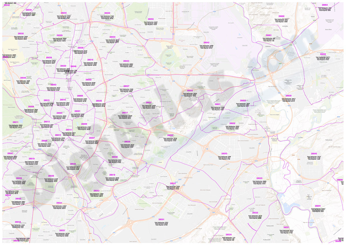
Cartagena - Population by postal code
Population by postal code of the municipality of CARTAGENA (Region of Murcia).
(...) Read more »
Excel
125,00 €
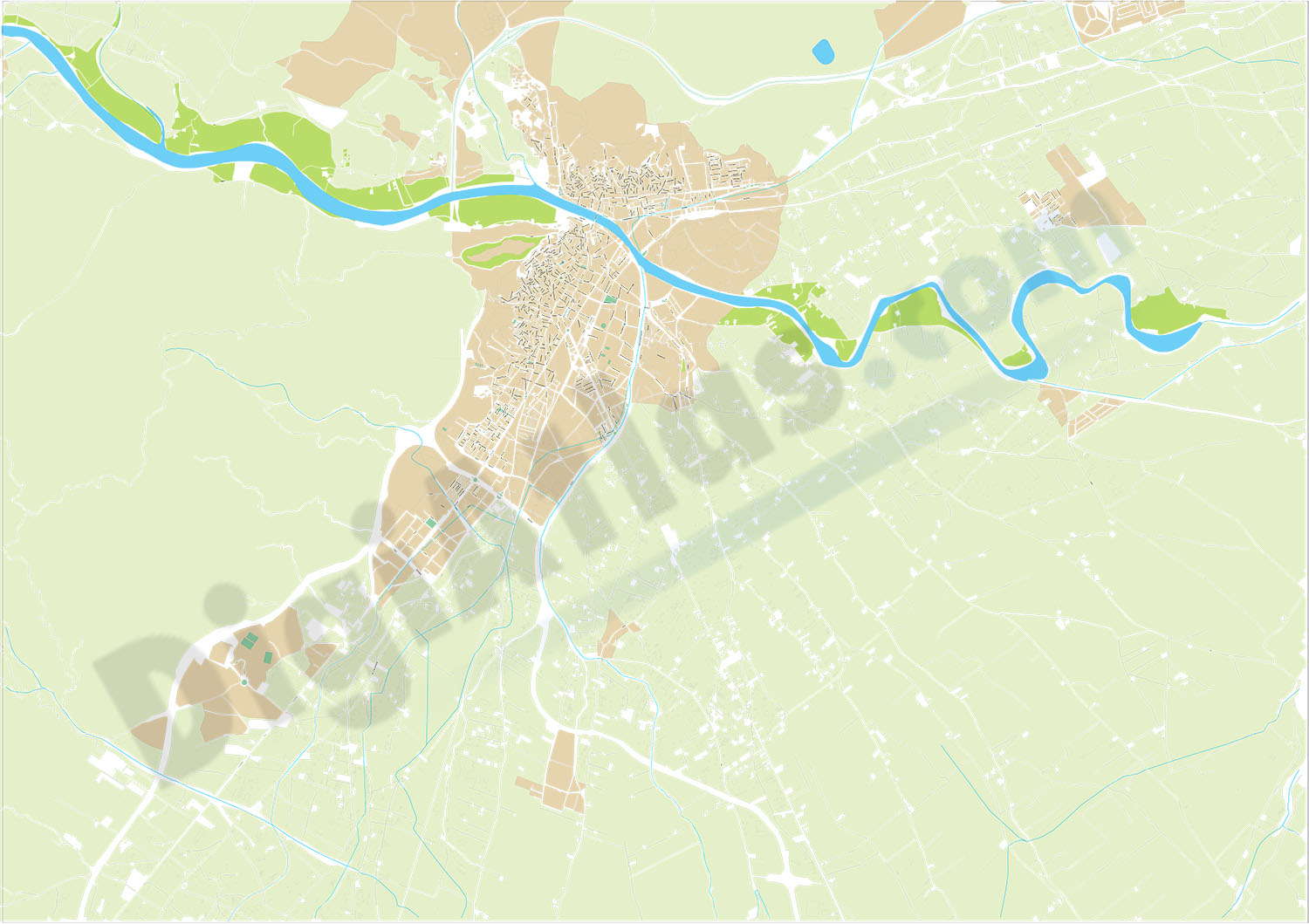
Cartagena (Murcia) - city map
Digital street map of CARTAGENA (Region of Murcia, Spain)
(...) Read more »
Adobe Illustrator, Acrobat PDF
59,00 €
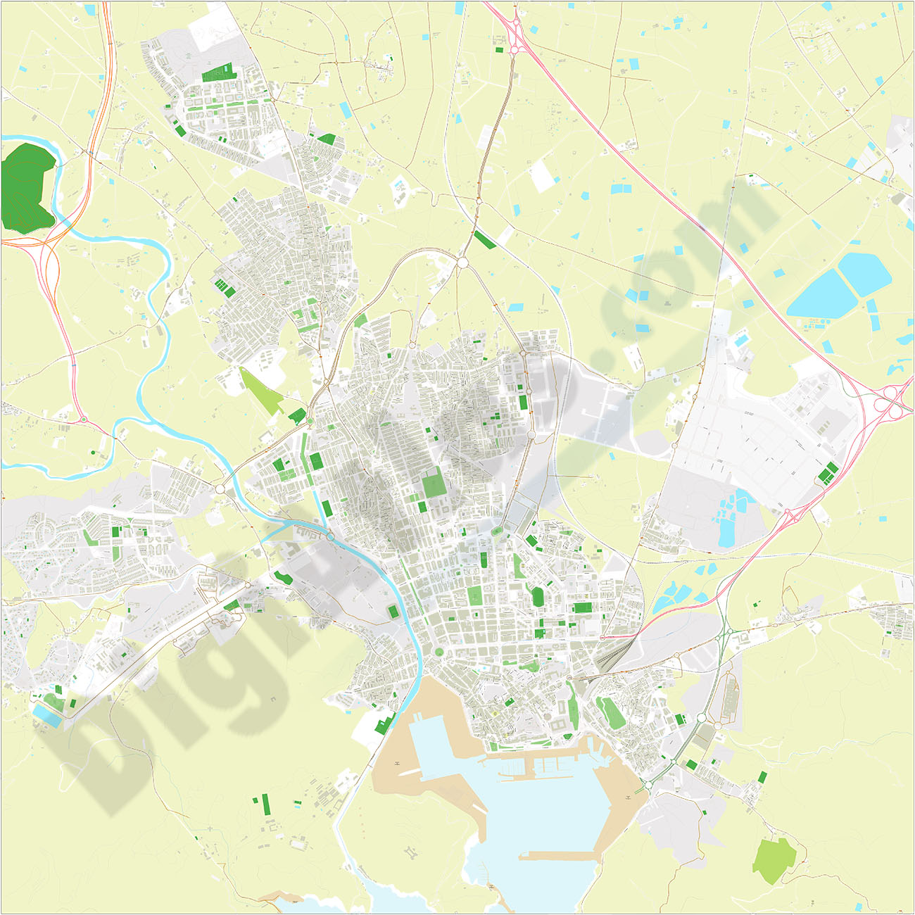
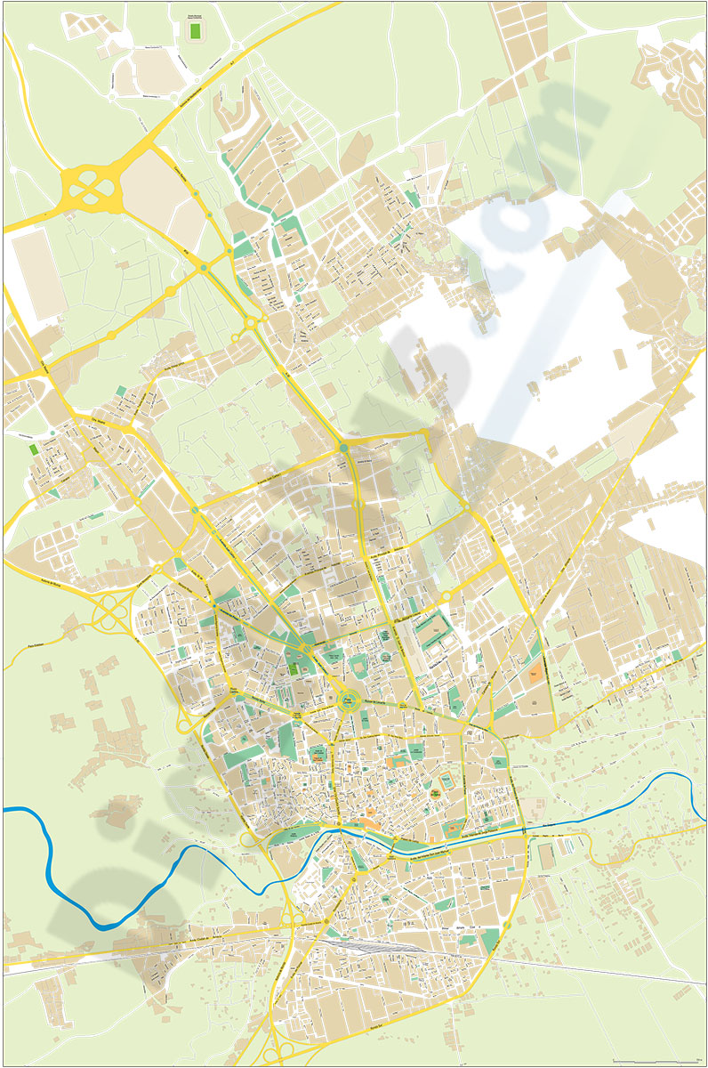
Cartagena - city map
Digital street map of CARTAGENA (Region of Murcia, Spain).
(...) Read more »
Adobe Illustrator, Acrobat PDF
75,00 €
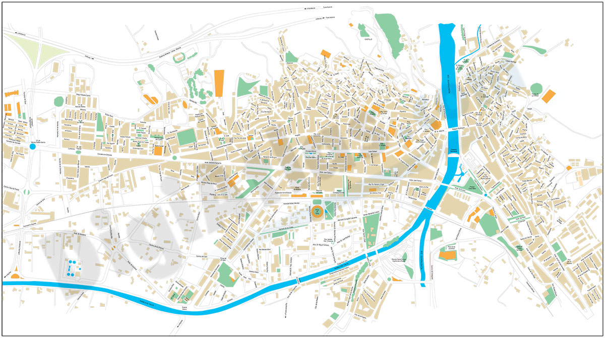
Lorca (Murcia) city map
Digital street map of Lorca city (Región de Murcia, Spain) with the delineation of streets and squares, blocks of houses and green areas, with colours and names.
(...) Read more »
Adobe Illustrator, Acrobat PDF
55,00 €
Murcia city map
City Map of Murcia (Region of Murcia, Spain) in digital format showing urban blocks of buildings, parks, green zones, street and square names. Downloads a fully editable vectorized file organized in l
(...) Read more »
Adobe Illustrator, PDF

55,00 €
Valencia and Murcia autonomous region map
Autonomous Community vector file map. Scale 1:1.000.000. Include provinces, roads, rivers and lakes, cities, geographic names, km distances and highways and major roads names. High-resolution color sh
(...) Read more »
Adobe Illustrator, Acrobat PDF
90,75 €
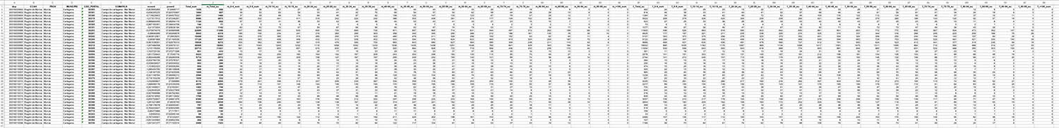
Cartagena and Madrid community - Population by postal code
Historical population data by postal code of the municipality of CARTAGENA (Region of Murcia) and the Community of Madrid.
Population data from 2017 to 2021.
Excel file structure: idpc - CCAA - province - municipality - Total 2017 - Total 2018 - Total 2019 - Total 2020 - Total 2021.
Data fron INE (Spanish National Statistical Institute).
See less «
Excel
59,00 €
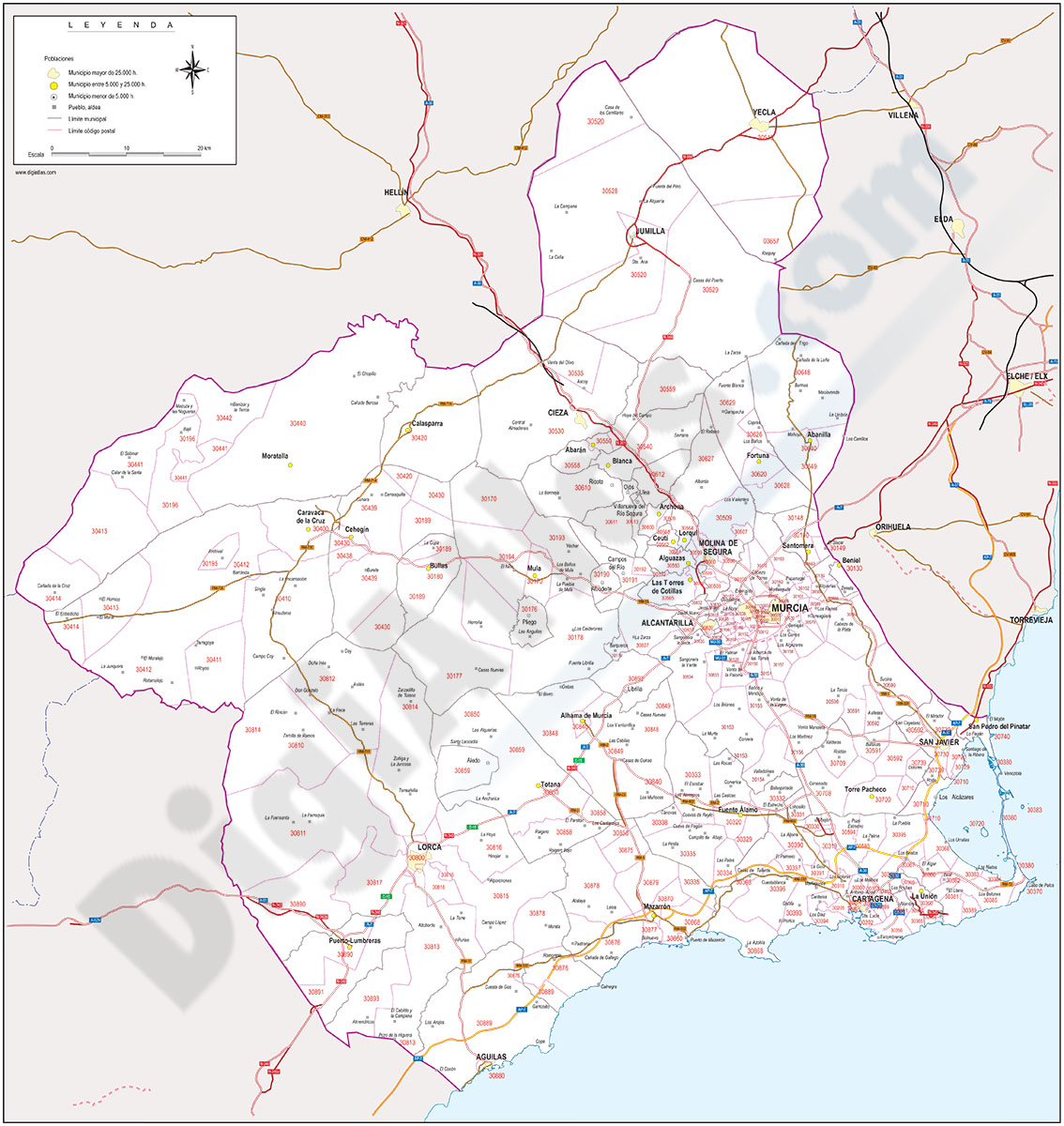
Region of Murcia map with municipalities, major roads and postal codes
Map of Region of Murcia (Spanish autonomous community) showing municipalities, postal codes areas and major roads.
Adobe Illustrator, Acrobat PDF