75,00 €
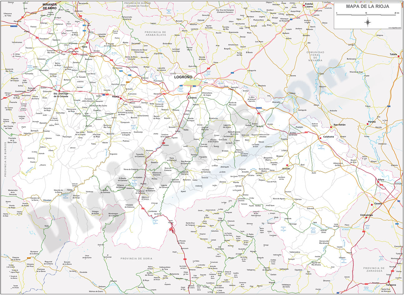
Map of La Rioja
Digital map of the autonomous community of La Rioja.
(...) Read more »
Adobe Illustrator, Acrobat PDF
59,00 €
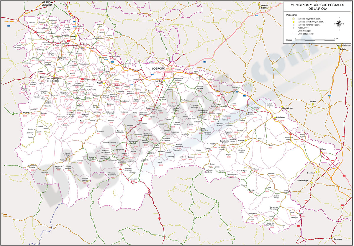
Map of La Rioja autonomous community with municipalities and postal codes
Digital map of the autonomous community of La Rioja (Spain) with municipalities, cities and towns grouped according to population, main road network and all 5-digit postcodes.
(...) Read more »
Adobe Illustrator, Acrobat PDF

98,00 €
Burgos and La Rioja - inhabitants by postcode
Digital map of the province of Burgos and the autonomous community of La Rioja showing the municipalities, postcode boundaries and the number of inhabitants of each postcode.
2 files are downloaded in vector format, fully editable and organised in separate layers.
Also included is an Excel file with the population data for each postcode, with the following structure: idcp - CCAA - Province - Comarca - Municipality - COD_INE - Postcode - Coord_X_ce - Coord_Y_ce - Inhabitants per CP.
See less «
Adobe Illustrator, Acrobat PDF y Excel
75,00 €
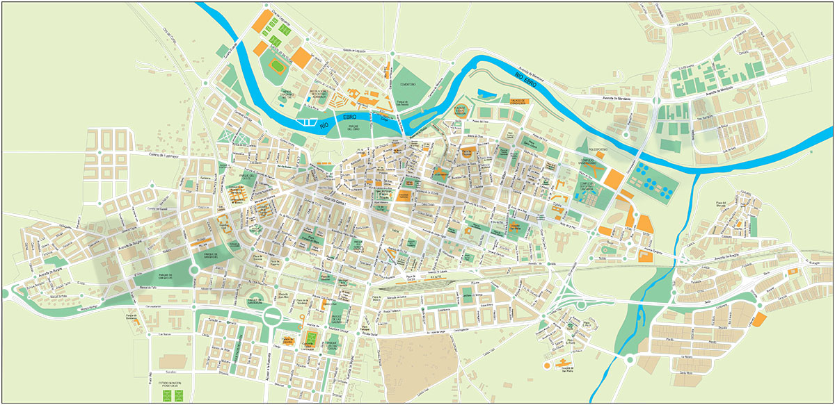
Logroño (La Rioja) - city map
Digital street map of LOGROñO city (capital of the autonomous community of La Rioja, Spain) with the delineation of streets and squares, blocks of houses and green areas, with colours and names.
Adobe Illustrator, Acrobat PDF

59,00 €
Map of Basque Country, Navarra and La Rioja
Map of the Basque Country, Navarra and La Rioja at a scale of 1: 300,000. Digital map with the provinces of the 3 autonomous communities, their municipalities, capitals, cities and towns grouped accor
(...) Read more »
Adobe Illustrator, Acrobat PDF, JPG (300dpi)