
79,00 €
Spain - postal codes by municipality and comarca
Complete Excel file with all the Postal Codes of Spain, along with the corresponding municipality, county and geographic coordinates. With 15,247 zip code areas, it is the definitive guide to l
(...) Read more »
Excel

79,00 €
Catalonia - map of postal codes
Digital map of Catalonia (Catalonia) with postcode areas. Georeferenced vectorial cartography in Shapefile (.shp) format.
Shapefile

59,29 €
Palma de Mallorca - districts and neighbourhoods
Georeferenced digital map of the city of Palma de Mallorca with the division of the districts, neighbourhoods and statistical areas of the city council of Palma.
Map in Shapefile format.
Shapefile (.shp)

78,65 €
Andalucia - map of comarcas
Digital map of Andalusia (Andalucia autonomous community, Spain) with the comarcas and municipalities in 100% editable vector format.
(...) Read more »
Adobe Illustrator, Acrobat PDF

90,00 €
Madrid - Number of dwellings
Digital cartography of the urban area of the Community of Madrid, Spain with the Number of buildings and dwellings in each cadastral parcel.
Shapefile

Ask price
Argentina - map of 4 digit postal codes
Digital map of the postal codes of Argentina in georeferenced Shapefile format.
Shapefile (.shp)
Ask price
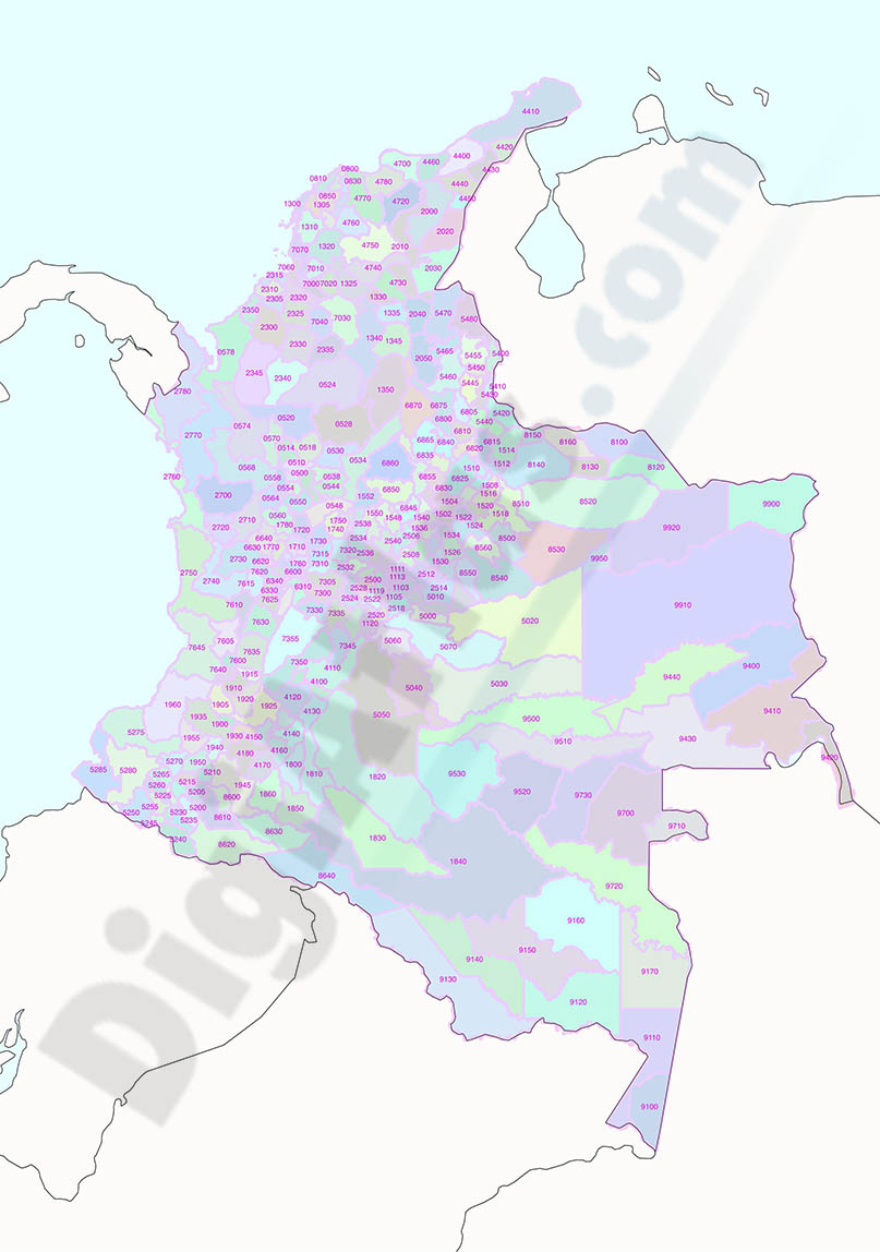
Colombia - map of 4 digit postal codes
Digital map of Colombia with the 4-digit postcodes.
Georeferenced cartography of Colombia with the 4-digit postal zones, which refer to the departments and regional zones.
(...) Read more »
Shapefile (.shp)

Ask price
Chile - map of 3 digit postal codes
Digital cartography of Chile with 3-digit postcodes.
The first three digits of the Chilean postcodes correspond to the communes.
Georeferenced file in Shapefile (.shp) format.
Shapefile (.shp)

79,00 €
Catalonia - postalcode by municipality and comarca
Excel file with all zipcodes of Catalonia, their municipality, comarca and coordinates.
Excel
Ask price
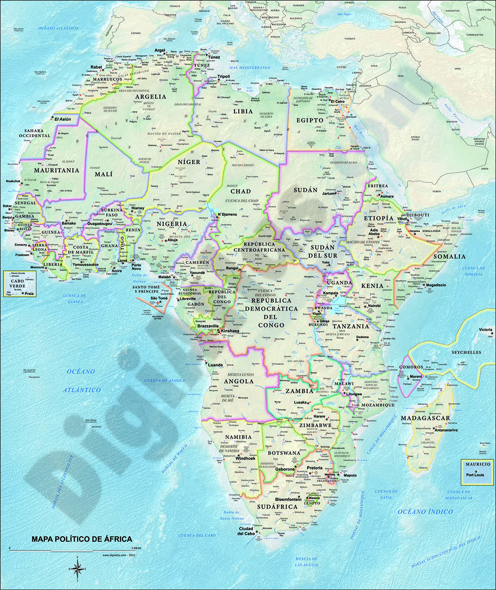
Map of Africa Poster
Poster-size digital map of Africa with detailed political and geographical information.
Adobe Illustrator, Acrobat PDF

Ask price
Map of Senegal poster
Digital physical and political map of Senegal, poster size, with the boundaries of the regions, Départements and Arrondissements, their capitals, cities and towns, road and rail network, rivers and l
(...) Read more »
Adobe Illustrator, Acrobat PDF

Ask price
Touristic map Santiago de Compostela area
Digital map of the area between Corcubión (A Coruña) and Forcarei (Pontevedra).
(...) Read more »
Adobe Illustrator, Acrobat PDF

90,75 €
Getxo and Leioa - digital map
Digital map of Getxo and Leioa. The map contains a satellite base image and layers with the names of streets and squares, street numbers and municipal boundaries.
Original dimensions 200x200 c
(...) Read more »
Adobe Illustrator, Adobe PDF

39,00 €
Map of Valencia 46009
Digital map of postal code 46019 of Valencia city showing street and square names.
Adobe Illustrator, PDF

95,00 €
Merida - urban area map
Digital map of Mérida (capital of the autonomous community of Extremadura, province of Badajoz, western central Spain) with the delineation of the urban area, municipal boundaries, communication rout
(...) Read more »
Adobe Illustrator, Adobe PDF

