55,00 €
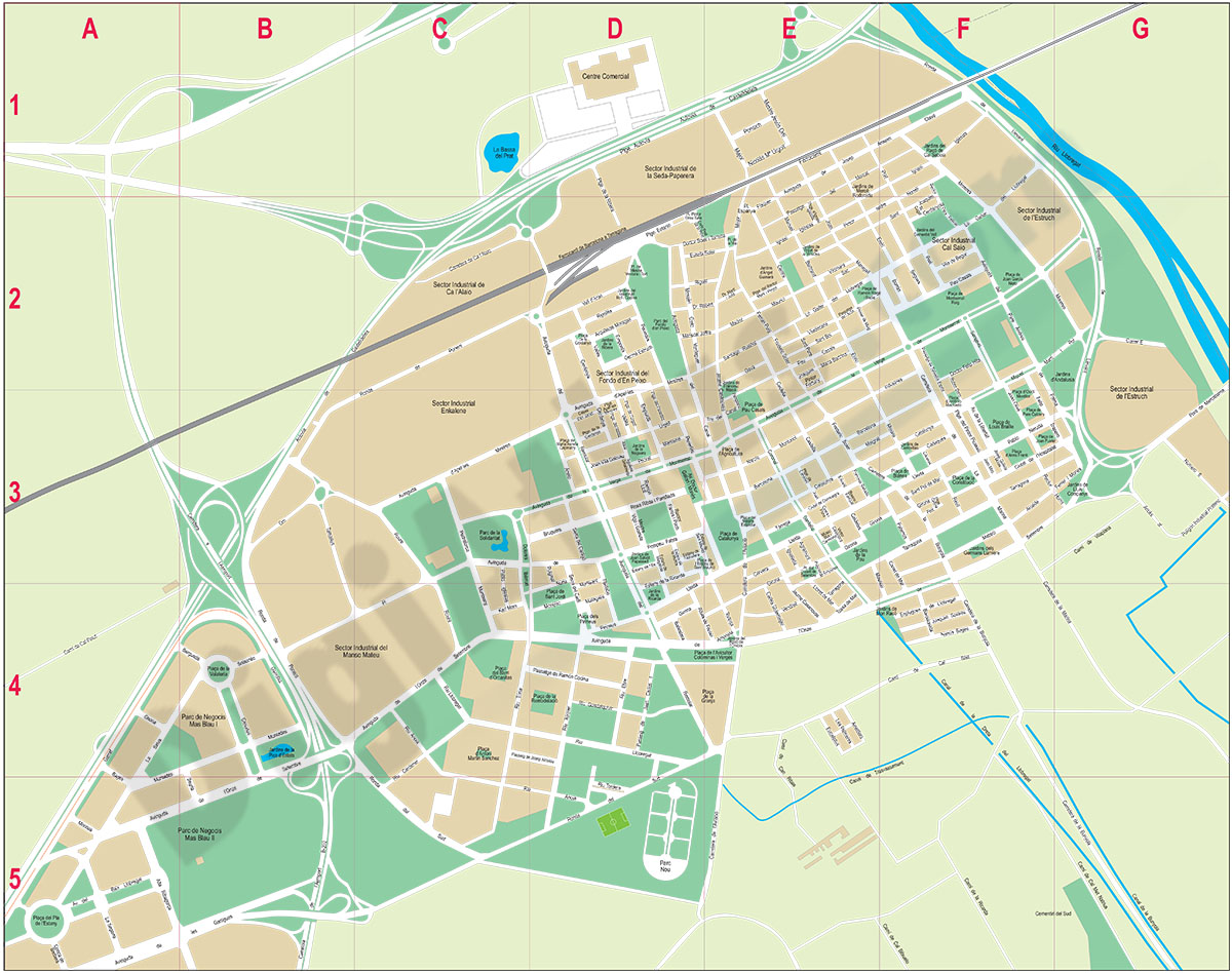
El Prat de Llobregat (Spain) - city map
Digital street map of El Prat de Llobregat (province of Barcelona) with the delineation of streets and squares, blocks of houses, parks and green areas, with colours and names.
(...) Read more »
Adobe Illustrator, Acrobat PDF
59,00 €
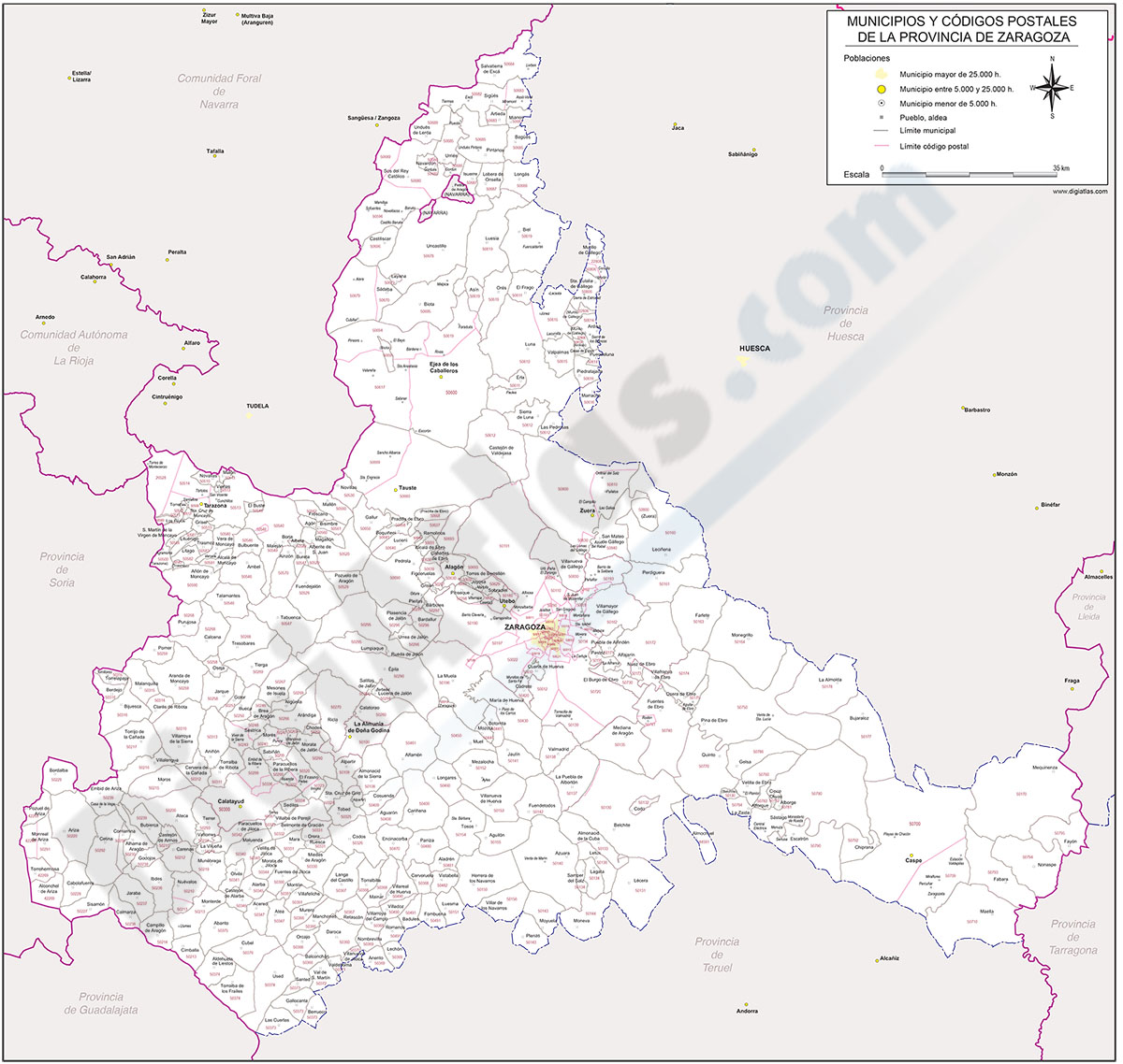
Map of Zaragoza province with municipalities and postal codes
-Postal codes map of Zaragoza province (autonomous community of Aragón, Spain), with municipalities borders, their capitals, cities and towns organized depending on population size, limits of
(...) Read more »
Adobe Illustrator, Acrobat PDF
59,00 €
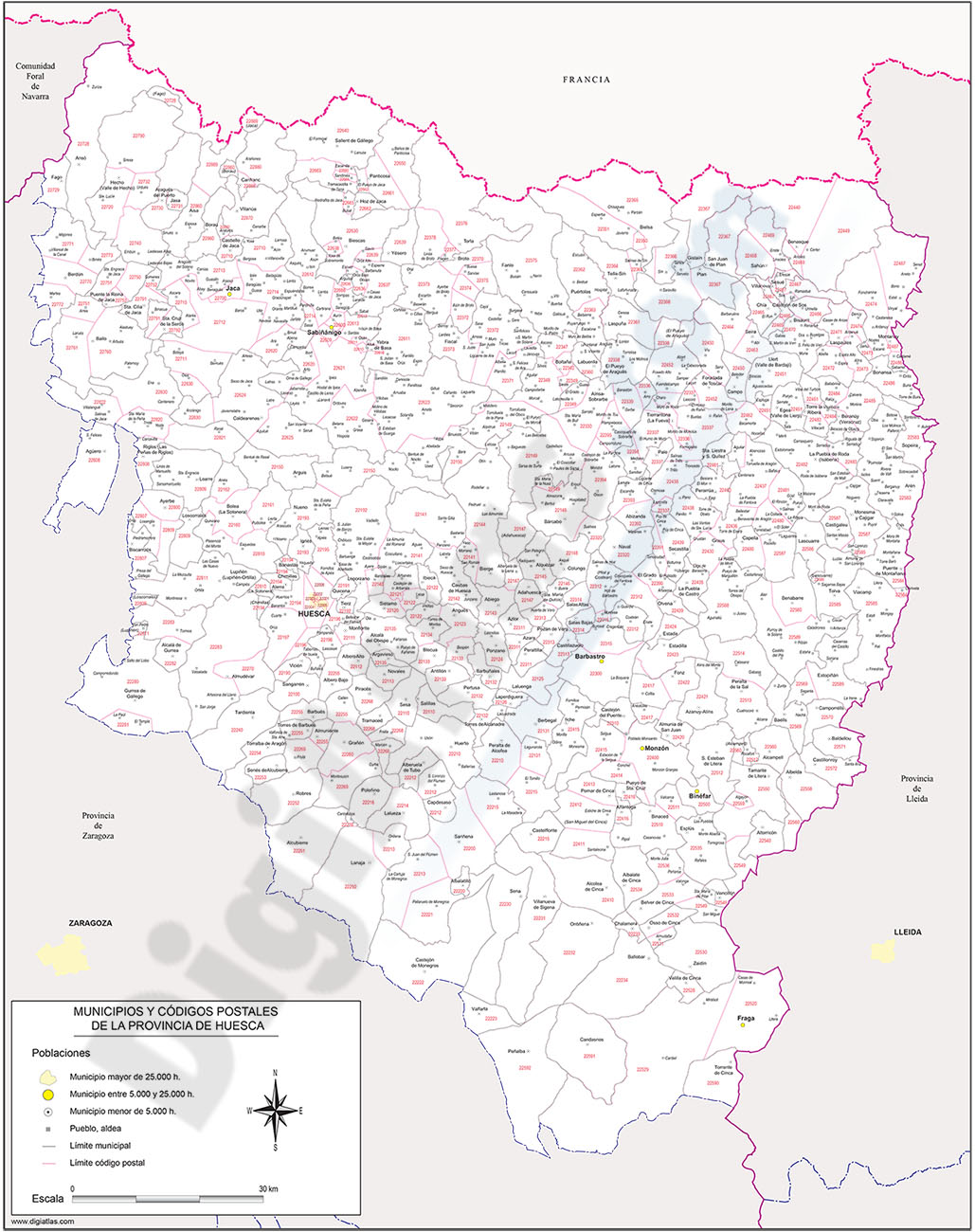
Map of Huesca province with municipalities and postal codes
Digital map of the province of Huesca (Aragon, Spain) with municipalities, towns and postal codes.
(...) Read more »
Adobe Illustrator, Acrobat PDF
55,00 €
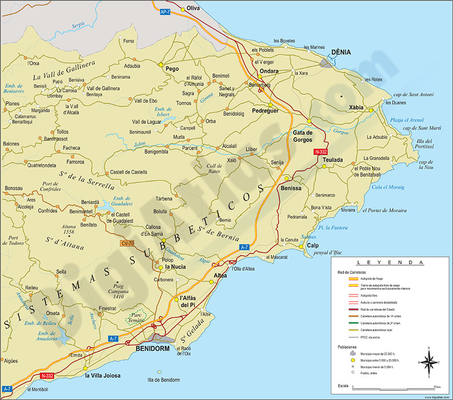
Map of Comarcas Marina Alta and Marina Baixa
Digital map of the comarca of Marina Alta and Marina Baja (Alicante province, Valencian Community, Spain). Map shows the administrative division, provincial and municipal borders, road network, cities
(...) Read more »
Adobe Illustrator, Acrobat PDF

29,00 €
Province of Milan with municipalities and cities
Vector map of the former province of Milan (Lombardy region) with municipal boundaries and towns.
(...) Read more »
Adobe Illustrator, Acrobat PDF
19,95 €
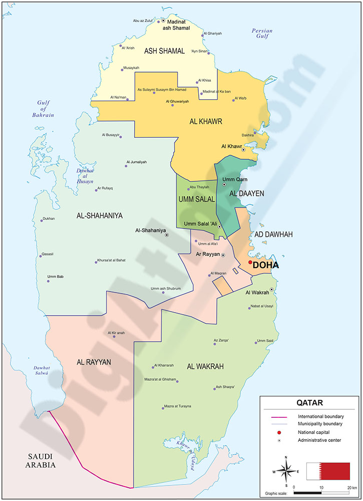
Map of Qatar
Political map of Qatar (State of Qatar) with the territorial and administrative organization, showing its eight municipalities (baladiyah) and their capitals.
(...) Read more »
Adobe Illustrator, Acrobat PDF

55,00 €
Community of Madrid - Population by Zip Code
NUMBER OF INHABITANTS BY ZIP CODE OF THE COMMUNITY OF MADRID.
Excel file with all the zip codes of the Community of Madrid with population data. Updated to 2024.
(...) Read more »
Excel
Ask price
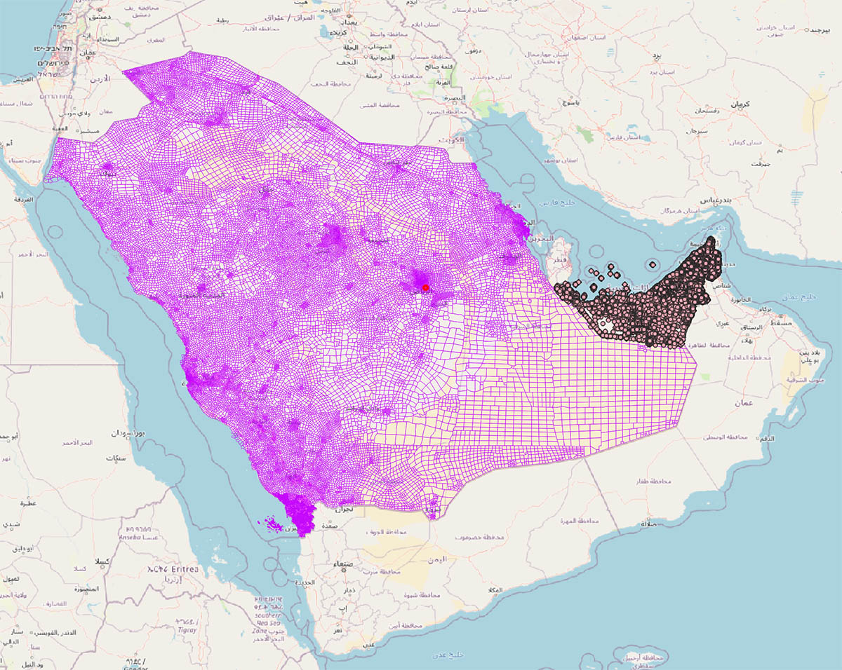
Saudi Arabia and UAE zip codes map with demographic data
Digital map of Saudi Arabia and United Arab Emirates (UAE), in geo-referenced vector Shapefile format, with 5-digit postal code areas and demographic data on population aged 0-5 years and women of rep
(...) Read more »
Shapefile format (.shp)
55,00 €
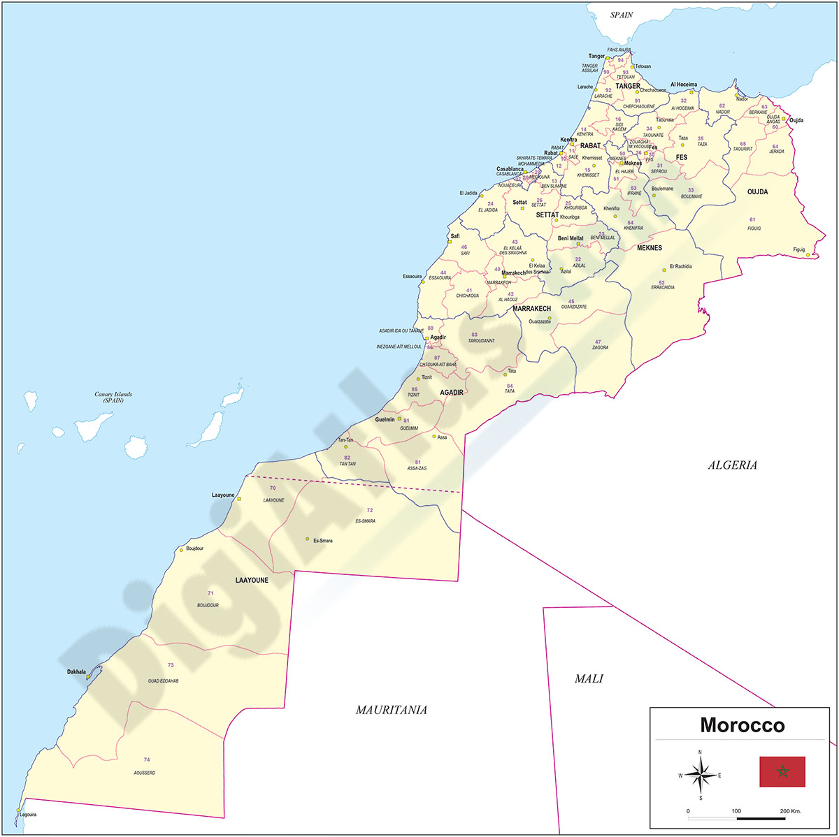
Map of Morocco with regions and Postal Codes
Vectorized and fully editable Map of Morocco and Western Sahara with regions, capitals and 2-digit postal codes.
100% editable vector files are downloaded, organised in separate layers so you can modify colours, texts and styles and adapt the map to any type of graphic design project.
See less «
Adobe Illustrator, Acrobat PDF
55,00 €
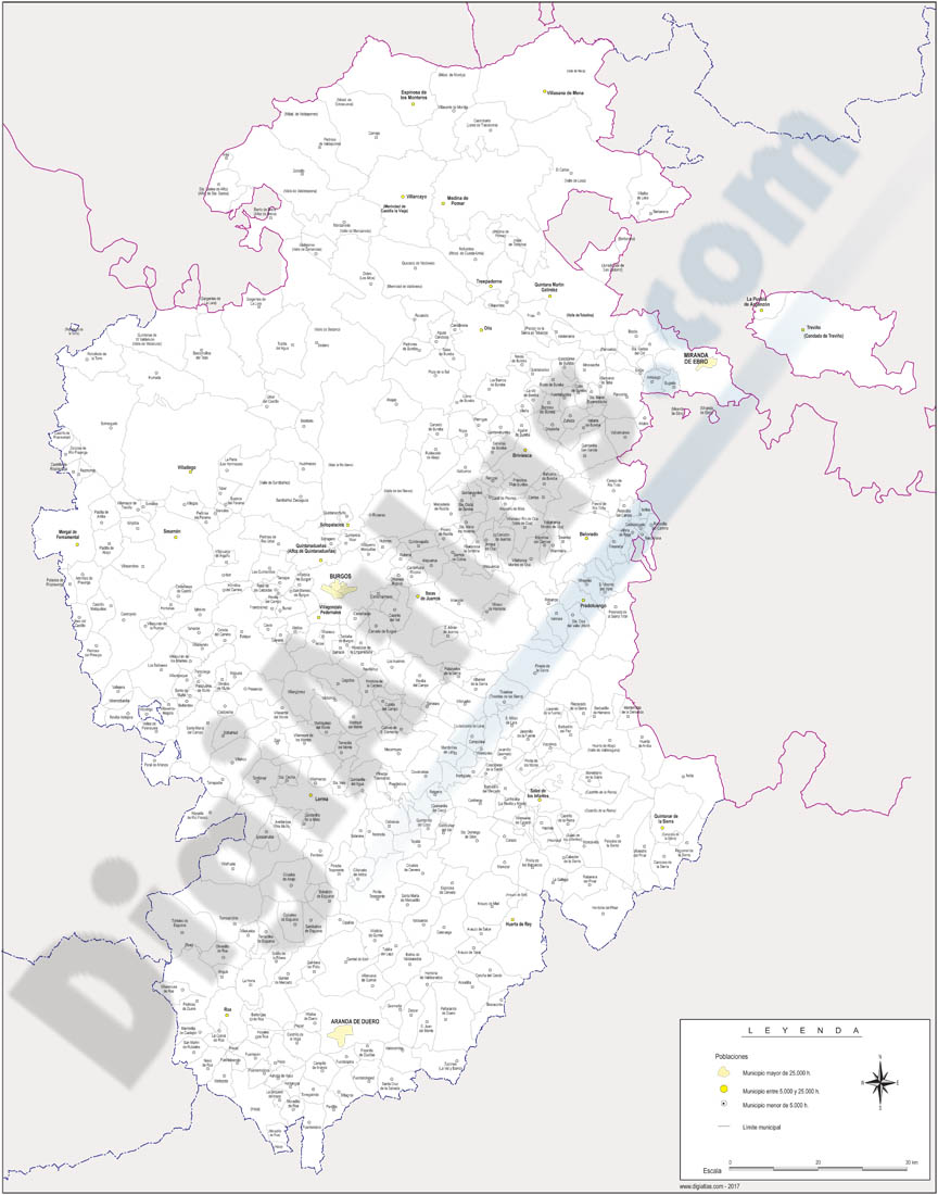
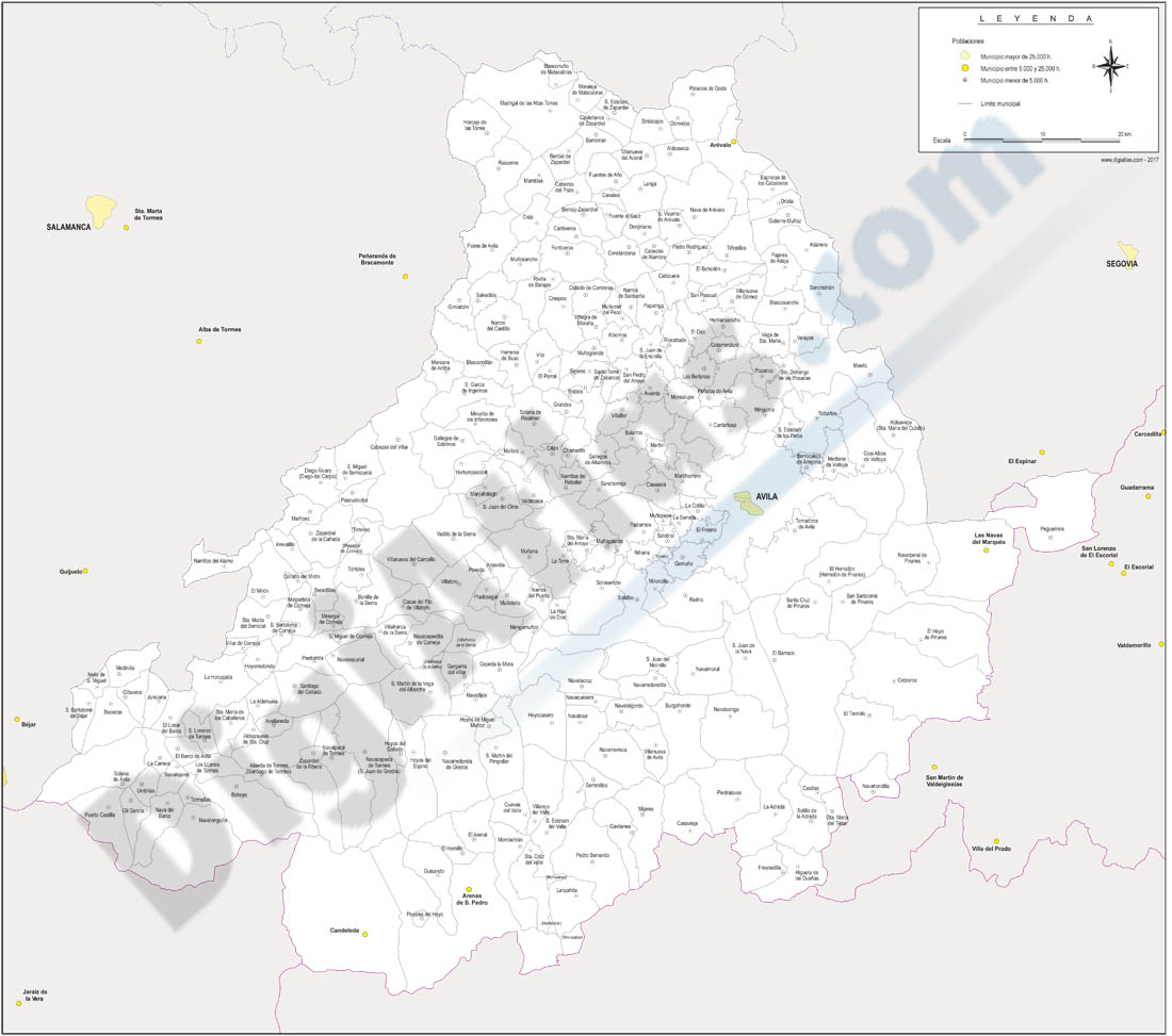
Castilla y Leon map with municipalities
Map of Castile and León (Castilla y León autonomous commuity) showing their provinces with municipalities in digital format.
Adobe Illustrator, PDF

19,95 €
Map of Ethiopia
Political map of Ethiopia, Federal Democratic Republic of Ethiopia (FDRE), with internal administrative division (nine administrative regions based on ethnicity (astedader akababiwach, singular: asted
(...) Read more »
Adobe Illustrator, Acrobat PDF
55,00 €
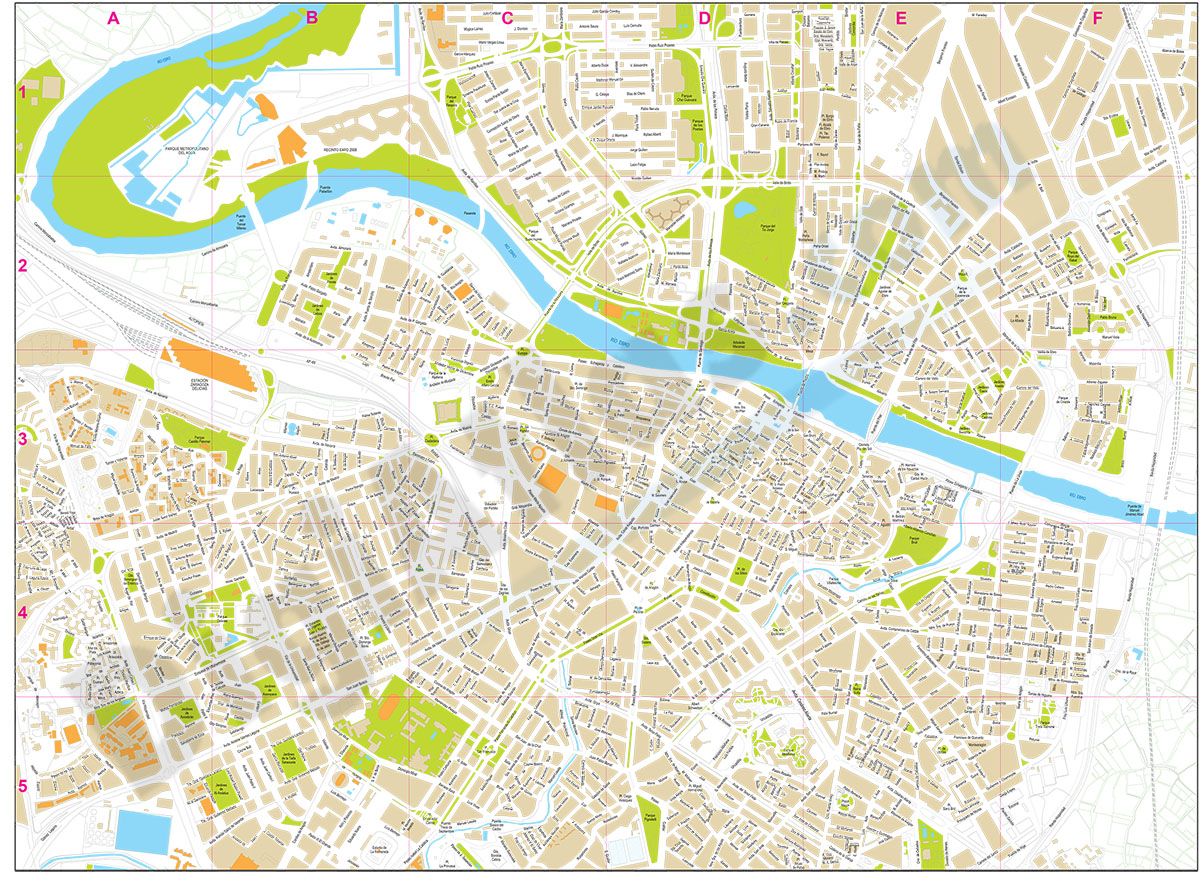
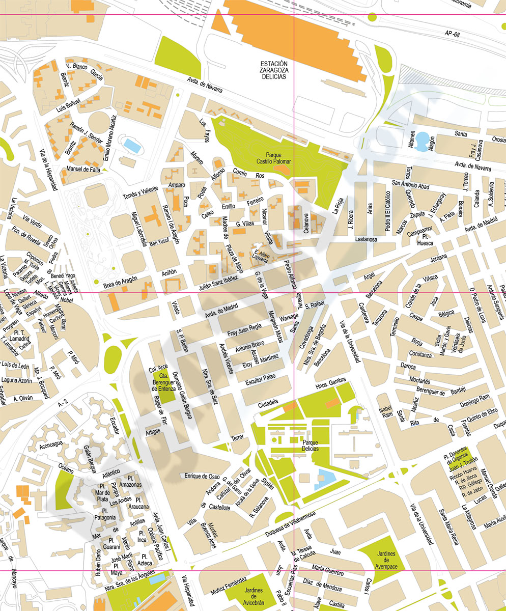
Zaragoza (Saragossa ) center - city map
Street map in digital format of the city centre of Zaragoza (Spain), with the delineation of streets and squares, blocks of houses, parks and green areas, with colours and names.
(...) Read more »
Adobe Illustrator, Acrobat PDF
59,99 €
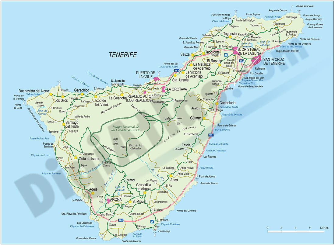
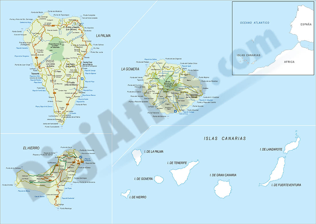
Map of Santa Cruz de Tenerife
Touristic map of the Province of Santa Cruz de Tenerife (Canary islands autonomous community) showing administrative boundaries, towns and cities, highways, major and minor roads, railroad, principal
(...) Read more »
Adobe Illustrator, PDF
95,00 €
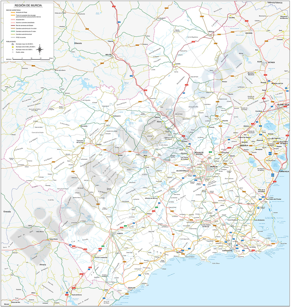
Map of Región de Murcia
Digital map of the Region of Murcia at scale 1:300.000
(...) Read more »
Adobe Illustrator, Acrobat PDF

175,00 €
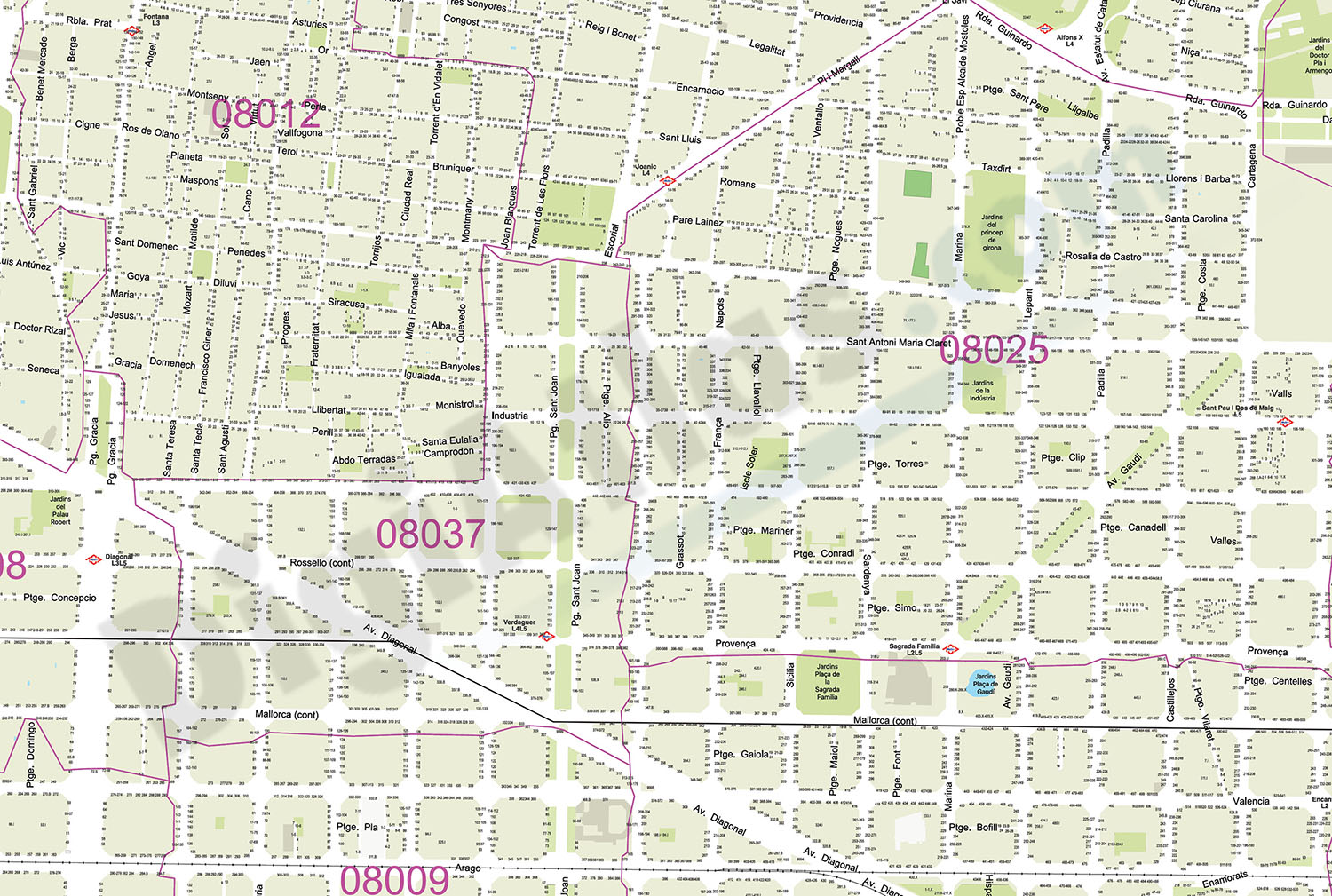
Barcelona - City map with portal numbers
Digital street map of Barcelona with street numbers.
(...) Read more »
Acrobat PDF

