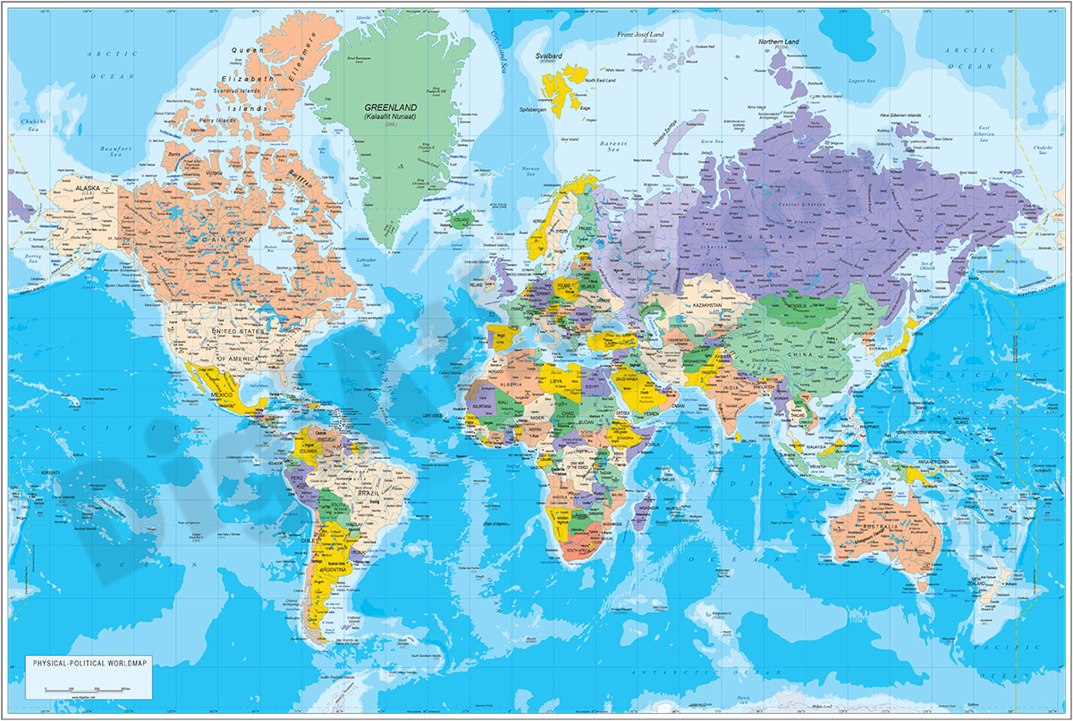
1- Physical-Political Poster World map
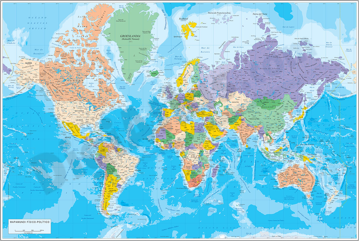
Physical and political digital world map, with borders, colours and names of countries, capitals, main rivers and lakes, capitals and important towns, geographical names and the altimetry and bathymetry strips of the land and sea relief.
Files... Read more
Adobe Illustrator, Acrobat PDF
3- Carte mondiale physico-politique DIN A4
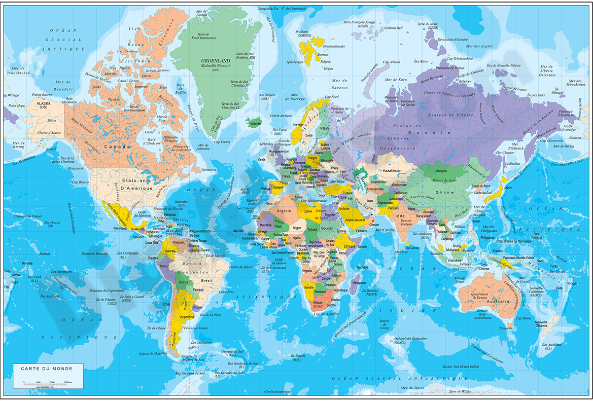
Carte digitale physico-politique du monde en format DIN A4 en français.
Carte pour l'école, la maison ou le bureau. Comprend le relief terrestre et maritime, les pays en couleur, les noms des pays, les principaux fleuves et lacs et les noms... Read more
Adobe Illustrator, Acrobat PDF
4- Map of Fiji
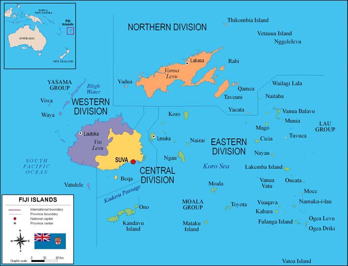
Fully editable vector file. Include political layers of inner administrative division, with their names and capitals.
Adobe Illustrator, PDF
5- Map of Indonesia
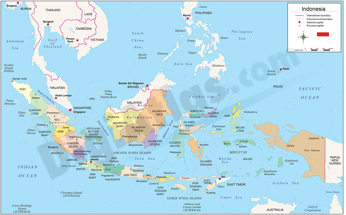
Digital political map of the Republic of Indonesia with internal administrative divisions, their names and capitals.
Vector map 100% editable.
Adobe Illustrator, Acrobat PDF
6- Map of New Zealand
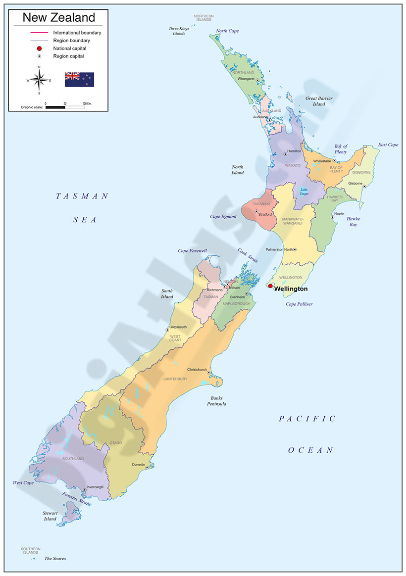
Political map of New Zealand with internal administrative divisions, their names and capitals.
100% editable vector map organized in separate layers.
Adobe Illustrator, Acrobat PDF
7- Map of Papua New Guinea
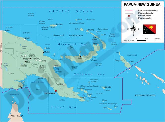
Fully editable vector file map of of Papua New Guinea showing political layers of inner administrative division, with their names and capitals.
Adobe Illustrator, PDF
8- Map of Tonga
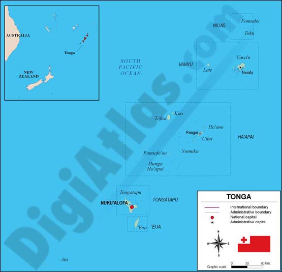
Fully editable vector file of Kingdom of Tonga showing political layers of inner administrative divisions ('Eua, Ha'apai, Niuas, Tongatapu, and Vava'u), with their names and capitals.
Adobe Illustrator, PDF
9- Oceania physical relief map
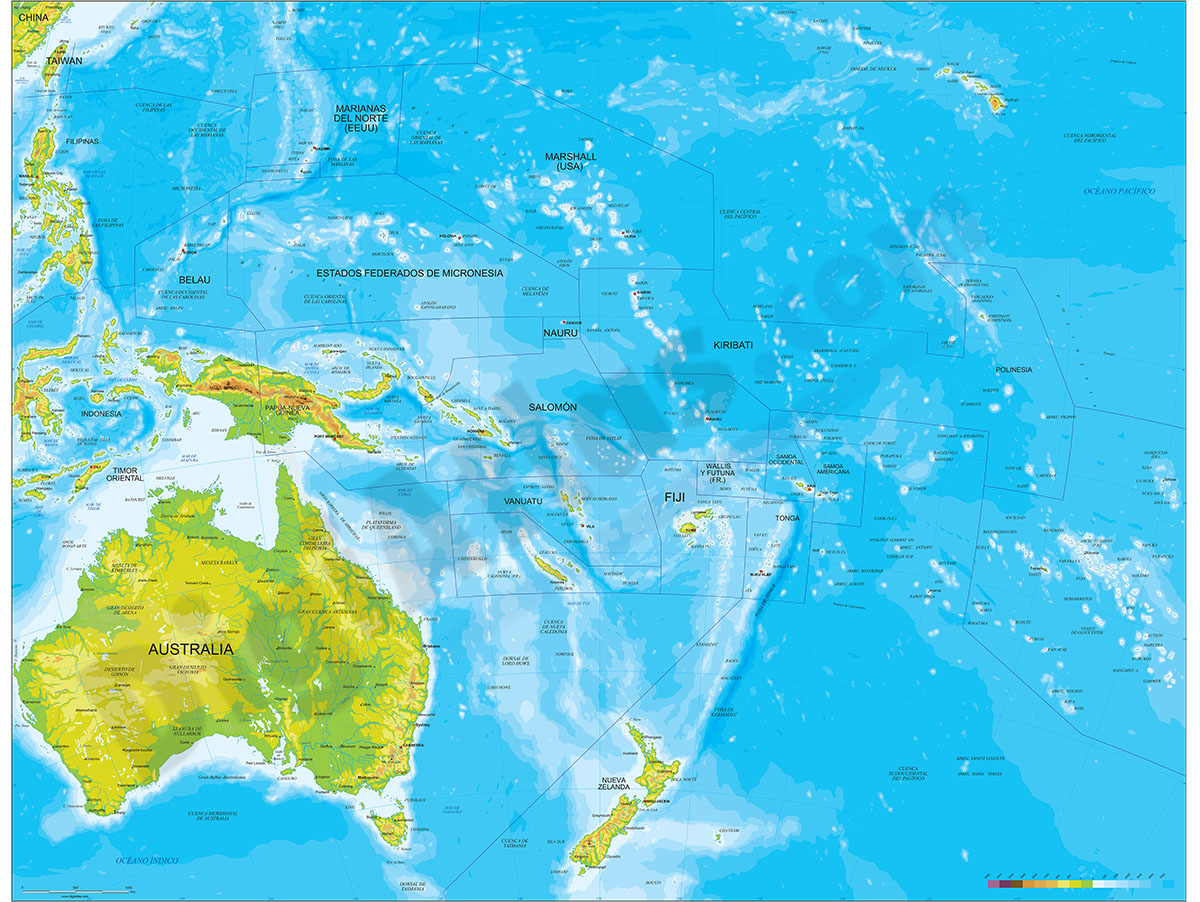
Digital map of OCEANIA geographic region (continent) showing bathymetric and topographic intervals. Fully editable vectorized file organized in separate layers.
Adobe Illustrator, acrobat PDF
10- Oceania political and geographical map
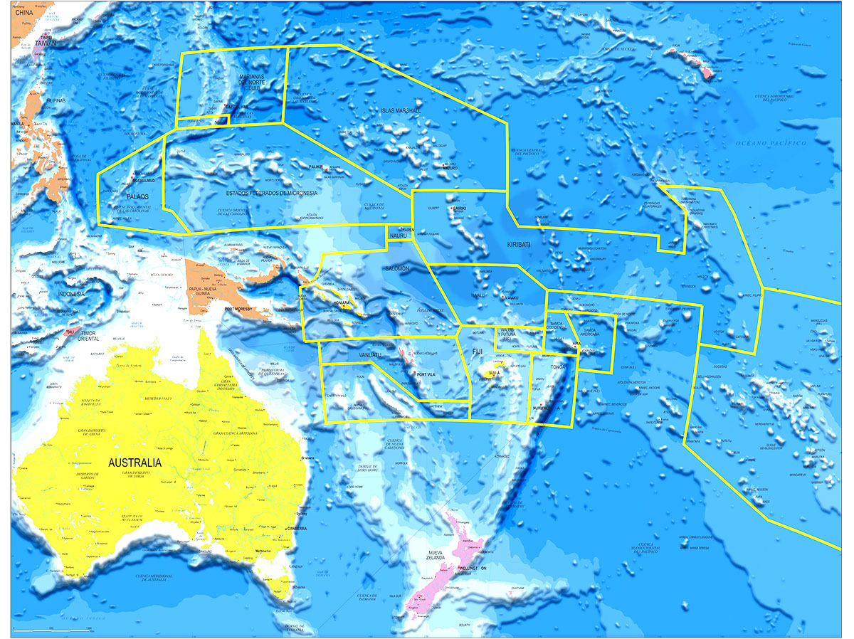
Fully editable vector file. Layers: colour and name of countries, international boundaries, major lakes, country capitals and relevant geographic names. High-resolution color shaded relief TIFF image.
Adobe Illustrator, PDF + TIFF, JPG (300dpi)
11- Physical Poster Worldmap centered in Bahrain
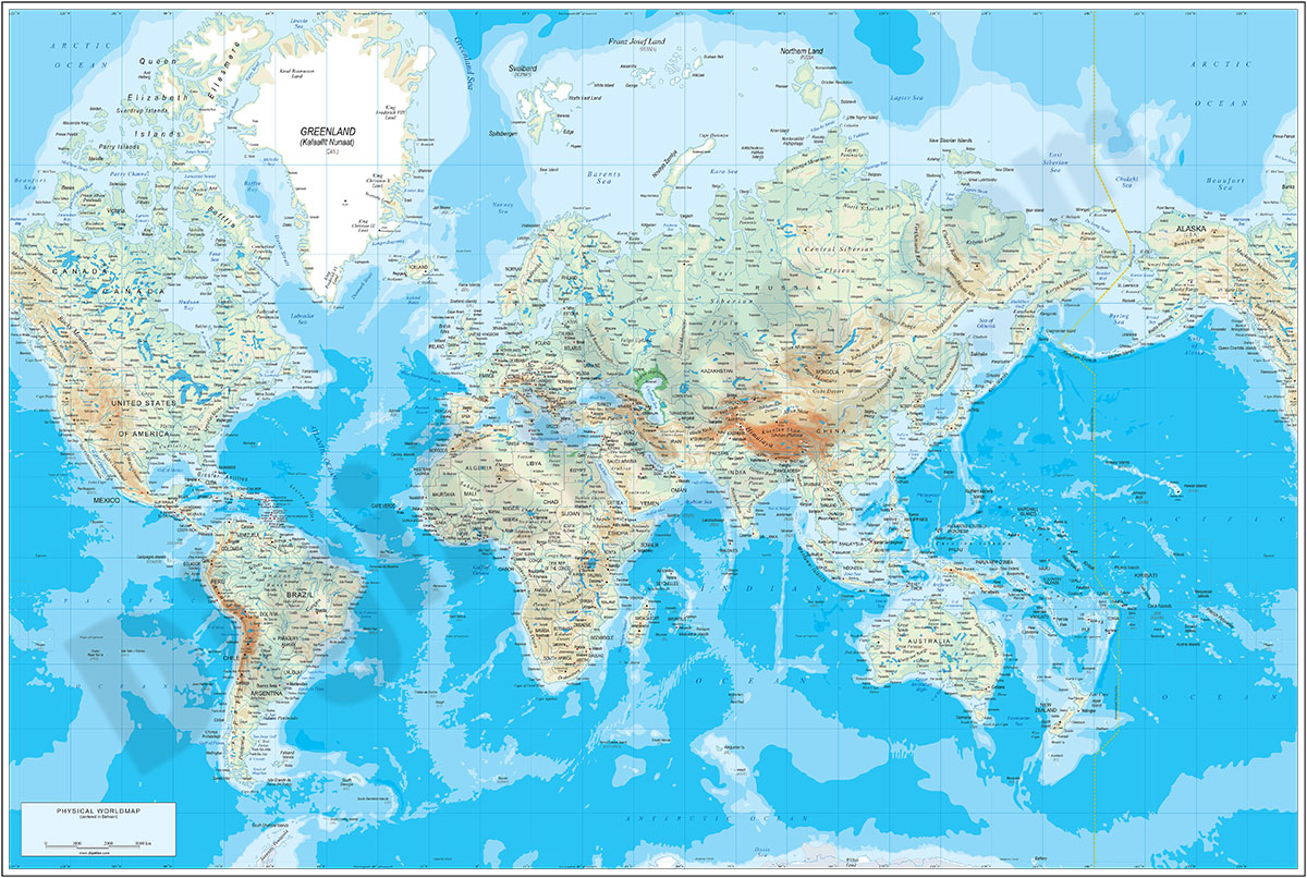
Poster-size physical world map centred on Bahrain
The map shows the altimetry and bathymetry colours, country borders, capitals, main rivers and lakes, capitals and most important towns, as well as geographical names.
Downloadable files in... Read more
Adobe Illustrator, Acrobat PDF
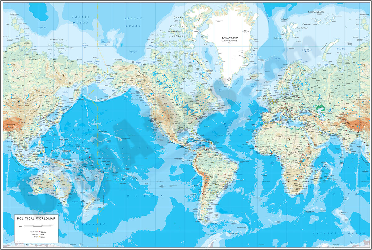
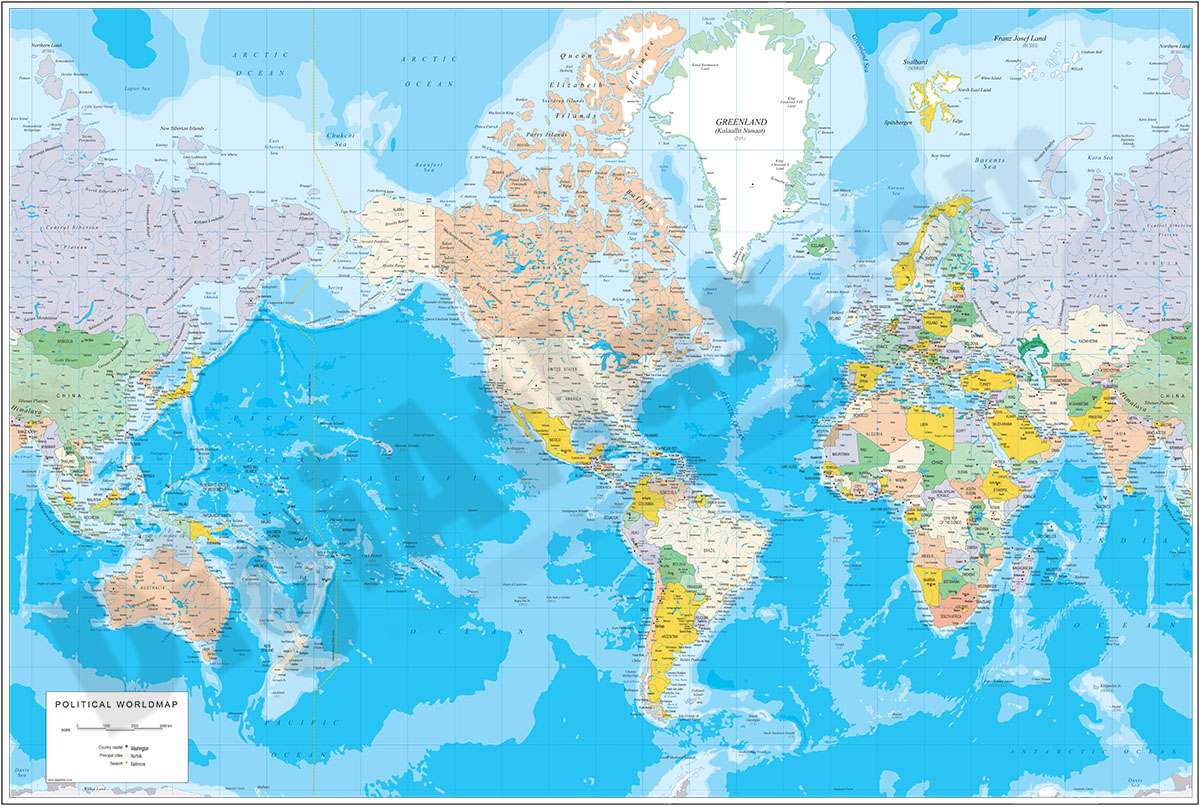
12- Physical Poster Worldmap vector file
Fully editable vector-file world map. Contains country boundaries and names, capitals, major cities, river and lakes and geographical names. Colors of topography and bathimetry are in separate vector layers. Poster size (100 x 70 cm). Names in... Read more
Adobe Illustrator, Acrobat PDF
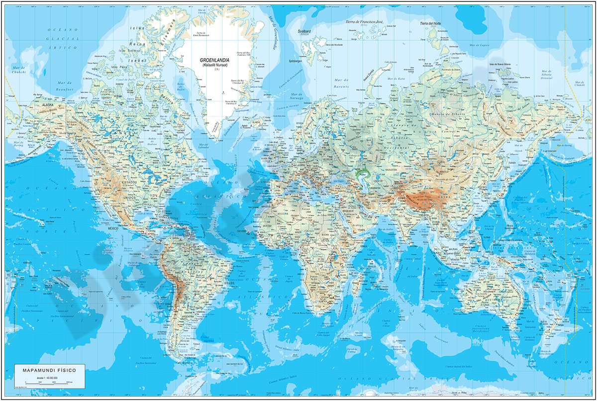
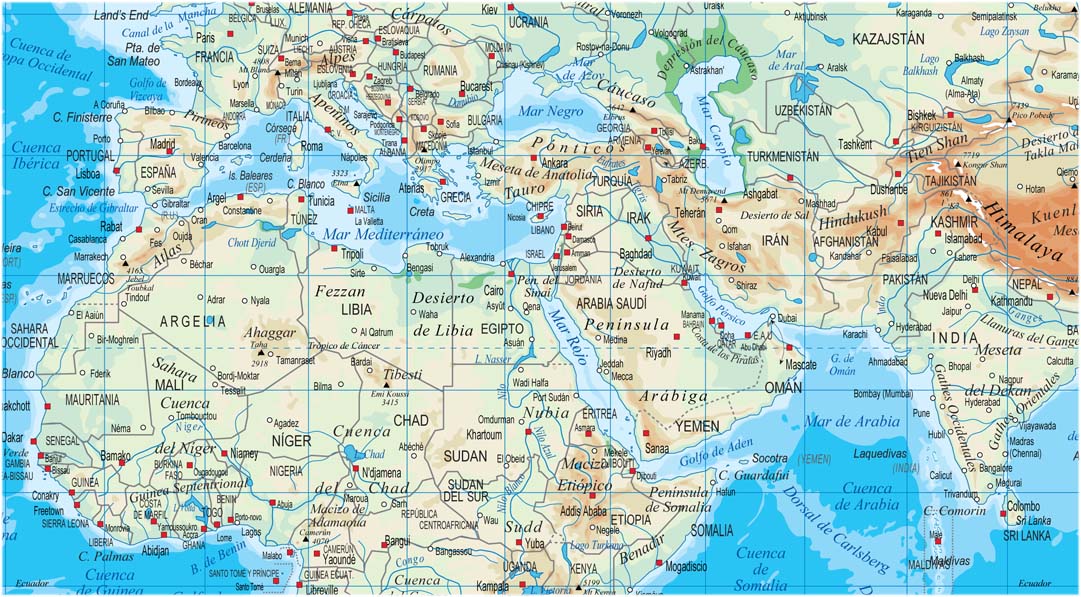
13- Physical-Political DIN A3 Worldmap
Vectorial physical-political world map in Catalan, Spanish and English languages. It includes land and sea relief, coloured countries, their capitals, main cities, rivers, lakes and most relevant geographical names. The text layers are translated... Read more
Adobe Illustrator, Acrobat PDF
14- Physical-Political Worldmap with Container Ports

Physical-political digital world mapa with container ports.
The map shows coloured altimetry and bathymetry bands, country borders, capitals, major rivers and lakes, geographical names and the location of more than 340 of the world's busiest... Read more
Adobe Illustrator, Acrobat PDF
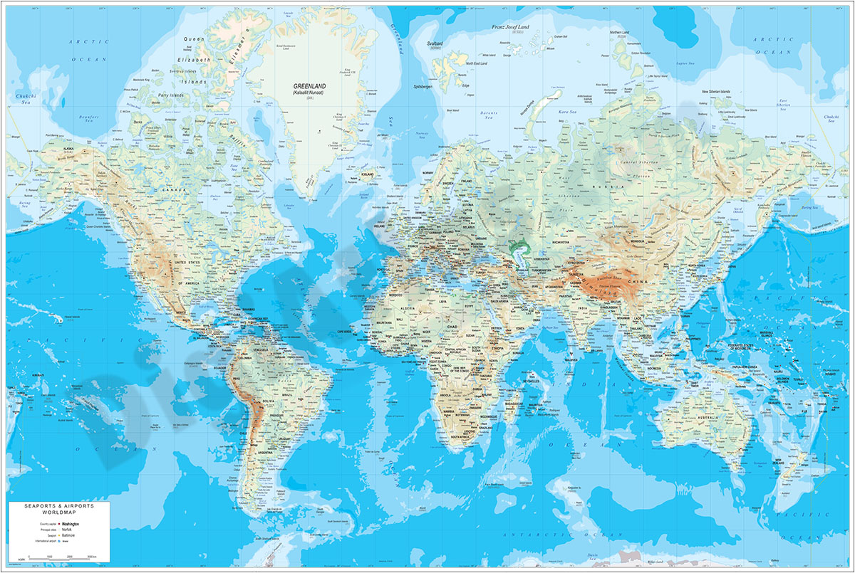
15- Physical-Political Worldmap with Sea Ports and Airports
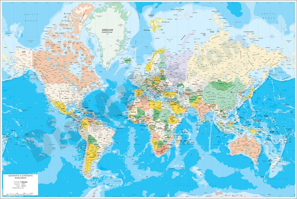
Poster-size physical-political digital world map.
The map shows the coloured altimetry and bathymetry strips, the borders of the countries, their capitals, main rivers and lakes, important towns and geographical names.
Files are downloaded in... Read more
Adobe Illustrator, Acrobat PDF
