59,00 €
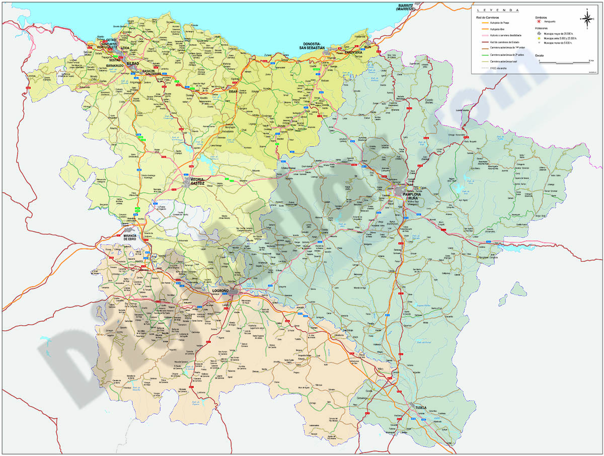
Map of Basque Country, Navarra and La Rioja
Map of the Basque Country, NAVARRA and La Rioja at a scale of 1: 300,000. Digital map with the provinces of the 3 autonomous communities, their municipalities, capitals, cities and towns grouped accor
(...) Read more »
Adobe Illustrator, Acrobat PDF, JPG (300dpi)
89,00 €
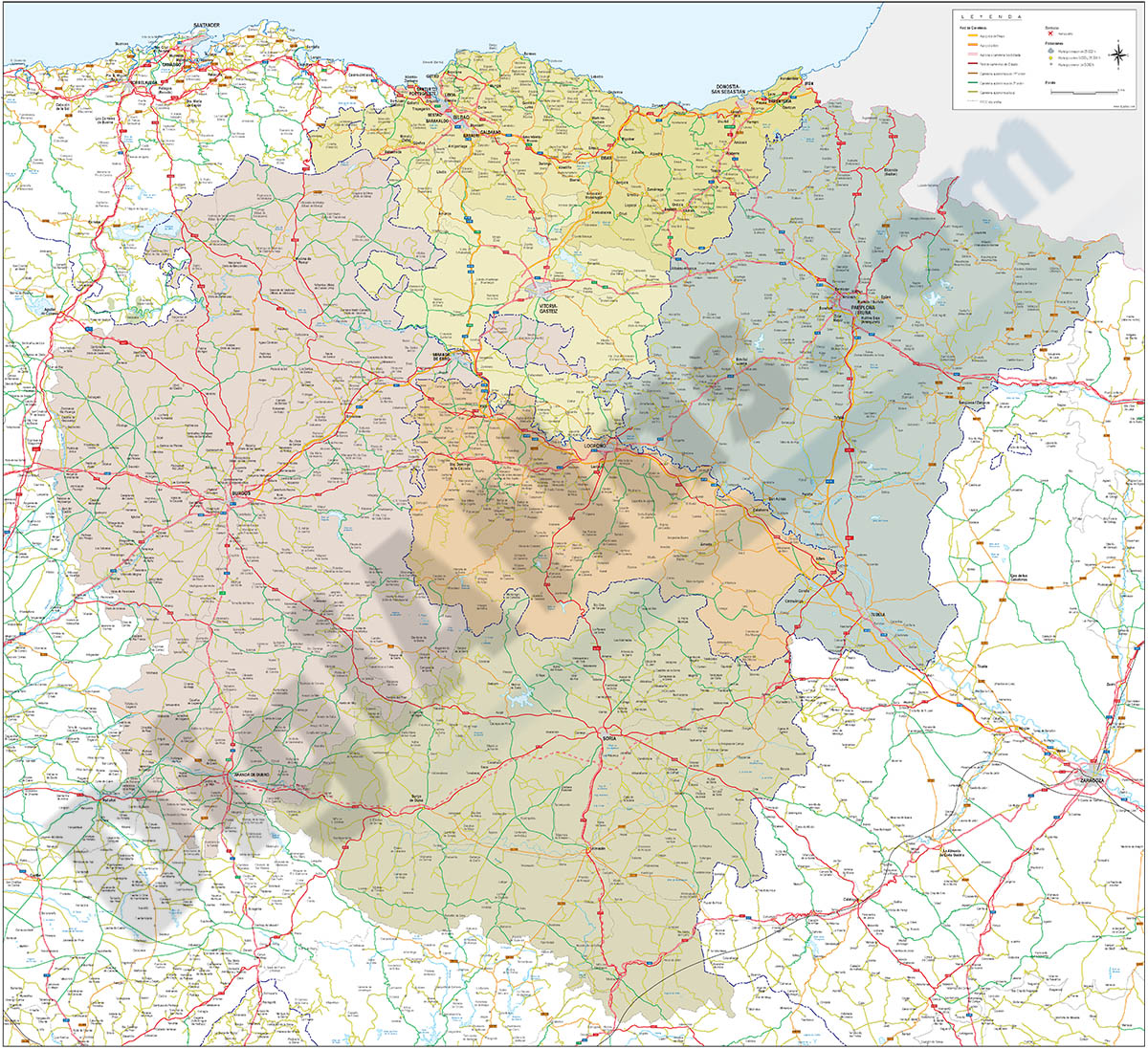
Map of Basque Country, Navarra, La Rioja, Burgos and Soria
Vector-file map of the Basque country, NAVARRA, La Rioja, Burgos and Soria spanish provinces, with detailed political and geographical information, such as administrative limits, towns and cities, roa
(...) Read more »
Acrobat PDF, JPG (300dpi)
98,00 €
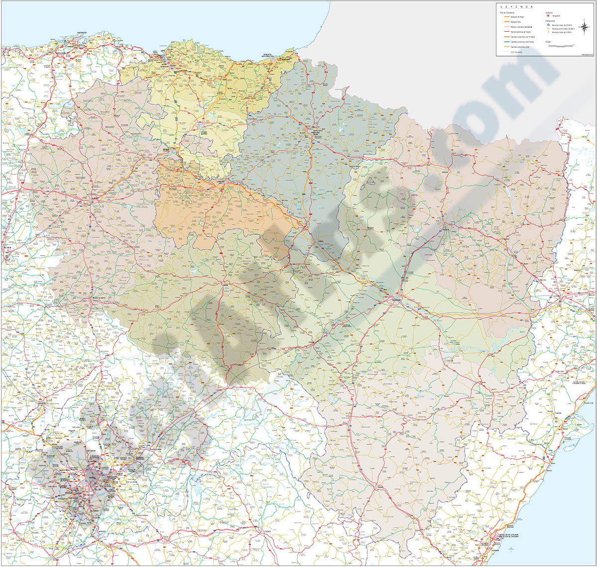
Map of Basque Country, Navarra, La Rioja, Burgos, Soria and Aragón
Vector-file map of the Basque country, NAVARRA, La Rioja, Burgos, Soria and Aragón spanish provinces, with detailed political and geographical information, such as administrative limits, towns and ci
(...) Read more »
Acrobat PDF, JPG (300dpi)
59,99 €
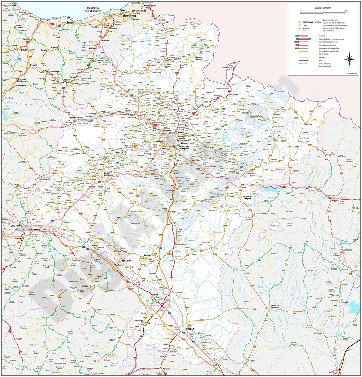
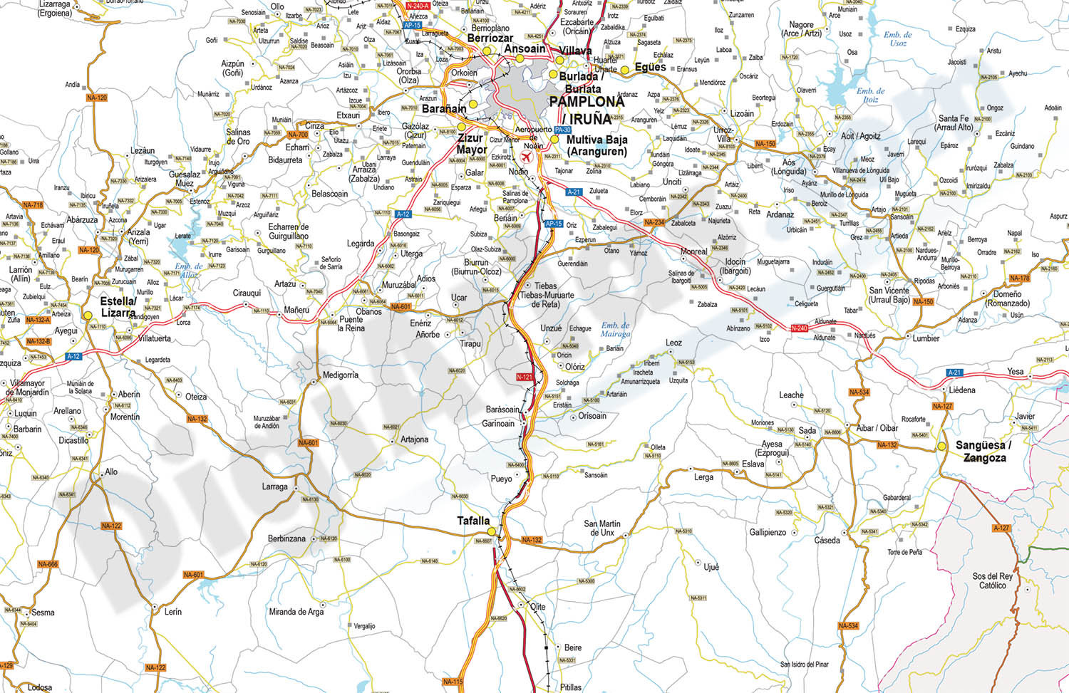
Navarre - Map of Chartered Community of Navarre
Digital map of the Autonomous Community of Navarre at a scale of 1:300.000, with the autonomous and provincial limits, municipalities, capitals, cities and towns grouped according to the number of inhabitants, road network: motorways, dual carriageways, dual carriageways, high performance roads, roads of general interest, roads of interest to the Autonomous Community, first and second order autonomous roads, local roads and other roads, railway network, rivers and lakes.
100% editable vector map (Adobe Illustrator and Acrobat PDF), organised in separate layers to customise colours, styles and generate different versions of the map for business and graphic design projects.
See less «
Adobe Illustrator, Acrobat PDF